Strong El Niño May Bring Record Sea Level and Coastal Flooding to Bay Area
Derek Bentley’s San Rafael karate studio flooded in January, when a heavy storm hit during one of the highest tides of the year.
Several inches of water rose from under the foundation and filled the building from the inside, soaking the karate mats so thoroughly that they squirted water when Bentley stepped across them.
“We were closed for about a week after the flood,” Bentley said. “Then we opened, but we used air dryers and some of the mats were still wet, and we had no carpet for a couple months.”
Now he fears a bout of déjà vu could be in his future if very strong El Niño conditions steer strong storms toward the Bay Area and once again flood his dojo.
“My fear is we will lose this place because it’ll just be too much water,” Bentley said. He runs Taylor’s House of Karate a few yards away from a marina on San Rafael Creek in Marin County. “I’ve never seen us beat water around here.”
California is no stranger to the impacts of periodic warming of water in the tropical Pacific. These conditions, what researchers call El Niño, have been associated with some of California’s most powerful and punishing storms.
For many months, weather experts have warned of what could be one of the strongest El Niño events on record. Federal scientists forecast a greater than 90% % chance of a very strong El Niño this fall and winter. The forecast raises the possibility of a worst-case flooding scenario that Bay Area officials and climate scientists have long been concerned about — in part because warm water expands, raising sea levels.
In terms of emergency planning, you can think of it as the coastal flooding equivalent of “the Big One”, when the highest tides, biggest storms and largest waves all coincide on top of the elevated sea levels. That superimposition is possible in any given year, but warm water from El Niño will temporarily elevate sea levels this year.
“We’re expecting likely the highest sea levels ever recorded on the California coast,” said Mark Merrifield, director of the Scripps Center for Climate Change Impacts and Adaptation, in a recent virtual town hall focused on El Niño. “As a sort of unlucky coincidence, the tidal cycle is also gonna be at a peak around the end of this year.”
El Niño forms when tropical trade winds weaken or reverse, allowing warm ocean water near Asia to slosh toward the Pacific Coast. That warming can reshape the jet stream and bring stormier weather while disrupting the ocean’s nutrient-rich upwelling, heating coastal waters, raising sea levels and stressing marine life.
While El Niño is a natural cycle, human-caused climate change is warming oceans, with large-scale ramifications, including long-term changes in weather and rising seas. This monthslong window into higher tides offers a glimpse of the Bay Area’s climate-altered future.
“El Niño is a good opportunity to see where our vulnerabilities are throughout the state,” Merrifield said. “It also is a sobering look at what we could expect with climate change.”
‘The worst coastal flooding on record’
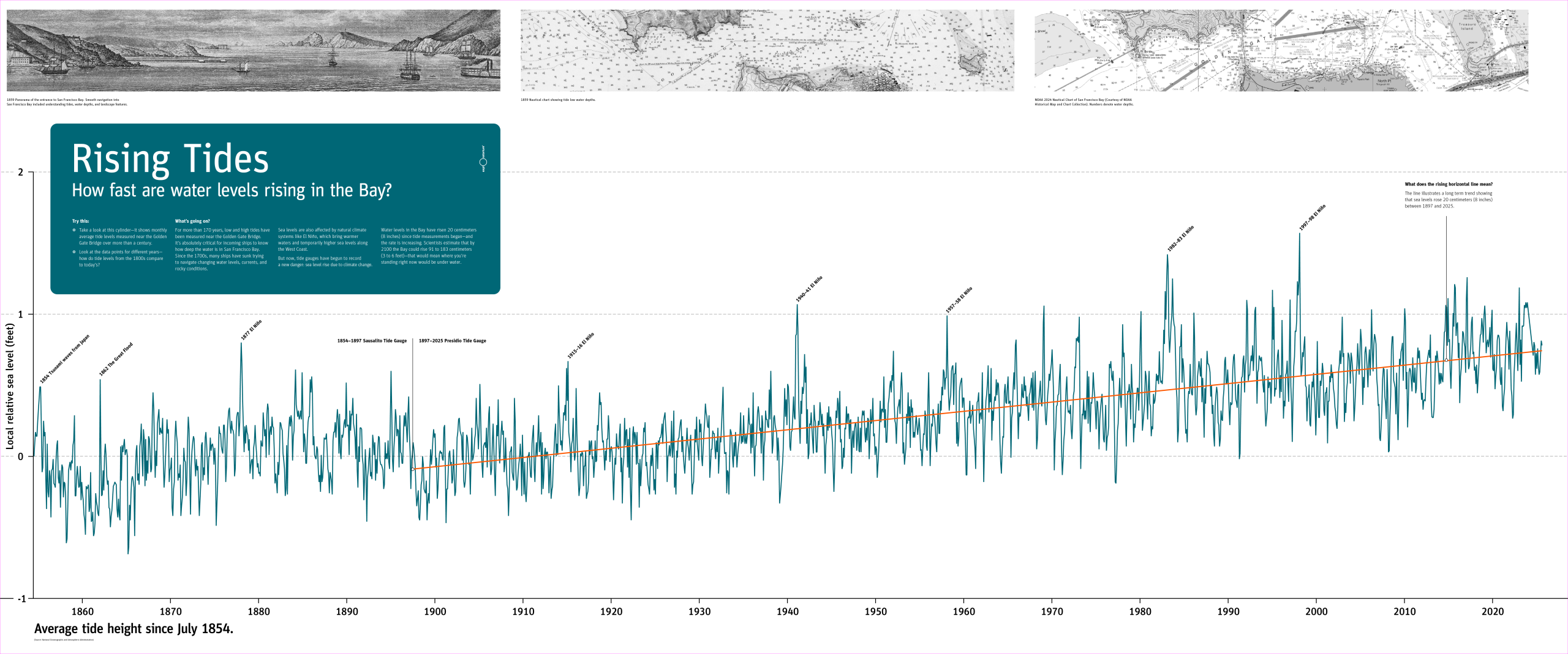
Melissa Lunden, a climate scientist-in-residence at the Exploratorium in San Francisco, is building an exhibit at Pier 15 that features a chart showing how the bay’s water level has risen since 1890. Every few years there’s a really large spike.
“During El Niño years the water levels are often higher,” Lunden said. Not every El Niño results in higher-than-average water levels. “But overall, the trend is increasing over the decades.”
The temporary rise researchers anticipate this year may come from several forces stacking together. First, the water levels in San Francisco Bay have risen about 8 inches since the 1890s. State scientists project another foot or more by 2050.
Second, warm water piling up in the Pacific expands, raising sea levels by several inches. As that water slowly sloshes east, it eventually smacks into South America and forces “local ocean water to push against the coast instead of flowing westward,” flattening out into the Pacific, said Daniel Swain, a climate scientist with UC Agriculture and Natural Resources.
These Kelvin waves are the delivery system for warm water associated with El Niño, and Swain said this process can cause up to 9 inches or more of additional temporary sea level rise along the coast and San Francisco Bay over days or weeks.
That rise will be “felt all the way inland into the Delta and Stockton,” Swain said. This El Niño “now appears to be most likely to become the singularly strongest on record and so I think there’s a decent chance we actually break historical records.”
Add natural king tides, which will be among the highest on record in December, changes in pressure, storm surge and back-to-back storms, and some places could experience as much as 5-to-6 feet of temporary inundation above historical high tide levels, Swain said.
“We could get all of those stacked at once,” Swain said, noting that flooding could occur even if only a few of the potential impacts occur in tandem.
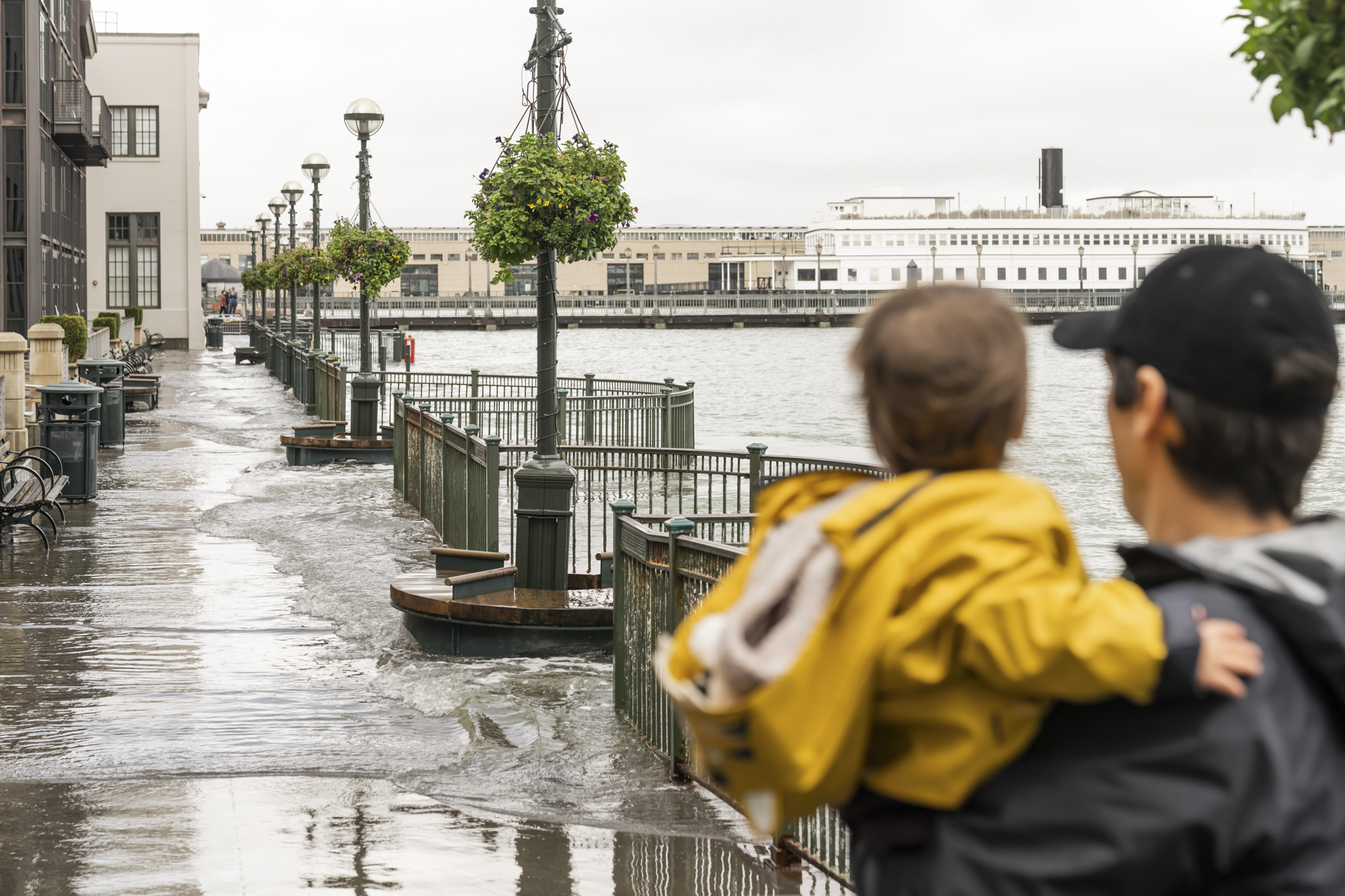
This short-term flooding “could be comparable to, or greater than, the worst coastal flooding on record in the San Francisco Bay region,” Swain said. “I foresee this being a major problem for the Bay Area this year.”
The high water anomaly has already begun. The tide gauge near the Golden Gate Bridge is running about 6 inches higher than where it typically is for this time of year, “and that’s partially because of El Niño,” said Sean Vitousek, a research oceanographer at the U.S. Geological Survey.
“Water levels are here to stay,” Vitousek said. “They will probably get larger in the winter as El Niño ramps up and we get more storm surge, waves and atmospheric pressure effects.”
‘Do the prep work’
In preparation, the California Department of Water Resources is staging more than 200 shipping containers filled with flood-response supplies across the state. Officials have stockpiled 4.3 million sandbags, 55,000 super sacks that can be filled with rocks or sand, and 400,000 tons of rock for emergencies such as levee repairs.
“We preposition materials around the state to make it faster to have them deployed,” said Michael Anderson, the state climatologist. The department is also working with the Army Corps of Engineers to have pumps ready and has partnered with NOAA and the Scripps Institution of Oceanography on a system of radar units to help detect hazardous weather events.
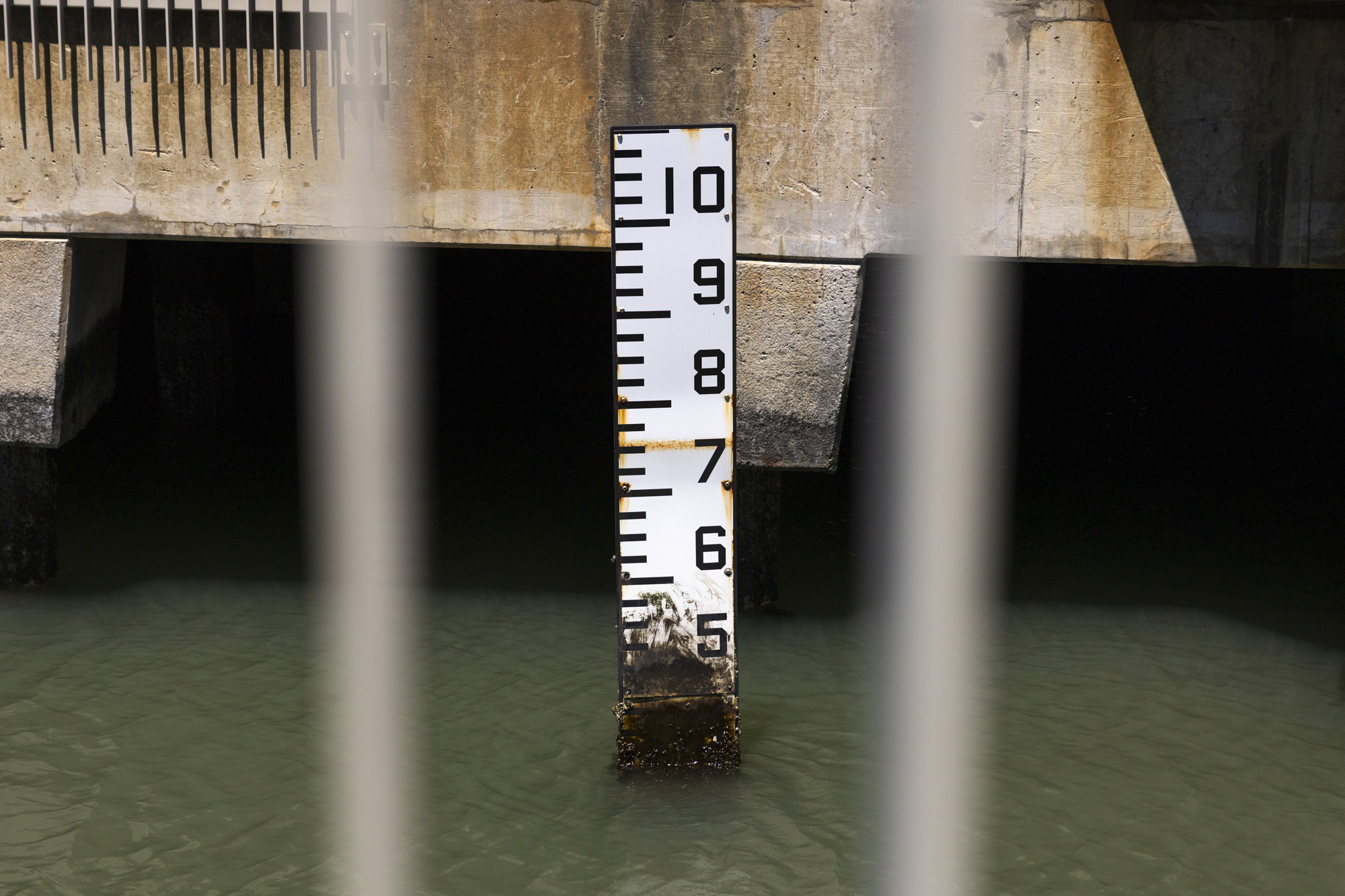
“That can really help communities know where the heavy rains are coming,” Anderson said.
Around the Bay Area, cities are also gearing up ahead of the year’s highest tides, which fall right around Thanksgiving and Christmas.
San Rafael, where high tides already flood streets and pumps weren’t designed for saltwater, is coordinating with critical agencies to improve communication so that roads can be closed quickly when it floods.
“That unfortunately doesn’t reduce the risk that those roads flood or those facilities are impacted,” said Kate Hagemann, a climate adaptation resilience planner with San Rafael.
Parts of Alameda, a low-lying island city with a shallow water table, often floods during high tides and storms. The city is preparing barricades and sandbags, readying pumps and clearing storm drains.
“We have a vacuum truck that’s able to quickly dislodge material that may prevent stormwater from flowing,” said Erin Smith, public works director for the City of Alameda.
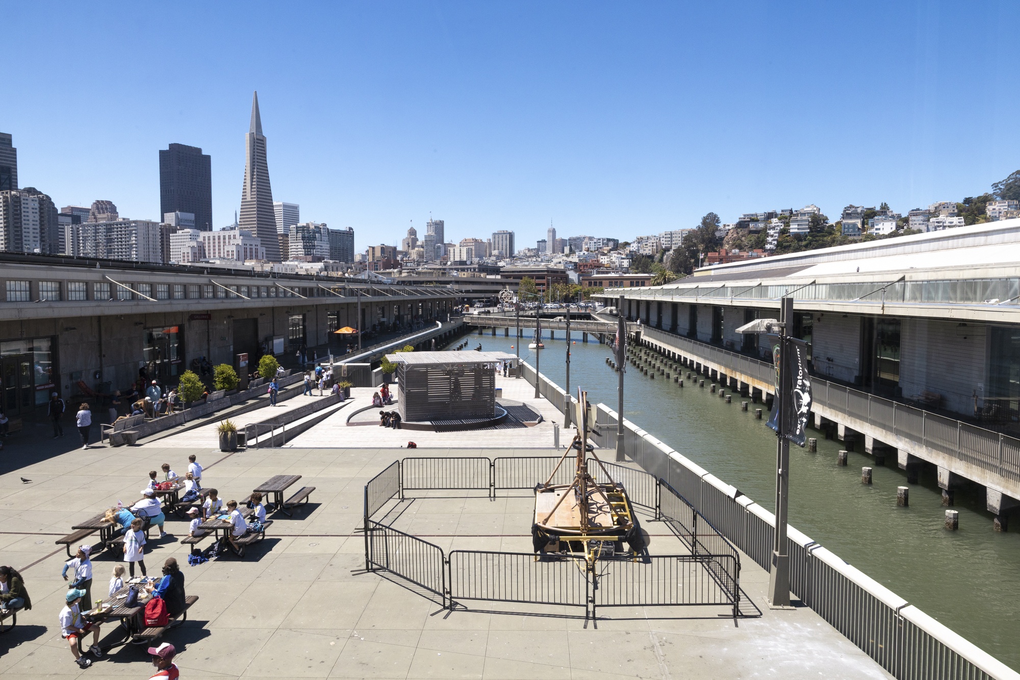
The Port of San Francisco is taking similar steps: clearing drains, planning traffic detours and staging pumps.
“King tides and these El Niño events are a glimpse into the future,” said Brad Benson, waterfront resilience program director for the Port. “In some of these areas, we have very important assets for the functioning of the city.”
One of Benson’s biggest concerns is the low-lying Muni tunnel entrance near the Ferry Building. About 60% of the city’s light rail fleet passes through it each night to reach the maintenance yard, making it critical to protect.
Californians can sign up for emergency alerts and create disaster plans by visiting the state’s Ready California site.
“Do the prep work,” said Nate Ortiz, assistant director for planning and preparedness with the California Office of Emergency Services. He suggested creating a go bag with documents, cash, food, water, medication and clothing. “Even if you can just get it started and incrementally build that out, it’s a great way to be a bit more prepared.”
‘We’ve been trying to fill the cracks in the bathtub’
The dangerous conditions may expose the weaknesses in flood protections across Bay Area cities, said Kristina Hill, a professor in the College of Environmental Design at UC Berkeley who studies sea level rise.
Many cities, including San Francisco, have treated their waterfronts like “a medieval town with a wall around them,” Hill said. Others, like San Rafael, have a patchwork of private levees. This winter will likely put those barriers to the test.
“We’ve been trying to fill the cracks in the bathtub by putting out little informal levees, and then occasionally a very big project like the San Francisco seawall,” Hill said. “We may see some of those informal things fail in surprising and important ways.”
Depending on the level of flooding, Hill said, it could show the region that it’s time “to do business differently” by building with more imagination and constructing buildings that are ready for higher seas. She dreams of floating buildings along the bay, like the Ferry Building, or entire blocks of housing as a way to live on the water.
“The things we’ve done in the past to prevent coastal flooding won’t work when that water doesn’t go back down again,” Hill said.
Bentley said that future — where the water doesn’t recede and daily tides inundate shorelines — is something he worries about at the dojo in San Rafael. From inside his practice, Bentley has a front-row view of the boats in the marina as they move up and down with the tide. He can tell when the water is rising.
“It was kind of crazy to drive in here and see the boats above you,” Bentley said. “Over the last three years I’ve noticed the boats are getting higher and higher and higher.”
And every time it rains, Bentley remembers the memory of the January flood that nearly shut down his practice.
“As someone who has lived and worked near water, I’ve only seen flooding get worse,” Bentley said. “We should just start preparing for it versus crossing our fingers.”