El Niño in the Bay Area: What You Need to Know
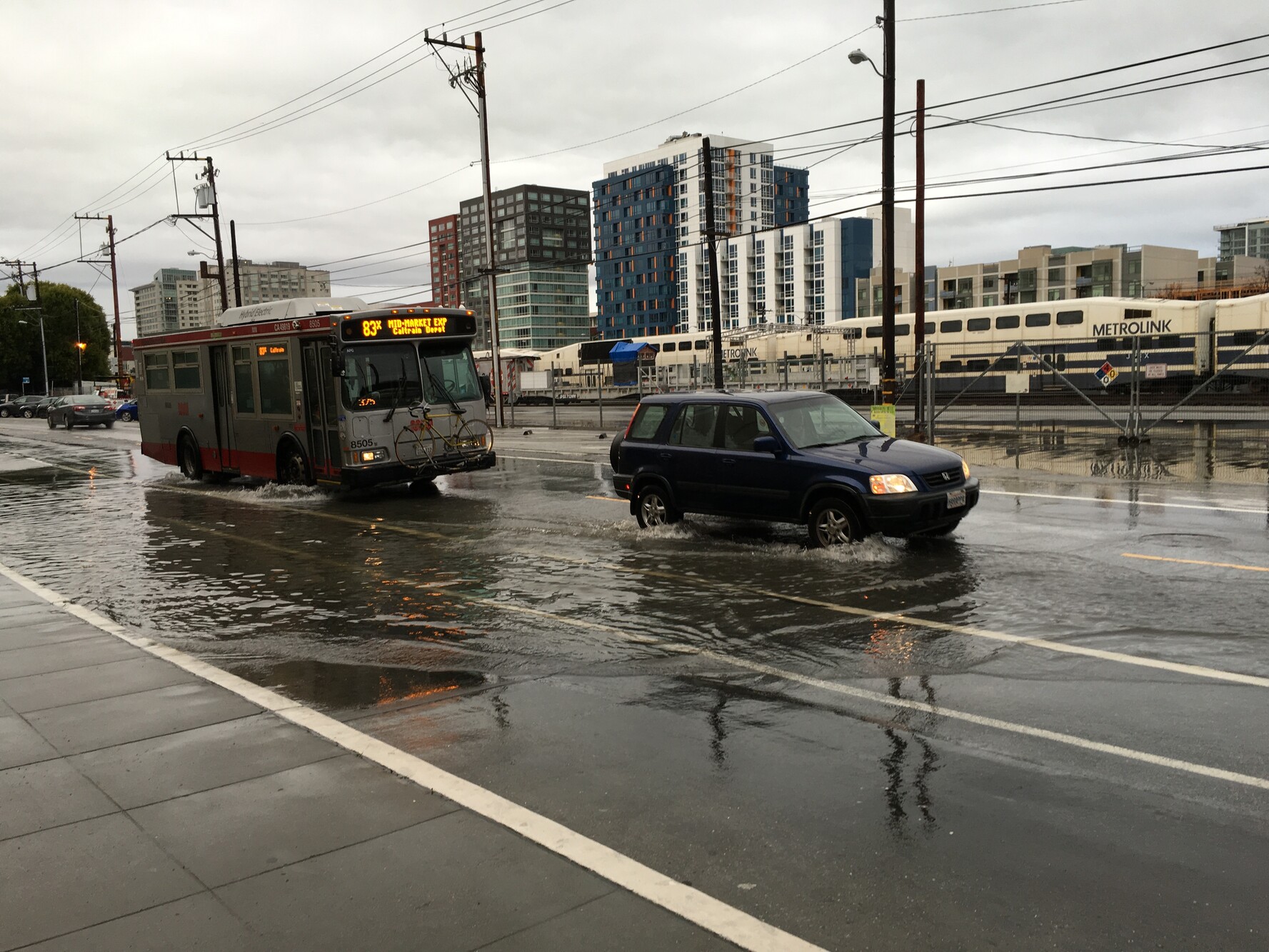
An El Niño is on, and this year, it’s been predicted to be the strongest in decades. Intensified by climate change, this natural climate cycle could bring flooding, road closures, and power outages, but also a healthy snowpack this winter. Bay Curious listener Katie Silva wanted to know, what makes this year’s El Niño different and what can she do to prepare? KQED Climate reporter Ezra David Romero explains how cities in the Bay Area are getting ready and what we can do to protect ourselves, our homes, and our communities.
Read Ezra David Romero’s full story “El Niño Could Bring a Wet, Wild Winter. How Can You — and Your Home — Be Ready?”
Episode Transcript
Olivia Allen-Price: Bay Curious listener Katie Silva has lived her whole life in California and knows all about El Niño.
Katie Silva: I grew up in California in the Central Coast area so I’ve been hearing about El Nino for my whole life growing up.
Olivia Allen-Price: But she wrote in to us after hearing this year’s El Niño called historic.
News Clip: Weather forecasters are warning this year’s El Niño could be the strongest in decades.
News Clip: This Super El Niño is already breaking records, intensifying faster than previous events.
News Clip: The weather phenomenon could bring intense damaging rainfall through the fall and winter months.
Katie Silva: What makes this year different and then also, like, as somebody who lives in the Bay Area, like, what do I need to know?
Olivia Allen-Price: Katie likes being prepared and knowing she can watch out for her neighbors when it counts. She has even taken community emergency response training.
Katie Silva: I’m just like a worrier and so I would rather overprepare and feel like I have the knowledge if it’s ever needed or ever relevant than worry and not know what to do about it.
Olivia Allen-Price: So we thought we’d do something of an AMA El Niño edition with someone who’s been covering this closely, KQED’s climate reporter, Ezra David Romero. Hi, Ezra.
Ezra David Romero: Hey.
Olivia Allen-Price: Okay, so first off, can you give us a quick refresher? What is an El Niño?
Ezra David Romero: So El Niño is this basic, like, natural climate cycle that happens in the atmosphere and the ocean thousands of miles away in the East Equatorial Pacific. It usually happens every two to seven years. And we know they’ve been part of our climate for thousands of years.
At its basics, what happens is the trade winds reverse. Usually they’re going west. And then as the trade wind reverse, they start going east. And that allows this like big bulge of water out near Asia to slowly move towards the Americas. As this change happens, the surface water warms up.
And then we have what are, like, called Kelvin waves. These are like these massive underwater waves that move about six miles per hour. And they hit the coast of Peru and Ecuador and that water splits off in each direction. And then that water slowly reaches places like California and the water expands, and that’s called thermal expansion.
Water expands when it warms up. And then, that can affect our marine species and then raise our sea levels and it goes on and on. El Niño doesn’t happen in San Francisco. It happens thousands of miles away and we get the effects of El Niño.
Olivia Allen-Price: What are scientists seeing that has led them to predict a more powerful El Niño this year?
Ezra David Romero: I think it all comes back down to the sea surface temperatures and like how warm the actual ocean is becoming thousands of miles away. You know, that’s why when you look at a map of El Niño out on the ocean, it’s like super dark red out there and that’s signifying that the water is super warm. According to NOAA, the Climate Prediction Center, there’s an 83% chance that this event will become one of the strongest El Niños recorded since 1950.
Olivia Allen-Price: Let’s break this down to a human scale. How might this affect our day-to-day lives?
Ezra David Romero: We could feel the effects of the rising ocean like we are right now. Seas are about a foot higher which means when we have king tides they could be a foot high than that. It also could mean that we could have a lot more rain because the jet stream can shift during an El Niño which means the storms could come towards the Bay Area and that means we could have more coastal rain, coastal flooding, river flooding like in places like Guerneville.
That means we could have power outages. There’s also, like, bigger waves during El Niño itself just like the physical surface waves that you see out there. They’re like 33% bigger during the El Niño year, so bigger waves. And this isn’t just a problem at sea level. More rain could bring landslides to our mountainous regions. And it could mean less snow at lower elevations and more rain. And it could mean a healthy snowpack at higher elevations. And so there’s lots of things that could happen. They’re talking about how it could peak sometime in November or December. And that’s still kind of unknown at this time. But the effects can still last months and months afterwards, or expected through the spring, I think.
Olivia Allen-Price: Feels like so much of this conversation is about could, because we really don’t know how it’s all gonna play out here, but there’s a lot of different scenarios that we should be ready for. Are there parts of the Bay Area that are more at risk of seeing some of those negative impacts?
Ezra David Romero: I think most coastal places are worried. You know, places like Pacifica, downtown San Francisco, San Rafael, places like Sausalito, Highway 101, Highway 37, even airports and places like that are all low-lying. All those places are the spots that people should be worried about.
When it comes to rain and the flooding and things like that, it really depends on where the storms happen. Sometimes they center around Napa, sometimes they center around San Francisco, San Jose, the Santa Cruz mountains. And so flooding really depends on, like, how fast that rain comes down. Is it falling in an area that’s already pretty soaked because they’ve had a bunch of other storms? Like what’s the capacity of the ground, the earth in that moment to soak up that water?
One of the big worries, there’s just like this epic scenario that could happen. When you have a king tide, which is around Thanksgiving and Christmas, that’s where, like, we have the highest tides of the year plus this one or so foot of temporary sea level rise. Then you have bigger waves during El Niño already. And then if there’s like a storm at the same time, then you have storm surge. And then you could have like multiple feet of water coming into a place like San Rafael or downtown San Francisco or Pacifica instead of about this one extra foot. And then that’s a bigger issue because our areas are not prepared for that.
Olivia Allen-Price: We’ll have more with KQED’s Ezra David Romero right after this break.
Olivia Allen-Price: And we’re back with KQED’s Ezra David Romero answering all sorts of questions about El Niño. I know some of your reporting has been looking at what cities are doing to adapt for this time. What are you learning?
Ezra David Romero: Yeah, cities across the Bay Area are doing a bunch of things. You know, there’s a bunch of emergency proclamation and declarations going out. Cities like Alameda and San Francisco and Pacifica, they’re installing pumps. You know they’re making sure they’re ready so if streets flow, they can pump it out. They’re encouraging people to get their homes ready and they’re clearing gutters and canals and things like that.
I talked to Kate Hagemann. She’s the climate adaptation resilience planner with San Rafael. And when we spoke last week, flooding had happened like four days in a row. And here’s what she had to say.
Kate Hagemann: One of the things that we’re trying really hard to do is to focus on preparedness because these are not our highest tides of the year. If the bump in water levels that we are seeing from El Niño and the Kelvin waves continue through the rest of the season, we would expect more severe flooding coming up in November and December.
Ezra David Romero: When I was out there, what I saw was like water coming out onto the streets, people driving through it. At one point, water like surrounded this entire Mexican restaurant. People were like throwing their keys over to move their car so they didn’t flood. Kate told me that the city had blocked some of the roads until water receded. Water even like surged out of utility holes and like rippled out into some front yards.
Olivia Allen-Price: One of our colleagues, Sarah Wright, went out with the San Francisco Army Corps of Engineers to clean some debris out of the bay. Let’s take a listen to her experience.
Sound of waves and radio chatter
Sarah Wright: It’s the first real rainy day of fall, or as this crew calls it, debris season. That’s when storms shower the region, washing loose scraps into our waterways and eventually into the bay. Today, I’m a passenger on an 86-foot catamaran, outfitted specifically for removing debris from the bay. It has a large open deck and a crane.
Sound of Peter Brownell on radio
Sarah Wright: Peter Brownell is the captain of this vessel. He’s just spotted a piece of wood in the water just east of the Golden Gate Bridge. He maneuvers the boat using a remote-controlled joystick while a crane operator extends the giant claw, lowers it, and clamps around the plank.
Sound of claw extending
Sarah Wright (in scene): There it goes. Picking up the log.
Sarah Wright: Each year, this crew plucks more than a thousand tons of debris out of the bay. And this winter, they’re expecting to be busy.
Peter Brownell: Yeah, especially with the Kelvin wave going on, I think, I mean, yeah, I think we’ll probably see more than we saw last year.
Sarah Wright: There can be major consequences if this debris is left floating in the bay. In June 1942, while landing in the Bay, a military float plane crashed into a piece of debris, killing the pilot. The U.S. Army Corps of Engineers has been running this mission ever since.
Peter Brownell: Obviously, there’s not a lot of military float planes landing in the bay right now, but the ferries, for instance, move it up to 35 knots, like over 40 miles per hour on the bay. So if they hit a 15-foot piling that’s a foot and a half in diameter, that’s going to take out that ferry.
Sarah Wright: In fact, we’re headed now to respond to a call from a ferry that reported a 26-foot plank right by Alcatraz Island. We set our eyes to the horizon. We’re searching in what’s called a current break, sort of like a seam in the water.
Peter Brownell: As the currents push up against each other, a lot of the debris ends up along these kind of drift lines on the current breaks like that.
Sarah Wright: Like a needle in a haystack, it takes a while, around 20 minutes to find the piece of wood.
Peter Brownell (via radio): Yeah, we’ve just located a 15 foot timber in our current location and we’re securing it now.
Sarah Wright: The crew jumps into action and once again plucks the plank out of the water all within a minute or two.
Sound of plank being dropped
Sarah Wright (in scene): The crane just dropped the plywood on top of the other log. We are, like, right in front of downtown San Francisco. So pretty scenic pickup we just had.
Sarah Wright: Brownell says this crew is keeping their eye on tide tables and weather and will be at the ready to recover more debris from the bay.
Olivia Allen-Price: It’s so interesting to learn how much preparation is happening around these cities. But Ezra, how can everyday people prepare?
Ezra David Romero: Okay, so I think you can think about it in like three buckets. One, you can prepare for the safety of yourself. Two, the security of where you live. And three, the safety of your broader community.
So let’s talk about what you need to do for yourself. I think you need to be ready for the power to go out. You know, have some non-perishable food on hand and then make sure you’re stocked up on batteries. Like, do you own a flashlight? Things like that. And then if you live in a flood prone area, I think it’s a really good idea to pack a go bag so you could be ready to leave if the water starts rising quickly. And then you’re also gonna wanna make sure you put any important documents somewhere safe.
And then for where you live. Okay, this is gonna vary wildly obviously by where you live, but generally you can clean out your gutters, you can patch up your roof. And then, if there’s anywhere rain can get into your house, you’re gonna wanna seal that up. Lots of cities also offer sandbags. I think some cities offer up to 10. So if you live in a flood prone area or you already know your home floods, you’re gonna wanna pick those up.
I spoke with Steven Torrence. He’s the Director of Emergency Management for Marin County. And he says what you do for your house can actually really help the greater community as well.
Steven Torrence: Yeah, regardless of if you live on a creek, if you lived up on the hill or at the bottom of the bay, those loose items, so those sticks, those branches, leaves, try to get rid of as many of those as possible. That is probably one of the key things that we can do. That’s less material that water can pick up and then ultimately clog our drains, clog the streets.
Ezra David Romero: A lot of cities also have these programs where you can adopt a drain, which basically means you take responsibility for making sure it’s clear of trash and debris that can actually flood streets when it gets super clogged.
And then lastly, I think one big thing we can all do, which might sound super simple, is definitely get to know your neighbors. Share phone numbers. Because the flooding and the rain this year could happen on key weekends, like Thanksgiving or Christmas, when you might not be home. So, conversation with your neighbors now could reap benefits later for you this winter.
Olivia Allen-Price: But I also often think like, oh, it’s gonna be, that’s gonna help out with drought next year. It’s gonna make it less likely that we’re in drought situations. Is that true? Can I think about it that way?
Ezra David Romero: I think the answer is yes and no. It really depends on where we get a bunch of rain or snow. It could really replenish all of our reservoirs, give us a lot of water, cause a lot problems in the meantime, but we could have full reservoirs because of it. There is also a future where, like, say it rains a lot in like Southern California and not as much in Northern California and then you could be in drought conditions next year. So yeah, it really just depends.
Olivia Allen-Price: We’ve been talking about all the downsides of El Niño. I’m a skier. There’s always a little hope that this could mean a good ski season. Are surfers excited about some potentially big waves coming? Are there any upsides to El Niño that recreationalists can look forward to?
Ezra David Romero: Yeah, I mean, I think extreme sports type people kind of look forward to bigger swells, potentially deeper snow, all that kind of stuff. I was down in Santa Cruz a few weeks ago, reporting on a story and it was during one of the high tides and the water was thrashing and like all these surfers were literally jumping into the water around us and they were going out there and it looked really dangerous to me. Like I wouldn’t want to go in, but they were loving it.
Also, when it comes to snow, I had done some interviews and the scientist I had talked to said, you know, we might have less snow at lower elevations, but at higher elevations we might get a lot of snow, you know, if these storms are really big. So ski resorts and places that are higher elevators could be really great places to catch some powder.
Olivia Allen-Price: And how does this El Niño preview our climate future? Like how, especially if our people who are in charge of cities thinking about what we’re experiencing this winter as a precursor of what’s to come.
Ezra David Romero: I think the clearest way to think of that is when it comes to flooding for me. It’s because it’s probably like the most sure thing we can see at this point, right? We have these projections that by 2050 we could have like a foot to a foot and a half of sea level rise on like the medium end and like at the higher end, like three feet or something like that. Like what happens this year could become everyday patterns or every like winter, fall, spring, summer patterns in the future.
California is already this land of the extremes, right? We have extreme droughts, we have extreme rain, we have flooding, it’s a big state and we deal with all these things just climatically. But with human-caused climate change, these extremes are becoming exacerbated, right, and I think that’s like the thought around El Niño. It’s sort of like a precursor and a warning about what we could experience if we don’t correct ourselves.
Olivia Allen-Price: Ezra David Romero, it is always so nice to chat with you, thank you for explaining all sorts of things El Niño to us.
Ezra David Romero: Hey, thanks for having me. It’s been fun.
Olivia Allen-Price: Bay Curious is made in San Francisco at member-supported KQED. Our show is produced by Katrina Schwartz, Christopher Beale, Anna Casalme, and me, Olivia Allen-Price. We get extra support from Maha Sanad, Katie Sprenger, Jen Chien, Ethan Toven-Lindsey and everyone on team KQED.
Big thanks to KQED members who helped support our work. You can become one today by visiting donate.kqed.org slash podcasts.
Some members of the KQED podcast team are represented by the Screen Actors Guild American Federation of Television and Radio Artists San Francisco Northern California Local.
I’m Olivia Allen-Price. Have a great week.