‘Marin Is the Hotspot’: Bay Area to See Coastal Flooding Through Saturday
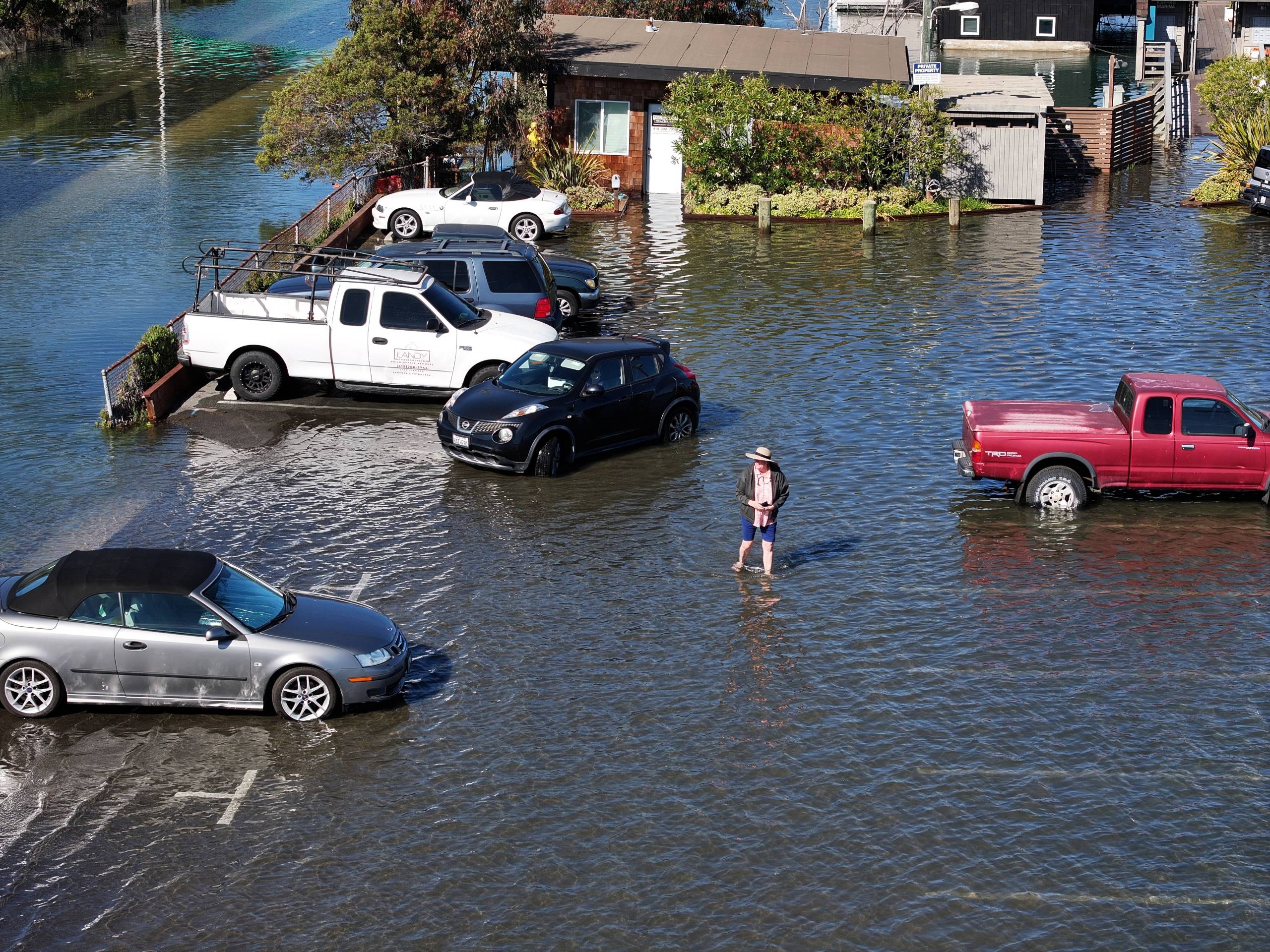
The edges of the San Francisco Bay are flooding this week. Kayakers cruised water-filled streets along Marin County‘s bayside. Waves splashed over Pier 14 in San Francisco’s Embarcadero. A river of water surrounded a Mexican restaurant in San Rafael. And it’s just the beginning.
“We have not seen the worst coastal flooding this year that we’re likely to see later,” Daniel Swain, a climate scientist with UC Agriculture and Natural Resources, said. “This is probably, unfortunately for those who are dealing with it, just a preview of what is to come.”
The National Weather Service extended a moderate coastal flood advisory through Saturday for nearly 2 feet of flooding in low-lying spots throughout the Bay Area and Central Coast.
Several factors are driving the extra-high water, including the influence of the full moon earlier this week and warming water caused by El Niño expanding and pushing local and sea levels up.
“We have that thermal expansion of the water from the El Niño, and that anomaly has been helping keep the water a bit higher than initially forecast,” Rachel Kennedy, a meteorologist with the National Weather Service’s Bay Area office, said.
The flooding is happening on sunny days, without storms to exacerbate impacts, and when the region isn’t experiencing the year’s highest tides.
“In Northern California, we’re pretty much running as high as we ever have been, including record-breaking October tides,” Swain said.
This winter’s king tides fall around Thanksgiving and Christmas. Swain said there’s a “very high likelihood of widespread and potentially serious coastal flooding” during those windows.
Parts of Marin County underwater
Kennedy called Marin County a flooding “hotspot.”
“It is starting to reach some people’s homes,” she said. “So, it’s more moderate than minor since people’s lives are being impacted.”
On Thursday afternoon, floodwaters blocked entrances to Highway 101 in north Sausalito. Cars and buses sloshed through the water and kayakers took to the new waterways.
At the tides’ peak on Thursday around 2 p.m., workers from El Tucan Tacos and Beer, a Mexican restaurant on the edge of a small harbor in San Rafael, raced to move their cars as a river of water separated the restaurant from the street.
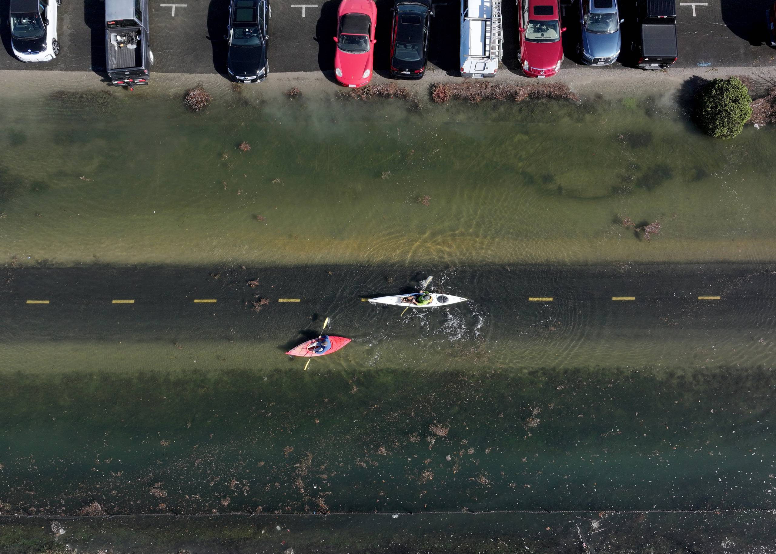
For three days, employee Marilyn Garcia watched water race down the street, stopping lunch service and racing to protect the waterside restaurant.
“Yesterday was bad, but today it got totally worse and a little higher,” Garcia said. “Right now, we have no entrance for anyone to get in or a way for people to pick up food.”
The restaurant recently poured a cement barrier to block water from entering the business, but Garcia said water seeps up underneath the patio near the water’s edge.
“We have sandbags, but it’s getting hectic,” Garcia said. “The water is still coming under and in the restaurant.”
Low-lying parts of San Rafael flooded most days this week. Agencies blocked roads until water receded, and water surged out of utility holes and rippled onto front yards, said Kate Hagemann, a climate adaptation and resilience planner with San Rafael.
“We are trying to focus on preparedness, since these are not the highest tides of the year,” Hagemann said. “We have a large part of San Rafael that is lower than the bay.”
A preview of what’s to come
Hagemann said Thursday’s flooding could be the worst this week, and she expects several dozen days of flooding over the next few months.
“We may have high tide flooding like this maybe 20 or 30 times this winter, and so we don’t necessarily have staff capacity to be out directing traffic every time this happens,” Hagemann said.
She sees the flooding as a window into a future where sea levels keep rising because of human-caused climate change.
“Unfortunately, what we are seeing this week will be every day in the future,” Hagemann said. “Fortunately, this isn’t forever. It’s just for this season. But in the background, these are the water levels that we would expect every day in the next 20 to 40 years.”
The city is also slowly working on a long-term fix, but it could cost around $2 billion. The city is studying solutions and published a sea level rise feasibility study last December.
They found that the area could flood repeatedly over the next few decades, but each potential solution would require major community feedback, restructuring parts of the city and big bucks.
In the meantime, Hagemann said that residents should take caution and pay attention to areas that flood.
“Just because the road is open, it doesn’t necessarily mean that it’s totally safe to just barrel through at 40 miles an hour,” Hagemann said. “I want to stress that everyone needs to keep up awareness and not drive through water that they can’t see through.”