Heading Outdoors for Labor Day Weekend? Here's Some Wildfire Safety Tips
Here are the morning’s top stories on Friday, September 4, 2026
- Two wildfires are raging in Big Sur – the Timber Fire to the north started in the first week of August, and several weeks later, the Plaskett Fire broke out to its south. As of Friday morning, they’ve together burned through more than 55,000 acres. Progress in slowing the fires has prompted the reopening of portions of Big Sur along Highway 1 in northern Monterey County. Earlier this week, KAZU reporter Katie Brown spoke with folks keeping the now-opened strip of the Big Sur Valley alive.
- Labor Day weekend is here, and we’re still in the middle of fire season without much rain in sight. We know many of you will likely be heading outdoors to enjoy California’s wilderness, so KQED Outdoors reporter Sarah Wright is joining us to walk us through some ways to stay safe.
This famous stretch of coast attracts millions of visitors each year. But it’s been mostly closed to the public, and thousands of firefighters from almost every state are pitching in.
Andrew Madsen is a public affairs officer with the U.S. Forest Service. He says most of the rigs are from California.
“There’s all kinds of LA County people here. Seen them from San Diego, Tulare…”
Just outside Pfeiffer State Park, firefighters are fueling up trucks and hooking their hoses up to hydrants sucking in thousands of gallons of water.
Madsen says the terrain is dry and extremely steep.
“ I mean ..it looks like an EKG readout,” he says about the topography.
It’s impossible to safely put firefighters in to go direct. So instead, firefighters are relying on aircrafts to drop water, and people and drones in those remote areas to identify the hot spots.
Madsen says the big help would be “ if we can get some rain on this thing, that’s typically what puts out Big Sur fires in the backcountry.”
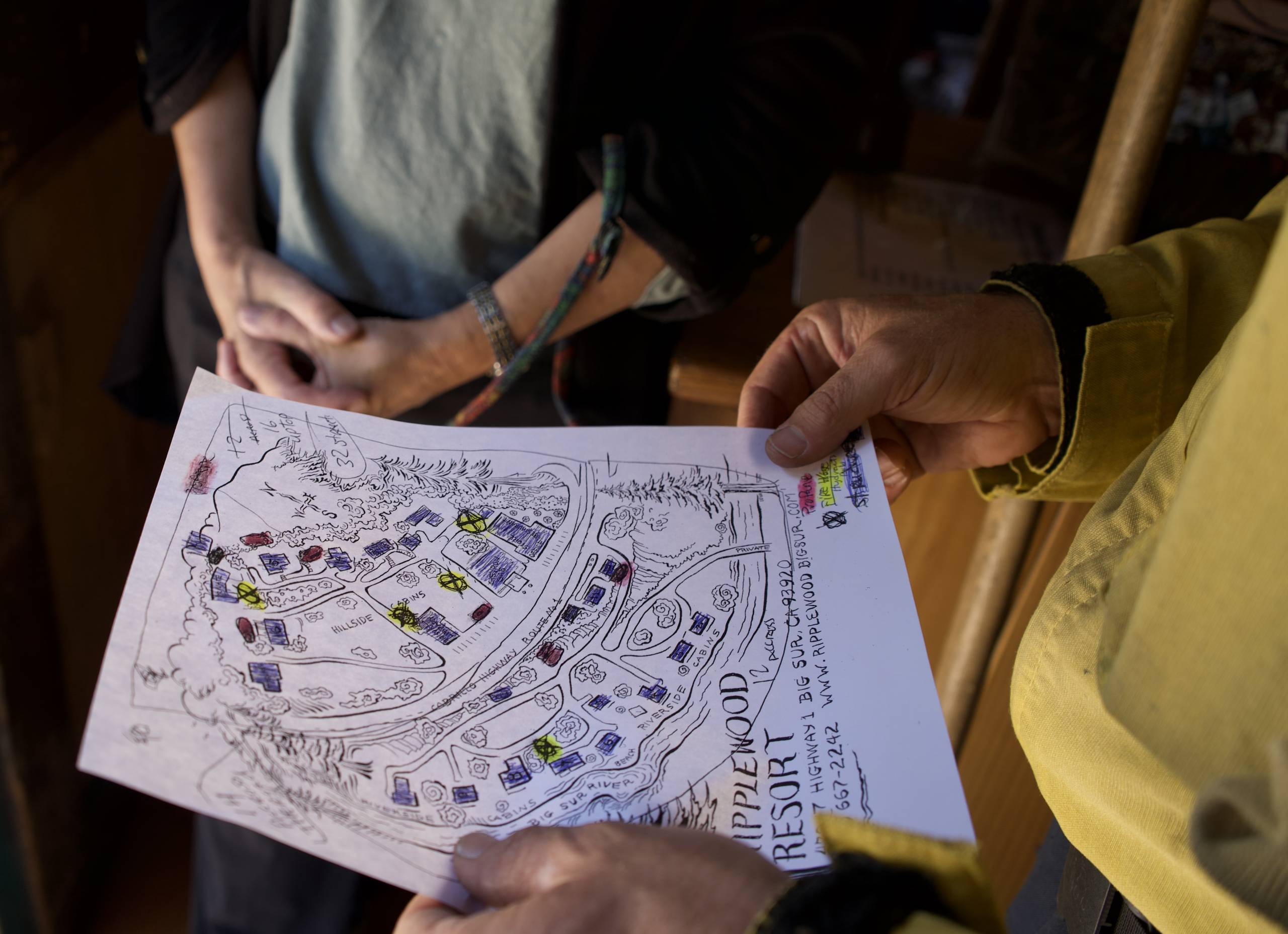
Rusty Sexton is a Battalion Chief from San Diego and relies on maps to strategize the best way to fight the blaze. Big Sur residents who’ve lived through wildfires have been sharing their own maps to point out wells and streams.
“They’ve been through it,” says Sexton. “They’ve seen it, and so they’ve got more on-the-ground information.”
Carol Shadwell is one of the folks Sexton is talking about. She owns Ripplewood Resort on Highway 1, in the heart of Big Sur. She’s talking to a firefighter and looking at a hand drawn map her sister created. Shadwell’s resort was in an evacuation zone but she never left. Firefighters were relying on the resort’s general store for basics.
“It’s my home,” says Shadwell. “I couldn’t imagine having to say, ‘Oh no, oh no, you can’t come in here. No, I can’t sell you what you need or want.'”
This is the fourth fire Shadwell has lived through. During the evacuation she extended store hours to accommodate firefighters.
When asked what she will do once the wildfire is fully extinguished, she says “Oh, I’m going on vacation.”
But firefighters say that’ll only happen once it rains.
Labor Day weekend is here, and as you’ve heard we’re still in the middle of fire season without much rain in sight. We know many of you will likely be heading outdoors to enjoy California’s wilderness so KQED Outdoors reporter Sarah Wright is joining us today to walk us through some ways to stay safe.
This interview has been edited for length and clarity.
BOLANOS: So what should campers know before they head out if they’re worried about a fire nearby or scared that one might start while they’re out?
WRIGHT: I think the first thing to do is to just check in with where you’re going. So let’s say you’re going to a state park or a national park, you can check the website or usually social media as well, and they’ll have fire information posted. If you’re really worried about it, you could call up the ranger station and local rangers will usually have all of the information about any fires that are burning nearby. And then also any evacuation information you may need to know. One thing I like to do is take note of paved roads nearby or escape routes nearby. So I think if you’re extra worried, those are great precautions. If you want to be double, double secure, I would check air quality, if that’s something that tends to bother you. Bring in a mask just in case, and you can even bring a go-bag or an emergency beacon if you are really worried that you’re going to have to leave quickly.
BOLANOS: Okay, let’s say I didn’t have time to do any of that and I’m out on the campground and it’s just too late. I didn’t know until I got there. What do I do in that case?
WRIGHT: Well, this has actually happened to me twice, so I’m an expert in this situation. One time was in Big Sur, I was driving down to my camp spot and I literally saw a fire on a mountain while I was down there, so I turned around, I got the heck out of there. I think that’s like my number one piece of advice – just go, don’t hesitate. The second time I rolled up to a campsite, it was beautiful, everything was great, and then a couple hours later, the ash started falling from the sky. And once again, I just left. It’s not worth it to be out there in danger. Just go. You may have to leave your stuff, so be okay with that. Don’t pack up your tent, it’s not worth it. And find that road that you took note of. There’s probably going to be emergency vehicles going up and down it, so if you happen to be stranded without a car or you need help, a paved road is a great place to be to get that help. And then if you do have cell service, maybe you’re the first to spot the fire, you can be the person that calls in 9-1-1.
BOLANOS: So what else should campers know during fire season?
WRIGHT: I think that here in California, we have a lot of messaging about how dangerous wildfires are. That includes you as a camper. A lot of people love having a campfire camp. Totally understandable. But there are many parks and zones of the California mountains where that is not a good idea and even banned for most of the summer. So pay lots of attention to what the local fire regulations are. If you’re out there, even if it’s not banned but it’s a really windy day, just don’t start that fire. Don’t use your stove. You can bring food that doesn’t require being cooked while you’re there. And if do make a campfire in a legal, safe way, make sure you put it out before you go to bed or before you leave your campsite. What that means, and I say this literally, it should be cool to the touch. You should be able to put your hand into the fire pit safely. And so that’s gonna take a little time, but that’s really the attention that we need to pay here in California because fires can escape so, so quickly.
BOLANOS: Sarah, thank you so much for those useful tips.
WRIGHT: No problem, thank you.