Super El Niño Threatens Heavy Storms, Flooding and Coastal Erosion
Airdate: Wednesday, October 21, 2026 at 9 AM
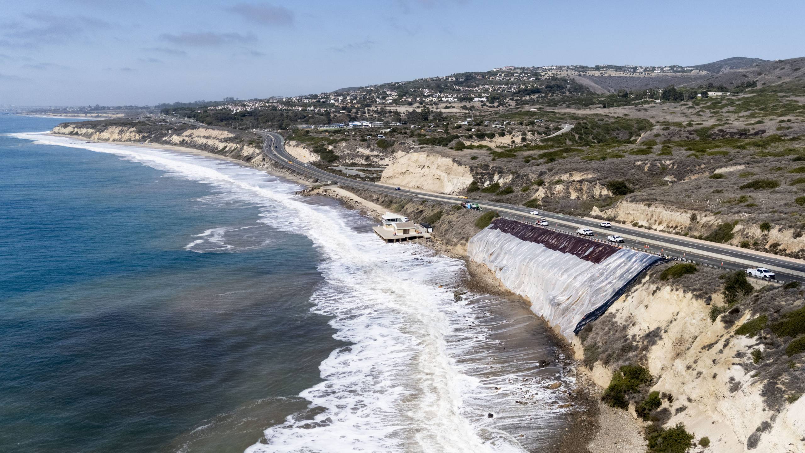
Communities up and down California are bracing for what experts are calling a “Super El Niño” that could bring an unusually wet winter. El Niño is a cyclical climate pattern during which a huge swath of Pacific Ocean waters heat up. The warmer water has long-ranging effects such as higher sea levels and a robust storm season. Some low-lying areas of the state are expecting heavy flooding and some coastal areas are concerned about erosion and mudslides. We’ll talk with experts on what would make this El Niño climate pattern “super” and what you need to know to prepare.
Guests:
- Ezra David Romero, climate reporter, KQED
- Brian Garcia, Warning Coordination Meteorologist, National Weather Service SF Bay Area/Monterey
- Michael W. Beck, Center for Coastal Climate Resilience Director, AXA Chair in Coastal Resilience, NSF Hub on Strong Coasts, UC Santa Cruz
- Patti D’Angelo Juachon, senior program director, Marin Community Foundation
Episode Transcript
This is a computer-generated transcript. While our team has reviewed it, there may be errors.
Alexis Madrigal: Welcome to Forum. I’m Alexis Madrigal. I can be a weather nerd. I find the quest to model the weather to be the kind of difficult challenge that’s worth paying attention to. Coming up in the era of climate change, I want to know if I’m likely to experience something that’s outside of the norms I’ve gotten used to living here.
This El Niño, which could end up being the strongest ever, seems likely to bring us a variety of unusual weather phenomena. But the precise what and where of it are not clear yet. Translating the big picture of, wow, the ocean is hot in the tropics, into what that might mean for San Rafael’s Canal neighborhood — it’s just really hard. Maybe we can get a little closer to being prepared for whatever is coming with our panel this morning.
We’re joined by Ezra David Romero, climate reporter here at KQED. Welcome.
Ezra David Romero: Thank you.
Alexis Madrigal: We have Brian Garcia, warning coordination meteorologist with the National Weather Service, San Francisco Bay Area and Monterey. Welcome.
Brian Garcia: Always a pleasure.
Alexis Madrigal: And we’ve got Michael W. Beck with the Center for Coastal Climate Resilience. Hold on, one more time: Michael Beck, director of the Center for Coastal Climate Resilience at UC Santa Cruz. Welcome.
Michael W. Beck: Thank you. Glad to be here.
Alexis Madrigal: Brian, so let’s just talk about this El Niño. You know, the media has termed it “Super El Niño.” How are you thinking about it in the scheme of El Niños?
Brian Garcia: Yeah, the media has definitely termed it in all sorts of hyperbole, with all sorts of colorful wording. But in the climatological and meteorological community, we simply refer to it as weak, moderate, strong, and very strong. In this case, where the El Niño–Southern Oscillation occurs in the equatorial Pacific, it’s looking to shatter records in terms of the sea surface temperature anomaly.
The last very strong El Niño that we had was back in 2015–2016, when we hit a 2.3-degree Celsius anomaly. Right now, we’re on track to crush that record.
Alexis Madrigal: So when you say that, I think, doesn’t this deserve the hyperbole of “Super El Niño”? It seems to me that we’re trying to communicate that this is potentially a really big deal.
Brian Garcia: Yeah, that’s a really good question. And, you know, I would kind of flip that back to you and say, when we talk about hurricanes, we talk about Category 5 hurricanes, right? Those are the strongest hurricanes. But every hurricane is a little different. Some are bigger, some are smaller. Some have broader and wider wind fields and larger impacts.
It’s the same with every El Niño. Every El Niño is a bit different, despite the sea surface temperature anomalies being so strong and potentially record-shattering. It doesn’t mean that we’re guaranteed specific impacts across our portion of the world, because El Niño happens in a tiny, almost postage-stamp-sized part of the world in the equatorial Pacific. All that does is potentially flex the muscles, and when it flexes, it shoves the weather patterns around in the hemisphere.
Alexis Madrigal: What do we know so far? I mean, we imagine this is going to peak in, what, November, December, something like that — the actual El Niño phenomenon. Does that coincide with the peak of strange weather here in the Bay Area, or unusual weather in California? Or is there some kind of lag built in?
Brian Garcia: Well, this year has actually been rather interesting overall, because we started in the spring with a marine heat wave that set up across portions of coastal Southern California, coastal Baja, and extending all the way down toward the Hawaiian Islands. So we were already dealing with warmer-than-normal water temperatures in our region.
But then El Niño really started taking over after last winter. We came out of this little weak La Niña, and it just spiked into El Niño. Whenever we hit those spikes, we can see the impacts across the area starting to ramp up. But then, like you said, it peaks, and we should peak somewhere in the October, November, December timeframe.
As it starts to drop, we’re still going to be in El Niño throughout the winter into the spring, potentially into summer. But the peak of the impacts typically lags the peak of the sea surface temperatures in that Niño 3.4 region in the equatorial Pacific.
Alexis Madrigal: So, if you were to say — obviously, there’s a ton of uncertainty about exactly what’s going to happen here — but, just as an example, do you think it’s massively more likely that we have a record-setting wet winter here in the Bay Area, a tiny bit more likely, or not much more likely at all than in an average year?
Brian Garcia: Yeah, good question. The words you used were “record-setting,” and I’ll say that research scientists down at the Center for Western Weather and Water Extremes at UC San Diego Scripps have done research in this realm to find out if there’s a correlation between atmospheric rivers and high-intensity rain or amounts of rain in California and the El Niño signal. They have not found a correlation between that.
We’ve actually had extremely wet years in La Niña years that have been very impactful across our area and have crushed some records. But we’ve also had very wet El Niño years, like a lot of your listeners will remember from 1982–1983 and 1997–1998, even 2022–2023 — some big El Niño wet years.
But this year, I’m not going on the books to say that we’re going to crush records by any stretch of the imagination. I will say that we need to prepare for winter like we would every winter and expect the type of flooding across our area that we could see any year.
Alexis Madrigal: Ezra, how are the different institutions around the Bay Area — cities, community groups, other kinds of organizations — preparing for this El Niño?
Ezra David Romero: Yeah, I think it’s sort of all hands on deck. Cities like San Rafael, Pacifica, and San Francisco are all investing in things like pumps. They’re sending messaging out there, encouraging people to cut trees or limbs around their homes, things like that.
I just got an email from Pacifica last week saying that they’re going to start working on their pier to make sure it’s safe. That’s all because there could be a 50 to 60 percent chance that we have above-normal precipitation, you know, from the Bay Area all throughout the South.
And that’s also because we have these Kelvin waves, we have expanded sea levels, so there’s just this layering effect. It could be water from all directions. But, like Brian said, this is potential. It could be an El Niño where we don’t get a lot of big storms up here in the Bay Area. But I think the message is clear that cities should be prepared.
Alexis Madrigal: Yeah, the potential is there. The potential is there.
Brian, when will it come into focus? When I was looking at what some of the models are putting out — and I’m not an expert in this, so I could be misreading these things — it seemed like it was starting to seem more likely that we were going to have a pretty wet winter, particularly here in the Bay Area, not just in Southern California.
Brian Garcia: Yeah, no, good question. When does it come into focus? You’ve got to remember that storms impact us locally in the weather window. When I talk about weather, we’re talking 14 days or less. When we’re talking in the climate window, months and seasons out — seasonal, subseasonal forecasting — that just really paints a broad-brush picture of what could potentially happen.
When it starts coming into focus, it’s a little bit of a loaded question, because we can see that it’s going to be wet this winter. The probabilities are that we’re going to be above normal for precipitation. But how do those storms arrive? What kind of ferocity do they arrive with? What intensity? Where do they make landfall? Who’s going to have the impacts? Those are questions for the weather window, 14 days or less.
So again, I go back to the idea that it’s winter. We have to prepare like we’re going to have an onslaught of precipitation and flooding, and hope for the best and prepare for the worst.
Alexis Madrigal: We’re talking about this year’s El Niño climate pattern, which could be the strongest ever, and what it means in terms of local effects. We’ve got Brian Garcia, warning coordination meteorologist for the National Weather Service, San Francisco Bay Area and Monterey. We’ve got KQED’s Ezra David Romero, our climate reporter, and Michael W. Beck, director of the Center for Coastal Climate Resilience at UC Santa Cruz.
Of course, we want to take your questions. We’ve all been hearing about this El Niño. What remains unresolved or unexplained for you? What are you doing to prepare? 866-733-6786. That’s 866-733-6786. Email us at [email protected]. You can find us on social media — Bluesky, Instagram, and Discord. We’re KQED Forum in all of those places.
Michael, someone like you, focused on coastal resilience, what are you watching about this El Niño?
Michael W. Beck: Yeah, so we’re particularly concerned about the coast, the tidal levels we’re seeing, and waves. I have a little — so I won’t speak to the precipitation patterns. Brian is really the expert on that, and I share his uncertainty. We’re still trying to understand the levels of precipitation.
But on the seaside, when we’re talking coastal sea levels and waves, I actually carry much more concern for this season than may be expressed here. What we’re seeing on the South Coast, where we’ve got waves coming in on top from the hurricanes, coming on top of higher sea levels, adding to those Kelvin wave levels — this is the kind of stuff that makes the season very challenging.
For us here on the Central Coast, I’m just looking at the water levels today, and every tide we’re running right now in the Monterey Bay area is a whole foot above normal. So when we get our king tides, we’re expecting probably to be closer to almost 18 inches above — that’s the king tide plus maybe as much as 18 inches.
When we get to December and January, even an average wave riding on top of that is going to be really concerning. And there’s every reason to believe — I mean, every surfer, of which I’m one, is looking forward to El Niño seasons because of the onslaught of big waves. And again, we’ll be lucky. I’m hopeful, as others are, that we’ll avoid some of the worst impacts. But there are already a lot of higher sea levels baked in, and hoping that we won’t get big waves this winter — I don’t think that’s a great bet to take.
Alexis Madrigal: We’re talking about this year’s El Niño with the director of the Center for Coastal Climate Resilience at UC Santa Cruz, Michael W. Beck. We’ve got the National Weather Service’s Brian Garcia, and we have our own Ezra David Romero, climate reporter here at KQED. I’m Alexis Madrigal. Stay tuned for more right after the break.
Welcome back to Forum. Alexis Madrigal here, talking about El Niño. Maybe you’ve heard of it. Ezra David Romero joins us from KQED. We’ve got Brian Garcia from the National Weather Service, and, of course, Michael W. Beck, director of the Center for Coastal Climate Resilience at UC Santa Cruz.
We’re taking your questions, of course, at 866-733-6786 or [email protected]. Let’s bring in Jonica in San Jose.
Jonica: Good morning. This is Jonica.
Alexis Madrigal: Hey, welcome!
Jonica: Hi, thank you. I just learned about a program that the City of San Jose is doing that I think is fantastic. They’re having an Adopt-a-Drain storm, where you can learn how to actually clean out the storm drain and make sure that everything’s clear. The city is providing tools to be able to do that, to make sure we don’t have flooding in our neighborhoods. I just wanted to share that I think it’s a fantastic way for people to get involved and take care of their own very local community.
Alexis Madrigal: Yeah, Jonica, thank you so much. I mean, Ezra, they’ve been doing this in San Francisco for a while, right? And people have these ways of — it’s just basically getting the leaves and branches out so the water doesn’t back up.
Ezra David Romero: I think KQED even has one for our drains around here. There are drains called “Thirsty Boy,” “You’re So Drain,” “Here Comes the Drain Again,” “Mac Drain,” “Drainman Green.” So you can adopt a drain.
Alexis Madrigal: And if you adopt it, you get to name it?
Ezra David Romero: Yeah, you get to name it. So, you know, name your street.
Alexis Madrigal: Clean your leaves. Yeah, yeah, I love it.
Before the break, Michael Beck, we were talking about the sea level being higher. A couple of thoughts I was having about it. One, it sounds like a dress rehearsal for climate change, right? We’re already seeing sea levels that are higher than they normally would be. But why is that? Is there a simple answer? Why are sea levels so much higher right now during El Niño?
Michael W. Beck: Yeah, well, you’ve got a couple of things baked into the system here. As Brian was indicating, the Pacific is very warm this season. Some of that warmth is raising our sea levels from that alone. We were seeing maybe eight to nine inches of sea level rise from what is mostly warmed water at the Santa Cruz Wharf.
Then we’ve got these Kelvin waves.
Alexis Madrigal: So wait, can I just stop you there really quickly? It’s basically that the water expands when it’s hotter. Is that why the sea level is higher?
Michael W. Beck: Yes, exactly.
Alexis Madrigal: Sorry, I know that’s very basic, but for those of us out there…
Michael W. Beck: No, no, no, I appreciate it. We really do need to understand these things. Yep, water is just expanding as it heats, and that’s the principal cause of a lot of the sea level rise that we see now. Later, we can talk about glaciers and melting, but right now, on top of that, we’ve got these Kelvin waves that are pushing water.
They’re not necessarily caused by El Niño. We can get those Kelvin waves in non-El Niño years, but they are certainly stronger in many El Niño years.
What you normally have — this is very much a global phenomenon — is the trade winds coming from South America and pushing water toward Indonesia and the Philippines. It’s very hot over there. If those trade winds break down and we get some westerly winds, then you start pushing that bulge of water. You can imagine that bulge like in a bathtub, and you’re pushing that bulge back toward our coast. It smacks into Ecuador, and then it starts proceeding along our coasts, both north and south.
We can see this pulse of rising water, and we’re trying to tease out the signal, but it looks to be adding five to six inches or so to those sea levels that were already rising from warming. One passed us, so one started showing up in the signals maybe around October 1, and it looks to have hit its trough around October 14. Now we’re already seeing the rise of the next Kelvin wave, and there’s at least one more behind that.
Alexis Madrigal: Brian Garcia, I mean, this is incredibly complex stuff happening in the ocean. Is that one of the reasons why it’s so difficult to model what might happen with the atmosphere?
Brian Garcia: Yeah, you know, this is a whole coupled system, right? The ocean-atmosphere system. It all works together. When we get warmer sea surface temperatures, you can evaporate more water into the atmosphere. We have a warmer atmosphere due to climate change, and so the atmosphere is able to hold more water. We could see some supercharged storms this year.
On top of that, like Mike was saying, we could have some pretty significant wave heights. As I go around and talk to our partners around the Bay Area and Central Coast regions, I tell them about floods and the winter threats that we talk about every year. But to Mike’s point, my biggest concern this winter is the salt water, because the salt water is something we have not seen at these levels in our recorded history — at the levels expected this winter.
Last January, on January 3, 2026, we had significant flooding in bayside Marin County. You look at the San Francisco tidal gauge, and we hit 8.4 feet based on the mean lower low water datum. That flooded some pretty big areas.
This year, and I agree with Mike, a foot of water is like no problem. We’ve already been running half a foot to a foot above normal. But the other piece of the equation is that we could add another foot on top of that. If we hit two feet at a king tide because of storm surge, thermal expansion, the tides, Kelvin waves — everything sets up at the right time and place, or the wrong time and place — we could see our tidal heights, our total water levels, hit something like 9.25 feet, as opposed to the 8.4 feet that flooded Marin this last winter.
Alexis Madrigal: Wow. I mean, Ezra, you spent some time up there in Marin. What would that even mean for that community?
Ezra David Romero: We think about San Rafael. That’s a community where there’s this creek that’s connected to the Bay, runs to the city, and the city is built right up to that shoreline. It’s protected by this hodgepodge of homemade levees. Some are pieces of board. Some are little humps of concrete.
That would mean some of these areas would flood. A study actually came out yesterday from UC Davis highlighting all the places they’re concerned about. It’s basically so many places along the California coast, and San Rafael is one of them. They basically say that what happened down in Los Angeles, on the southern coast, just a week and a half ago could happen up here, right? As these Kelvin waves and as the ocean expands, it moves north. They’re saying that the farther this happens, the more this warms, places like Pacifica, San Rafael, San Francisco, Santa Cruz — all these kinds of places could have crazy flooding.
I just wanted to add one thing about the Kelvin wave that I learned in my reporting. I wanted to dispel the idea that this is a big wave coming in like a tsunami or something like that. Mike can talk more about this, but it’s an internal wave in the ocean, moving between the warm and cold layers. So it’s not something you necessarily physically see, but it’s happening.
Alexis Madrigal: God, it’s so interesting. Okay, let’s get to Smirkoff here. Rodney in Milpitas, welcome.
Rodney: Hi, two things. One, if and when would we know if we’re going to get hit hard here in the Bay Area — October, November, December? Two, you have tens of thousands and thousands of cars coming into the Bay Area, and that’s going to have a major effect on traffic.
Alexis Madrigal: Mm-hmm, like if we lost some of the highways or something. Yeah, I mean, Allie also comes in with a similar question. When do we expect the rain to start, and for how long do we expect it to last? Brian, I know they’re asking you things that are a little bit impossible to answer, but we can look out now past October. The rains did not start in October. Now we’re into November and December. What do you expect?
Brian Garcia: Yeah, you know, it’s the million-dollar question, and I’ll try to answer the impossible here. The models have indicated that with this system that’s moving through today and tomorrow, it’s really going into Southern California and the Central Coast, bringing some showers and thunderstorms there. Maybe as far north as Santa Cruz and southern Santa Clara County.
As this goes through, it might open the door to more of what we call a zonal pattern, meaning it’s essentially a highway from west to east across the Pacific, straight toward us. So it might open up into a zonal-type pattern where we can start getting more wet weather.
That said, we’re going into winter. We’re expecting the wet weather to really start up in earnest probably in the November-December-ish timeframe, which is our normal window. But the seasonal models have been indicating that our peak timeframe for the rain to hit its maximum — I’m not saying we won’t have rain outside of this, but for it to hit its maximum — looks like it’s going to be January. That’s going to be our big test.
When we talk about January and rainfall, I think of king tides, of course, because we have king tides around Thanksgiving, Christmas, and Martin Luther King Jr. Day. If we have a lot of rain during a king tide event, to your caller’s comment, we’re going to back up storm drains. We’re going to back up systems that drain into the Bay and into the ocean, and we can cause flooding in areas where we may have never seen flooding before, impacting our roadways in a major way, not to mention homes and livelihoods.
Alexis Madrigal: So if I can just — let’s imagine we’re in January. The form this would really take, right, would be where you look at the weather and you see, “Atmospheric river, atmospheric river, atmospheric river, atmospheric river,” right? And it’s not one storm; it’s one storm after the other.
Brian Garcia: Yeah, that’s exactly right. We did this in January and February of 2017. We turned the corner from New Year’s into New Year’s Day, and we started with three atmospheric rivers back to back to back, with a four- or five-day break. We hit that cycle for almost two full months.
Alexis Madrigal: Oh, I remember.
Brian Garcia: Yeah, I do too. I have PTSD from it. Around the Bay Area, we had so much saturation and so much flooding. You’ve got to remember, that was the year Coyote Creek flooded. That was the year the Oroville Dam almost collapsed. We had all these major impacts from just these back-to-back-to-back storms, not to mention the landslides everywhere around the Bay Area.
When we get these types of systems, like you described, back-to-back systems again and again, it ultimately saturates the soils to a point where there’s no room left in the end. So everything’s just runoff, and that’s when we get our dramatic type of flooding.
Alexis Madrigal: Ezra — Alexis. Oh, go ahead, yeah. Go ahead, Mike.
Michael W. Beck: I did just want to note that, yeah, the rain part of this is very significant, but just as Brian said, our king tides are peaking on those holiday weekends. Even if we didn’t have a lot of rain, we’re talking about a foot and a half to two feet of water on top of those king tides. Even if we have just extra-windy storms and some waves that are even moderate, that’s really problematic.
As has happened here in Santa Cruz, when we lost the Capitola Wharf and when we lost the Santa Cruz Wharf, if those are combined with some of our big wave events, even without a lot of rain, it’s super concerning. And as the caller indicated, those are heavy travel times, right in those holiday peaks, right when we’re going to have a lot of water in the coastal system, no matter what.
Alexis Madrigal: I mean, Mike, as I understand it, you’re zooming in from the Resilient California Summit in Sacramento. Obviously, there are many people there dedicated to the same set of issues. What’s the buzz there? Do you feel like people are adequately worried? Do you feel like they’re super worried? What’s the feeling there?
Michael W. Beck: Well, the kind of folks you have at a resilience summit like the one we’re at now — we’re all here in part because the state of California is releasing the fifth climate assessment. It has many concerning elements in it that we need to be prepared for. But the folks here are focused on resilience, trying to figure out what we can do to help with those risks now and into the future.
That’s what we’re here to show: that there are options on our coast, some cost-effective options. We’ve been assessing the risks of flooding and erosion in key places along the coast, like Santa Cruz and Ventura. But importantly, there are solutions, like dunes and some offshore reefs, that can be particularly cost-effective, and we show where. So we’ve got to begin really thinking about solutions, and I think that will be even clearer to us after this season.
Alexis Madrigal: Ben in Glen Ellyn, let’s bring you in. Welcome.
Ben: Hi, thanks for taking my call. I just want to remind you all that in 2015–2016, when they were predicting a very wet winter, just like they are this time, it ended up being below-average precipitation in California and above-average in the Pacific Northwest, where they had been predicting a dry winter. It was the following season, 2016–2017, that ended up being above average. So I just wanted to remind people.
Alexis Madrigal: Yeah, no, this is interesting. Thank you so much, Ben. There is a lot of uncertainty in this, right, Ezra? I mean, that is just the nature of the system.
Ezra David Romero: Yeah, I’ve been covering climate and weather and drought news since 2012 in California. I was in Fresno and Sacramento. I’ve covered many El Niño years now, and not all of them — we kind of get this hysteria every time, in some way, but it doesn’t always pan out that way, which is kind of good for California.
California is also this place of ebbs and flows, dries and hots and wets. That’s kind of our climate anyway. But with human-caused climate change, you’re amping all of this up. Scientists are talking about how we’re potentially going to have shorter bursts of rain — the same amount, but in more intense periods.
I’ve been doing interviews all this week about this, and they’re talking about how this El Niño is sort of a look into the future, you know, that’s happening now and that could even get worse in the future.
Alexis Madrigal: Prem, this one’s also for you, Ezra, although Mike, maybe you know the answer to this too. Prem writes in to say, “I know I need to take down a tree that’s really close to the house, but I can’t afford it. Are there any resources for homeowners for this type of preparation?”
Ezra David Romero: I mean, I think I was talking to Marin County about this, and I know that there are some programs like that. I think they’re dependent on where you live. I know the UC system has a whole website dedicated to this kind of stuff. You can go there and find the right resource. So I think those resources are there, but you just have to —
Alexis Madrigal: Maybe, and maybe not in every place.
Ezra David Romero: Maybe not in every place.
Alexis Madrigal: Yeah. Mike, I imagine the state of California is at least somewhat thinking about these kinds of things.
Michael W. Beck: Yes. I can’t speak specifically to whether there’s an opportunity to get some support for that. But we did see, when Ezra and I were together, that the county was lopping off a lot of eucalyptus trees right in some of the beach areas where the winds are usually really strong. So that’s something very important that can be done.
Around my own house, I’m doing those sorts of measures where I’m able to do them safely myself. I do them, and then I’m trying to think about who I need to bring in, talking about how I get backup power prepared for that.
The other really important thing I’d like to talk to folks about, to make sure they understand, is that one of the most important things you can do to reduce risks is know your neighbors and work in community. Social vulnerability is one of the biggest contributors to risk, and there are things we can do about that.
Our neighbors on my block get together at a happy hour, so we understand what everyone’s needs and resources are, and we can work collectively when we hit some of these storm events. That’s really important. Community is important.
Alexis Madrigal: I agree with that. We’re talking about this year’s El Niño climate pattern, what it can mean for us locally, potential impacts, and what you can do to get ready for it.
We’ve got Mike Beck, director of the Center for Coastal Climate Resilience at UC Santa Cruz, Brian Garcia from the National Weather Service, and KQED’s Ezra David Romero. Of course, we want to hear from you, too, if you have questions about this year’s El Niño. If you live along the coast and you’ve experienced severe storms or flooding in the past, we’d love to hear how you’re getting ready. 866-733-6786. That’s 866-733-6786, or [email protected].
I’m Alexis Madrigal. Stay tuned.
Welcome back to Forum. Alexis Madrigal here. We are talking about El Niño as it comes into focus and what might happen here in the Bay Area and across California. We’re joined by KQED’s Ezra David Romero. We have the National Weather Service, San Francisco Bay Area and Monterey’s Brian Garcia. And we have Mike Beck, director of the Center for Coastal Climate Resilience at UC Santa Cruz.
We’re taking your questions as well about this El Niño. I know it’s been a little bit confusing for me, even, about what’s going on. 866-733-6786, or [email protected]. Go to social media — Bluesky, Instagram, or Discord.
This next question comes from the Discord. It’s a really good one. Douglas writes, “In weather forecasting, one of the most frequent tools we use is comparing current conditions to those that are similar in the past, known as analogs. This gives us a window into being able to chart impacts as a specific event occurs. How confident is our modeling when it comes to an unprecedented El Niño and the impacts it might have along the West Coast, with no analogs to draw from and use in our models?” What do you think, Brian?
Brian Garcia: Yeah, fantastic question. You know, that’s a big challenge. In terms of strong and very strong El Niños, we have nine on record since 1950, since we started measuring the sea surface temperature in the equatorial Pacific. With nine on the record, that’s not a big data set, and so we’re learning every time this comes around.
A previous caller mentioned 2015–2016 being so different from other years. It was billed as the huge El Niño, and it didn’t pan out to be a normal water year. That’s because of a whole host of other factors. When we look at analogs, we can just talk about odds at that point.
Of the nine strong and very strong El Niños we’ve had since 1950, our area favors being wetter than normal, but it’s not guaranteed. Then there’s the strength of the storms. Like I said earlier, with a warming ocean and a warming atmosphere, we can hold more water vapor in the atmosphere, so we could supercharge storms. There are things we’ll look at this winter and, years from now, look back on and say, “Oh, that was the signal of the change.”
Michael W. Beck: Mm-hmm.
Brian Garcia: So I think we’re potentially going to see things this winter that we have no analogs for, that we just don’t know what’s going to happen with. We do the best we can. The weather models are getting better and better, but they take climatology into account as well, so they don’t always keep up the way we want them to.
Alexis Madrigal: I mean, one question I had, too — and it’s something Daniel Swain, who’s been on the show before, may be familiar to people, a climatologist who does a lot of weather in the West and is known as Weather West on social media — he’s been drawing attention to how far east this El Niño event is occurring. Why would that matter? Is it just because of how it changes the storm tracks and things?
Brian Garcia: Yeah, great question. Yes, how far east the El Niño happens ultimately plays into where convection, or thunderstorms, happen over the equatorial Pacific. Then there’s a cell that occurs from the equatorial Pacific that transits energy and moisture and other things to the northern or southern, farther latitudes — higher latitudes.
Once you get that energy into higher latitudes, then you have to look at some of the different patterns that are out there. The Madden-Julian Oscillation may help line up where those thunderstorms are, where the Hadley cell can take them into the mid-latitudes. Then we have what we call an Arctic Oscillation. If we’re in a deep negative phase, we can get the jet stream down far enough to grab some of that moisture, and if it’s in the right spot, it spins it right toward us.
So where those thunderstorms are, where that heat pool is in the equatorial Pacific, matters immensely to what our weather is going to be like this winter.
Alexis Madrigal: So interesting. Just such a complex system. Let’s bring in Chris in Modesto.
Chris: Hi there. I have a son who has a company, Blue Tunisphere Fishing Company in Ventura, and I was wondering how this affects fishing and people in the fishing industry.
Alexis Madrigal: Oh, yeah. Oh, yeah, sure. Thanks, Chris. You know, Mike, maybe we can come to you on this, just to think about the changing ocean conditions around this and what that might do for marine life.
Michael W. Beck: Indeed, the really significant changes in ocean temperatures have meant a lot of changes in our ecosystems. The easiest way to think about this — and it’s only partly true — is that with more warm water pushing up from the tropics, we’ve got more species that are used to warmer waters pushing into our systems. So they’re changing some of the dynamics of those.
There’s a great deal of concern on our coast for kelp ecosystems, which are cold-water ecosystems. When we contribute to their loss — they’ve already been pretty heavily battered in recent years — these increases in temperatures are really affecting kelp loss, as will really significant wave events. So we’re pretty concerned about some of those nearshore ecosystems and what that means for all of the fish that reside in them.
Alexis Madrigal: Also, kind of a fun question, because, at least as I understand it, El Niño was first sort of hinted at by fishermen in South America, off the coast of South America, who noticed that when the water got warmer, their catches dropped. Ezra, did you want to say something?
Ezra David Romero: Oh, yeah. I’ve been talking with some scientists from UC Berkeley who are going out in the next couple of weeks to basically kind of save abalone that are crawling up to get away from urchins, which voraciously eat this kelp. They’re saying they have to go take some samples so that if this El Niño gets really bad, they don’t go extinct. So they’re going to raise them and breed them.
I think scientists across California — biologists, marine scientists — are taking this really seriously to protect species that could be in danger if waters continue to warm.
Alexis Madrigal: Let me ask this question here from Kimberly. Excuse me. Brian, I think this one may go to you, although Mike may take it. Kimberly writes, “I recall hearing about how the current administration cut funding for ocean buoy monitoring as it relates to climate or ocean conditions. Will this potentially affect our knowledge and study of this and future El Niño cycles?”
Brian Garcia: Yeah, I’m going to kick that one to Mike.
Alexis Madrigal: Okay, Mike. Yeah.
Michael W. Beck: Yes. My understanding is that a great deal of that funding was, in fact, saved when it was pointed out just how important that monitoring was to all aspects — not just ecosystems and biology, but commerce, among other things. So, as far as I’m aware, there were not those cuts.
Now, that said, we’re here with many of our federal colleagues who are struggling to piece together the information that helps inform all of us so we can be better prepared for the season. And yes, it’s not just what’s out there in terms of the monitoring devices, but who can use that data to actually better inform us about these changes. That is a real concern.
Brian Garcia: Yeah, and I’ll follow up really quick, if you don’t mind. You’ve got to remember, this is also a global community. We have colleagues not just from the U.S., but also from Europe, Japan, the Japanese Meteorological Agency, the Bureau of Meteorology in Australia. Everybody has a hand in ocean observing because it impacts all of us.
What impacts us directly here impacts the globe, and the globe can step in — and does step in — to help supplement things that we may or may not lose.
Alexis Madrigal: Got it. Let’s bring in one other guest just to help us think about some of these preparations that are going on. We have Patti D’Angelo Juachon, senior program director for the Marin Community Foundation. Welcome.
Patti D’Angelo Juachon: Thank you. Glad to be here.
Alexis Madrigal: So, Patti, how are you all getting involved in this? You’re sort of directly funding some projects?
Patti D’Angelo Juachon: Yeah, and we look at El Niño really as a taste of what our future normal will be. We want to make sure that Marin, and the rest of the Bay Area, remains livable and beautiful, and a place where people can be healthy.
As we look to those future conditions, we know that we have to invest in projects right now around restoration of wetlands that serve as flood protection and carbon sinks. There are so many co-benefits with these types of living shoreline projects, or just helping communities prepare.
Right now, we’re offering preparedness grants to mutual aid groups that serve our most economically disadvantaged communities, because everybody has to help themselves, but some people need help to do that. You can have sand and sandbags, but can you actually fill them and get them to your place of residence?
We’re really thinking about the folks who are the least connected, who may be isolated for financial or other reasons, making sure that they know where to sign up for emergency alerts, and really seeing that people have the information they need to be safe. That’s our very near-term focus.
Then, looking again at our future conditions, we’re looking at projects and processes. How can we think about governance and funding for the big picture — the billions of dollars we’ll need to make our communities resilient?
Alexis Madrigal: Yeah, Mike, how do you think about this? I mean, who’s going to pay for all the preparation and new infrastructure that’s required by climate change adaptation?
Michael W. Beck: Yeah, that’s a really important question. We’ve been working on this a lot. I totally agree with the investment in wetlands. The loss of wetlands in our state, and globally, has been a significant blow to coastal protection in many areas.
But what we need to be aware of is that California, relatively speaking — not relatively, California is a well-off state. Compared to many of the places I work, we’ll be able to respond. But that response is going to be expensive, and it’s then going to limit all the other choices we’d like to make, the other things we’d like to invest in.
So what I tell folks is we need to find those cost-effective adaptation options. The sooner we start, the better it will be. The less risk there will be for the future, the cheaper it will be. The longer we wait, the more expensive and more difficult it gets. And if we’ve got houses over sand, it is nearly impossible to protect them.
Ezra David Romero: I was going to say, the cost of inaction from sea level rise itself is $230 billion for the Bay Area, but the cost of preparing for it through 2050 is like $110 billion. So we’re talking about billions and billions and billions of dollars, and each of these projects can cost millions to billions. There’s a lot of figuring out that’s going to have to happen.
Alexis Madrigal: Yeah, it’s such an interesting thing to imagine. When we look at all of this infrastructure, from the little dams to the levees to these pumping systems to all of the islands and the Delta, do we have a sense of where that money might come from at some point?
Ezra David Romero: I mean, San Francisco right now is trying to figure that out. We have a more-than-100-year-old seawall that extends along the Embarcadero. The Army Corps of Engineers, the city, and the port are working on a plan to reinvent that. But they’re having issues as well. It’s going to cost billions of dollars to do that, and a lot of that might have to come from Congress.
So I think there’s this figuring out of how to convince people — where private dollars can come from for all of that as well. The question is quite unanswered, to be honest.
Alexis Madrigal: Yeah. Let’s actually get to Brett here in Alamo. Welcome, Brett. Can you hear me?
Brett: Yeah, sure can.
Alexis Madrigal: Go ahead.
Brett: Perfect. My question is around, as we’re talking about coastal and mitigating risks around that, and urban flooding and cleaning drains, I’m now more sensitive to areas like the Santa Cruz Mountains, which over the last five years have experienced massive fires, over 800,000 acres. What kind of mitigation are we looking at in terms of those burn fields and the debris fields that are potentially going to come down from those big storms?
I grew up in the Santa Cruz Mountains during the ’80s and experienced the 1982–1983 storm and the massive mudslides. But now that we’ve got more land exposed, not just generally in Santa Cruz, but in California in general, with these massive fires that we’ve experienced, have there been any discussions around how the impact is going to be —
Alexis Madrigal: Yeah, thanks so much for that, Brett. I mean, Mike Beck, this is sort of the mutually reinforcing problems that we have here, right?
Michael W. Beck: Yeah, indeed. There is great concern, particularly if this is a really wet year. Those of us who remember when all the atmospheric rivers were passing over us and Highway 17 was closed know we had really terrible conditions because of those fires, and less on the slope. Yeah, the risks are increased there, that’s for sure.
I’m not an expert on those areas. I know that we have a lot of folks from the UC Santa Cruz campus who live in those communities and have been working on vegetation restoration and reducing some of the streamside erosion in a variety of ways. But we are still at higher risk going into this season than in many years.
Alexis Madrigal: Brian, one for you. A listener writes, “Wind has done more damage to my property than rain. Does El Niño mean increased wind velocities?”
Brian Garcia: El Niño itself doesn’t mean increased wind velocities. But the fact is that, again, going back to the idea that we could have some supercharged storms this winter, I would expect some storms that have stronger winds.
You’re absolutely right to write in about this, because in our service area, the San Francisco Bay Area, in terms of environmental killers, it’s the ocean first and then wind second, because wind falls on homes, cars, and people as they go out for their runs. So if I could advise anybody of anything, if there’s a storm going on, you don’t need to get your run in. Stay home.
Alexis Madrigal: Brian, why are you looking at me, Brian?
Brian Garcia: You know, if the shoe fits, right? Yeah, right. But, yeah, be safe. Live to see another day.
Alexis Madrigal: Yeah, no, I need to hear that. I know. Ezra, you have a guide to getting ready? Is that true?
Ezra David Romero: Yeah. So a few months ago, I created a guide called “El Niño Could Bring a Wet, Wild Winter: How You and Your Home Can Be Ready.” We answer a bunch of questions about your home. We include all the alert numbers you can put into your phone, so when there’s an emergency, no matter what county you live in, you have them. It’s an in-depth guide.
Go to kqed.org to find that and figure out how to make sure you’re safe during El Niño. Get a go bag, go to the store, buy some water, get some batteries — all those kinds of things you need.
Alexis Madrigal: A listener, Sharon, writes in to say, “Who can I contact to find out specific information regarding actual flooding risk in my own neighborhood? I live near the Bay, and even though there’s a levee installed, it has never actually been tested for flooding yet.”
Ezra David Romero: Mike might have a good answer to that because, in this fifth climate assessment, he’s doing some modeling around this risk. Mike, where do you think she should go?
Michael W. Beck: Well, I actually have to get back to that, because, one, we have been developing an understanding of flood risk. We’re mapping some of the areas that would flood if a storm that’s 20 percent stronger than average comes together with all these higher sea levels. We’ll be releasing some maps soon that show where those areas will be flooded, both in Santa Cruz and in portions of San Francisco Bay.
We’ll be releasing that very soon. That doesn’t tell you — so what I want to be very clear about is, I think the caller is asking about a specific event, like, “How do I know during a specific event?” For that, I would be directing people to the National Weather Service and its resources.
But we are trying to show that a lot of areas could be in a situation where we’re overtopping dikes in quite a few places if we put together just a little bit stronger storm with the kind of water levels we’re anticipating.
Alexis Madrigal: Thank you, Mike Beck, director of the Center for Coastal Climate Resilience at UC Santa Cruz. We’ve also been joined by Brian Garcia of the National Weather Service, KQED’s Ezra David Romero, and Patti D’Angelo Juachon, senior program director at the Marin Community Foundation. Thank you so much to all of our callers and commenters. I’m Alexis. Stay tuned for another hour of Forum ahead.