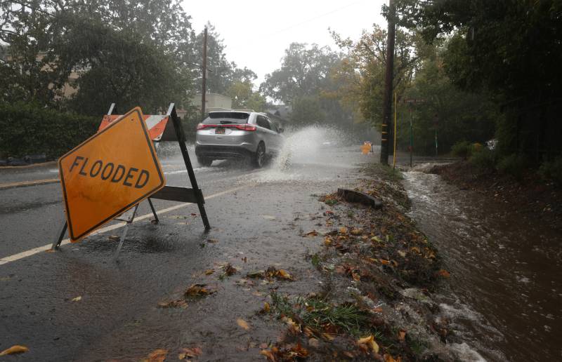
As she reviewed her recent findings on a computer at her then-home in Menlo Park, the power went out. The cause? An atmospheric river in February of last year.
“It was kind of an ironic moment to be thwarted by the very thing I’m trying to understand,” said Knight, a USGS research geographer who studies paleoclimatology — the effects of weather on Earth in the past.
By looking 3,200 years into the past, Knight extended atmospheric river knowledge significantly: twice in three millennia, atmospheric river activity exceeded anything in modern instrumental record keeping, deluging the state with widespread rainfall beyond what current Californians have ever experienced.
The 32 massive storms that drenched California last year pale in comparison to some of the storms in the state’s past. Climate scientists argue Knight’s data established a new baseline for understanding intensifying storms in today’s warming world because of human-caused climate change.
Sponsored
“Understanding what happened when we didn’t have this additional layer of climate change is important to consider as a baseline for what to expect,” she said.
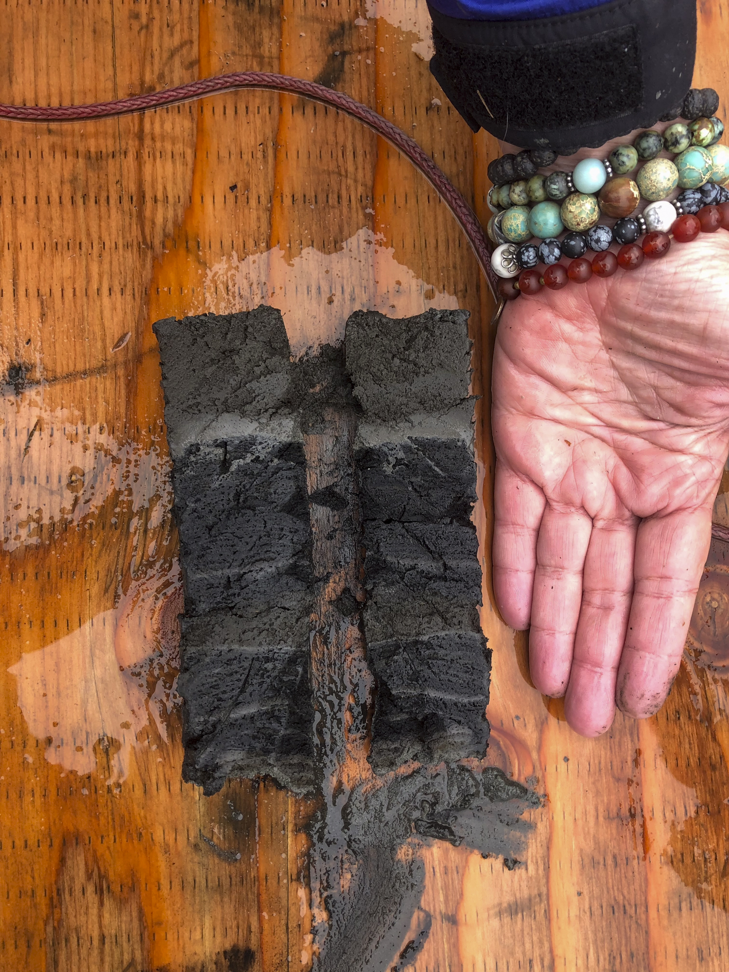
U.S. Geological Survey Scientists Clarke Knight, Lysanna Anderson, Marie Champagne hold an extracted sediment core. They later analyzed the cores to determine past atmospheric river activity.
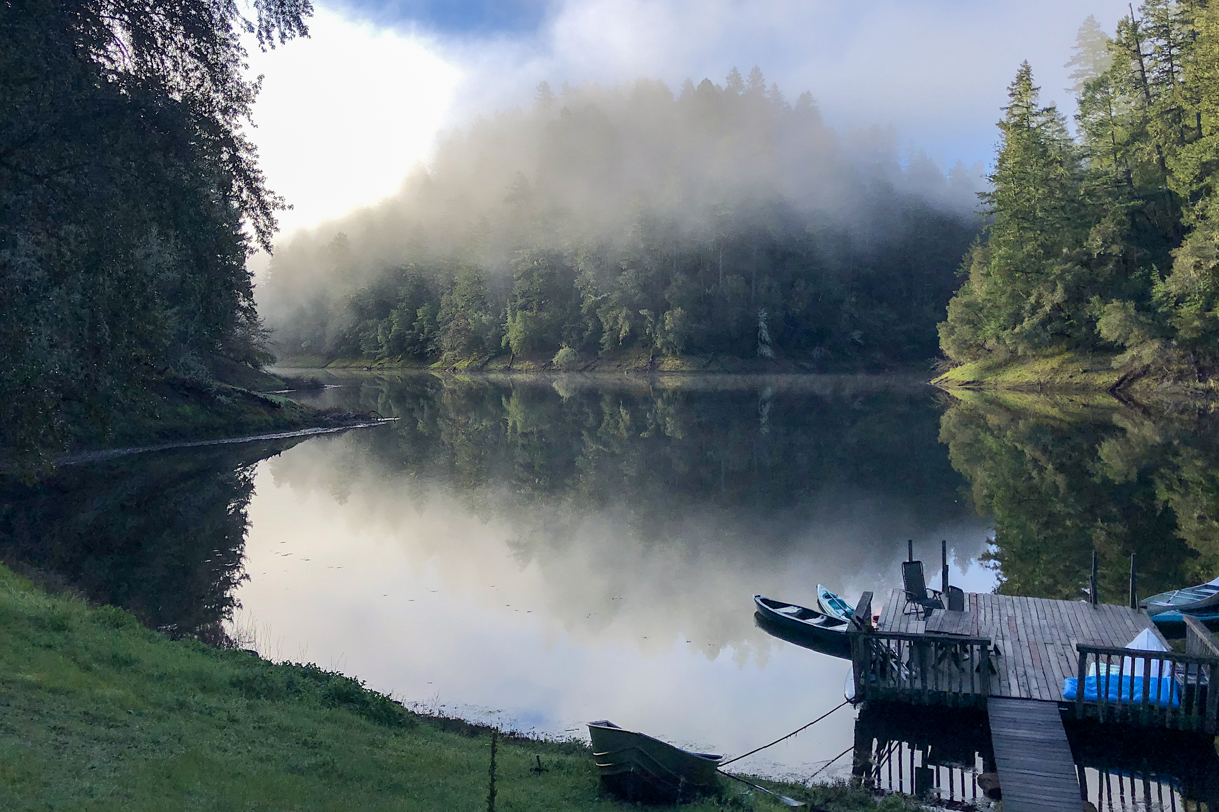
Knight and her colleagues extracted around 15-foot-deep sediment samples from the bottom of Leonard Lake, an almost entirely undisturbed lake in Mendocino County. Atmospheric rivers often hit the lake, causing sediment layers to settle on the lake floor, cementing things like titanium and silica into place. Using radiocarbon dating to determine the age of those organic materials, Knight compared that signal with current records. Once unearthed, the cores provided a more precise long-term history of atmospheric rivers in California.
Related Stories
“We have provided some of the first direct physical evidence of atmospheric storms in California’s history that had not been previously known,” she said. “[It is] about 20 times longer than the information we had previously.”
‘It sets the baseline’
Widespread meteorology records in California began in the late 1940s, and for the longest time, historians viewed the wettest and most disastrous rain event in California as the Great Flood of 1862 — which killed at least 4,000 people and cost more than $3 billion in today’s dollars.
Cody Poulsen, who studies atmospheric rivers at the Scripps Institution of Oceanography, said Knight’s findings are one missing puzzle piece in our understanding of future weather patterns in a warming climate.
“It sets the baseline in the sense that it provides a logical connection regarding the importance of atmospheric rivers,” he said. “This study creates a sobering result that the things that we think are extreme, amplified via global warming and climate change, could be more extreme.”
Clarke Knight studied Leonard Lake in Mendocino County because it sits relatively untouched and because atmospheric rivers often hit the body of water.
Knight’s study does have limitations. First, it focused only on one lake. Poulsen said that samples from lakes across the state are needed to have a more comprehensive view of atmospheric rivers’ effect on California in the past.
“This is just the tip of the spear,” he said.
Also, the study doesn’t resolve individual storms or water years. Instead, each data point holds around 10 years of information, “which in our field is extremely high resolution,” Knight said.
John Chiang, a UC Berkeley professor who studies atmospheric science, said Knight’s new record doesn’t accurately predict future storms in California.
“That being said, it does set a baseline in that this is a first of its kind to reconstruct the atmospheric activity in the past,” he said. “This data doesn’t corroborate the exact physics of what we think will happen in a future climate. Those variations occurred in the past when we didn’t have humanity.”
Knight hopes to expand her work to similar lakes across the coastal range and said learning from history “sets us up for a better conversation about risks.” She also would like her study to cause the state and water managers to “reassess the ability of existing infrastructure to handle these events.”
USGS research geologist Lysanna Anderson compares sediment samples from Leonard Lake in Mendocino County to her hand. Each layer of soil represents years of sediment deposited onto the lake floor.
Michael Anderson, the state’s climatologist, is excited about the study because it takes computer model projections of future weather and turns them into “tangible” observations showing what happened in the past.
“That creates a stronger motivation to keep up the work we’re doing,” he said. “Our system is built to manage floods up to a certain size. Beyond that, the system can be overwhelmed.”
Anderson said the study is helpful in understanding “what makes extreme storms happen,” but more data is needed as the state prepares its reservoirs and waterways for extreme storms.
Along the Russian River in Sonoma and Mendocino counties, water managers track atmospheric rivers using radar units dispersed across mountaintops, flights during storms and the release of water from reservoirs when a big storm approaches.
“I think the findings bolster our current efforts to plan for the extremes that we’ve already been doing,” said Chris Delaney, principal engineer at Sonoma Water.
He said the agency might use Knight’s study in future planning because the new information means extreme events could extend beyond what the agency can handle.
“What we think is a 100-year event or a 500-year event now is probably not accurate if you were to look at the much longer period of climate like this study has done,” Delaney said.
Nathan Baskett, a hydrogeologist for Sonoma Water, said that having this new historical information about atmospheric rivers allows the agency to prepare for what could happen in the coming decades as the world continues to warm.
Sponsored
“It’s nice to see that they have actual physical evidence of it,” he said. “From where I’m sitting, the more data, the better because I think that having that kind of data helps us project for the future.”
lower waypoint
Get the best of KQED’s science coverage in your inbox weekly.
To learn more about how we use your information, please read our privacy policy.
window.__IS_SSR__=true
window.__INITIAL_STATE__={"attachmentsReducer":{"audio_0":{"type":"attachments","id":"audio_0","imgSizes":{"kqedFullSize":{"file":"https://ww2.kqed.org/news/wp-content/themes/KQED-unified/img/audio_bgs/background0.jpg"}}},"audio_1":{"type":"attachments","id":"audio_1","imgSizes":{"kqedFullSize":{"file":"https://ww2.kqed.org/news/wp-content/themes/KQED-unified/img/audio_bgs/background1.jpg"}}},"audio_2":{"type":"attachments","id":"audio_2","imgSizes":{"kqedFullSize":{"file":"https://ww2.kqed.org/news/wp-content/themes/KQED-unified/img/audio_bgs/background2.jpg"}}},"audio_3":{"type":"attachments","id":"audio_3","imgSizes":{"kqedFullSize":{"file":"https://ww2.kqed.org/news/wp-content/themes/KQED-unified/img/audio_bgs/background3.jpg"}}},"audio_4":{"type":"attachments","id":"audio_4","imgSizes":{"kqedFullSize":{"file":"https://ww2.kqed.org/news/wp-content/themes/KQED-unified/img/audio_bgs/background4.jpg"}}},"placeholder":{"type":"attachments","id":"placeholder","imgSizes":{"thumbnail":{"file":"https://ww2.kqed.org/wp-content/uploads/sites/10/2018/01/GettyImages-896326950-160x96.jpg","width":160,"height":96,"mimeType":"image/jpeg"},"medium":{"file":"https://ww2.kqed.org/wp-content/uploads/sites/10/2018/01/GettyImages-896326950-800x478.jpg","width":800,"height":478,"mimeType":"image/jpeg"},"large":{"file":"https://ww2.kqed.org/wp-content/uploads/sites/10/2018/01/GettyImages-896326950-1020x610.jpg","width":1020,"height":610,"mimeType":"image/jpeg"},"fd-lrg":{"file":"https://ww2.kqed.org/wp-content/uploads/sites/10/2018/01/GettyImages-896326950-1920x1148.jpg","width":1920,"height":1148,"mimeType":"image/jpeg"},"fd-med":{"file":"https://ww2.kqed.org/wp-content/uploads/sites/10/2018/01/GettyImages-896326950-1180x705.jpg","width":1180,"height":705,"mimeType":"image/jpeg"},"fd-sm":{"file":"https://ww2.kqed.org/wp-content/uploads/sites/10/2018/01/GettyImages-896326950-960x574.jpg","width":960,"height":574,"mimeType":"image/jpeg"},"post-thumbnail":{"file":"https://ww2.kqed.org/wp-content/uploads/sites/10/2018/01/GettyImages-896326950-672x372.jpg","width":672,"height":372,"mimeType":"image/jpeg"},"twentyfourteen-full-width":{"file":"https://ww2.kqed.org/wp-content/uploads/sites/10/2018/01/GettyImages-896326950-1038x576.jpg","width":1038,"height":576,"mimeType":"image/jpeg"},"xxsmall":{"file":"https://ww2.kqed.org/wp-content/uploads/sites/10/2018/01/GettyImages-896326950-240x143.jpg","width":240,"height":143,"mimeType":"image/jpeg"},"xsmall":{"file":"https://ww2.kqed.org/wp-content/uploads/sites/10/2018/01/GettyImages-896326950-375x224.jpg","width":375,"height":224,"mimeType":"image/jpeg"},"small":{"file":"https://ww2.kqed.org/wp-content/uploads/sites/10/2018/01/GettyImages-896326950-520x311.jpg","width":520,"height":311,"mimeType":"image/jpeg"},"xlarge":{"file":"https://ww2.kqed.org/wp-content/uploads/sites/10/2018/01/GettyImages-896326950-1180x705.jpg","width":1180,"height":705,"mimeType":"image/jpeg"},"full-width":{"file":"https://ww2.kqed.org/wp-content/uploads/sites/10/2018/01/GettyImages-896326950-1920x1148.jpg","width":1920,"height":1148,"mimeType":"image/jpeg"},"guest-author-32":{"file":"https://ww2.kqed.org/wp-content/uploads/sites/10/2018/01/GettyImages-896326950-32x32.jpg","width":32,"height":32,"mimeType":"image/jpeg"},"guest-author-50":{"file":"https://ww2.kqed.org/wp-content/uploads/sites/10/2018/01/GettyImages-896326950-50x50.jpg","width":50,"height":50,"mimeType":"image/jpeg"},"guest-author-64":{"file":"https://ww2.kqed.org/wp-content/uploads/sites/10/2018/01/GettyImages-896326950-64x64.jpg","width":64,"height":64,"mimeType":"image/jpeg"},"guest-author-96":{"file":"https://ww2.kqed.org/wp-content/uploads/sites/10/2018/01/GettyImages-896326950-96x96.jpg","width":96,"height":96,"mimeType":"image/jpeg"},"guest-author-128":{"file":"https://ww2.kqed.org/wp-content/uploads/sites/10/2018/01/GettyImages-896326950-128x128.jpg","width":128,"height":128,"mimeType":"image/jpeg"},"detail":{"file":"https://ww2.kqed.org/wp-content/uploads/sites/10/2018/01/GettyImages-896326950-150x150.jpg","width":150,"height":150,"mimeType":"image/jpeg"},"kqedFullSize":{"file":"https://ww2.kqed.org/wp-content/uploads/sites/10/2018/01/GettyImages-896326950-e1514998105161.jpg","width":1920,"height":1148}}},"science_1956195":{"type":"attachments","id":"science_1956195","meta":{"index":"attachments_1591205162","site":"science","id":"1956195","found":true},"title":"Monarch 1","publishDate":1579917116,"status":"inherit","parent":1956190,"modified":1579917365,"caption":"A monarch butterfly nectaring on swamp milkweed.","credit":"Stephanie McKnight/Xerces Society","description":null,"imgSizes":{"thumbnail":{"file":"https://ww2.kqed.org/app/uploads/sites/35/2020/01/Monarch-1-160x120.jpg","width":160,"height":120,"mimeType":"image/jpeg"},"medium":{"file":"https://ww2.kqed.org/app/uploads/sites/35/2020/01/Monarch-1-800x600.jpg","width":800,"height":600,"mimeType":"image/jpeg"},"medium_large":{"file":"https://ww2.kqed.org/app/uploads/sites/35/2020/01/Monarch-1-768x576.jpg","width":768,"height":576,"mimeType":"image/jpeg"},"large":{"file":"https://ww2.kqed.org/app/uploads/sites/35/2020/01/Monarch-1-1020x765.jpg","width":1020,"height":765,"mimeType":"image/jpeg"},"post-thumbnail":{"file":"https://ww2.kqed.org/app/uploads/sites/35/2020/01/Monarch-1-672x372.jpg","width":672,"height":372,"mimeType":"image/jpeg"},"twentyfourteen-full-width":{"file":"https://ww2.kqed.org/app/uploads/sites/35/2020/01/Monarch-1-1038x576.jpg","width":1038,"height":576,"mimeType":"image/jpeg"},"full-width":{"file":"https://ww2.kqed.org/app/uploads/sites/35/2020/01/Monarch-1-1920x1441.jpg","width":1920,"height":1441,"mimeType":"image/jpeg"},"kqedFullSize":{"file":"https://ww2.kqed.org/app/uploads/sites/35/2020/01/Monarch-1.jpg","width":3024,"height":2269}},"fetchFailed":false,"isLoading":false},"science_1992725":{"type":"attachments","id":"science_1992725","meta":{"index":"attachments_1591205162","site":"science","id":"1992725","found":true},"title":"240510-SICK PELICANS-MD-10-KQED-1","publishDate":1715477285,"status":"inherit","parent":1992713,"modified":1715477334,"caption":"Rescued California Brown Pelicans are fed frozen fish at International Bird Rescue in Fairfield on May 11, 2024.","credit":"Martin do Nascimento/KQED","altTag":null,"description":null,"imgSizes":{"medium":{"file":"https://cdn.kqed.org/wp-content/uploads/sites/35/2024/05/240510-SICK-PELICANS-MD-10-KQED-1-800x533.jpg","width":800,"height":533,"mimeType":"image/jpeg"},"large":{"file":"https://cdn.kqed.org/wp-content/uploads/sites/35/2024/05/240510-SICK-PELICANS-MD-10-KQED-1-1020x680.jpg","width":1020,"height":680,"mimeType":"image/jpeg"},"thumbnail":{"file":"https://cdn.kqed.org/wp-content/uploads/sites/35/2024/05/240510-SICK-PELICANS-MD-10-KQED-1-160x107.jpg","width":160,"height":107,"mimeType":"image/jpeg"},"medium_large":{"file":"https://cdn.kqed.org/wp-content/uploads/sites/35/2024/05/240510-SICK-PELICANS-MD-10-KQED-1-768x512.jpg","width":768,"height":512,"mimeType":"image/jpeg"},"1536x1536":{"file":"https://cdn.kqed.org/wp-content/uploads/sites/35/2024/05/240510-SICK-PELICANS-MD-10-KQED-1-1536x1024.jpg","width":1536,"height":1024,"mimeType":"image/jpeg"},"post-thumbnail":{"file":"https://cdn.kqed.org/wp-content/uploads/sites/35/2024/05/240510-SICK-PELICANS-MD-10-KQED-1-672x372.jpg","width":672,"height":372,"mimeType":"image/jpeg"},"twentyfourteen-full-width":{"file":"https://cdn.kqed.org/wp-content/uploads/sites/35/2024/05/240510-SICK-PELICANS-MD-10-KQED-1-1038x576.jpg","width":1038,"height":576,"mimeType":"image/jpeg"},"full-width":{"file":"https://cdn.kqed.org/wp-content/uploads/sites/35/2024/05/240510-SICK-PELICANS-MD-10-KQED-1-1920x1280.jpg","width":1920,"height":1280,"mimeType":"image/jpeg"},"kqedFullSize":{"file":"https://cdn.kqed.org/wp-content/uploads/sites/35/2024/05/240510-SICK-PELICANS-MD-10-KQED-1.jpg","width":2000,"height":1333}},"fetchFailed":false,"isLoading":false},"science_1992756":{"type":"attachments","id":"science_1992756","meta":{"index":"attachments_1591205162","site":"science","id":"1992756","found":true},"title":"Northern Lights in the Bay Area","publishDate":1715621850,"status":"inherit","parent":1992745,"modified":1715627744,"caption":"A view of the northern lights over the Bay Bridge on May 10, 2024.","credit":"Shreenivasan Manievannan","altTag":null,"description":null,"imgSizes":{"medium":{"file":"https://cdn.kqed.org/wp-content/uploads/sites/35/2024/05/9C3BB325-2D3B-4450-AF51-36481D9C2232-1-800x535.jpg","width":800,"height":535,"mimeType":"image/jpeg"},"large":{"file":"https://cdn.kqed.org/wp-content/uploads/sites/35/2024/05/9C3BB325-2D3B-4450-AF51-36481D9C2232-1-1020x682.jpg","width":1020,"height":682,"mimeType":"image/jpeg"},"thumbnail":{"file":"https://cdn.kqed.org/wp-content/uploads/sites/35/2024/05/9C3BB325-2D3B-4450-AF51-36481D9C2232-1-160x107.jpg","width":160,"height":107,"mimeType":"image/jpeg"},"medium_large":{"file":"https://cdn.kqed.org/wp-content/uploads/sites/35/2024/05/9C3BB325-2D3B-4450-AF51-36481D9C2232-1-768x513.jpg","width":768,"height":513,"mimeType":"image/jpeg"},"post-thumbnail":{"file":"https://cdn.kqed.org/wp-content/uploads/sites/35/2024/05/9C3BB325-2D3B-4450-AF51-36481D9C2232-1-672x372.jpg","width":672,"height":372,"mimeType":"image/jpeg"},"twentyfourteen-full-width":{"file":"https://cdn.kqed.org/wp-content/uploads/sites/35/2024/05/9C3BB325-2D3B-4450-AF51-36481D9C2232-1-1038x576.jpg","width":1038,"height":576,"mimeType":"image/jpeg"},"kqedFullSize":{"file":"https://cdn.kqed.org/wp-content/uploads/sites/35/2024/05/9C3BB325-2D3B-4450-AF51-36481D9C2232-1.jpg","width":1080,"height":722}},"fetchFailed":false,"isLoading":false},"science_1970583":{"type":"attachments","id":"science_1970583","meta":{"index":"attachments_1591205162","site":"science","id":"1970583","found":true},"title":"Ryan and Jennifer Montano search through the remains of their Vacaville, Calif., home, destroyed in the LNU Lightning Complex Fire in August.","publishDate":1603298909,"status":"inherit","parent":1970581,"modified":1715712866,"caption":"Ryan and Jennifer Montano search through the remains of their Vacaville, California, home, which was destroyed in the LNU Lightning Complex Fire in August 2020.","credit":"Lauren Sommer/NPR","altTag":null,"description":null,"imgSizes":{"medium":{"file":"https://cdn.kqed.org/wp-content/uploads/sites/35/2020/10/dsc02840_slide-156ffe8681254744e0ae0018f4d403f22afe665d-800x533.jpg","width":800,"height":533,"mimeType":"image/jpeg"},"large":{"file":"https://cdn.kqed.org/wp-content/uploads/sites/35/2020/10/dsc02840_slide-156ffe8681254744e0ae0018f4d403f22afe665d-1020x680.jpg","width":1020,"height":680,"mimeType":"image/jpeg"},"thumbnail":{"file":"https://cdn.kqed.org/wp-content/uploads/sites/35/2020/10/dsc02840_slide-156ffe8681254744e0ae0018f4d403f22afe665d-160x107.jpg","width":160,"height":107,"mimeType":"image/jpeg"},"medium_large":{"file":"https://cdn.kqed.org/wp-content/uploads/sites/35/2020/10/dsc02840_slide-156ffe8681254744e0ae0018f4d403f22afe665d-768x512.jpg","width":768,"height":512,"mimeType":"image/jpeg"},"1536x1536":{"file":"https://cdn.kqed.org/wp-content/uploads/sites/35/2020/10/dsc02840_slide-156ffe8681254744e0ae0018f4d403f22afe665d-1536x1024.jpg","width":1536,"height":1024,"mimeType":"image/jpeg"},"2048x2048":{"file":"https://cdn.kqed.org/wp-content/uploads/sites/35/2020/10/dsc02840_slide-156ffe8681254744e0ae0018f4d403f22afe665d-2048x1365.jpg","width":2048,"height":1365,"mimeType":"image/jpeg"},"post-thumbnail":{"file":"https://cdn.kqed.org/wp-content/uploads/sites/35/2020/10/dsc02840_slide-156ffe8681254744e0ae0018f4d403f22afe665d-672x372.jpg","width":672,"height":372,"mimeType":"image/jpeg"},"twentyfourteen-full-width":{"file":"https://cdn.kqed.org/wp-content/uploads/sites/35/2020/10/dsc02840_slide-156ffe8681254744e0ae0018f4d403f22afe665d-1038x576.jpg","width":1038,"height":576,"mimeType":"image/jpeg"},"full-width":{"file":"https://cdn.kqed.org/wp-content/uploads/sites/35/2020/10/dsc02840_slide-156ffe8681254744e0ae0018f4d403f22afe665d-1920x1280.jpg","width":1920,"height":1280,"mimeType":"image/jpeg"},"kqedFullSize":{"file":"https://cdn.kqed.org/wp-content/uploads/sites/35/2020/10/dsc02840_slide-156ffe8681254744e0ae0018f4d403f22afe665d-scaled.jpg","width":2560,"height":1706}},"fetchFailed":false,"isLoading":false},"science_1992812":{"type":"attachments","id":"science_1992812","meta":{"index":"attachments_1591205162","site":"science","id":"1992812","found":true},"title":"240513-RAWMILK-01-BL-KQED","publishDate":1715728368,"status":"inherit","parent":0,"modified":1715889875,"caption":"One-gallon containers of raw milk sit in the dairy section of Sprouts Farmers Market supermarket in Daly City on May 13, 2024.","credit":"Beth LaBerge/KQED","altTag":"Gallons of raw milk in jugs inside a refrigerator.","description":null,"imgSizes":{"medium":{"file":"https://cdn.kqed.org/wp-content/uploads/sites/35/2024/05/240513-RAWMILK-01-BL-KQED-800x533.jpg","width":800,"height":533,"mimeType":"image/jpeg"},"large":{"file":"https://cdn.kqed.org/wp-content/uploads/sites/35/2024/05/240513-RAWMILK-01-BL-KQED-1020x680.jpg","width":1020,"height":680,"mimeType":"image/jpeg"},"thumbnail":{"file":"https://cdn.kqed.org/wp-content/uploads/sites/35/2024/05/240513-RAWMILK-01-BL-KQED-160x107.jpg","width":160,"height":107,"mimeType":"image/jpeg"},"medium_large":{"file":"https://cdn.kqed.org/wp-content/uploads/sites/35/2024/05/240513-RAWMILK-01-BL-KQED-768x512.jpg","width":768,"height":512,"mimeType":"image/jpeg"},"1536x1536":{"file":"https://cdn.kqed.org/wp-content/uploads/sites/35/2024/05/240513-RAWMILK-01-BL-KQED-1536x1024.jpg","width":1536,"height":1024,"mimeType":"image/jpeg"},"post-thumbnail":{"file":"https://cdn.kqed.org/wp-content/uploads/sites/35/2024/05/240513-RAWMILK-01-BL-KQED-672x372.jpg","width":672,"height":372,"mimeType":"image/jpeg"},"twentyfourteen-full-width":{"file":"https://cdn.kqed.org/wp-content/uploads/sites/35/2024/05/240513-RAWMILK-01-BL-KQED-1038x576.jpg","width":1038,"height":576,"mimeType":"image/jpeg"},"full-width":{"file":"https://cdn.kqed.org/wp-content/uploads/sites/35/2024/05/240513-RAWMILK-01-BL-KQED-1920x1280.jpg","width":1920,"height":1280,"mimeType":"image/jpeg"},"kqedFullSize":{"file":"https://cdn.kqed.org/wp-content/uploads/sites/35/2024/05/240513-RAWMILK-01-BL-KQED.jpg","width":2000,"height":1333}},"fetchFailed":false,"isLoading":false},"science_1992654":{"type":"attachments","id":"science_1992654","meta":{"index":"attachments_1591205162","site":"science","id":"1992654","found":true},"title":"240508-SWINGDISTRICTCLIMATE-12-BL-KQED","publishDate":1715274590,"status":"inherit","parent":0,"modified":1715373902,"caption":"Sebastian Cervantes, an organizer in the Central Valley, stands in Merced, California, on May 8, 2024.","credit":"Beth LaBerge/KQED","altTag":null,"description":null,"imgSizes":{"medium":{"file":"https://cdn.kqed.org/wp-content/uploads/sites/35/2024/05/240508-SWINGDISTRICTCLIMATE-12-BL-KQED-800x533.jpg","width":800,"height":533,"mimeType":"image/jpeg"},"large":{"file":"https://cdn.kqed.org/wp-content/uploads/sites/35/2024/05/240508-SWINGDISTRICTCLIMATE-12-BL-KQED-1020x680.jpg","width":1020,"height":680,"mimeType":"image/jpeg"},"thumbnail":{"file":"https://cdn.kqed.org/wp-content/uploads/sites/35/2024/05/240508-SWINGDISTRICTCLIMATE-12-BL-KQED-160x107.jpg","width":160,"height":107,"mimeType":"image/jpeg"},"medium_large":{"file":"https://cdn.kqed.org/wp-content/uploads/sites/35/2024/05/240508-SWINGDISTRICTCLIMATE-12-BL-KQED-768x512.jpg","width":768,"height":512,"mimeType":"image/jpeg"},"1536x1536":{"file":"https://cdn.kqed.org/wp-content/uploads/sites/35/2024/05/240508-SWINGDISTRICTCLIMATE-12-BL-KQED-1536x1024.jpg","width":1536,"height":1024,"mimeType":"image/jpeg"},"post-thumbnail":{"file":"https://cdn.kqed.org/wp-content/uploads/sites/35/2024/05/240508-SWINGDISTRICTCLIMATE-12-BL-KQED-672x372.jpg","width":672,"height":372,"mimeType":"image/jpeg"},"twentyfourteen-full-width":{"file":"https://cdn.kqed.org/wp-content/uploads/sites/35/2024/05/240508-SWINGDISTRICTCLIMATE-12-BL-KQED-1038x576.jpg","width":1038,"height":576,"mimeType":"image/jpeg"},"full-width":{"file":"https://cdn.kqed.org/wp-content/uploads/sites/35/2024/05/240508-SWINGDISTRICTCLIMATE-12-BL-KQED-1920x1280.jpg","width":1920,"height":1280,"mimeType":"image/jpeg"},"kqedFullSize":{"file":"https://cdn.kqed.org/wp-content/uploads/sites/35/2024/05/240508-SWINGDISTRICTCLIMATE-12-BL-KQED.jpg","width":2000,"height":1333}},"fetchFailed":false,"isLoading":false},"science_12935":{"type":"attachments","id":"science_12935","meta":{"index":"attachments_1591205162","site":"science","id":"12935","found":true},"title":"pelicanrock_scale","publishDate":1389329283,"status":"inherit","parent":12909,"modified":1389329283,"caption":"Pelican Rock marks the northern end of Martins Beach. (Amy Standen/KQED)","credit":null,"description":"Pelican Rock marks the northern end of Martins Beach. (Amy Standen/KQED)","imgSizes":{"kqedFullSize":{"file":"https://ww2.kqed.org/app/uploads/sites/35/2014/01/pelicanrock_scale-e1389396164850.jpg","width":1280,"height":720}},"fetchFailed":false,"isLoading":false},"science_1992437":{"type":"attachments","id":"science_1992437","meta":{"index":"attachments_1591205162","site":"science","id":"1992437","found":true},"title":"CaliforniaStateParkDosRiosTract01","publishDate":1713892560,"status":"inherit","parent":1992433,"modified":1713895356,"caption":"The confluence of the San Joaquin River, left, and Tuolumne River, right, along the Dos Rios Ranch on Tuesday, Sept. 21, 2021, in Modesto, California.","credit":"Brian van der Brug/Los Angeles Times via Getty Images","altTag":null,"description":null,"imgSizes":{"medium":{"file":"https://cdn.kqed.org/wp-content/uploads/sites/35/2024/04/CaliforniaStateParkDosRiosTract01-800x533.jpg","width":800,"height":533,"mimeType":"image/jpeg"},"large":{"file":"https://cdn.kqed.org/wp-content/uploads/sites/35/2024/04/CaliforniaStateParkDosRiosTract01-1020x680.jpg","width":1020,"height":680,"mimeType":"image/jpeg"},"thumbnail":{"file":"https://cdn.kqed.org/wp-content/uploads/sites/35/2024/04/CaliforniaStateParkDosRiosTract01-160x107.jpg","width":160,"height":107,"mimeType":"image/jpeg"},"medium_large":{"file":"https://cdn.kqed.org/wp-content/uploads/sites/35/2024/04/CaliforniaStateParkDosRiosTract01-768x512.jpg","width":768,"height":512,"mimeType":"image/jpeg"},"1536x1536":{"file":"https://cdn.kqed.org/wp-content/uploads/sites/35/2024/04/CaliforniaStateParkDosRiosTract01-1536x1024.jpg","width":1536,"height":1024,"mimeType":"image/jpeg"},"post-thumbnail":{"file":"https://cdn.kqed.org/wp-content/uploads/sites/35/2024/04/CaliforniaStateParkDosRiosTract01-672x372.jpg","width":672,"height":372,"mimeType":"image/jpeg"},"twentyfourteen-full-width":{"file":"https://cdn.kqed.org/wp-content/uploads/sites/35/2024/04/CaliforniaStateParkDosRiosTract01-1038x576.jpg","width":1038,"height":576,"mimeType":"image/jpeg"},"kqedFullSize":{"file":"https://cdn.kqed.org/wp-content/uploads/sites/35/2024/04/CaliforniaStateParkDosRiosTract01.jpg","width":1920,"height":1280}},"fetchFailed":false,"isLoading":false},"science_1992646":{"type":"attachments","id":"science_1992646","meta":{"index":"attachments_1591205162","site":"science","id":"1992646","found":true},"title":"New Sixth Street Bridge and Los Angeles River","publishDate":1715211503,"status":"inherit","parent":1992639,"modified":1715211600,"caption":"California’s new proposal would vary by income. Low-income households would pay $6 or $12, while middle-class and high-income households would pay $24.","credit":"Citizen of the Planet/Universal Images Group via Getty Images","altTag":null,"description":null,"imgSizes":{"medium":{"file":"https://cdn.kqed.org/wp-content/uploads/sites/35/2024/05/GettyImages-1457745918-800x533.jpg","width":800,"height":533,"mimeType":"image/jpeg"},"large":{"file":"https://cdn.kqed.org/wp-content/uploads/sites/35/2024/05/GettyImages-1457745918-1020x680.jpg","width":1020,"height":680,"mimeType":"image/jpeg"},"thumbnail":{"file":"https://cdn.kqed.org/wp-content/uploads/sites/35/2024/05/GettyImages-1457745918-160x107.jpg","width":160,"height":107,"mimeType":"image/jpeg"},"medium_large":{"file":"https://cdn.kqed.org/wp-content/uploads/sites/35/2024/05/GettyImages-1457745918-768x512.jpg","width":768,"height":512,"mimeType":"image/jpeg"},"1536x1536":{"file":"https://cdn.kqed.org/wp-content/uploads/sites/35/2024/05/GettyImages-1457745918-1536x1024.jpg","width":1536,"height":1024,"mimeType":"image/jpeg"},"2048x2048":{"file":"https://cdn.kqed.org/wp-content/uploads/sites/35/2024/05/GettyImages-1457745918-2048x1365.jpg","width":2048,"height":1365,"mimeType":"image/jpeg"},"post-thumbnail":{"file":"https://cdn.kqed.org/wp-content/uploads/sites/35/2024/05/GettyImages-1457745918-672x372.jpg","width":672,"height":372,"mimeType":"image/jpeg"},"twentyfourteen-full-width":{"file":"https://cdn.kqed.org/wp-content/uploads/sites/35/2024/05/GettyImages-1457745918-1038x576.jpg","width":1038,"height":576,"mimeType":"image/jpeg"},"full-width":{"file":"https://cdn.kqed.org/wp-content/uploads/sites/35/2024/05/GettyImages-1457745918-1920x1280.jpg","width":1920,"height":1280,"mimeType":"image/jpeg"},"kqedFullSize":{"file":"https://cdn.kqed.org/wp-content/uploads/sites/35/2024/05/GettyImages-1457745918-scaled.jpg","width":2560,"height":1707}},"fetchFailed":false,"isLoading":false},"science_1981944":{"type":"attachments","id":"science_1981944","meta":{"index":"attachments_1591205162","site":"science","id":"1981944","found":true},"title":"Water pours out of Lake Oroville in Northern California in March. Reservoirs levels plummeted over the last three years, but now have more water than they can hold.","publishDate":1679589957,"status":"inherit","parent":1981943,"modified":1715188781,"caption":"Water pours out of Lake Oroville in Northern California in March 2023. Reservoir levels plummeted over the last three years but now have more water than they can hold.","credit":"Ken James/California Department of Water Resources","altTag":"Water flowing at high speeds out of a lake.","description":"A drone provides an aerial view of the small cloud mist formed as water flows over the four energy dissipator blocks at the end of the Lake Oroville main spillway. The California Department of Water Resources increased the water release down the main spillway from 4,000 cubic feet per second (cfs) to 8,000 cfs. Main spillway releases will continue to manage lake levels in anticipation of rain and snowmelt. Photo taken March 10, 2023.\n\nKen James / California Department of Water Resources","imgSizes":{"medium":{"file":"https://cdn.kqed.org/wp-content/uploads/sites/35/2023/03/2023_03_10_kj_0135_oroville_spillway_release_drone_custom-1c4d8c2890281e48323fb324cfa8dc4fdda4bca7-800x554.jpg","width":800,"height":554,"mimeType":"image/jpeg"},"large":{"file":"https://cdn.kqed.org/wp-content/uploads/sites/35/2023/03/2023_03_10_kj_0135_oroville_spillway_release_drone_custom-1c4d8c2890281e48323fb324cfa8dc4fdda4bca7-1020x706.jpg","width":1020,"height":706,"mimeType":"image/jpeg"},"thumbnail":{"file":"https://cdn.kqed.org/wp-content/uploads/sites/35/2023/03/2023_03_10_kj_0135_oroville_spillway_release_drone_custom-1c4d8c2890281e48323fb324cfa8dc4fdda4bca7-160x111.jpg","width":160,"height":111,"mimeType":"image/jpeg"},"medium_large":{"file":"https://cdn.kqed.org/wp-content/uploads/sites/35/2023/03/2023_03_10_kj_0135_oroville_spillway_release_drone_custom-1c4d8c2890281e48323fb324cfa8dc4fdda4bca7-768x531.jpg","width":768,"height":531,"mimeType":"image/jpeg"},"1536x1536":{"file":"https://cdn.kqed.org/wp-content/uploads/sites/35/2023/03/2023_03_10_kj_0135_oroville_spillway_release_drone_custom-1c4d8c2890281e48323fb324cfa8dc4fdda4bca7-1536x1063.jpg","width":1536,"height":1063,"mimeType":"image/jpeg"},"2048x2048":{"file":"https://cdn.kqed.org/wp-content/uploads/sites/35/2023/03/2023_03_10_kj_0135_oroville_spillway_release_drone_custom-1c4d8c2890281e48323fb324cfa8dc4fdda4bca7-2048x1417.jpg","width":2048,"height":1417,"mimeType":"image/jpeg"},"post-thumbnail":{"file":"https://cdn.kqed.org/wp-content/uploads/sites/35/2023/03/2023_03_10_kj_0135_oroville_spillway_release_drone_custom-1c4d8c2890281e48323fb324cfa8dc4fdda4bca7-672x372.jpg","width":672,"height":372,"mimeType":"image/jpeg"},"twentyfourteen-full-width":{"file":"https://cdn.kqed.org/wp-content/uploads/sites/35/2023/03/2023_03_10_kj_0135_oroville_spillway_release_drone_custom-1c4d8c2890281e48323fb324cfa8dc4fdda4bca7-1038x576.jpg","width":1038,"height":576,"mimeType":"image/jpeg"},"full-width":{"file":"https://cdn.kqed.org/wp-content/uploads/sites/35/2023/03/2023_03_10_kj_0135_oroville_spillway_release_drone_custom-1c4d8c2890281e48323fb324cfa8dc4fdda4bca7-1920x1329.jpg","width":1920,"height":1329,"mimeType":"image/jpeg"},"kqedFullSize":{"file":"https://cdn.kqed.org/wp-content/uploads/sites/35/2023/03/2023_03_10_kj_0135_oroville_spillway_release_drone_custom-1c4d8c2890281e48323fb324cfa8dc4fdda4bca7.jpg","width":2500,"height":1730}},"fetchFailed":false,"isLoading":false},"science_1992516":{"type":"attachments","id":"science_1992516","meta":{"index":"attachments_1591205162","site":"science","id":"1992516","found":true},"title":"\"Bomb Cyclone\" Brings Heavy Precipitation To Northwest United States","publishDate":1714511665,"status":"inherit","parent":1992513,"modified":1714519104,"caption":" A car drives along a flooded street in Ross on Oct. 24, 2021. ","credit":"Justin Sullivan/Getty Images","altTag":"A car drives through water on a road, causing a splash with a sign that says 'Flooded' to the right.","description":null,"imgSizes":{"medium":{"file":"https://cdn.kqed.org/wp-content/uploads/sites/35/2024/04/GettyImages-1348746232_qut-800x516.jpg","width":800,"height":516,"mimeType":"image/jpeg"},"large":{"file":"https://cdn.kqed.org/wp-content/uploads/sites/35/2024/04/GettyImages-1348746232_qut-1020x658.jpg","width":1020,"height":658,"mimeType":"image/jpeg"},"thumbnail":{"file":"https://cdn.kqed.org/wp-content/uploads/sites/35/2024/04/GettyImages-1348746232_qut-160x103.jpg","width":160,"height":103,"mimeType":"image/jpeg"},"medium_large":{"file":"https://cdn.kqed.org/wp-content/uploads/sites/35/2024/04/GettyImages-1348746232_qut-768x495.jpg","width":768,"height":495,"mimeType":"image/jpeg"},"1536x1536":{"file":"https://cdn.kqed.org/wp-content/uploads/sites/35/2024/04/GettyImages-1348746232_qut-1536x990.jpg","width":1536,"height":990,"mimeType":"image/jpeg"},"post-thumbnail":{"file":"https://cdn.kqed.org/wp-content/uploads/sites/35/2024/04/GettyImages-1348746232_qut-672x372.jpg","width":672,"height":372,"mimeType":"image/jpeg"},"twentyfourteen-full-width":{"file":"https://cdn.kqed.org/wp-content/uploads/sites/35/2024/04/GettyImages-1348746232_qut-1038x576.jpg","width":1038,"height":576,"mimeType":"image/jpeg"},"kqedFullSize":{"file":"https://cdn.kqed.org/wp-content/uploads/sites/35/2024/04/GettyImages-1348746232_qut.jpg","width":1920,"height":1238}},"fetchFailed":false,"isLoading":false}},"audioPlayerReducer":{"postId":"stream_live"},"authorsReducer":{"byline_science_1992713":{"type":"authors","id":"byline_science_1992713","meta":{"override":true},"slug":"byline_science_1992713","name":"\u003ca href=\"https://www.kqed.org/author/afinney\">Annelise Finney\u003c/a>","isLoading":false},"byline_science_1992816":{"type":"authors","id":"byline_science_1992816","meta":{"override":true},"slug":"byline_science_1992816","name":"Kristel Tjandra","isLoading":false},"byline_science_1992433":{"type":"authors","id":"byline_science_1992433","meta":{"override":true},"slug":"byline_science_1992433","name":"Kristel Tjandra","isLoading":false},"byline_science_1992639":{"type":"authors","id":"byline_science_1992639","meta":{"override":true},"slug":"byline_science_1992639","name":"Alix Soliman, Guy Marzorati and Kevin Stark","isLoading":false},"kqedscience":{"type":"authors","id":"6387","meta":{"index":"authors_1591205172","id":"6387","found":true},"name":"KQED Science","firstName":"KQED","lastName":"Science","slug":"kqedscience","email":"kqedscience@gmail.com","display_author_email":false,"staff_mastheads":[],"title":null,"bio":"KQED Science brings you award-winning science and environment coverage from the Bay Area and beyond by the flagship Northern California PBS and NPR affiliate.","avatar":"https://secure.gravatar.com/avatar/5a295ff49cf82a8c0f30937d3f788b2f?s=600&d=blank&r=g","twitter":null,"facebook":null,"instagram":null,"linkedin":null,"sites":[{"site":"science","roles":["contributor"]},{"site":"quest","roles":["editor"]},{"site":"food","roles":["contributor"]}],"headData":{"title":"KQED Science | KQED","description":null,"ogImgSrc":"https://secure.gravatar.com/avatar/5a295ff49cf82a8c0f30937d3f788b2f?s=600&d=blank&r=g","twImgSrc":"https://secure.gravatar.com/avatar/5a295ff49cf82a8c0f30937d3f788b2f?s=600&d=blank&r=g"},"isLoading":false,"link":"/author/kqedscience"},"dventon":{"type":"authors","id":"11088","meta":{"index":"authors_1591205172","id":"11088","found":true},"name":"Danielle Venton","firstName":"Danielle","lastName":"Venton","slug":"dventon","email":"dventon@kqed.org","display_author_email":true,"staff_mastheads":["science"],"title":"Science reporter","bio":"Danielle Venton is a reporter for KQED Science. She covers wildfires, space and oceans (though she is prone to sea sickness).\r\n\r\nBefore joining KQED in 2015, Danielle was a staff reporter at KRCB in Sonoma County and a freelancer. She studied science communication at UC Santa Cruz and formerly worked at CERN in Geneva, Switzerland where she wrote about computing. She lives in Sonoma County and enjoys backpacking.","avatar":"https://secure.gravatar.com/avatar/ebaf11ee6cfb7bb40329a143d463829e?s=600&d=blank&r=g","twitter":"DanielleVenton","facebook":null,"instagram":null,"linkedin":null,"sites":[{"site":"arts","roles":["contributor"]},{"site":"news","roles":["editor"]},{"site":"futureofyou","roles":["editor"]},{"site":"science","roles":["editor"]}],"headData":{"title":"Danielle Venton | KQED","description":"Science reporter","ogImgSrc":"https://secure.gravatar.com/avatar/ebaf11ee6cfb7bb40329a143d463829e?s=600&d=blank&r=g","twImgSrc":"https://secure.gravatar.com/avatar/ebaf11ee6cfb7bb40329a143d463829e?s=600&d=blank&r=g"},"isLoading":false,"link":"/author/dventon"},"smohamad":{"type":"authors","id":"11631","meta":{"index":"authors_1591205172","id":"11631","found":true},"name":"Sarah Mohamad","firstName":"Sarah","lastName":"Mohamad","slug":"smohamad","email":"smohamad@KQED.org","display_author_email":true,"staff_mastheads":[],"title":"Engagement Producer and Reporter, KQED Science","bio":"Sarah Mohamad is an engagement producer and reporter for KQED's digital engagement team. She leads social media, newsletter, and engagement efforts for KQED Science content. Prior to this role, she played a key role as project manager for NSF's \u003ca href=\"https://www.kqed.org/crackingthecode\">\u003cem>Cracking the Code: Influencing Millennial Science Engagement\u003c/em> \u003c/a>audience research. Prior to joining KQED Science, Sarah worked in a brand new role as Digital Marketing Strategist at WPSU Penn State.","avatar":"https://secure.gravatar.com/avatar/085f65bb82616965f87e3d12f8550931?s=600&d=blank&r=g","twitter":"sarahkmohamad","facebook":null,"instagram":null,"linkedin":null,"sites":[{"site":"arts","roles":["editor"]},{"site":"news","roles":["editor"]},{"site":"about","roles":["editor"]},{"site":"science","roles":["editor"]}],"headData":{"title":"Sarah Mohamad | KQED","description":"Engagement Producer and Reporter, KQED Science","ogImgSrc":"https://secure.gravatar.com/avatar/085f65bb82616965f87e3d12f8550931?s=600&d=blank&r=g","twImgSrc":"https://secure.gravatar.com/avatar/085f65bb82616965f87e3d12f8550931?s=600&d=blank&r=g"},"isLoading":false,"link":"/author/smohamad"},"jrodriguez":{"type":"authors","id":"11690","meta":{"index":"authors_1591205172","id":"11690","found":true},"name":"Joe Fitzgerald Rodriguez","firstName":"Joe","lastName":"Fitzgerald Rodriguez","slug":"jrodriguez","email":"jrodriguez@kqed.org","display_author_email":true,"staff_mastheads":["news"],"title":"Reporter and Producer","bio":"Joe Fitzgerald Rodriguez is a reporter and digital producer for KQED covering politics. Joe most recently wrote for the \u003cem>San Francisco Examiner\u003c/em> as a political columnist covering The City. He was raised in San Francisco and has spent his reporting career in his beloved, foggy, city by the bay. Joe was 12-years-old when he conducted his first interview in journalism, grilling former San Francisco Mayor Willie Brown for the Marina Middle School newspaper, \u003cem>The Penguin Press, \u003c/em>and he continues to report on the San Francisco Bay Area to this day.","avatar":"https://secure.gravatar.com/avatar/2247beb0564c1e9c62228d5649d2edac?s=600&d=blank&r=g","twitter":"FitztheReporter","facebook":null,"instagram":"https://www.instagram.com/fitzthereporter/","linkedin":null,"sites":[{"site":"","roles":["editor"]},{"site":"arts","roles":["editor"]},{"site":"news","roles":["editor"]},{"site":"science","roles":["editor"]},{"site":"elections","roles":["editor"]},{"site":"liveblog","roles":["editor"]}],"headData":{"title":"Joe Fitzgerald Rodriguez | KQED","description":"Reporter and Producer","ogImgSrc":"https://secure.gravatar.com/avatar/2247beb0564c1e9c62228d5649d2edac?s=600&d=blank&r=g","twImgSrc":"https://secure.gravatar.com/avatar/2247beb0564c1e9c62228d5649d2edac?s=600&d=blank&r=g"},"isLoading":false,"link":"/author/jrodriguez"},"eromero":{"type":"authors","id":"11746","meta":{"index":"authors_1591205172","id":"11746","found":true},"name":"Ezra David Romero","firstName":"Ezra David","lastName":"Romero","slug":"eromero","email":"eromero@kqed.org","display_author_email":true,"staff_mastheads":["news","science"],"title":"Climate Reporter","bio":"Ezra David Romero is a climate reporter for KQED News. He covers the absence and excess of water in the Bay Area — think sea level rise, flooding and drought. For nearly a decade he’s covered how warming temperatures are altering the lives of Californians. He’s reported on farmers worried their pistachio trees aren’t getting enough sleep, families desperate for water, scientists studying dying giant sequoias, and alongside firefighters containing wildfires. His work has appeared on local stations across California and nationally on public radio shows like Morning Edition, Here and Now, All Things Considered and Science Friday. ","avatar":"https://secure.gravatar.com/avatar/9c15bb8bab267e058708a9eeaeef16bf?s=600&d=blank&r=g","twitter":"ezraromero","facebook":null,"instagram":null,"linkedin":null,"sites":[{"site":"news","roles":["editor"]},{"site":"science","roles":["editor"]}],"headData":{"title":"Ezra David Romero | KQED","description":"Climate Reporter","ogImgSrc":"https://secure.gravatar.com/avatar/9c15bb8bab267e058708a9eeaeef16bf?s=600&d=blank&r=g","twImgSrc":"https://secure.gravatar.com/avatar/9c15bb8bab267e058708a9eeaeef16bf?s=600&d=blank&r=g"},"isLoading":false,"link":"/author/eromero"}},"breakingNewsReducer":{},"campaignFinanceReducer":{},"firebase":{"requesting":{},"requested":{},"timestamps":{},"data":{},"ordered":{},"auth":{"isLoaded":false,"isEmpty":true},"authError":null,"profile":{"isLoaded":false,"isEmpty":true},"listeners":{"byId":{},"allIds":[]},"isInitializing":false,"errors":[]},"navBarReducer":{"navBarId":"news","fullView":true,"showPlayer":false},"navMenuReducer":{"menus":[{"key":"menu1","items":[{"name":"News","link":"/","type":"title"},{"name":"Politics","link":"/politics"},{"name":"Science","link":"/science"},{"name":"Education","link":"/educationnews"},{"name":"Housing","link":"/housing"},{"name":"Immigration","link":"/immigration"},{"name":"Criminal Justice","link":"/criminaljustice"},{"name":"Silicon Valley","link":"/siliconvalley"},{"name":"Forum","link":"/forum"},{"name":"The California Report","link":"/californiareport"}]},{"key":"menu2","items":[{"name":"Arts & Culture","link":"/arts","type":"title"},{"name":"Critics’ Picks","link":"/thedolist"},{"name":"Cultural Commentary","link":"/artscommentary"},{"name":"Food & Drink","link":"/food"},{"name":"Bay Area Hip-Hop","link":"/bayareahiphop"},{"name":"Rebel Girls","link":"/rebelgirls"},{"name":"Arts Video","link":"/artsvideos"}]},{"key":"menu3","items":[{"name":"Podcasts","link":"/podcasts","type":"title"},{"name":"Bay Curious","link":"/podcasts/baycurious"},{"name":"Rightnowish","link":"/podcasts/rightnowish"},{"name":"The Bay","link":"/podcasts/thebay"},{"name":"On Our Watch","link":"/podcasts/onourwatch"},{"name":"Mindshift","link":"/podcasts/mindshift"},{"name":"Consider This","link":"/podcasts/considerthis"},{"name":"Political Breakdown","link":"/podcasts/politicalbreakdown"}]},{"key":"menu4","items":[{"name":"Live Radio","link":"/radio","type":"title"},{"name":"TV","link":"/tv","type":"title"},{"name":"Events","link":"/events","type":"title"},{"name":"For Educators","link":"/education","type":"title"},{"name":"Support KQED","link":"/support","type":"title"},{"name":"About","link":"/about","type":"title"},{"name":"Help Center","link":"https://kqed-helpcenter.kqed.org/s","type":"title"}]}]},"pagesReducer":{},"postsReducer":{"stream_live":{"type":"live","id":"stream_live","audioUrl":"https://streams.kqed.org/kqedradio","title":"Live Stream","excerpt":"Live Stream information currently unavailable.","link":"/radio","featImg":"","label":{"name":"KQED Live","link":"/"}},"stream_kqedNewscast":{"type":"posts","id":"stream_kqedNewscast","audioUrl":"https://www.kqed.org/.stream/anon/radio/RDnews/newscast.mp3?_=1","title":"KQED Newscast","featImg":"","label":{"name":"88.5 FM","link":"/"}},"science_1992696":{"type":"posts","id":"science_1992696","meta":{"index":"posts_1591205157","site":"science","id":"1992696","found":true},"guestAuthors":[],"slug":"the-bay-area-butterfly-festival-is-happening-this-weekend-in-vallejo","title":"The Bay Area Butterfly Festival Is Happening This Weekend in Vallejo","publishDate":1715691651,"format":"standard","headTitle":"The Bay Area Butterfly Festival Is Happening This Weekend in Vallejo | KQED","labelTerm":{"site":"science"},"content":"\u003cp>When Vilma Aquino first moved to Mare Island back in 2007, she would see hundreds of butterflies as she drove along the main drag of Vallejo’s peninsula.\u003c/p>\n\u003cp>“I thought I had died and gone to heaven,” she said, recalling the beautiful black and orange hues of the winged insect, fluttering against the backdrop of the San Francisco Bay.\u003c/p>\n\u003cp>Nowadays, when she goes over to the overwintering grounds of the monarch butterflies near Saint Peter’s Chapel, her experience is much different. Recently, she was there, and when she looked up, “I could see twelve,” she said.\u003c/p>\n\u003cp>The decline of monarch butterflies and other pollinators in this area is an urgent problem, she said, because they’re important for pollinating all kinds of different wildflowers and other plants like blueberries, figs, and more.\u003c/p>\n\u003cp>Aquino is the founding member of \u003ca href=\"http://www.vallejopeoplesgarden.org/\">Vallejo People’s Garden\u003c/a>, a nonprofit, volunteer-run community organization that focuses on educating the community about organic gardening and ways people can steward the land to help pollinators and the health of the community.\u003c/p>\n\u003cp>[ad fullwidth]\u003c/p>\n\u003cp>She helped organize the \u003ca href=\"https://www.eventbrite.com/e/bay-area-butterfly-festival-2024-tickets-807492420567\">Bay Area Butterfly Festival\u003c/a> on Mare Island, happening on May 19. The event aims to bring thousands of people together to enjoy a day learning about the importance of pollinators and sustainability while enjoying food, live music, and a beautiful view of the Carquinez Strait from the boardwalk on Mare Island.\u003c/p>\n\u003cp>Organizers said it’s the first of its kind for the region.\u003c/p>\n\u003cp>Vallejo is a major migration path for the western monarch butterfly and used to be a place where thousands of monarchs overwinter. Across California, habitat loss, use of pesticides, disease, and a changing climate have contributed to the decline in their population. \u003ca href=\"https://www.smithsonianmag.com/smart-news/monarch-butterflies-wintering-california-down-30-percent-from-last-year-180983720/\">Monarch populations in California are 30% down from last year \u003c/a>and are a tiny fraction of what they were a few decades ago, according to the \u003ca href=\"https://xerces.org/\">Xerces Society for Invertebrate Conservation\u003c/a>.\u003c/p>\n\u003cp>“We have a historic overwintering site in Vallejo,” said Annina Puccio, executive director of the \u003ca href=\"https://monarchmilkweedproject.org/\">Monarch Milkweed Project\u003c/a>, a nonprofit organization focused on education around pollinators, especially monarch butterflies. The group is helping organize the festival/\u003c/p>\n\u003cp>\u003cspan style=\"font-weight: 400\">[aside postID=news_11901374 hero='https://ww2.kqed.org/app/uploads/sites/10/2022/01/Monarch-flower-1020x574.jpg']\u003c/span>\u003c/p>\n\u003cp>“The problem is with the decimation of the monarch population; we have not seen the amount of monarchs that we used to see,” she said. “We’re running out of time, and we need to save [our pollinators]. It’s so important to our food sources.”\u003c/p>\n\u003cp>“There’s a whole diversity of pollinators out there that most people don’t realize that they are pollinators and how important they are to the environment,” Puccio said.\u003c/p>\n\u003cp>At this family-friendly festival, there will be more than a hundred vendors and exhibitors sharing the importance of butterflies like monarchs and ways people can help with the population decline of these pollinators.\u003c/p>\n\u003cp>There will be kid-friendly activities like arts and crafts and educational games, local businesses selling sustainable art and ware, and food trucks offering a variety of cuisines.\u003c/p>\n\u003cp>The proceeds from the event will go back to educating the community, Aquino added. “For the Vallejo People’s Garden, it would be hyperlocal, where we can make a change in our own backyard to teach our community in helping bring back the population of the monarchs that overwinter here on Mare Island,” Aquino said.\u003c/p>\n\u003cp>“Our goal is when people walk away from [the festival], they’re going to know so much more about our pollinators, and they’re going to know what they can do to make a difference,” Puccio said.\u003c/p>\n\u003cp>\u003c/p>\n\u003cp>\u003cem>The Bay Area Butterfly Festival is on Sunday, May 19, 10 a.m. – 5 p.m. at 860 Nimitz Ave., Vallejo.\u003c/em>\u003c/p>\n\n","blocks":[],"excerpt":"Monarch butterflies, bees, birds, and other pollinators play an important role in our environment. That’s why community members want to make them the star of the show at the Bay Area Butterfly Festival on Mare Island, Vallejo.","status":"publish","parent":0,"modified":1715703423,"stats":{"hasAudio":false,"hasVideo":false,"hasChartOrMap":false,"iframeSrcs":[],"hasGoogleForm":false,"hasGallery":false,"hasHearkenModule":false,"hasPolis":false,"paragraphCount":19,"wordCount":649},"headData":{"title":"The Bay Area Butterfly Festival Is Happening This Weekend in Vallejo | KQED","description":"Monarch butterflies, bees, birds, and other pollinators play an important role in our environment. That’s why community members want to make them the star of the show at the Bay Area Butterfly Festival on Mare Island, Vallejo.","ogTitle":"","ogDescription":"","ogImgId":"","twTitle":"","twDescription":"","twImgId":"","schema":{"@context":"http://schema.org","@type":"Article","headline":"The Bay Area Butterfly Festival Is Happening This Weekend in Vallejo","datePublished":"2024-05-14T13:00:51.000Z","dateModified":"2024-05-14T16:17:03.000Z","image":"https://cdn.kqed.org/wp-content/uploads/2020/02/KQED-OG-Image@1x.png"}},"sticky":false,"excludeFromSiteSearch":"Include","articleAge":"0","path":"/science/1992696/the-bay-area-butterfly-festival-is-happening-this-weekend-in-vallejo","audioTrackLength":null,"parsedContent":[{"type":"contentString","content":"\u003cdiv class=\"post-body\">\u003cp>\u003cp>When Vilma Aquino first moved to Mare Island back in 2007, she would see hundreds of butterflies as she drove along the main drag of Vallejo’s peninsula.\u003c/p>\n\u003cp>“I thought I had died and gone to heaven,” she said, recalling the beautiful black and orange hues of the winged insect, fluttering against the backdrop of the San Francisco Bay.\u003c/p>\n\u003cp>Nowadays, when she goes over to the overwintering grounds of the monarch butterflies near Saint Peter’s Chapel, her experience is much different. Recently, she was there, and when she looked up, “I could see twelve,” she said.\u003c/p>\n\u003cp>The decline of monarch butterflies and other pollinators in this area is an urgent problem, she said, because they’re important for pollinating all kinds of different wildflowers and other plants like blueberries, figs, and more.\u003c/p>\n\u003cp>Aquino is the founding member of \u003ca href=\"http://www.vallejopeoplesgarden.org/\">Vallejo People’s Garden\u003c/a>, a nonprofit, volunteer-run community organization that focuses on educating the community about organic gardening and ways people can steward the land to help pollinators and the health of the community.\u003c/p>\n\u003cp>\u003c/p>\u003c/div>","attributes":{"named":{},"numeric":[]}},{"type":"component","content":"","name":"ad","attributes":{"named":{"label":"fullwidth"},"numeric":["fullwidth"]}},{"type":"contentString","content":"\u003cdiv class=\"post-body\">\u003cp>\u003c/p>\n\u003cp>She helped organize the \u003ca href=\"https://www.eventbrite.com/e/bay-area-butterfly-festival-2024-tickets-807492420567\">Bay Area Butterfly Festival\u003c/a> on Mare Island, happening on May 19. The event aims to bring thousands of people together to enjoy a day learning about the importance of pollinators and sustainability while enjoying food, live music, and a beautiful view of the Carquinez Strait from the boardwalk on Mare Island.\u003c/p>\n\u003cp>Organizers said it’s the first of its kind for the region.\u003c/p>\n\u003cp>Vallejo is a major migration path for the western monarch butterfly and used to be a place where thousands of monarchs overwinter. Across California, habitat loss, use of pesticides, disease, and a changing climate have contributed to the decline in their population. \u003ca href=\"https://www.smithsonianmag.com/smart-news/monarch-butterflies-wintering-california-down-30-percent-from-last-year-180983720/\">Monarch populations in California are 30% down from last year \u003c/a>and are a tiny fraction of what they were a few decades ago, according to the \u003ca href=\"https://xerces.org/\">Xerces Society for Invertebrate Conservation\u003c/a>.\u003c/p>\n\u003cp>“We have a historic overwintering site in Vallejo,” said Annina Puccio, executive director of the \u003ca href=\"https://monarchmilkweedproject.org/\">Monarch Milkweed Project\u003c/a>, a nonprofit organization focused on education around pollinators, especially monarch butterflies. The group is helping organize the festival/\u003c/p>\n\u003cp>\u003cspan style=\"font-weight: 400\">\u003c/p>\u003c/div>","attributes":{"named":{},"numeric":[]}},{"type":"component","content":"","name":"aside","attributes":{"named":{"postid":"news_11901374","hero":"https://ww2.kqed.org/app/uploads/sites/10/2022/01/Monarch-flower-1020x574.jpg","label":""},"numeric":[]}},{"type":"contentString","content":"\u003cdiv class=\"post-body\">\u003cp>\u003c/span>\u003c/p>\n\u003cp>“The problem is with the decimation of the monarch population; we have not seen the amount of monarchs that we used to see,” she said. “We’re running out of time, and we need to save [our pollinators]. It’s so important to our food sources.”\u003c/p>\n\u003cp>“There’s a whole diversity of pollinators out there that most people don’t realize that they are pollinators and how important they are to the environment,” Puccio said.\u003c/p>\n\u003cp>At this family-friendly festival, there will be more than a hundred vendors and exhibitors sharing the importance of butterflies like monarchs and ways people can help with the population decline of these pollinators.\u003c/p>\n\u003cp>There will be kid-friendly activities like arts and crafts and educational games, local businesses selling sustainable art and ware, and food trucks offering a variety of cuisines.\u003c/p>\n\u003cp>The proceeds from the event will go back to educating the community, Aquino added. “For the Vallejo People’s Garden, it would be hyperlocal, where we can make a change in our own backyard to teach our community in helping bring back the population of the monarchs that overwinter here on Mare Island,” Aquino said.\u003c/p>\n\u003cp>“Our goal is when people walk away from [the festival], they’re going to know so much more about our pollinators, and they’re going to know what they can do to make a difference,” Puccio said.\u003c/p>\n\u003cp>\u003c/p>\n\u003cp>\u003cem>The Bay Area Butterfly Festival is on Sunday, May 19, 10 a.m. – 5 p.m. at 860 Nimitz Ave., Vallejo.\u003c/em>\u003c/p>\n\n\u003c/div>\u003c/p>","attributes":{"named":{},"numeric":[]}}],"link":"/science/1992696/the-bay-area-butterfly-festival-is-happening-this-weekend-in-vallejo","authors":["11631"],"categories":["science_40","science_4450"],"tags":["science_1120","science_205","science_2053"],"featImg":"science_1956195","label":"science"},"science_1992713":{"type":"posts","id":"science_1992713","meta":{"index":"posts_1591205157","site":"science","id":"1992713","found":true},"guestAuthors":[],"slug":"sick-brown-pelicans-are-turning-up-along-the-coast-and-we-dont-know-why","title":"Sick Brown Pelicans Are Turning Up Along the Coast — and We Don't Know Why","publishDate":1715461229,"format":"standard","headTitle":"Sick Brown Pelicans Are Turning Up Along the Coast — and We Don’t Know Why | KQED","labelTerm":{"site":"science"},"content":"\u003cp>Dozens of malnourished and injured brown pelicans are turning up along the Northern California coastline.\u003c/p>\n\u003cp>Russ Curtis, a spokesperson for the nonprofit organization International Bird Rescue, said the organization has also recovered sick pelicans in Southern California. Since April 20, the organization has cared for more than 235 pelicans at its wildlife rescue centers in Fairfield in the Bay Area and San Pedro in Los Angeles.\u003c/p>\n\u003cp>“They’re in really poor physical shape. They’re starving, and they haven’t gotten enough nutrition,” Curtis said in an interview with KQED. Some of the injuries are from fishing lines and hooks.\u003c/p>\n\u003cp>“When there’s not the fishing stock that they can find, they take chances around fishing piers and fishing boats and places where there are people with fishing tackle,” he continued.\u003c/p>\n\u003cfigure id=\"attachment_1992738\" class=\"wp-caption alignnone\" style=\"max-width: 2000px\">\u003cimg loading=\"lazy\" decoding=\"async\" class=\"wp-image-1992738 size-full\" src=\"https://cdn.kqed.org/wp-content/uploads/sites/35/2024/05/240510-SICK-PELICANS-MD-04-KQED-1.jpg\" alt=\"\" width=\"2000\" height=\"1333\" srcset=\"https://cdn.kqed.org/wp-content/uploads/sites/35/2024/05/240510-SICK-PELICANS-MD-04-KQED-1.jpg 2000w, https://cdn.kqed.org/wp-content/uploads/sites/35/2024/05/240510-SICK-PELICANS-MD-04-KQED-1-800x533.jpg 800w, https://cdn.kqed.org/wp-content/uploads/sites/35/2024/05/240510-SICK-PELICANS-MD-04-KQED-1-1020x680.jpg 1020w, https://cdn.kqed.org/wp-content/uploads/sites/35/2024/05/240510-SICK-PELICANS-MD-04-KQED-1-160x107.jpg 160w, https://cdn.kqed.org/wp-content/uploads/sites/35/2024/05/240510-SICK-PELICANS-MD-04-KQED-1-768x512.jpg 768w, https://cdn.kqed.org/wp-content/uploads/sites/35/2024/05/240510-SICK-PELICANS-MD-04-KQED-1-1536x1024.jpg 1536w, https://cdn.kqed.org/wp-content/uploads/sites/35/2024/05/240510-SICK-PELICANS-MD-04-KQED-1-1920x1280.jpg 1920w\" sizes=\"(max-width: 2000px) 100vw, 2000px\">\u003cfigcaption class=\"wp-caption-text\">Caeley Carnahan (left) and Esther Timberlake examine a California Brown Pelican and feed it vitamins in a rehabilitation pen at International Bird Rescue in Fairfield on May 11, 2024. \u003ccite>(Martin do Nascimento/KQED)\u003c/cite>\u003c/figcaption>\u003c/figure>\n\u003cp>Sick birds have been spotted off Alameda Point in the Bay Area, which is a roosting ground for brown pelicans. But many were found where people usually don’t find these stocky, large seabirds. On city streets and parking lots, for example. One bird in Santa Cruz attempted to walk into a bar, Curtis said. The majority of pelicans at the Fairfield center came from the Monterey and Santa Cruz areas.\u003c/p>\n\u003cp>It’s not clear why the birds are having trouble finding food.\u003c/p>\n\u003cp>“It’s still a mystery,” Curtis said. “We haven’t had any conclusive proof of what’s really going out in the wild right now.”\u003c/p>\n\u003cfigure id=\"attachment_1992742\" class=\"wp-caption alignnone\" style=\"max-width: 2000px\">\u003cimg loading=\"lazy\" decoding=\"async\" class=\"wp-image-1992742 size-full\" src=\"https://cdn.kqed.org/wp-content/uploads/sites/35/2024/05/240510-SICK-PELICANS-MD-06-KQED-2-1.jpg\" alt=\"\" width=\"2000\" height=\"1333\" srcset=\"https://cdn.kqed.org/wp-content/uploads/sites/35/2024/05/240510-SICK-PELICANS-MD-06-KQED-2-1.jpg 2000w, https://cdn.kqed.org/wp-content/uploads/sites/35/2024/05/240510-SICK-PELICANS-MD-06-KQED-2-1-800x533.jpg 800w, https://cdn.kqed.org/wp-content/uploads/sites/35/2024/05/240510-SICK-PELICANS-MD-06-KQED-2-1-1020x680.jpg 1020w, https://cdn.kqed.org/wp-content/uploads/sites/35/2024/05/240510-SICK-PELICANS-MD-06-KQED-2-1-160x107.jpg 160w, https://cdn.kqed.org/wp-content/uploads/sites/35/2024/05/240510-SICK-PELICANS-MD-06-KQED-2-1-768x512.jpg 768w, https://cdn.kqed.org/wp-content/uploads/sites/35/2024/05/240510-SICK-PELICANS-MD-06-KQED-2-1-1536x1024.jpg 1536w, https://cdn.kqed.org/wp-content/uploads/sites/35/2024/05/240510-SICK-PELICANS-MD-06-KQED-2-1-1920x1280.jpg 1920w\" sizes=\"(max-width: 2000px) 100vw, 2000px\">\u003cfigcaption class=\"wp-caption-text\">Russ Curtis at International Bird Rescue in Fairfield on May 11, 2024. \u003ccite>(Martin do Nascimento/KQED)\u003c/cite>\u003c/figcaption>\u003c/figure>\n\u003cp>The \u003cem>Los Angeles Times\u003c/em> reported there was a similar spike in malnourished brown pelicans along California’s coast in 2022, with no clear cause. International Bird Rescue reported other spikes in starving brown pelicans in 2010 and 2012.\u003c/p>\n\u003cp>During these prior incidents, International Bird Rescue cared for pelicans for weeks.\u003c/p>\n\u003cp>“We’re not going to release them back out to an area where there is not proper fish stock for them to feed on,” Curtis said. “They would just rebound and probably come back into care at some point.”\u003c/p>\n\u003cfigure id=\"attachment_1992728\" class=\"wp-caption alignnone\" style=\"max-width: 2000px\">\u003cimg loading=\"lazy\" decoding=\"async\" class=\"wp-image-1992728 size-full\" src=\"https://cdn.kqed.org/wp-content/uploads/sites/35/2024/05/240510-SICK-PELICANS-MD-05-KQED-1.jpg\" alt=\"\" width=\"2000\" height=\"1333\" srcset=\"https://cdn.kqed.org/wp-content/uploads/sites/35/2024/05/240510-SICK-PELICANS-MD-05-KQED-1.jpg 2000w, https://cdn.kqed.org/wp-content/uploads/sites/35/2024/05/240510-SICK-PELICANS-MD-05-KQED-1-800x533.jpg 800w, https://cdn.kqed.org/wp-content/uploads/sites/35/2024/05/240510-SICK-PELICANS-MD-05-KQED-1-1020x680.jpg 1020w, https://cdn.kqed.org/wp-content/uploads/sites/35/2024/05/240510-SICK-PELICANS-MD-05-KQED-1-160x107.jpg 160w, https://cdn.kqed.org/wp-content/uploads/sites/35/2024/05/240510-SICK-PELICANS-MD-05-KQED-1-768x512.jpg 768w, https://cdn.kqed.org/wp-content/uploads/sites/35/2024/05/240510-SICK-PELICANS-MD-05-KQED-1-1536x1024.jpg 1536w, https://cdn.kqed.org/wp-content/uploads/sites/35/2024/05/240510-SICK-PELICANS-MD-05-KQED-1-1920x1280.jpg 1920w\" sizes=\"(max-width: 2000px) 100vw, 2000px\">\u003cfigcaption class=\"wp-caption-text\">Rescued California Brown Pelicans in a rehabilitation pen at International Bird Rescue in Fairfield on May 11, 2024. \u003ccite>(Martin do Nascimento/KQED)\u003c/cite>\u003c/figcaption>\u003c/figure>\n\u003cp>While they wait for more information, Curtis said wildlife rescue centers like theirs — which rely on public donations — are feeling a financial squeeze.\u003c/p>\n\u003cp>“At this point, we’re going through about 500 pounds of fish a day just at this center, and that’s about $1,000 a day,” he said.\u003c/p>\n\u003cp>Curtis said the public can help by keeping an eye out for unwell brown pelicans.\u003c/p>\n\u003cfigure id=\"attachment_1992740\" class=\"wp-caption alignnone\" style=\"max-width: 2000px\">\u003cimg loading=\"lazy\" decoding=\"async\" class=\"wp-image-1992740 size-full\" src=\"https://cdn.kqed.org/wp-content/uploads/sites/35/2024/05/240510-SICK-PELICANS-MD-02-KQED-2.jpg\" alt=\"\" width=\"2000\" height=\"1333\" srcset=\"https://cdn.kqed.org/wp-content/uploads/sites/35/2024/05/240510-SICK-PELICANS-MD-02-KQED-2.jpg 2000w, https://cdn.kqed.org/wp-content/uploads/sites/35/2024/05/240510-SICK-PELICANS-MD-02-KQED-2-800x533.jpg 800w, https://cdn.kqed.org/wp-content/uploads/sites/35/2024/05/240510-SICK-PELICANS-MD-02-KQED-2-1020x680.jpg 1020w, https://cdn.kqed.org/wp-content/uploads/sites/35/2024/05/240510-SICK-PELICANS-MD-02-KQED-2-160x107.jpg 160w, https://cdn.kqed.org/wp-content/uploads/sites/35/2024/05/240510-SICK-PELICANS-MD-02-KQED-2-768x512.jpg 768w, https://cdn.kqed.org/wp-content/uploads/sites/35/2024/05/240510-SICK-PELICANS-MD-02-KQED-2-1536x1024.jpg 1536w, https://cdn.kqed.org/wp-content/uploads/sites/35/2024/05/240510-SICK-PELICANS-MD-02-KQED-2-1920x1280.jpg 1920w\" sizes=\"(max-width: 2000px) 100vw, 2000px\">\u003cfigcaption class=\"wp-caption-text\">Julie Skoglund (center) and Caeley Carnahan examine a California Brown Pelican in a rehabilitation pen at International Bird Rescue in Fairfield on May 11, 2024. \u003ccite>(Martin do Nascimento/KQED)\u003c/cite>\u003c/figcaption>\u003c/figure>\n\u003cp>“As you enjoy the warm weather and you’re at the beach or along the coast, if you see a pelican that’s out of place or might have a fishing line injury, if you see something, say something,” Curtis said. “Let your local animal control know that there’s a bird in distress, and let’s get it into care as soon as we can.”\u003c/p>\n\u003cp>\u003cem>If you see an injured or unwell pelican, you can reach International Bird Rescue’s Bird HelpLine at 866-SOS-BIRD or get help by calling your local animal control.\u003c/em>\u003c/p>\n\u003cp>[ad fullwidth]\u003c/p>\n\u003cp>\u003c/p>\n","blocks":[],"excerpt":"International Bird Rescue has recovered dozens of emaciated brown pelicans already. ","status":"publish","parent":0,"modified":1715627250,"stats":{"hasAudio":false,"hasVideo":false,"hasChartOrMap":false,"iframeSrcs":[],"hasGoogleForm":false,"hasGallery":false,"hasHearkenModule":false,"hasPolis":false,"paragraphCount":17,"wordCount":630},"headData":{"title":"Sick Brown Pelicans Are Turning Up Along the Coast — and We Don't Know Why | KQED","description":"International Bird Rescue has recovered dozens of emaciated brown pelicans already. ","ogTitle":"","ogDescription":"","ogImgId":"","twTitle":"","twDescription":"","twImgId":"","schema":{"@context":"http://schema.org","@type":"Article","headline":"Sick Brown Pelicans Are Turning Up Along the Coast — and We Don't Know Why","datePublished":"2024-05-11T21:00:29.000Z","dateModified":"2024-05-13T19:07:30.000Z","image":"https://cdn.kqed.org/wp-content/uploads/2020/02/KQED-OG-Image@1x.png"}},"sticky":false,"nprByline":"\u003ca href=\"https://www.kqed.org/author/afinney\">Annelise Finney\u003c/a>","nprStoryId":"kqed-1992713","excludeFromSiteSearch":"Include","showOnAuthorArchivePages":"No","articleAge":"0","path":"/science/1992713/sick-brown-pelicans-are-turning-up-along-the-coast-and-we-dont-know-why","audioTrackLength":null,"parsedContent":[{"type":"contentString","content":"\u003cdiv class=\"post-body\">\u003cp>\u003cp>Dozens of malnourished and injured brown pelicans are turning up along the Northern California coastline.\u003c/p>\n\u003cp>Russ Curtis, a spokesperson for the nonprofit organization International Bird Rescue, said the organization has also recovered sick pelicans in Southern California. Since April 20, the organization has cared for more than 235 pelicans at its wildlife rescue centers in Fairfield in the Bay Area and San Pedro in Los Angeles.\u003c/p>\n\u003cp>“They’re in really poor physical shape. They’re starving, and they haven’t gotten enough nutrition,” Curtis said in an interview with KQED. Some of the injuries are from fishing lines and hooks.\u003c/p>\n\u003cp>“When there’s not the fishing stock that they can find, they take chances around fishing piers and fishing boats and places where there are people with fishing tackle,” he continued.\u003c/p>\n\u003cfigure id=\"attachment_1992738\" class=\"wp-caption alignnone\" style=\"max-width: 2000px\">\u003cimg loading=\"lazy\" decoding=\"async\" class=\"wp-image-1992738 size-full\" src=\"https://cdn.kqed.org/wp-content/uploads/sites/35/2024/05/240510-SICK-PELICANS-MD-04-KQED-1.jpg\" alt=\"\" width=\"2000\" height=\"1333\" srcset=\"https://cdn.kqed.org/wp-content/uploads/sites/35/2024/05/240510-SICK-PELICANS-MD-04-KQED-1.jpg 2000w, https://cdn.kqed.org/wp-content/uploads/sites/35/2024/05/240510-SICK-PELICANS-MD-04-KQED-1-800x533.jpg 800w, https://cdn.kqed.org/wp-content/uploads/sites/35/2024/05/240510-SICK-PELICANS-MD-04-KQED-1-1020x680.jpg 1020w, https://cdn.kqed.org/wp-content/uploads/sites/35/2024/05/240510-SICK-PELICANS-MD-04-KQED-1-160x107.jpg 160w, https://cdn.kqed.org/wp-content/uploads/sites/35/2024/05/240510-SICK-PELICANS-MD-04-KQED-1-768x512.jpg 768w, https://cdn.kqed.org/wp-content/uploads/sites/35/2024/05/240510-SICK-PELICANS-MD-04-KQED-1-1536x1024.jpg 1536w, https://cdn.kqed.org/wp-content/uploads/sites/35/2024/05/240510-SICK-PELICANS-MD-04-KQED-1-1920x1280.jpg 1920w\" sizes=\"(max-width: 2000px) 100vw, 2000px\">\u003cfigcaption class=\"wp-caption-text\">Caeley Carnahan (left) and Esther Timberlake examine a California Brown Pelican and feed it vitamins in a rehabilitation pen at International Bird Rescue in Fairfield on May 11, 2024. \u003ccite>(Martin do Nascimento/KQED)\u003c/cite>\u003c/figcaption>\u003c/figure>\n\u003cp>Sick birds have been spotted off Alameda Point in the Bay Area, which is a roosting ground for brown pelicans. But many were found where people usually don’t find these stocky, large seabirds. On city streets and parking lots, for example. One bird in Santa Cruz attempted to walk into a bar, Curtis said. The majority of pelicans at the Fairfield center came from the Monterey and Santa Cruz areas.\u003c/p>\n\u003cp>It’s not clear why the birds are having trouble finding food.\u003c/p>\n\u003cp>“It’s still a mystery,” Curtis said. “We haven’t had any conclusive proof of what’s really going out in the wild right now.”\u003c/p>\n\u003cfigure id=\"attachment_1992742\" class=\"wp-caption alignnone\" style=\"max-width: 2000px\">\u003cimg loading=\"lazy\" decoding=\"async\" class=\"wp-image-1992742 size-full\" src=\"https://cdn.kqed.org/wp-content/uploads/sites/35/2024/05/240510-SICK-PELICANS-MD-06-KQED-2-1.jpg\" alt=\"\" width=\"2000\" height=\"1333\" srcset=\"https://cdn.kqed.org/wp-content/uploads/sites/35/2024/05/240510-SICK-PELICANS-MD-06-KQED-2-1.jpg 2000w, https://cdn.kqed.org/wp-content/uploads/sites/35/2024/05/240510-SICK-PELICANS-MD-06-KQED-2-1-800x533.jpg 800w, https://cdn.kqed.org/wp-content/uploads/sites/35/2024/05/240510-SICK-PELICANS-MD-06-KQED-2-1-1020x680.jpg 1020w, https://cdn.kqed.org/wp-content/uploads/sites/35/2024/05/240510-SICK-PELICANS-MD-06-KQED-2-1-160x107.jpg 160w, https://cdn.kqed.org/wp-content/uploads/sites/35/2024/05/240510-SICK-PELICANS-MD-06-KQED-2-1-768x512.jpg 768w, https://cdn.kqed.org/wp-content/uploads/sites/35/2024/05/240510-SICK-PELICANS-MD-06-KQED-2-1-1536x1024.jpg 1536w, https://cdn.kqed.org/wp-content/uploads/sites/35/2024/05/240510-SICK-PELICANS-MD-06-KQED-2-1-1920x1280.jpg 1920w\" sizes=\"(max-width: 2000px) 100vw, 2000px\">\u003cfigcaption class=\"wp-caption-text\">Russ Curtis at International Bird Rescue in Fairfield on May 11, 2024. \u003ccite>(Martin do Nascimento/KQED)\u003c/cite>\u003c/figcaption>\u003c/figure>\n\u003cp>The \u003cem>Los Angeles Times\u003c/em> reported there was a similar spike in malnourished brown pelicans along California’s coast in 2022, with no clear cause. International Bird Rescue reported other spikes in starving brown pelicans in 2010 and 2012.\u003c/p>\n\u003cp>During these prior incidents, International Bird Rescue cared for pelicans for weeks.\u003c/p>\n\u003cp>“We’re not going to release them back out to an area where there is not proper fish stock for them to feed on,” Curtis said. “They would just rebound and probably come back into care at some point.”\u003c/p>\n\u003cfigure id=\"attachment_1992728\" class=\"wp-caption alignnone\" style=\"max-width: 2000px\">\u003cimg loading=\"lazy\" decoding=\"async\" class=\"wp-image-1992728 size-full\" src=\"https://cdn.kqed.org/wp-content/uploads/sites/35/2024/05/240510-SICK-PELICANS-MD-05-KQED-1.jpg\" alt=\"\" width=\"2000\" height=\"1333\" srcset=\"https://cdn.kqed.org/wp-content/uploads/sites/35/2024/05/240510-SICK-PELICANS-MD-05-KQED-1.jpg 2000w, https://cdn.kqed.org/wp-content/uploads/sites/35/2024/05/240510-SICK-PELICANS-MD-05-KQED-1-800x533.jpg 800w, https://cdn.kqed.org/wp-content/uploads/sites/35/2024/05/240510-SICK-PELICANS-MD-05-KQED-1-1020x680.jpg 1020w, https://cdn.kqed.org/wp-content/uploads/sites/35/2024/05/240510-SICK-PELICANS-MD-05-KQED-1-160x107.jpg 160w, https://cdn.kqed.org/wp-content/uploads/sites/35/2024/05/240510-SICK-PELICANS-MD-05-KQED-1-768x512.jpg 768w, https://cdn.kqed.org/wp-content/uploads/sites/35/2024/05/240510-SICK-PELICANS-MD-05-KQED-1-1536x1024.jpg 1536w, https://cdn.kqed.org/wp-content/uploads/sites/35/2024/05/240510-SICK-PELICANS-MD-05-KQED-1-1920x1280.jpg 1920w\" sizes=\"(max-width: 2000px) 100vw, 2000px\">\u003cfigcaption class=\"wp-caption-text\">Rescued California Brown Pelicans in a rehabilitation pen at International Bird Rescue in Fairfield on May 11, 2024. \u003ccite>(Martin do Nascimento/KQED)\u003c/cite>\u003c/figcaption>\u003c/figure>\n\u003cp>While they wait for more information, Curtis said wildlife rescue centers like theirs — which rely on public donations — are feeling a financial squeeze.\u003c/p>\n\u003cp>“At this point, we’re going through about 500 pounds of fish a day just at this center, and that’s about $1,000 a day,” he said.\u003c/p>\n\u003cp>Curtis said the public can help by keeping an eye out for unwell brown pelicans.\u003c/p>\n\u003cfigure id=\"attachment_1992740\" class=\"wp-caption alignnone\" style=\"max-width: 2000px\">\u003cimg loading=\"lazy\" decoding=\"async\" class=\"wp-image-1992740 size-full\" src=\"https://cdn.kqed.org/wp-content/uploads/sites/35/2024/05/240510-SICK-PELICANS-MD-02-KQED-2.jpg\" alt=\"\" width=\"2000\" height=\"1333\" srcset=\"https://cdn.kqed.org/wp-content/uploads/sites/35/2024/05/240510-SICK-PELICANS-MD-02-KQED-2.jpg 2000w, https://cdn.kqed.org/wp-content/uploads/sites/35/2024/05/240510-SICK-PELICANS-MD-02-KQED-2-800x533.jpg 800w, https://cdn.kqed.org/wp-content/uploads/sites/35/2024/05/240510-SICK-PELICANS-MD-02-KQED-2-1020x680.jpg 1020w, https://cdn.kqed.org/wp-content/uploads/sites/35/2024/05/240510-SICK-PELICANS-MD-02-KQED-2-160x107.jpg 160w, https://cdn.kqed.org/wp-content/uploads/sites/35/2024/05/240510-SICK-PELICANS-MD-02-KQED-2-768x512.jpg 768w, https://cdn.kqed.org/wp-content/uploads/sites/35/2024/05/240510-SICK-PELICANS-MD-02-KQED-2-1536x1024.jpg 1536w, https://cdn.kqed.org/wp-content/uploads/sites/35/2024/05/240510-SICK-PELICANS-MD-02-KQED-2-1920x1280.jpg 1920w\" sizes=\"(max-width: 2000px) 100vw, 2000px\">\u003cfigcaption class=\"wp-caption-text\">Julie Skoglund (center) and Caeley Carnahan examine a California Brown Pelican in a rehabilitation pen at International Bird Rescue in Fairfield on May 11, 2024. \u003ccite>(Martin do Nascimento/KQED)\u003c/cite>\u003c/figcaption>\u003c/figure>\n\u003cp>“As you enjoy the warm weather and you’re at the beach or along the coast, if you see a pelican that’s out of place or might have a fishing line injury, if you see something, say something,” Curtis said. “Let your local animal control know that there’s a bird in distress, and let’s get it into care as soon as we can.”\u003c/p>\n\u003cp>\u003cem>If you see an injured or unwell pelican, you can reach International Bird Rescue’s Bird HelpLine at 866-SOS-BIRD or get help by calling your local animal control.\u003c/em>\u003c/p>\n\u003cp>\u003c/p>\u003c/div>","attributes":{"named":{},"numeric":[]}},{"type":"component","content":"","name":"ad","attributes":{"named":{"label":"fullwidth"},"numeric":["fullwidth"]}},{"type":"contentString","content":"\u003cdiv class=\"post-body\">\u003cp>\u003c/p>\n\u003cp>\u003c/p>\n\u003c/div>\u003c/p>","attributes":{"named":{},"numeric":[]}}],"link":"/science/1992713/sick-brown-pelicans-are-turning-up-along-the-coast-and-we-dont-know-why","authors":["byline_science_1992713"],"categories":["science_2874","science_30","science_40","science_4450"],"tags":["science_163","science_4417","science_4414","science_309","science_804"],"featImg":"science_1992725","label":"science"},"science_1992745":{"type":"posts","id":"science_1992745","meta":{"index":"posts_1591205157","site":"science","id":"1992745","found":true},"guestAuthors":[],"slug":"see-northern-lights-aurora-borealis-bay-area","title":"See How the Northern Lights Lit Up the Bay Area This Weekend","publishDate":1715627199,"format":"standard","headTitle":"See How the Northern Lights Lit Up the Bay Area This Weekend | KQED","labelTerm":{"site":"science"},"content":"\u003cp>This weekend, many Bay Area residents caught a glimpse of the pinkish, purple glow of the aurora borealis illuminating the night skies — thanks to \u003ca href=\"https://www.npr.org/sections/pictureshow/2024/05/11/1250750303/photos-see-northern-lights-from-rare-solar-storm\">a powerful solar storm\u003c/a>.\u003c/p>\n\u003cp>Images of the northern lights lit up social media, which experts had cautioned might not be visible everywhere. “\u003ca href=\"https://www.fraknoi.com/astronomy/injecting-caution-into-media-reports-of-northern-lights-as-far-south-as-california/\">The redder the color over a state or province, the more likely auroras will be visible.\u003c/a> The greener the color, the less likely they will be visible,” said Andrew Fraknoi, astronomer and professor at the University of San Francisco’s Fromm Institute and the OLLI Program at SF State.\u003c/p>\n\u003cp>This was the strongest such solar storm seen in over 20 years. But if you were one of the many people who missed the light show this time around, don’t worry. “\u003ca href=\"https://www.fraknoi.com/astronomy/injecting-caution-into-media-reports-of-northern-lights-as-far-south-as-california/\">The next year or so will be a good time for space weather fans,\u003c/a>” Fraknoi said.\u003c/p>\n\u003cp>Here’s a roundup of some of those stunning moments around the Bay Area.\u003c/p>\n\u003cfigure id=\"attachment_1992754\" class=\"wp-caption alignnone\" style=\"max-width: 1169px\">\u003cimg loading=\"lazy\" decoding=\"async\" class=\"wp-image-1992754 size-full\" src=\"https://cdn.kqed.org/wp-content/uploads/sites/35/2024/05/99C42DD2-C04A-476F-B3B9-AF9F195F01D5-1.jpg\" alt=\"\" width=\"1169\" height=\"785\" srcset=\"https://cdn.kqed.org/wp-content/uploads/sites/35/2024/05/99C42DD2-C04A-476F-B3B9-AF9F195F01D5-1.jpg 1169w, https://cdn.kqed.org/wp-content/uploads/sites/35/2024/05/99C42DD2-C04A-476F-B3B9-AF9F195F01D5-1-800x537.jpg 800w, https://cdn.kqed.org/wp-content/uploads/sites/35/2024/05/99C42DD2-C04A-476F-B3B9-AF9F195F01D5-1-1020x685.jpg 1020w, https://cdn.kqed.org/wp-content/uploads/sites/35/2024/05/99C42DD2-C04A-476F-B3B9-AF9F195F01D5-1-160x107.jpg 160w, https://cdn.kqed.org/wp-content/uploads/sites/35/2024/05/99C42DD2-C04A-476F-B3B9-AF9F195F01D5-1-768x516.jpg 768w\" sizes=\"(max-width: 1169px) 100vw, 1169px\">\u003cfigcaption class=\"wp-caption-text\">Northern lights captured above Rat Rock, China Camp State Park. \u003ccite>(Shreenivasan Manievannan)\u003c/cite>\u003c/figcaption>\u003c/figure>\n\u003cfigure id=\"attachment_1992755\" class=\"wp-caption alignnone\" style=\"max-width: 1080px\">\u003cimg loading=\"lazy\" decoding=\"async\" class=\"wp-image-1992755 size-full\" src=\"https://cdn.kqed.org/wp-content/uploads/sites/35/2024/05/E461FAA3-2C83-46D6-B90E-BE77A67A3490-1.jpg\" alt=\"\" width=\"1080\" height=\"720\" srcset=\"https://cdn.kqed.org/wp-content/uploads/sites/35/2024/05/E461FAA3-2C83-46D6-B90E-BE77A67A3490-1.jpg 1080w, https://cdn.kqed.org/wp-content/uploads/sites/35/2024/05/E461FAA3-2C83-46D6-B90E-BE77A67A3490-1-800x533.jpg 800w, https://cdn.kqed.org/wp-content/uploads/sites/35/2024/05/E461FAA3-2C83-46D6-B90E-BE77A67A3490-1-1020x680.jpg 1020w, https://cdn.kqed.org/wp-content/uploads/sites/35/2024/05/E461FAA3-2C83-46D6-B90E-BE77A67A3490-1-160x107.jpg 160w, https://cdn.kqed.org/wp-content/uploads/sites/35/2024/05/E461FAA3-2C83-46D6-B90E-BE77A67A3490-1-768x512.jpg 768w\" sizes=\"(max-width: 1080px) 100vw, 1080px\">\u003cfigcaption class=\"wp-caption-text\">A view of the northern lights in Sonoma County on May 10, 2024. \u003ccite>(Shreenivasan Manievannan)\u003c/cite>\u003c/figcaption>\u003c/figure>\n\u003cfigure id=\"attachment_1992769\" class=\"wp-caption alignnone\" style=\"max-width: 1024px\">\u003cimg loading=\"lazy\" decoding=\"async\" class=\"wp-image-1992769 size-full\" style=\"font-weight: bold;background-color: transparent;color: #767676\" src=\"https://cdn.kqed.org/wp-content/uploads/sites/35/2024/05/GettyImages-2151894225.jpg\" alt=\"\" width=\"1024\" height=\"683\" srcset=\"https://cdn.kqed.org/wp-content/uploads/sites/35/2024/05/GettyImages-2151894225.jpg 1024w, https://cdn.kqed.org/wp-content/uploads/sites/35/2024/05/GettyImages-2151894225-800x534.jpg 800w, https://cdn.kqed.org/wp-content/uploads/sites/35/2024/05/GettyImages-2151894225-1020x680.jpg 1020w, https://cdn.kqed.org/wp-content/uploads/sites/35/2024/05/GettyImages-2151894225-160x107.jpg 160w, https://cdn.kqed.org/wp-content/uploads/sites/35/2024/05/GettyImages-2151894225-768x512.jpg 768w\" sizes=\"(max-width: 1024px) 100vw, 1024px\">\u003cfigcaption class=\"wp-caption-text\">The northern lights (aurora borealis) illuminate the sky of San Francisco North Bay as seen from China Camp Beach in San Rafael, California, on May 11, 2024. \u003ccite>(Tayfun Coskun/Anadolu via Getty Images)\u003c/cite>\u003c/figcaption>\u003c/figure>\n\u003cfigure id=\"attachment_1992757\" class=\"wp-caption alignnone\" style=\"max-width: 1440px\">\u003cimg loading=\"lazy\" decoding=\"async\" class=\"size-full wp-image-1992757\" src=\"https://cdn.kqed.org/wp-content/uploads/sites/35/2024/05/5BBF8ED2-A744-49AD-A5FE-07431FAD81FE.jpg\" alt=\"\" width=\"1440\" height=\"2157\" srcset=\"https://cdn.kqed.org/wp-content/uploads/sites/35/2024/05/5BBF8ED2-A744-49AD-A5FE-07431FAD81FE.jpg 1440w, https://cdn.kqed.org/wp-content/uploads/sites/35/2024/05/5BBF8ED2-A744-49AD-A5FE-07431FAD81FE-800x1198.jpg 800w, https://cdn.kqed.org/wp-content/uploads/sites/35/2024/05/5BBF8ED2-A744-49AD-A5FE-07431FAD81FE-1020x1528.jpg 1020w, https://cdn.kqed.org/wp-content/uploads/sites/35/2024/05/5BBF8ED2-A744-49AD-A5FE-07431FAD81FE-160x240.jpg 160w, https://cdn.kqed.org/wp-content/uploads/sites/35/2024/05/5BBF8ED2-A744-49AD-A5FE-07431FAD81FE-768x1150.jpg 768w, https://cdn.kqed.org/wp-content/uploads/sites/35/2024/05/5BBF8ED2-A744-49AD-A5FE-07431FAD81FE-1025x1536.jpg 1025w, https://cdn.kqed.org/wp-content/uploads/sites/35/2024/05/5BBF8ED2-A744-49AD-A5FE-07431FAD81FE-1367x2048.jpg 1367w\" sizes=\"(max-width: 1440px) 100vw, 1440px\">\u003cfigcaption class=\"wp-caption-text\">Northern lights above a red jeep in Sonoma County on May 10, 2024. \u003ccite>(punksworld on Instagram)\u003c/cite>\u003c/figcaption>\u003c/figure>\n\u003cfigure id=\"attachment_1992758\" class=\"wp-caption alignnone\" style=\"max-width: 1080px\">\u003cimg loading=\"lazy\" decoding=\"async\" class=\"size-full wp-image-1992758\" src=\"https://cdn.kqed.org/wp-content/uploads/sites/35/2024/05/Snapinsta.app_436270251_3872977819599208_1102055545489797992_n_1080.jpg\" alt=\"\" width=\"1080\" height=\"1080\" srcset=\"https://cdn.kqed.org/wp-content/uploads/sites/35/2024/05/Snapinsta.app_436270251_3872977819599208_1102055545489797992_n_1080.jpg 1080w, https://cdn.kqed.org/wp-content/uploads/sites/35/2024/05/Snapinsta.app_436270251_3872977819599208_1102055545489797992_n_1080-800x800.jpg 800w, https://cdn.kqed.org/wp-content/uploads/sites/35/2024/05/Snapinsta.app_436270251_3872977819599208_1102055545489797992_n_1080-1020x1020.jpg 1020w, https://cdn.kqed.org/wp-content/uploads/sites/35/2024/05/Snapinsta.app_436270251_3872977819599208_1102055545489797992_n_1080-160x160.jpg 160w, https://cdn.kqed.org/wp-content/uploads/sites/35/2024/05/Snapinsta.app_436270251_3872977819599208_1102055545489797992_n_1080-768x768.jpg 768w\" sizes=\"(max-width: 1080px) 100vw, 1080px\">\u003cfigcaption class=\"wp-caption-text\">Northern lights in Pacifica on May 10, 2024. \u003ccite>(weekendwanderersinc on Instagram)\u003c/cite>\u003c/figcaption>\u003c/figure>\n\u003cfigure id=\"attachment_1992770\" class=\"wp-caption alignnone\" style=\"max-width: 1080px\">\u003cimg loading=\"lazy\" decoding=\"async\" class=\"size-full wp-image-1992770\" src=\"https://cdn.kqed.org/wp-content/uploads/sites/35/2024/05/Snapinsta.app_442137004_422592330720065_3064411462958783830_n_1080.jpg\" alt=\"\" width=\"1080\" height=\"1080\" srcset=\"https://cdn.kqed.org/wp-content/uploads/sites/35/2024/05/Snapinsta.app_442137004_422592330720065_3064411462958783830_n_1080.jpg 1080w, https://cdn.kqed.org/wp-content/uploads/sites/35/2024/05/Snapinsta.app_442137004_422592330720065_3064411462958783830_n_1080-800x800.jpg 800w, https://cdn.kqed.org/wp-content/uploads/sites/35/2024/05/Snapinsta.app_442137004_422592330720065_3064411462958783830_n_1080-1020x1020.jpg 1020w, https://cdn.kqed.org/wp-content/uploads/sites/35/2024/05/Snapinsta.app_442137004_422592330720065_3064411462958783830_n_1080-160x160.jpg 160w, https://cdn.kqed.org/wp-content/uploads/sites/35/2024/05/Snapinsta.app_442137004_422592330720065_3064411462958783830_n_1080-768x768.jpg 768w\" sizes=\"(max-width: 1080px) 100vw, 1080px\">\u003cfigcaption class=\"wp-caption-text\">Northern lights seen in Pacifica. \u003ccite>(sooshroot on Instagram)\u003c/cite>\u003c/figcaption>\u003c/figure>\n\u003cfigure id=\"attachment_1992766\" class=\"wp-caption alignnone\" style=\"max-width: 1280px\">\u003cimg loading=\"lazy\" decoding=\"async\" class=\"size-full wp-image-1992766\" src=\"https://cdn.kqed.org/wp-content/uploads/sites/35/2024/05/d5x7nopwi80d1-1.jpeg\" alt=\"\" width=\"1280\" height=\"960\" srcset=\"https://cdn.kqed.org/wp-content/uploads/sites/35/2024/05/d5x7nopwi80d1-1.jpeg 1280w, https://cdn.kqed.org/wp-content/uploads/sites/35/2024/05/d5x7nopwi80d1-1-800x600.jpeg 800w, https://cdn.kqed.org/wp-content/uploads/sites/35/2024/05/d5x7nopwi80d1-1-1020x765.jpeg 1020w, https://cdn.kqed.org/wp-content/uploads/sites/35/2024/05/d5x7nopwi80d1-1-160x120.jpeg 160w, https://cdn.kqed.org/wp-content/uploads/sites/35/2024/05/d5x7nopwi80d1-1-768x576.jpeg 768w\" sizes=\"(max-width: 1280px) 100vw, 1280px\">\u003cfigcaption class=\"wp-caption-text\">Northern lights seen above houses in Dublin. \u003ccite>(Chakri)\u003c/cite>\u003c/figcaption>\u003c/figure>\n\u003cfigure id=\"attachment_1992788\" class=\"wp-caption alignnone\" style=\"max-width: 640px\">\u003cimg loading=\"lazy\" decoding=\"async\" class=\"size-full wp-image-1992788\" src=\"https://cdn.kqed.org/wp-content/uploads/sites/35/2024/05/from-milpitas-v0-qyq0n2lckrzc1.jpg\" alt=\"\" width=\"640\" height=\"853\" srcset=\"https://cdn.kqed.org/wp-content/uploads/sites/35/2024/05/from-milpitas-v0-qyq0n2lckrzc1.jpg 640w, https://cdn.kqed.org/wp-content/uploads/sites/35/2024/05/from-milpitas-v0-qyq0n2lckrzc1-160x213.jpg 160w\" sizes=\"(max-width: 640px) 100vw, 640px\">\u003cfigcaption class=\"wp-caption-text\">Northern lights seen in Milpitas. \u003ccite>(_DigitalHunk_ on Reddit)\u003c/cite>\u003c/figcaption>\u003c/figure>\n\u003cfigure id=\"attachment_1992810\" class=\"wp-caption alignnone\" style=\"max-width: 1600px\">\u003cimg loading=\"lazy\" decoding=\"async\" class=\"size-full wp-image-1992810\" src=\"https://cdn.kqed.org/wp-content/uploads/sites/35/2024/05/3ff84ee6-71bb-4302-860f-0293bc6ee987.jpg\" alt=\"\" width=\"1600\" height=\"1200\" srcset=\"https://cdn.kqed.org/wp-content/uploads/sites/35/2024/05/3ff84ee6-71bb-4302-860f-0293bc6ee987.jpg 1600w, https://cdn.kqed.org/wp-content/uploads/sites/35/2024/05/3ff84ee6-71bb-4302-860f-0293bc6ee987-800x600.jpg 800w, https://cdn.kqed.org/wp-content/uploads/sites/35/2024/05/3ff84ee6-71bb-4302-860f-0293bc6ee987-1020x765.jpg 1020w, https://cdn.kqed.org/wp-content/uploads/sites/35/2024/05/3ff84ee6-71bb-4302-860f-0293bc6ee987-160x120.jpg 160w, https://cdn.kqed.org/wp-content/uploads/sites/35/2024/05/3ff84ee6-71bb-4302-860f-0293bc6ee987-768x576.jpg 768w, https://cdn.kqed.org/wp-content/uploads/sites/35/2024/05/3ff84ee6-71bb-4302-860f-0293bc6ee987-1536x1152.jpg 1536w\" sizes=\"(max-width: 1600px) 100vw, 1600px\">\u003cfigcaption class=\"wp-caption-text\">Northern lights captured off Pine Flat Road in Healdsburg, Sonoma County. \u003ccite>(Reed Maidenberg )\u003c/cite>\u003c/figcaption>\u003c/figure>\n\u003cp>https://twitter.com/danbrekke/status/1789180045208228062\u003c/p>\n\u003cp>[ad fullwidth]\u003c/p>\n\u003cp>https://twitter.com/drwpuma/status/1789518716931285015\u003c/p>\n\u003cp>https://twitter.com/EddalaineMF/status/1789307673630106010\u003c/p>\n\u003cp>https://twitter.com/DivyaDubey1/status/1789187575183519942\u003c/p>\n\u003cp>https://twitter.com/kurtzmanphoto/status/1789479847376695494\u003c/p>\n\u003cp>https://twitter.com/Buyside_Guy/status/1789183826629177682\u003c/p>\n\u003cp>https://www.instagram.com/p/C65VUZPriAx\u003c/p>\n\u003cp>\u003c/p>\n\u003cp> \u003c/p>\n\n","blocks":[],"excerpt":"If you missed out on the seeing the aurora borealis this weekend, these stunning images might cure your FOMO (or, let's be honest, make it worse.)","status":"publish","parent":0,"modified":1715718548,"stats":{"hasAudio":false,"hasVideo":false,"hasChartOrMap":false,"iframeSrcs":[],"hasGoogleForm":false,"hasGallery":false,"hasHearkenModule":false,"hasPolis":false,"paragraphCount":6,"wordCount":334},"headData":{"title":"See How the Northern Lights Lit Up the Bay Area This Weekend | KQED","description":"If you missed out on the seeing the aurora borealis this weekend, these stunning images might cure your FOMO (or, let's be honest, make it worse.)","ogTitle":"","ogDescription":"","ogImgId":"","twTitle":"","twDescription":"","twImgId":"","schema":{"@context":"http://schema.org","@type":"Article","headline":"See How the Northern Lights Lit Up the Bay Area This Weekend","datePublished":"2024-05-13T19:06:39.000Z","dateModified":"2024-05-14T20:29:08.000Z","image":"https://cdn.kqed.org/wp-content/uploads/2020/02/KQED-OG-Image@1x.png"}},"sticky":false,"nprStoryId":"kqed-1992745","excludeFromSiteSearch":"Include","articleAge":"0","path":"/science/1992745/see-northern-lights-aurora-borealis-bay-area","audioTrackLength":null,"parsedContent":[{"type":"contentString","content":"\u003cdiv class=\"post-body\">\u003cp>\u003cp>This weekend, many Bay Area residents caught a glimpse of the pinkish, purple glow of the aurora borealis illuminating the night skies — thanks to \u003ca href=\"https://www.npr.org/sections/pictureshow/2024/05/11/1250750303/photos-see-northern-lights-from-rare-solar-storm\">a powerful solar storm\u003c/a>.\u003c/p>\n\u003cp>Images of the northern lights lit up social media, which experts had cautioned might not be visible everywhere. “\u003ca href=\"https://www.fraknoi.com/astronomy/injecting-caution-into-media-reports-of-northern-lights-as-far-south-as-california/\">The redder the color over a state or province, the more likely auroras will be visible.\u003c/a> The greener the color, the less likely they will be visible,” said Andrew Fraknoi, astronomer and professor at the University of San Francisco’s Fromm Institute and the OLLI Program at SF State.\u003c/p>\n\u003cp>This was the strongest such solar storm seen in over 20 years. But if you were one of the many people who missed the light show this time around, don’t worry. “\u003ca href=\"https://www.fraknoi.com/astronomy/injecting-caution-into-media-reports-of-northern-lights-as-far-south-as-california/\">The next year or so will be a good time for space weather fans,\u003c/a>” Fraknoi said.\u003c/p>\n\u003cp>Here’s a roundup of some of those stunning moments around the Bay Area.\u003c/p>\n\u003cfigure id=\"attachment_1992754\" class=\"wp-caption alignnone\" style=\"max-width: 1169px\">\u003cimg loading=\"lazy\" decoding=\"async\" class=\"wp-image-1992754 size-full\" src=\"https://cdn.kqed.org/wp-content/uploads/sites/35/2024/05/99C42DD2-C04A-476F-B3B9-AF9F195F01D5-1.jpg\" alt=\"\" width=\"1169\" height=\"785\" srcset=\"https://cdn.kqed.org/wp-content/uploads/sites/35/2024/05/99C42DD2-C04A-476F-B3B9-AF9F195F01D5-1.jpg 1169w, https://cdn.kqed.org/wp-content/uploads/sites/35/2024/05/99C42DD2-C04A-476F-B3B9-AF9F195F01D5-1-800x537.jpg 800w, https://cdn.kqed.org/wp-content/uploads/sites/35/2024/05/99C42DD2-C04A-476F-B3B9-AF9F195F01D5-1-1020x685.jpg 1020w, https://cdn.kqed.org/wp-content/uploads/sites/35/2024/05/99C42DD2-C04A-476F-B3B9-AF9F195F01D5-1-160x107.jpg 160w, https://cdn.kqed.org/wp-content/uploads/sites/35/2024/05/99C42DD2-C04A-476F-B3B9-AF9F195F01D5-1-768x516.jpg 768w\" sizes=\"(max-width: 1169px) 100vw, 1169px\">\u003cfigcaption class=\"wp-caption-text\">Northern lights captured above Rat Rock, China Camp State Park. \u003ccite>(Shreenivasan Manievannan)\u003c/cite>\u003c/figcaption>\u003c/figure>\n\u003cfigure id=\"attachment_1992755\" class=\"wp-caption alignnone\" style=\"max-width: 1080px\">\u003cimg loading=\"lazy\" decoding=\"async\" class=\"wp-image-1992755 size-full\" src=\"https://cdn.kqed.org/wp-content/uploads/sites/35/2024/05/E461FAA3-2C83-46D6-B90E-BE77A67A3490-1.jpg\" alt=\"\" width=\"1080\" height=\"720\" srcset=\"https://cdn.kqed.org/wp-content/uploads/sites/35/2024/05/E461FAA3-2C83-46D6-B90E-BE77A67A3490-1.jpg 1080w, https://cdn.kqed.org/wp-content/uploads/sites/35/2024/05/E461FAA3-2C83-46D6-B90E-BE77A67A3490-1-800x533.jpg 800w, https://cdn.kqed.org/wp-content/uploads/sites/35/2024/05/E461FAA3-2C83-46D6-B90E-BE77A67A3490-1-1020x680.jpg 1020w, https://cdn.kqed.org/wp-content/uploads/sites/35/2024/05/E461FAA3-2C83-46D6-B90E-BE77A67A3490-1-160x107.jpg 160w, https://cdn.kqed.org/wp-content/uploads/sites/35/2024/05/E461FAA3-2C83-46D6-B90E-BE77A67A3490-1-768x512.jpg 768w\" sizes=\"(max-width: 1080px) 100vw, 1080px\">\u003cfigcaption class=\"wp-caption-text\">A view of the northern lights in Sonoma County on May 10, 2024. \u003ccite>(Shreenivasan Manievannan)\u003c/cite>\u003c/figcaption>\u003c/figure>\n\u003cfigure id=\"attachment_1992769\" class=\"wp-caption alignnone\" style=\"max-width: 1024px\">\u003cimg loading=\"lazy\" decoding=\"async\" class=\"wp-image-1992769 size-full\" style=\"font-weight: bold;background-color: transparent;color: #767676\" src=\"https://cdn.kqed.org/wp-content/uploads/sites/35/2024/05/GettyImages-2151894225.jpg\" alt=\"\" width=\"1024\" height=\"683\" srcset=\"https://cdn.kqed.org/wp-content/uploads/sites/35/2024/05/GettyImages-2151894225.jpg 1024w, https://cdn.kqed.org/wp-content/uploads/sites/35/2024/05/GettyImages-2151894225-800x534.jpg 800w, https://cdn.kqed.org/wp-content/uploads/sites/35/2024/05/GettyImages-2151894225-1020x680.jpg 1020w, https://cdn.kqed.org/wp-content/uploads/sites/35/2024/05/GettyImages-2151894225-160x107.jpg 160w, https://cdn.kqed.org/wp-content/uploads/sites/35/2024/05/GettyImages-2151894225-768x512.jpg 768w\" sizes=\"(max-width: 1024px) 100vw, 1024px\">\u003cfigcaption class=\"wp-caption-text\">The northern lights (aurora borealis) illuminate the sky of San Francisco North Bay as seen from China Camp Beach in San Rafael, California, on May 11, 2024. \u003ccite>(Tayfun Coskun/Anadolu via Getty Images)\u003c/cite>\u003c/figcaption>\u003c/figure>\n\u003cfigure id=\"attachment_1992757\" class=\"wp-caption alignnone\" style=\"max-width: 1440px\">\u003cimg loading=\"lazy\" decoding=\"async\" class=\"size-full wp-image-1992757\" src=\"https://cdn.kqed.org/wp-content/uploads/sites/35/2024/05/5BBF8ED2-A744-49AD-A5FE-07431FAD81FE.jpg\" alt=\"\" width=\"1440\" height=\"2157\" srcset=\"https://cdn.kqed.org/wp-content/uploads/sites/35/2024/05/5BBF8ED2-A744-49AD-A5FE-07431FAD81FE.jpg 1440w, https://cdn.kqed.org/wp-content/uploads/sites/35/2024/05/5BBF8ED2-A744-49AD-A5FE-07431FAD81FE-800x1198.jpg 800w, https://cdn.kqed.org/wp-content/uploads/sites/35/2024/05/5BBF8ED2-A744-49AD-A5FE-07431FAD81FE-1020x1528.jpg 1020w, https://cdn.kqed.org/wp-content/uploads/sites/35/2024/05/5BBF8ED2-A744-49AD-A5FE-07431FAD81FE-160x240.jpg 160w, https://cdn.kqed.org/wp-content/uploads/sites/35/2024/05/5BBF8ED2-A744-49AD-A5FE-07431FAD81FE-768x1150.jpg 768w, https://cdn.kqed.org/wp-content/uploads/sites/35/2024/05/5BBF8ED2-A744-49AD-A5FE-07431FAD81FE-1025x1536.jpg 1025w, https://cdn.kqed.org/wp-content/uploads/sites/35/2024/05/5BBF8ED2-A744-49AD-A5FE-07431FAD81FE-1367x2048.jpg 1367w\" sizes=\"(max-width: 1440px) 100vw, 1440px\">\u003cfigcaption class=\"wp-caption-text\">Northern lights above a red jeep in Sonoma County on May 10, 2024. \u003ccite>(punksworld on Instagram)\u003c/cite>\u003c/figcaption>\u003c/figure>\n\u003cfigure id=\"attachment_1992758\" class=\"wp-caption alignnone\" style=\"max-width: 1080px\">\u003cimg loading=\"lazy\" decoding=\"async\" class=\"size-full wp-image-1992758\" src=\"https://cdn.kqed.org/wp-content/uploads/sites/35/2024/05/Snapinsta.app_436270251_3872977819599208_1102055545489797992_n_1080.jpg\" alt=\"\" width=\"1080\" height=\"1080\" srcset=\"https://cdn.kqed.org/wp-content/uploads/sites/35/2024/05/Snapinsta.app_436270251_3872977819599208_1102055545489797992_n_1080.jpg 1080w, https://cdn.kqed.org/wp-content/uploads/sites/35/2024/05/Snapinsta.app_436270251_3872977819599208_1102055545489797992_n_1080-800x800.jpg 800w, https://cdn.kqed.org/wp-content/uploads/sites/35/2024/05/Snapinsta.app_436270251_3872977819599208_1102055545489797992_n_1080-1020x1020.jpg 1020w, https://cdn.kqed.org/wp-content/uploads/sites/35/2024/05/Snapinsta.app_436270251_3872977819599208_1102055545489797992_n_1080-160x160.jpg 160w, https://cdn.kqed.org/wp-content/uploads/sites/35/2024/05/Snapinsta.app_436270251_3872977819599208_1102055545489797992_n_1080-768x768.jpg 768w\" sizes=\"(max-width: 1080px) 100vw, 1080px\">\u003cfigcaption class=\"wp-caption-text\">Northern lights in Pacifica on May 10, 2024. \u003ccite>(weekendwanderersinc on Instagram)\u003c/cite>\u003c/figcaption>\u003c/figure>\n\u003cfigure id=\"attachment_1992770\" class=\"wp-caption alignnone\" style=\"max-width: 1080px\">\u003cimg loading=\"lazy\" decoding=\"async\" class=\"size-full wp-image-1992770\" src=\"https://cdn.kqed.org/wp-content/uploads/sites/35/2024/05/Snapinsta.app_442137004_422592330720065_3064411462958783830_n_1080.jpg\" alt=\"\" width=\"1080\" height=\"1080\" srcset=\"https://cdn.kqed.org/wp-content/uploads/sites/35/2024/05/Snapinsta.app_442137004_422592330720065_3064411462958783830_n_1080.jpg 1080w, https://cdn.kqed.org/wp-content/uploads/sites/35/2024/05/Snapinsta.app_442137004_422592330720065_3064411462958783830_n_1080-800x800.jpg 800w, https://cdn.kqed.org/wp-content/uploads/sites/35/2024/05/Snapinsta.app_442137004_422592330720065_3064411462958783830_n_1080-1020x1020.jpg 1020w, https://cdn.kqed.org/wp-content/uploads/sites/35/2024/05/Snapinsta.app_442137004_422592330720065_3064411462958783830_n_1080-160x160.jpg 160w, https://cdn.kqed.org/wp-content/uploads/sites/35/2024/05/Snapinsta.app_442137004_422592330720065_3064411462958783830_n_1080-768x768.jpg 768w\" sizes=\"(max-width: 1080px) 100vw, 1080px\">\u003cfigcaption class=\"wp-caption-text\">Northern lights seen in Pacifica. \u003ccite>(sooshroot on Instagram)\u003c/cite>\u003c/figcaption>\u003c/figure>\n\u003cfigure id=\"attachment_1992766\" class=\"wp-caption alignnone\" style=\"max-width: 1280px\">\u003cimg loading=\"lazy\" decoding=\"async\" class=\"size-full wp-image-1992766\" src=\"https://cdn.kqed.org/wp-content/uploads/sites/35/2024/05/d5x7nopwi80d1-1.jpeg\" alt=\"\" width=\"1280\" height=\"960\" srcset=\"https://cdn.kqed.org/wp-content/uploads/sites/35/2024/05/d5x7nopwi80d1-1.jpeg 1280w, https://cdn.kqed.org/wp-content/uploads/sites/35/2024/05/d5x7nopwi80d1-1-800x600.jpeg 800w, https://cdn.kqed.org/wp-content/uploads/sites/35/2024/05/d5x7nopwi80d1-1-1020x765.jpeg 1020w, https://cdn.kqed.org/wp-content/uploads/sites/35/2024/05/d5x7nopwi80d1-1-160x120.jpeg 160w, https://cdn.kqed.org/wp-content/uploads/sites/35/2024/05/d5x7nopwi80d1-1-768x576.jpeg 768w\" sizes=\"(max-width: 1280px) 100vw, 1280px\">\u003cfigcaption class=\"wp-caption-text\">Northern lights seen above houses in Dublin. \u003ccite>(Chakri)\u003c/cite>\u003c/figcaption>\u003c/figure>\n\u003cfigure id=\"attachment_1992788\" class=\"wp-caption alignnone\" style=\"max-width: 640px\">\u003cimg loading=\"lazy\" decoding=\"async\" class=\"size-full wp-image-1992788\" src=\"https://cdn.kqed.org/wp-content/uploads/sites/35/2024/05/from-milpitas-v0-qyq0n2lckrzc1.jpg\" alt=\"\" width=\"640\" height=\"853\" srcset=\"https://cdn.kqed.org/wp-content/uploads/sites/35/2024/05/from-milpitas-v0-qyq0n2lckrzc1.jpg 640w, https://cdn.kqed.org/wp-content/uploads/sites/35/2024/05/from-milpitas-v0-qyq0n2lckrzc1-160x213.jpg 160w\" sizes=\"(max-width: 640px) 100vw, 640px\">\u003cfigcaption class=\"wp-caption-text\">Northern lights seen in Milpitas. \u003ccite>(_DigitalHunk_ on Reddit)\u003c/cite>\u003c/figcaption>\u003c/figure>\n\u003cfigure id=\"attachment_1992810\" class=\"wp-caption alignnone\" style=\"max-width: 1600px\">\u003cimg loading=\"lazy\" decoding=\"async\" class=\"size-full wp-image-1992810\" src=\"https://cdn.kqed.org/wp-content/uploads/sites/35/2024/05/3ff84ee6-71bb-4302-860f-0293bc6ee987.jpg\" alt=\"\" width=\"1600\" height=\"1200\" srcset=\"https://cdn.kqed.org/wp-content/uploads/sites/35/2024/05/3ff84ee6-71bb-4302-860f-0293bc6ee987.jpg 1600w, https://cdn.kqed.org/wp-content/uploads/sites/35/2024/05/3ff84ee6-71bb-4302-860f-0293bc6ee987-800x600.jpg 800w, https://cdn.kqed.org/wp-content/uploads/sites/35/2024/05/3ff84ee6-71bb-4302-860f-0293bc6ee987-1020x765.jpg 1020w, https://cdn.kqed.org/wp-content/uploads/sites/35/2024/05/3ff84ee6-71bb-4302-860f-0293bc6ee987-160x120.jpg 160w, https://cdn.kqed.org/wp-content/uploads/sites/35/2024/05/3ff84ee6-71bb-4302-860f-0293bc6ee987-768x576.jpg 768w, https://cdn.kqed.org/wp-content/uploads/sites/35/2024/05/3ff84ee6-71bb-4302-860f-0293bc6ee987-1536x1152.jpg 1536w\" sizes=\"(max-width: 1600px) 100vw, 1600px\">\u003cfigcaption class=\"wp-caption-text\">Northern lights captured off Pine Flat Road in Healdsburg, Sonoma County. \u003ccite>(Reed Maidenberg )\u003c/cite>\u003c/figcaption>\u003c/figure>\u003c/p>\u003c/div>","attributes":{"named":{},"numeric":[]}},{"type":"component","content":"","name":"singleTwitterStatus","attributes":{"named":{"id":"1789180045208228062"},"numeric":[]}},{"type":"contentString","content":"\u003cdiv class=\"post-body\">\u003cp>\n\u003cp>\u003c/p>\u003c/div>","attributes":{"named":{},"numeric":[]}},{"type":"component","content":"","name":"ad","attributes":{"named":{"label":"fullwidth"},"numeric":["fullwidth"]}},{"type":"contentString","content":"\u003cdiv class=\"post-body\">\u003cp>\u003c/p>\u003c/p>\u003c/div>","attributes":{"named":{},"numeric":[]}},{"type":"component","content":"","name":"singleTwitterStatus","attributes":{"named":{"id":"1789518716931285015"},"numeric":[]}},{"type":"contentString","content":"\u003cdiv class=\"post-body\">\u003cp>\u003c/p>\u003c/div>","attributes":{"named":{},"numeric":[]}},{"type":"component","content":"","name":"singleTwitterStatus","attributes":{"named":{"id":"1789307673630106010"},"numeric":[]}},{"type":"contentString","content":"\u003cdiv class=\"post-body\">\u003cp>\u003c/p>\u003c/div>","attributes":{"named":{},"numeric":[]}},{"type":"component","content":"","name":"singleTwitterStatus","attributes":{"named":{"id":"1789187575183519942"},"numeric":[]}},{"type":"contentString","content":"\u003cdiv class=\"post-body\">\u003cp>\u003c/p>\u003c/div>","attributes":{"named":{},"numeric":[]}},{"type":"component","content":"","name":"singleTwitterStatus","attributes":{"named":{"id":"1789479847376695494"},"numeric":[]}},{"type":"contentString","content":"\u003cdiv class=\"post-body\">\u003cp>\u003c/p>\u003c/div>","attributes":{"named":{},"numeric":[]}},{"type":"component","content":"","name":"singleTwitterStatus","attributes":{"named":{"id":"1789183826629177682"},"numeric":[]}},{"type":"contentString","content":"\u003cdiv class=\"post-body\">\u003cp>\u003c/p>\u003c/div>","attributes":{"named":{},"numeric":[]}},{"type":"component","content":"","name":"instagramLink","attributes":{"named":{"instagramId":"C65VUZPriAx"},"numeric":[]}},{"type":"contentString","content":"\u003cdiv class=\"post-body\">\u003cp>\u003cp>\u003c/p>\n\u003cp> \u003c/p>\n\n\u003c/div>\u003c/p>","attributes":{"named":{},"numeric":[]}}],"link":"/science/1992745/see-northern-lights-aurora-borealis-bay-area","authors":["11631"],"categories":["science_4450"],"tags":["science_4992","science_5303","science_5304"],"featImg":"science_1992756","label":"science"},"science_1992803":{"type":"posts","id":"science_1992803","meta":{"index":"posts_1591205157","site":"science","id":"1992803","found":true},"guestAuthors":[],"slug":"newsom-seeks-faster-track-for-home-insurance-rate-hikes-as-market-shrinks","title":"Newsom Seeks Faster Track for Home Insurance Rate Hikes as Market Shrinks","publishDate":1715711087,"format":"standard","headTitle":"Newsom Seeks Faster Track for Home Insurance Rate Hikes as Market Shrinks | KQED","labelTerm":{"site":"science"},"content":"\u003cp>With wildfire risk and inflation making new homeowners insurance policies \u003ca href=\"https://www.kqed.org/news/11980757/state-insurance-chief-tries-to-fix-insurance-market-hit-by-climate-change-rising-premiums-and-canceled-policies\">increasingly difficult to find in California\u003c/a>, Gov. Gavin Newsom is pushing to fast-track new regulations that could speed up state reviews of requested rate hikes by insurers.\u003c/p>\n\u003cp>The rules Newsom requested by executive order last fall are part of a series of proposed changes from the California Department of Insurance that would go into effect at the end of this year. But speaking on Friday at a press conference, Newsom said he didn’t think that would be soon enough.\u003c/p>\n\u003cp>“December? I don’t think we have that much time,” Newsom said. “We need to move. We need to move.”\u003c/p>\n\u003cp>He plans to work with legislators on a trailer bill, to be attached to the state budget, that could go into effect July 1, enacting regulatory changes to streamline the information insurance companies have to provide to the state when they want to make a change to their rates, whether those are increases or decreases. The proposed changes covered by the trailer bill would also impose time limits on how long the insurance department has to approve or deny those requests.\u003c/p>\n\u003cp>Currently, this can take many months, even several years. It’s a major complaint from the insurance industry, which has seen a growing number of insurers \u003ca href=\"https://www.kqed.org/science/1992401/homeowners-insurance-market-stretched-even-thinner-as-2-more-companies-leave-california\">pull out of California’s homeowners market\u003c/a> in recent months. From their perspective, by the time a rate increase is approved, it’s already out of date. Newsom wants to see this take only two months at most.\u003c/p>\n\u003cp>[ad fullwidth]\u003c/p>\n\u003cp>“We need to get this rate ruling process done, and that’s why we want to expedite it over a 60-day period. We need to stabilize this market. We need to send the right signals,” he said.\u003c/p>\n\u003cp>Leaders of the state’s powerful Consumer Watchdog organization pushed back on Newsom’s proposal, \u003ca href=\"https://www.latimes.com/business/story/2024-05-13/california-governor-newsom-insurance-rates-fair-plan\">saying it could become a “rubber stamp” for proposed rate increases\u003c/a>.\u003c/p>\n\u003cp>Meanwhile, the insurance department will continue working on the rest of a suite of regulatory overhauls under what it is calling the \u003ca href=\"https://www.insurance.ca.gov/01-consumers/180-climate-change/SustainableInsuranceStrategy.cfm\">Sustainable Insurance Strategy\u003c/a>. This includes allowing insurers to use forward-looking models to set rates instead of just historical data; allowing some reinsurance costs — reinsurance is insurance for insurance companies — into customer rates; and requiring insurers to write a lot more coverage in risky parts of the state, with the goal of de-populating the teetering FAIR Plan, California’s insurer of last resort.\u003c/p>\n\u003cp>California’s Insurance Commissioner Ricardo Lara wrote on X, formerly Twitter, that he appreciated the governor’s support and agreed quick action was needed.\u003c/p>\n\u003cp>Jill Epstein, CEO of the Independent Insurance Agents and Brokers of California, said it was hard to know exactly what to think about the bill until details were released.\u003c/p>\n\u003cp>“Certainly, we would welcome anything that will expedite this process,” Epstein said. “It sounds great, and I hope it’s meaningful when it gets put in print.”\u003c/p>\n\u003cp>The announcement could be a major step toward assuaging the concerns of insurers operating in California.\u003c/p>\n\u003cp>[aside label=\"Related Stories\" postID=\"science_1992401,news_11980757,science_1985175\"]“I’ve been watching this happen over the last three, four or five years. And we reached that tipping point, and we fell over it,” said Karl Susman, owner of Susman Insurance Agency. “And so now everyone is rushing to try and fix the problem that has been occurring slowly. So, on one hand, I’m shocked that they’re taking this as seriously as they, frankly, should have been for quite some time.”\u003c/p>\n\u003cp>On the other hand, he said, Newsom’s action on something that is already part of the Sustainable Insurance Strategy could signal to private insurance carriers that the state is serious about enacting changes. He said that may encourage them to start re-entering the insurance market sooner than the end of this year.\u003c/p>\n\u003cp>Already, in a recent insurance hearing, one major company said it would return to the state once reforms are enacted. “If the regulations were in effect today, we would begin selling new homeowner insurance policies tomorrow,” said Gerald Zimmerman, senior vice president of government relations for Allstate.\u003c/p>\n\u003cp>Still, the changes will not likely immediately relieve homeowners paying for insurance policies. “It’s still going to be a while,” Epstein said. “And when I say relief, let’s be clear that people’s premiums and the rates are going up. Everyone agrees that [will happen]. So when I say relief, I mean relief from a market that is so stressed.”\u003c/p>\n\u003cp>She pointed to the FAIR Plan, which is so over-committed and under-resourced it is nearing a breaking point.\u003c/p>\n\u003cp>\u003c/p>\n\u003cp>“We need more options,” Epstein said. “The way it all works, the more options we have for our consumers, the more stable our market, the lower the prices will get. And that’s where we were for so many years. And we need to get back.”\u003c/p>\n\n","blocks":[],"excerpt":"With wildfire risk and inflation destabilizing California's homeowners insurance market, Gov. Gavin Newsom is pushing to fast-track new regulatory changes.","status":"publish","parent":0,"modified":1715713022,"stats":{"hasAudio":false,"hasVideo":false,"hasChartOrMap":false,"iframeSrcs":[],"hasGoogleForm":false,"hasGallery":false,"hasHearkenModule":false,"hasPolis":false,"paragraphCount":20,"wordCount":863},"headData":{"title":"Newsom Seeks Faster Track for Home Insurance Rate Hikes as Market Shrinks | KQED","description":"With wildfire risk and inflation destabilizing California's homeowners insurance market, Gov. Gavin Newsom is pushing to fast-track new regulatory changes.","ogTitle":"","ogDescription":"","ogImgId":"","twTitle":"","twDescription":"","twImgId":"","schema":{"@context":"http://schema.org","@type":"Article","headline":"Newsom Seeks Faster Track for Home Insurance Rate Hikes as Market Shrinks","datePublished":"2024-05-14T18:24:47.000Z","dateModified":"2024-05-14T18:57:02.000Z","image":"https://cdn.kqed.org/wp-content/uploads/2020/02/KQED-OG-Image@1x.png"}},"sticky":false,"nprStoryId":"kqed-1992803","excludeFromSiteSearch":"Include","articleAge":"0","path":"/science/1992803/newsom-seeks-faster-track-for-home-insurance-rate-hikes-as-market-shrinks","audioTrackLength":null,"parsedContent":[{"type":"contentString","content":"\u003cdiv class=\"post-body\">\u003cp>\u003cp>With wildfire risk and inflation making new homeowners insurance policies \u003ca href=\"https://www.kqed.org/news/11980757/state-insurance-chief-tries-to-fix-insurance-market-hit-by-climate-change-rising-premiums-and-canceled-policies\">increasingly difficult to find in California\u003c/a>, Gov. Gavin Newsom is pushing to fast-track new regulations that could speed up state reviews of requested rate hikes by insurers.\u003c/p>\n\u003cp>The rules Newsom requested by executive order last fall are part of a series of proposed changes from the California Department of Insurance that would go into effect at the end of this year. But speaking on Friday at a press conference, Newsom said he didn’t think that would be soon enough.\u003c/p>\n\u003cp>“December? I don’t think we have that much time,” Newsom said. “We need to move. We need to move.”\u003c/p>\n\u003cp>He plans to work with legislators on a trailer bill, to be attached to the state budget, that could go into effect July 1, enacting regulatory changes to streamline the information insurance companies have to provide to the state when they want to make a change to their rates, whether those are increases or decreases. The proposed changes covered by the trailer bill would also impose time limits on how long the insurance department has to approve or deny those requests.\u003c/p>\n\u003cp>Currently, this can take many months, even several years. It’s a major complaint from the insurance industry, which has seen a growing number of insurers \u003ca href=\"https://www.kqed.org/science/1992401/homeowners-insurance-market-stretched-even-thinner-as-2-more-companies-leave-california\">pull out of California’s homeowners market\u003c/a> in recent months. From their perspective, by the time a rate increase is approved, it’s already out of date. Newsom wants to see this take only two months at most.\u003c/p>\n\u003cp>\u003c/p>\u003c/div>","attributes":{"named":{},"numeric":[]}},{"type":"component","content":"","name":"ad","attributes":{"named":{"label":"fullwidth"},"numeric":["fullwidth"]}},{"type":"contentString","content":"\u003cdiv class=\"post-body\">\u003cp>\u003c/p>\n\u003cp>“We need to get this rate ruling process done, and that’s why we want to expedite it over a 60-day period. We need to stabilize this market. We need to send the right signals,” he said.\u003c/p>\n\u003cp>Leaders of the state’s powerful Consumer Watchdog organization pushed back on Newsom’s proposal, \u003ca href=\"https://www.latimes.com/business/story/2024-05-13/california-governor-newsom-insurance-rates-fair-plan\">saying it could become a “rubber stamp” for proposed rate increases\u003c/a>.\u003c/p>\n\u003cp>Meanwhile, the insurance department will continue working on the rest of a suite of regulatory overhauls under what it is calling the \u003ca href=\"https://www.insurance.ca.gov/01-consumers/180-climate-change/SustainableInsuranceStrategy.cfm\">Sustainable Insurance Strategy\u003c/a>. This includes allowing insurers to use forward-looking models to set rates instead of just historical data; allowing some reinsurance costs — reinsurance is insurance for insurance companies — into customer rates; and requiring insurers to write a lot more coverage in risky parts of the state, with the goal of de-populating the teetering FAIR Plan, California’s insurer of last resort.\u003c/p>\n\u003cp>California’s Insurance Commissioner Ricardo Lara wrote on X, formerly Twitter, that he appreciated the governor’s support and agreed quick action was needed.\u003c/p>\n\u003cp>Jill Epstein, CEO of the Independent Insurance Agents and Brokers of California, said it was hard to know exactly what to think about the bill until details were released.\u003c/p>\n\u003cp>“Certainly, we would welcome anything that will expedite this process,” Epstein said. “It sounds great, and I hope it’s meaningful when it gets put in print.”\u003c/p>\n\u003cp>The announcement could be a major step toward assuaging the concerns of insurers operating in California.\u003c/p>\n\u003cp>\u003c/p>\u003c/div>","attributes":{"named":{},"numeric":[]}},{"type":"component","content":"","name":"aside","attributes":{"named":{"label":"Related Stories ","postid":"science_1992401,news_11980757,science_1985175"},"numeric":[]}},{"type":"contentString","content":"\u003cdiv class=\"post-body\">\u003cp>“I’ve been watching this happen over the last three, four or five years. And we reached that tipping point, and we fell over it,” said Karl Susman, owner of Susman Insurance Agency. “And so now everyone is rushing to try and fix the problem that has been occurring slowly. So, on one hand, I’m shocked that they’re taking this as seriously as they, frankly, should have been for quite some time.”\u003c/p>\n\u003cp>On the other hand, he said, Newsom’s action on something that is already part of the Sustainable Insurance Strategy could signal to private insurance carriers that the state is serious about enacting changes. He said that may encourage them to start re-entering the insurance market sooner than the end of this year.\u003c/p>\n\u003cp>Already, in a recent insurance hearing, one major company said it would return to the state once reforms are enacted. “If the regulations were in effect today, we would begin selling new homeowner insurance policies tomorrow,” said Gerald Zimmerman, senior vice president of government relations for Allstate.\u003c/p>\n\u003cp>Still, the changes will not likely immediately relieve homeowners paying for insurance policies. “It’s still going to be a while,” Epstein said. “And when I say relief, let’s be clear that people’s premiums and the rates are going up. Everyone agrees that [will happen]. So when I say relief, I mean relief from a market that is so stressed.”\u003c/p>\n\u003cp>She pointed to the FAIR Plan, which is so over-committed and under-resourced it is nearing a breaking point.\u003c/p>\n\u003cp>\u003c/p>\n\u003cp>“We need more options,” Epstein said. “The way it all works, the more options we have for our consumers, the more stable our market, the lower the prices will get. And that’s where we were for so many years. And we need to get back.”\u003c/p>\n\n\u003c/div>\u003c/p>","attributes":{"named":{},"numeric":[]}}],"link":"/science/1992803/newsom-seeks-faster-track-for-home-insurance-rate-hikes-as-market-shrinks","authors":["11088"],"categories":["science_31","science_35","science_40","science_4450"],"tags":["science_5178","science_5275","science_5274","science_3779","science_113"],"featImg":"science_1970583","label":"science"},"science_1992816":{"type":"posts","id":"science_1992816","meta":{"index":"posts_1591205157","site":"science","id":"1992816","found":true},"guestAuthors":[],"slug":"californians-urged-to-avoid-raw-milk-amid-bird-flu-outbreak-on-dairy-farms","title":"Californians Urged to Avoid Raw Milk Amid Bird Flu Outbreak on Dairy Farms","publishDate":1715889657,"format":"standard","headTitle":"Californians Urged to Avoid Raw Milk Amid Bird Flu Outbreak on Dairy Farms | KQED","labelTerm":{"site":"science"},"content":"\u003cp>Raw milk can carry dangerous bacteria at any time. But as bird flu continues to circulate in cow herds across the U.S., federal regulators and health experts are cautioning California’s raw milk producers and consumers that the risks from drinking unpasteurized milk are heading in one direction: up.\u003c/p>\n\u003cp>Despite the warnings, raw milk continues to be produced and sold in the state’s grocers, and the California Department of Food and Agriculture told KQED its sale remains legal, which officials allow so long as \u003ca href=\"https://www.cdfa.ca.gov/ahfss/Milk_and_Dairy_Food_Safety/rawmilk.html\">producers can show a\u003c/a> “continual and highly diligent attention to cleanliness and hygiene at both the farm and the bottling plant.”\u003c/p>\n\u003cp>Unlike pasteurized milk, raw milk does not undergo a heating process that is meant to kill or inactivate harmful bacteria and viruses. Researchers do not yet know how the virus may be transmitted to humans, and scientists like UC Davis’ Essam Abdelfattah are concerned that people who drink raw milk could get sick. “Any human being drinking raw milk is putting themselves at higher risk for diseases,” Abdelfattah said.\u003c/p>\n\u003cp>With California allowing the sale of raw milk, regulators are putting consumers at a higher risk of exposure to multiple diseases, not only bacterial diseases but also avian influenza, he said. Abdelfattah is a veterinary scientist.\u003c/p>\n\u003cp>The U.S. Department of Agriculture detected the\u003ca href=\"https://www.who.int/emergencies/disease-outbreak-news/item/2024-DON512#:~:text=On%2025%20March%2C%20the%20USDA,recently%20received%20cows%20from%20Texas.\"> first cases of bird flu\u003c/a>, or H5N1, in dairy cattle on March 25 in Texas and Kansas. Since then, the USDA has \u003ca href=\"https://www.aphis.usda.gov/livestock-poultry-disease/avian/avian-influenza/hpai-detections/livestock\">detected dozens of herds positive for the virus\u003c/a> in 9 states.\u003c/p>\n\u003cp>[ad fullwidth]\u003c/p>\n\u003cp>While none of these cases were in California, scientists recommend erring on the side of caution.\u003c/p>\n\u003cp>“Like many infectious agents, there is no magic wall between states,” said Peter Chin-Hong, infectious disease physician at UCSF.\u003c/p>\n\u003cp>That means that the possibility of the virus reaching California shouldn’t be ruled out. “Personally, for me and my family members, people I care about, and my patients, I’ll tell them to lay off raw milk right now,” Chin-Hong said.\u003c/p>\n\u003cp>Although scientists agree that the likelihood of human transmissions from cows is \u003ca href=\"https://www.cdc.gov/flu/avianflu/inhumans.htm#:~:text=The%20detections%20of,against%20bird%20flu.\">currently low\u003c/a>, that could change in the next few months. “The ground zero of avian flu is not the cow; it’s the bird. And birds fly from state to state with wild abandon,” Chin-Hong said.\u003c/p>\n\u003cp>So far, there have been \u003ca href=\"https://www.cdc.gov/flu/avianflu/avian-flu-summary.htm\">two reported human cases of bird flu\u003c/a> in the U.S., one following an exposure to poultry in 2022 and one, more \u003ca href=\"https://www.cdc.gov/media/releases/2024/p0401-avian-flu.html\">recently\u003c/a>, in a person who interacted with infected dairy cows in Texas.\u003c/p>\n\u003ch2>Debate over drinking raw milk\u003c/h2>\n\u003cp>The Food and Drug Administration bans the \u003ca href=\"https://www.fda.gov/food/buy-store-serve-safe-food/food-safety-and-raw-milk\">interstate sale of raw milk\u003c/a> and has long cautioned people against drinking it because of the risk of foodborne diseases; guidance that the agency is \u003ca href=\"https://www.fda.gov/food/alerts-advisories-safety-information/updates-highly-pathogenic-avian-influenza-hpai?utm_medium=email&utm_source=govdelivery\">now reiterating\u003c/a> because of the spread of bird flu. The agency asked that the industry \u003ca href=\"https://www.fda.gov/food/milk-guidance-documents-regulatory-information/questions-and-answers-regarding-milk-safety-during-highly-pathogenic-avian-influenza-hpai-outbreaks#:~:text=Because%20of%20the%20limited%20information,those%20infected%20with%20avian%20influenza\">stop manufacturing or selling raw milk products\u003c/a> from cows showing symptoms or that were exposed to the virus. The Centers for Disease Control and Prevention also warns people that \u003ca href=\"https://www.cdc.gov/foodsafety/rawmilk/fast-facts.html\">drinking raw milk can lead to serious illness\u003c/a>.\u003c/p>\n\u003cp>[aside postID=\"news_11986062,news_11970666\" label=\"Related Stories\"]Last month, the FDA reported that \u003ca href=\"https://www.fda.gov/food/alerts-advisories-safety-information/updates-highly-pathogenic-avian-influenza-hpai\">1 in 5 pasteurized milk products\u003c/a> nationwide tested positive for the H5N1 virus. Pasteurized milk appears to still be safe to consume because the process makes the virus inactive. Nevertheless, experts believe that the significant viral load might suggest that the \u003ca href=\"https://www.hsph.harvard.edu/news/features/bird-flu-doesnt-pose-imminent-pandemic-risk-but-lack-of-transparency-planning-a-cause-for-concern/\">virus is spreading at a higher rate \u003c/a>than previously known.\u003c/p>\n\u003cp>Industry groups and producers of raw milk have pushed back, \u003ca href=\"https://www.rawmilkinstitute.org/updates/avian-flu-and-raw-milk-a-common-sense-approach#:~:text=The%20FDA%20acknowledges%20that%20%E2%80%9Cthere,raw%20milk%20can%20be%20carefully\">calling the warnings against raw milk related to avian flu “fear-mongering.”\u003c/a> Mark McAfee, the CEO and founder of Raw Farm, a dairy farm in Fresno and one of the largest raw milk producers in the country, said the sale of his company’s product “has never been higher.”\u003c/p>\n\u003cp>“Farmers have figured out how to produce raw milk at a very low risk,” he said. He argues there are ways to produce raw milk that are clean and safe to drink. This includes sourcing milk from a single farm and ensuring that the milking equipment is clean.\u003c/p>\n\u003cp>Bonni Gilley, a Fresno resident, has been drinking raw milk for more than 20 years and said it hasn’t made her sick. The recent warning left her undeterred. “Raw means raw, like out of the lady, out of the cow,” she said. “To me, it’s more wholesome. I always look for products that are as close to being directly off the vine as possible.”\u003c/p>\n\u003cp>But Chin-Hong thinks continuing raw milk consumption, given the rapidly evolving nature of the virus, is “like playing Russian roulette.”\u003c/p>\n\u003cp>“The risk of infection isn’t the same for everyone,” Chin-Hong said.\u003c/p>\n\u003cp>When it comes to potential infection, he is most concerned about elderly people, young children, immunocompromised and pregnant individuals. “It’s often more challenging to treat these individuals just because their immune system isn’t quite as developed or robust. And the ability of drugs to work depends on some help from the immune system,” he said.\u003c/p>\n\u003cp>Health officials have been \u003ca href=\"https://www.fda.gov/vaccines-blood-biologics/safety-availability-biologics/influenza-virus-vaccine-h5n1-national-stockpile\">stockpiling\u003c/a> vaccines and adjuvants and are ready to manufacture more if needed. Doctors can currently choose from \u003ca href=\"https://www.cdc.gov/flu/avianflu/novel-av-treatment-guidance.htm\">four antiviral options\u003c/a> and administer them to those suspected of H5N1 infections.\u003c/p>\n\u003cp>There is currently no requirement to test raw milk for H5N1. The FDA and USDA said they are working on \u003ca href=\"https://www.usda.gov/media/press-releases/2024/05/10/usda-hhs-announce-new-actions-reduce-impact-and-spread-h5n1#:~:text=To%20help%20states%20comply%20with,and%20Response%2C%20known%20as%20CEIRRs.\">testing retail milk and dairy samples\u003c/a> for H5N1.\u003c/p>\n\u003cp>Those who choose to continue to drink raw milk should be extra cautious, Chin-Hong said. He recommends that people look out for any symptoms, such as headache, muscle aches, difficulty breathing, diarrhea, or vomiting, and contact their healthcare provider. “Because the earlier someone can get ahead of it, the better,” he said.\u003c/p>\n\u003ch2>Slowing the spread of bird flu\u003c/h2>\n\u003cp>Jaydee Hanson, policy director at the Center for Food Safety, a nonprofit that advocates for food and agricultural issues, said too much attention has been given to drinking or not drinking milk. The bigger issue is containing the potential spread of the virus.\u003c/p>\n\u003cp>For weeks, the USDA has \u003ca href=\"https://www.usda.gov/media/press-releases/2024/04/24/usda-actions-protect-livestock-health-highly-pathogenic-h5n1-avian\">required H5N1 PCR or genetic testing\u003c/a> for all dairy cattle before they are moved between states. But Hanson thinks that rule is not strict enough.\u003c/p>\n\u003cp>“The USDA and the FDA need to be banning any shipment of animals from farms that are known to have the bird flu to other operations, whether in the state or out of state,” he said. “We don’t want this virus to mutate and act in mammals the way it does in poultry. The FDA and the USDA need to get their act together.”\u003c/p>\n\u003cp>Avian flu can be \u003ca href=\"https://www.cdc.gov/flu/avianflu/virus-transmission.htm\">transmitted \u003c/a>from birds to other animals through direct contact, such as with saliva, mucus, and feces of infected animals, or through another animal, like pigs.\u003c/p>\n\u003cp>Pigs are known to be susceptible to both avian and human influenza viruses. They theoretically could act as an \u003ca href=\"https://www.cdc.gov/flu/avianflu/virus-transmission.htm\">intermediate host\u003c/a>, or a go-between, of the new kind of infection, passing on a hybrid mutation of the virus to a person.\u003c/p>\n\u003cp>If this hybrid virus survives in humans, it can be easily transmitted to other humans. Something similar happened in 2009 with another avian influenza virus, H1N1, which \u003ca href=\"https://www.ncbi.nlm.nih.gov/pmc/articles/PMC3841239/\">killed over 200,000 people worldwide\u003c/a>.\u003c/p>\n\u003cp>While the risk to the general public remains low, UC Davis’s Abdelfattah said people who work on farms and have regular contact with infected animals should be extra cautious because they are at higher risk of infection. “We need to care about the safety of these workers because these people are on the front line,” he said.\u003c/p>\n\u003cp>[ad floatright]\u003c/p>\n\u003cp>Some of the precautions include wearing personal protective equipment such as gloves and masks while handling sick animals. California health officials told KQED that they will support a one-time distribution of respirators, gloves, safety goggles and other protective equipment to workers at dairy and poultry farms, as well as slaughterhouses, as these businesses scramble to protect against bird flu.\u003c/p>\n\n","blocks":[],"excerpt":"With bird flu spreading on dairy farms across the U.S., federal scientists and health experts warn people about increased risks from drinking raw milk. ","status":"publish","parent":0,"modified":1715899065,"stats":{"hasAudio":false,"hasVideo":false,"hasChartOrMap":false,"iframeSrcs":[],"hasGoogleForm":false,"hasGallery":false,"hasHearkenModule":false,"hasPolis":false,"paragraphCount":31,"wordCount":1369},"headData":{"title":"Californians Urged to Avoid Raw Milk Amid Bird Flu Outbreak on Dairy Farms | KQED","description":"With bird flu spreading on dairy farms across the U.S., federal scientists and health experts warn people about increased risks from drinking raw milk. ","ogTitle":"","ogDescription":"","ogImgId":"","twTitle":"","twDescription":"","twImgId":"","schema":{"@context":"http://schema.org","@type":"Article","headline":"Californians Urged to Avoid Raw Milk Amid Bird Flu Outbreak on Dairy Farms","datePublished":"2024-05-16T20:00:57.000Z","dateModified":"2024-05-16T22:37:45.000Z","image":"https://cdn.kqed.org/wp-content/uploads/2020/02/KQED-OG-Image@1x.png"}},"sticky":false,"nprByline":"Kristel Tjandra","nprStoryId":"kqed-1992816","excludeFromSiteSearch":"Include","showOnAuthorArchivePages":"No","articleAge":"0","path":"/science/1992816/californians-urged-to-avoid-raw-milk-amid-bird-flu-outbreak-on-dairy-farms","audioTrackLength":null,"parsedContent":[{"type":"contentString","content":"\u003cdiv class=\"post-body\">\u003cp>\u003cp>Raw milk can carry dangerous bacteria at any time. But as bird flu continues to circulate in cow herds across the U.S., federal regulators and health experts are cautioning California’s raw milk producers and consumers that the risks from drinking unpasteurized milk are heading in one direction: up.\u003c/p>\n\u003cp>Despite the warnings, raw milk continues to be produced and sold in the state’s grocers, and the California Department of Food and Agriculture told KQED its sale remains legal, which officials allow so long as \u003ca href=\"https://www.cdfa.ca.gov/ahfss/Milk_and_Dairy_Food_Safety/rawmilk.html\">producers can show a\u003c/a> “continual and highly diligent attention to cleanliness and hygiene at both the farm and the bottling plant.”\u003c/p>\n\u003cp>Unlike pasteurized milk, raw milk does not undergo a heating process that is meant to kill or inactivate harmful bacteria and viruses. Researchers do not yet know how the virus may be transmitted to humans, and scientists like UC Davis’ Essam Abdelfattah are concerned that people who drink raw milk could get sick. “Any human being drinking raw milk is putting themselves at higher risk for diseases,” Abdelfattah said.\u003c/p>\n\u003cp>With California allowing the sale of raw milk, regulators are putting consumers at a higher risk of exposure to multiple diseases, not only bacterial diseases but also avian influenza, he said. Abdelfattah is a veterinary scientist.\u003c/p>\n\u003cp>The U.S. Department of Agriculture detected the\u003ca href=\"https://www.who.int/emergencies/disease-outbreak-news/item/2024-DON512#:~:text=On%2025%20March%2C%20the%20USDA,recently%20received%20cows%20from%20Texas.\"> first cases of bird flu\u003c/a>, or H5N1, in dairy cattle on March 25 in Texas and Kansas. Since then, the USDA has \u003ca href=\"https://www.aphis.usda.gov/livestock-poultry-disease/avian/avian-influenza/hpai-detections/livestock\">detected dozens of herds positive for the virus\u003c/a> in 9 states.\u003c/p>\n\u003cp>\u003c/p>\u003c/div>","attributes":{"named":{},"numeric":[]}},{"type":"component","content":"","name":"ad","attributes":{"named":{"label":"fullwidth"},"numeric":["fullwidth"]}},{"type":"contentString","content":"\u003cdiv class=\"post-body\">\u003cp>\u003c/p>\n\u003cp>While none of these cases were in California, scientists recommend erring on the side of caution.\u003c/p>\n\u003cp>“Like many infectious agents, there is no magic wall between states,” said Peter Chin-Hong, infectious disease physician at UCSF.\u003c/p>\n\u003cp>That means that the possibility of the virus reaching California shouldn’t be ruled out. “Personally, for me and my family members, people I care about, and my patients, I’ll tell them to lay off raw milk right now,” Chin-Hong said.\u003c/p>\n\u003cp>Although scientists agree that the likelihood of human transmissions from cows is \u003ca href=\"https://www.cdc.gov/flu/avianflu/inhumans.htm#:~:text=The%20detections%20of,against%20bird%20flu.\">currently low\u003c/a>, that could change in the next few months. “The ground zero of avian flu is not the cow; it’s the bird. And birds fly from state to state with wild abandon,” Chin-Hong said.\u003c/p>\n\u003cp>So far, there have been \u003ca href=\"https://www.cdc.gov/flu/avianflu/avian-flu-summary.htm\">two reported human cases of bird flu\u003c/a> in the U.S., one following an exposure to poultry in 2022 and one, more \u003ca href=\"https://www.cdc.gov/media/releases/2024/p0401-avian-flu.html\">recently\u003c/a>, in a person who interacted with infected dairy cows in Texas.\u003c/p>\n\u003ch2>Debate over drinking raw milk\u003c/h2>\n\u003cp>The Food and Drug Administration bans the \u003ca href=\"https://www.fda.gov/food/buy-store-serve-safe-food/food-safety-and-raw-milk\">interstate sale of raw milk\u003c/a> and has long cautioned people against drinking it because of the risk of foodborne diseases; guidance that the agency is \u003ca href=\"https://www.fda.gov/food/alerts-advisories-safety-information/updates-highly-pathogenic-avian-influenza-hpai?utm_medium=email&utm_source=govdelivery\">now reiterating\u003c/a> because of the spread of bird flu. The agency asked that the industry \u003ca href=\"https://www.fda.gov/food/milk-guidance-documents-regulatory-information/questions-and-answers-regarding-milk-safety-during-highly-pathogenic-avian-influenza-hpai-outbreaks#:~:text=Because%20of%20the%20limited%20information,those%20infected%20with%20avian%20influenza\">stop manufacturing or selling raw milk products\u003c/a> from cows showing symptoms or that were exposed to the virus. The Centers for Disease Control and Prevention also warns people that \u003ca href=\"https://www.cdc.gov/foodsafety/rawmilk/fast-facts.html\">drinking raw milk can lead to serious illness\u003c/a>.\u003c/p>\n\u003cp>\u003c/p>\u003c/div>","attributes":{"named":{},"numeric":[]}},{"type":"component","content":"","name":"aside","attributes":{"named":{"postid":"news_11986062,news_11970666","label":"Related Stories "},"numeric":[]}},{"type":"contentString","content":"\u003cdiv class=\"post-body\">\u003cp>Last month, the FDA reported that \u003ca href=\"https://www.fda.gov/food/alerts-advisories-safety-information/updates-highly-pathogenic-avian-influenza-hpai\">1 in 5 pasteurized milk products\u003c/a> nationwide tested positive for the H5N1 virus. Pasteurized milk appears to still be safe to consume because the process makes the virus inactive. Nevertheless, experts believe that the significant viral load might suggest that the \u003ca href=\"https://www.hsph.harvard.edu/news/features/bird-flu-doesnt-pose-imminent-pandemic-risk-but-lack-of-transparency-planning-a-cause-for-concern/\">virus is spreading at a higher rate \u003c/a>than previously known.\u003c/p>\n\u003cp>Industry groups and producers of raw milk have pushed back, \u003ca href=\"https://www.rawmilkinstitute.org/updates/avian-flu-and-raw-milk-a-common-sense-approach#:~:text=The%20FDA%20acknowledges%20that%20%E2%80%9Cthere,raw%20milk%20can%20be%20carefully\">calling the warnings against raw milk related to avian flu “fear-mongering.”\u003c/a> Mark McAfee, the CEO and founder of Raw Farm, a dairy farm in Fresno and one of the largest raw milk producers in the country, said the sale of his company’s product “has never been higher.”\u003c/p>\n\u003cp>“Farmers have figured out how to produce raw milk at a very low risk,” he said. He argues there are ways to produce raw milk that are clean and safe to drink. This includes sourcing milk from a single farm and ensuring that the milking equipment is clean.\u003c/p>\n\u003cp>Bonni Gilley, a Fresno resident, has been drinking raw milk for more than 20 years and said it hasn’t made her sick. The recent warning left her undeterred. “Raw means raw, like out of the lady, out of the cow,” she said. “To me, it’s more wholesome. I always look for products that are as close to being directly off the vine as possible.”\u003c/p>\n\u003cp>But Chin-Hong thinks continuing raw milk consumption, given the rapidly evolving nature of the virus, is “like playing Russian roulette.”\u003c/p>\n\u003cp>“The risk of infection isn’t the same for everyone,” Chin-Hong said.\u003c/p>\n\u003cp>When it comes to potential infection, he is most concerned about elderly people, young children, immunocompromised and pregnant individuals. “It’s often more challenging to treat these individuals just because their immune system isn’t quite as developed or robust. And the ability of drugs to work depends on some help from the immune system,” he said.\u003c/p>\n\u003cp>Health officials have been \u003ca href=\"https://www.fda.gov/vaccines-blood-biologics/safety-availability-biologics/influenza-virus-vaccine-h5n1-national-stockpile\">stockpiling\u003c/a> vaccines and adjuvants and are ready to manufacture more if needed. Doctors can currently choose from \u003ca href=\"https://www.cdc.gov/flu/avianflu/novel-av-treatment-guidance.htm\">four antiviral options\u003c/a> and administer them to those suspected of H5N1 infections.\u003c/p>\n\u003cp>There is currently no requirement to test raw milk for H5N1. The FDA and USDA said they are working on \u003ca href=\"https://www.usda.gov/media/press-releases/2024/05/10/usda-hhs-announce-new-actions-reduce-impact-and-spread-h5n1#:~:text=To%20help%20states%20comply%20with,and%20Response%2C%20known%20as%20CEIRRs.\">testing retail milk and dairy samples\u003c/a> for H5N1.\u003c/p>\n\u003cp>Those who choose to continue to drink raw milk should be extra cautious, Chin-Hong said. He recommends that people look out for any symptoms, such as headache, muscle aches, difficulty breathing, diarrhea, or vomiting, and contact their healthcare provider. “Because the earlier someone can get ahead of it, the better,” he said.\u003c/p>\n\u003ch2>Slowing the spread of bird flu\u003c/h2>\n\u003cp>Jaydee Hanson, policy director at the Center for Food Safety, a nonprofit that advocates for food and agricultural issues, said too much attention has been given to drinking or not drinking milk. The bigger issue is containing the potential spread of the virus.\u003c/p>\n\u003cp>For weeks, the USDA has \u003ca href=\"https://www.usda.gov/media/press-releases/2024/04/24/usda-actions-protect-livestock-health-highly-pathogenic-h5n1-avian\">required H5N1 PCR or genetic testing\u003c/a> for all dairy cattle before they are moved between states. But Hanson thinks that rule is not strict enough.\u003c/p>\n\u003cp>“The USDA and the FDA need to be banning any shipment of animals from farms that are known to have the bird flu to other operations, whether in the state or out of state,” he said. “We don’t want this virus to mutate and act in mammals the way it does in poultry. The FDA and the USDA need to get their act together.”\u003c/p>\n\u003cp>Avian flu can be \u003ca href=\"https://www.cdc.gov/flu/avianflu/virus-transmission.htm\">transmitted \u003c/a>from birds to other animals through direct contact, such as with saliva, mucus, and feces of infected animals, or through another animal, like pigs.\u003c/p>\n\u003cp>Pigs are known to be susceptible to both avian and human influenza viruses. They theoretically could act as an \u003ca href=\"https://www.cdc.gov/flu/avianflu/virus-transmission.htm\">intermediate host\u003c/a>, or a go-between, of the new kind of infection, passing on a hybrid mutation of the virus to a person.\u003c/p>\n\u003cp>If this hybrid virus survives in humans, it can be easily transmitted to other humans. Something similar happened in 2009 with another avian influenza virus, H1N1, which \u003ca href=\"https://www.ncbi.nlm.nih.gov/pmc/articles/PMC3841239/\">killed over 200,000 people worldwide\u003c/a>.\u003c/p>\n\u003cp>While the risk to the general public remains low, UC Davis’s Abdelfattah said people who work on farms and have regular contact with infected animals should be extra cautious because they are at higher risk of infection. “We need to care about the safety of these workers because these people are on the front line,” he said.\u003c/p>\n\u003cp>\u003c/p>\u003c/div>","attributes":{"named":{},"numeric":[]}},{"type":"component","content":"","name":"ad","attributes":{"named":{"label":"floatright"},"numeric":["floatright"]}},{"type":"contentString","content":"\u003cdiv class=\"post-body\">\u003cp>\u003c/p>\n\u003cp>Some of the precautions include wearing personal protective equipment such as gloves and masks while handling sick animals. California health officials told KQED that they will support a one-time distribution of respirators, gloves, safety goggles and other protective equipment to workers at dairy and poultry farms, as well as slaughterhouses, as these businesses scramble to protect against bird flu.\u003c/p>\n\n\u003c/div>\u003c/p>","attributes":{"named":{},"numeric":[]}}],"link":"/science/1992816/californians-urged-to-avoid-raw-milk-amid-bird-flu-outbreak-on-dairy-farms","authors":["byline_science_1992816"],"categories":["science_39","science_40","science_4450"],"tags":["science_1120","science_664","science_4417","science_4414","science_5306"],"featImg":"science_1992812","label":"science"},"science_1992686":{"type":"posts","id":"science_1992686","meta":{"index":"posts_1591205157","site":"science","id":"1992686","found":true},"guestAuthors":[],"slug":"climate-voters-grapple-with-ethical-dilemma-in-californias-district-13-race","title":"Climate Voters Grapple With Ethical Dilemma in California's District 13 Race","publishDate":1715598034,"format":"standard","headTitle":"Climate Voters Grapple With Ethical Dilemma in California’s District 13 Race | KQED","labelTerm":{"site":"science"},"content":"\u003cp>Central Valley resident Sebastian Cervantes is all too familiar with flooded homes, bone-dry earth and amber-tinted, smoke-filled skies.\u003c/p>\n\u003cp>“Climate is a huge issue, not just for me but for everyone in the Central Valley,” he said.\u003c/p>\n\u003cp>Cervantes typically votes for candidates with solid climate agendas because he’s “lived through and experienced” climate disasters in California.\u003c/p>\n\u003cp>But this year, he’s willing to put his climate advocacy aside. Cervantes said he can’t ethically vote for candidates this election cycle who support or aid Israel’s war in Gaza. He plans to abstain from voting.\u003c/p>\n\u003cp>[ad fullwidth]\u003c/p>\n\u003cp>“These politicians don’t care about us or the climate; they mostly care about their profit and motives,” he said. “If they want to continue the status quo, then we’ll just say we don’t want you.”\u003c/p>\n\u003cp>The 27-year-old lives in Atwater, a city in Merced County and California’s U.S. House District 13. The primarily rural district extends south of Stockton and to the edge of Fresno. Merced is one of its most populous cities, even with a population of fewer than 100,000 people.\u003c/p>\n\u003cfigure id=\"attachment_1992662\" class=\"wp-caption aligncenter\" style=\"max-width: 2000px\">\u003cimg loading=\"lazy\" decoding=\"async\" class=\"size-full wp-image-1992662\" src=\"https://cdn.kqed.org/wp-content/uploads/sites/35/2024/05/240508-SWINGDISTRICTCLIMATE-57-BL-KQED.jpg\" alt=\"\" width=\"2000\" height=\"1333\" srcset=\"https://cdn.kqed.org/wp-content/uploads/sites/35/2024/05/240508-SWINGDISTRICTCLIMATE-57-BL-KQED.jpg 2000w, https://cdn.kqed.org/wp-content/uploads/sites/35/2024/05/240508-SWINGDISTRICTCLIMATE-57-BL-KQED-800x533.jpg 800w, https://cdn.kqed.org/wp-content/uploads/sites/35/2024/05/240508-SWINGDISTRICTCLIMATE-57-BL-KQED-1020x680.jpg 1020w, https://cdn.kqed.org/wp-content/uploads/sites/35/2024/05/240508-SWINGDISTRICTCLIMATE-57-BL-KQED-160x107.jpg 160w, https://cdn.kqed.org/wp-content/uploads/sites/35/2024/05/240508-SWINGDISTRICTCLIMATE-57-BL-KQED-768x512.jpg 768w, https://cdn.kqed.org/wp-content/uploads/sites/35/2024/05/240508-SWINGDISTRICTCLIMATE-57-BL-KQED-1536x1024.jpg 1536w, https://cdn.kqed.org/wp-content/uploads/sites/35/2024/05/240508-SWINGDISTRICTCLIMATE-57-BL-KQED-1920x1280.jpg 1920w\" sizes=\"(max-width: 2000px) 100vw, 2000px\">\u003cfigcaption class=\"wp-caption-text\">A sign says, ‘Old Town Atwater’ in Atwater, Merced County, in the Central Valley on May 8, 2024. \u003ccite>(Beth LaBerge/KQED)\u003c/cite>\u003c/figcaption>\u003c/figure>\n\u003cp>The race for District 13 is one of the tightest in the country and could help decide control of the U.S. House of Representatives. In 2022, Republican John Duarte defeated Democrat Adam Gray by fewer than 600 votes, and the two candidates will face off again in November.\u003c/p>\n\u003cp>The effects of climate are among the top issues voters here care about, said \u003ca href=\"https://bse.berkeley.edu/lisa-garc%C3%ADa-bedolla\">Lisa García Bedolla\u003c/a>, UC Berkeley’s vice provost for graduate studies. Last summer, she polled over 300 District 13 registered voters about their top concerns.\u003c/p>\n\u003cp>But election experts said growing dissent over \u003ca href=\"https://www.nytimes.com/2024/04/24/world/middleeast/israel-us-aid.html\">U.S. support of Israel’s war\u003c/a> may dip congressional races toward conservative candidates.\u003c/p>\n\u003cp>Democrats will need progressives like Cervantes to win, and these voters would typically support President Joe Biden and his party because of their climate policies, which include passing the biggest climate law in U.S. history: the Inflation Reduction Act. Former President Donald Trump has pledged to reverse that and \u003ca href=\"https://www.npr.org/2020/09/14/912799501/i-don-t-think-science-knows-visiting-fires-trump-denies-climate-change\">declined to acknowledge the role climate change played in fueling California’s megafires\u003c/a> while visiting the state during the fire storms of 2020.\u003c/p>\n\u003cfigure id=\"attachment_1992661\" class=\"wp-caption aligncenter\" style=\"max-width: 2000px\">\u003cimg loading=\"lazy\" decoding=\"async\" class=\"size-full wp-image-1992661\" src=\"https://cdn.kqed.org/wp-content/uploads/sites/35/2024/05/240508-SWINGDISTRICTCLIMATE-50-BL-KQED.jpg\" alt=\"\" width=\"2000\" height=\"1333\" srcset=\"https://cdn.kqed.org/wp-content/uploads/sites/35/2024/05/240508-SWINGDISTRICTCLIMATE-50-BL-KQED.jpg 2000w, https://cdn.kqed.org/wp-content/uploads/sites/35/2024/05/240508-SWINGDISTRICTCLIMATE-50-BL-KQED-800x533.jpg 800w, https://cdn.kqed.org/wp-content/uploads/sites/35/2024/05/240508-SWINGDISTRICTCLIMATE-50-BL-KQED-1020x680.jpg 1020w, https://cdn.kqed.org/wp-content/uploads/sites/35/2024/05/240508-SWINGDISTRICTCLIMATE-50-BL-KQED-160x107.jpg 160w, https://cdn.kqed.org/wp-content/uploads/sites/35/2024/05/240508-SWINGDISTRICTCLIMATE-50-BL-KQED-768x512.jpg 768w, https://cdn.kqed.org/wp-content/uploads/sites/35/2024/05/240508-SWINGDISTRICTCLIMATE-50-BL-KQED-1536x1024.jpg 1536w, https://cdn.kqed.org/wp-content/uploads/sites/35/2024/05/240508-SWINGDISTRICTCLIMATE-50-BL-KQED-1920x1280.jpg 1920w\" sizes=\"(max-width: 2000px) 100vw, 2000px\">\u003cfigcaption class=\"wp-caption-text\">Standing water pools on a street corner in Planada, Merced County, on May 8, 2024, in an area of the town that flooded in 2023. \u003ccite>(Beth LaBerge/KQED)\u003c/cite>\u003c/figcaption>\u003c/figure>\n\u003cp>But these voters are so disillusioned with the U.S. and\u003ca href=\"https://www.kqed.org/news/tag/gaza/\"> its financial support of Israel\u003c/a>, which is in its eighth month of a siege of Gaza, that they might sit out this election altogether. “Our taxes are being spent on bombs and advanced military equipment to help Israeli soldiers continue displacing Palestinians,” Cervantes said.\u003c/p>\n\u003cp>Cervantes voted for Democrat Adam Gray in 2022 and said he might reconsider abstaining this year if Gray denounced U.S. support of Israel and called for a cease-fire. Gray did not respond to KQED for comment — and Duarte declined.\u003c/p>\n\u003cp>Voters like Cervantes are making their \u003ca href=\"https://www.kqed.org/news/11984845/pro-palestinian-protests-on-california-college-campuses-what-are-students-demanding\">voices heard on college campuses\u003c/a> across the country, pushing for a cease-fire in Gaza and asking colleges to divest from companies working with Israel’s military.\u003c/p>\n\u003cp>Since the Oct. 7 attack by Hamas, \u003ca href=\"https://www.npr.org/2024/05/07/1249550208/israel-gaza-rafah-crossing\">Israeli forces have killed over 34,000 Palestinians\u003c/a>, according to Gaza’s Health Ministry. Israel’s attacks have displaced some \u003ca href=\"https://apnews.com/article/israel-hamas-war-news-04-30-2024-f5e14fd176d69f9c4e23b48f3ab5af6a#:~:text=The%20war%20in%20Gaza%20has,to%20the%20brink%20of%20famine.\">80% of Gaza’s 2.3 million residents\u003c/a>, and the United Nations has rung the alarm about \u003ca href=\"https://www.reuters.com/world/middle-east/un-chief-says-incremental-progress-toward-averting-gaza-famine-2024-04-30/\">a possible famine in northern Gaza\u003c/a>.\u003c/p>\n\u003cp>The war in Gaza is \u003ca href=\"https://www.npr.org/series/1205445976/middle-east-crisis\">based on a decades-long conflict\u003c/a>.\u003c/p>\n\u003ch2>‘A microcosm for that broader national contest’\u003c/h2>\n\u003cp>\u003ca href=\"https://www.ppic.org/person/mark-baldassare/\">Mark Baldassare\u003c/a>, statewide survey director for the Public Policy Institute of California, said while Cervantes’ views might feel anecdotal, protests on university campuses nationwide should cause candidates to worry come November.\u003c/p>\n\u003cp>“People who say they feel their vote doesn’t count have to be taken seriously,” he said. \u003cem>“\u003c/em>There’s every reason to believe that District 13 is going to be one of the closest House races in the country.”\u003c/p>\n\u003cfigure id=\"attachment_1992657\" class=\"wp-caption aligncenter\" style=\"max-width: 2000px\">\u003cimg loading=\"lazy\" decoding=\"async\" class=\"size-full wp-image-1992657\" src=\"https://cdn.kqed.org/wp-content/uploads/sites/35/2024/05/240508-SWINGDISTRICTCLIMATE-28-BL-KQED.jpg\" alt=\"\" width=\"2000\" height=\"1333\" srcset=\"https://cdn.kqed.org/wp-content/uploads/sites/35/2024/05/240508-SWINGDISTRICTCLIMATE-28-BL-KQED.jpg 2000w, https://cdn.kqed.org/wp-content/uploads/sites/35/2024/05/240508-SWINGDISTRICTCLIMATE-28-BL-KQED-800x533.jpg 800w, https://cdn.kqed.org/wp-content/uploads/sites/35/2024/05/240508-SWINGDISTRICTCLIMATE-28-BL-KQED-1020x680.jpg 1020w, https://cdn.kqed.org/wp-content/uploads/sites/35/2024/05/240508-SWINGDISTRICTCLIMATE-28-BL-KQED-160x107.jpg 160w, https://cdn.kqed.org/wp-content/uploads/sites/35/2024/05/240508-SWINGDISTRICTCLIMATE-28-BL-KQED-768x512.jpg 768w, https://cdn.kqed.org/wp-content/uploads/sites/35/2024/05/240508-SWINGDISTRICTCLIMATE-28-BL-KQED-1536x1024.jpg 1536w, https://cdn.kqed.org/wp-content/uploads/sites/35/2024/05/240508-SWINGDISTRICTCLIMATE-28-BL-KQED-1920x1280.jpg 1920w\" sizes=\"(max-width: 2000px) 100vw, 2000px\">\u003cfigcaption class=\"wp-caption-text\">Sebastian Cervantes holds a photo on his phone from a pro-Palestinian rally he attended in Yosemite National Park on May 8, 2024, in Merced, Merced County. \u003ccite>(Beth LaBerge/KQED)\u003c/cite>\u003c/figcaption>\u003c/figure>\n\u003cp>In a February poll, \u003ca href=\"https://www.ppic.org/publication/ppic-statewide-survey-californians-and-their-government-february-2024/\">Baldassare found that more than 6 in 10\u003c/a> Californians would support Israel and Hamas agreeing to a cease-fire now. He said that global or foreign affairs usually don’t play a prominent role in people’s voting choices, but that could change this year.\u003c/p>\n\u003cp>Candidates have six months to convince Californians in critical races to vote. Baldassare said there’s still time for an issue like climate change to surface that could persuade them to vote.\u003c/p>\n\u003cp>Baldassare will release new environment and climate-centered polling in late July but said previous polling shows “there’s a core group of” voters who want elected officials “to deal with climate change.”\u003c/p>\n\u003cp>Baldassare said Democrats winning District 13 is essential for their hope of controlling the house in 2025. So, clear messaging from candidates on climate change and their stances on U.S. aid for Israel’s war is crucial this election cycle.\u003c/p>\n\u003cp>“[These issues are] what’s going to be on their minds when they’re thinking about who they’re going to vote for and whether they’re going to vote in November,” he said.\u003c/p>\n\u003cfigure id=\"attachment_1992655\" class=\"wp-caption aligncenter\" style=\"max-width: 2000px\">\u003cimg loading=\"lazy\" decoding=\"async\" class=\"size-full wp-image-1992655\" src=\"https://cdn.kqed.org/wp-content/uploads/sites/35/2024/05/240508-SWINGDISTRICTCLIMATE-18-BL-KQED.jpg\" alt=\"\" width=\"2000\" height=\"1333\" srcset=\"https://cdn.kqed.org/wp-content/uploads/sites/35/2024/05/240508-SWINGDISTRICTCLIMATE-18-BL-KQED.jpg 2000w, https://cdn.kqed.org/wp-content/uploads/sites/35/2024/05/240508-SWINGDISTRICTCLIMATE-18-BL-KQED-800x533.jpg 800w, https://cdn.kqed.org/wp-content/uploads/sites/35/2024/05/240508-SWINGDISTRICTCLIMATE-18-BL-KQED-1020x680.jpg 1020w, https://cdn.kqed.org/wp-content/uploads/sites/35/2024/05/240508-SWINGDISTRICTCLIMATE-18-BL-KQED-160x107.jpg 160w, https://cdn.kqed.org/wp-content/uploads/sites/35/2024/05/240508-SWINGDISTRICTCLIMATE-18-BL-KQED-768x512.jpg 768w, https://cdn.kqed.org/wp-content/uploads/sites/35/2024/05/240508-SWINGDISTRICTCLIMATE-18-BL-KQED-1536x1024.jpg 1536w, https://cdn.kqed.org/wp-content/uploads/sites/35/2024/05/240508-SWINGDISTRICTCLIMATE-18-BL-KQED-1920x1280.jpg 1920w\" sizes=\"(max-width: 2000px) 100vw, 2000px\">\u003cfigcaption class=\"wp-caption-text\">Sebastian Cervantes speaks with members of We’Ced Youth Media, a Youth Leadership Institute project that teaches young people journalism and advocacy skills, in Merced, on May 8, 2024. \u003ccite>(Beth LaBerge/KQED)\u003c/cite>\u003c/figcaption>\u003c/figure>\n\u003cp>\u003ca href=\"https://polisci.berkeley.edu/people/person/eric-schickler\">Eric Schickler\u003c/a>, co-director of UC Berkeley’s Institute of Governmental Studies, said that in an election year, congressional candidates often lean on messaging from presidential candidates to convince people to turn out to the polls. He said progressives would likely argue that another term of former President Trump would be detrimental to climate progress, abortion rights and immigration.\u003c/p>\n\u003cp>“The Democrats’ nightmare is having a repeat of what happened last time where low turnout in these solidly blue states allowed Republicans to capture a number of seats,” he said. “District 13 is basically a microcosm for that broader national contest.”\u003c/p>\n\u003cp>But Schickler said people’s unrest over America’s support of Israel could keep voters home in November.\u003c/p>\n\u003cp>“The contest in District 13 is, in a lot of ways, a bellwether for this larger national battle for the majority in the House of Representatives, which is going to play a key role in shaping our politics, no matter whether Trump or Biden wins in 2024,” he said.\u003c/p>\n\u003ch2>The Central Valley race\u003c/h2>\n\u003cp>Some on the left are alarmed by the potential for progressive voters to sit out. \u003ca href=\"https://www.battlegroundca.org/\">Battleground California\u003c/a>, a new super PAC, said it will invest $15 million to target races, including District 13, where Latino, AAPI and Black voters could make the “difference towards a Democratic-controlled Congress.” The group will also target young voters who care about policies to mitigate human-caused climate change.\u003c/p>\n\u003cp>“Climate change for young voters, especially Latino voters, is increasingly becoming a litmus test for them to tell the good guys from the bad guy,” said Pablo Rodriguez, founding executive director of \u003ca href=\"https://www.anewcalifornia.org/\">Communities for a New California\u003c/a>, one of the groups behind the super PAC.\u003c/p>\n\u003cfigure id=\"attachment_1992656\" class=\"wp-caption aligncenter\" style=\"max-width: 2000px\">\u003cimg loading=\"lazy\" decoding=\"async\" class=\"size-full wp-image-1992656\" src=\"https://cdn.kqed.org/wp-content/uploads/sites/35/2024/05/240508-SWINGDISTRICTCLIMATE-19-BL-KQED.jpg\" alt=\"\" width=\"2000\" height=\"1333\" srcset=\"https://cdn.kqed.org/wp-content/uploads/sites/35/2024/05/240508-SWINGDISTRICTCLIMATE-19-BL-KQED.jpg 2000w, https://cdn.kqed.org/wp-content/uploads/sites/35/2024/05/240508-SWINGDISTRICTCLIMATE-19-BL-KQED-800x533.jpg 800w, https://cdn.kqed.org/wp-content/uploads/sites/35/2024/05/240508-SWINGDISTRICTCLIMATE-19-BL-KQED-1020x680.jpg 1020w, https://cdn.kqed.org/wp-content/uploads/sites/35/2024/05/240508-SWINGDISTRICTCLIMATE-19-BL-KQED-160x107.jpg 160w, https://cdn.kqed.org/wp-content/uploads/sites/35/2024/05/240508-SWINGDISTRICTCLIMATE-19-BL-KQED-768x512.jpg 768w, https://cdn.kqed.org/wp-content/uploads/sites/35/2024/05/240508-SWINGDISTRICTCLIMATE-19-BL-KQED-1536x1024.jpg 1536w, https://cdn.kqed.org/wp-content/uploads/sites/35/2024/05/240508-SWINGDISTRICTCLIMATE-19-BL-KQED-1920x1280.jpg 1920w\" sizes=\"(max-width: 2000px) 100vw, 2000px\">\u003cfigcaption class=\"wp-caption-text\">A sticker says, ‘Voter’ on a filing cabinet at the offices for We’Ced Youth Media, a Youth Leadership Institute project that teaches young people journalism and advocacy skills, in Merced, on May 8, 2024. \u003ccite>(Beth LaBerge/KQED)\u003c/cite>\u003c/figcaption>\u003c/figure>\n\u003cp>Their big push is to get out the vote in November. According to the group’s internal data, District 13 has more than 140,000 registered Democrats and 94,000 Republicans, with nearly 90,000 Independents. But in 2022, only 32% of eligible voters cast a ballot and 275,000 people didn’t vote.\u003c/p>\n\u003cp>Rodriguez said the super PACs will flood the district with organizers who will listen to voters. He added that national candidates might want to dismiss the views of young protesters pushing for divestment from fossil fuels or against U.S. aid for Israel, “but we have to remind them again that all they’re asking for is transparency from the government.”\u003c/p>\n\u003cp>Rodriguez said that whichever party does a better job of listening to young people and those not affiliated with a party will be able to win the slim margin of voters needed in races like District 13.\u003c/p>\n\u003cfigure id=\"attachment_1992659\" class=\"wp-caption aligncenter\" style=\"max-width: 2000px\">\u003cimg loading=\"lazy\" decoding=\"async\" class=\"size-full wp-image-1992659\" src=\"https://cdn.kqed.org/wp-content/uploads/sites/35/2024/05/240508-SWINGDISTRICTCLIMATE-40-BL-KQED.jpg\" alt=\"\" width=\"2000\" height=\"1333\" srcset=\"https://cdn.kqed.org/wp-content/uploads/sites/35/2024/05/240508-SWINGDISTRICTCLIMATE-40-BL-KQED.jpg 2000w, https://cdn.kqed.org/wp-content/uploads/sites/35/2024/05/240508-SWINGDISTRICTCLIMATE-40-BL-KQED-800x533.jpg 800w, https://cdn.kqed.org/wp-content/uploads/sites/35/2024/05/240508-SWINGDISTRICTCLIMATE-40-BL-KQED-1020x680.jpg 1020w, https://cdn.kqed.org/wp-content/uploads/sites/35/2024/05/240508-SWINGDISTRICTCLIMATE-40-BL-KQED-160x107.jpg 160w, https://cdn.kqed.org/wp-content/uploads/sites/35/2024/05/240508-SWINGDISTRICTCLIMATE-40-BL-KQED-768x512.jpg 768w, https://cdn.kqed.org/wp-content/uploads/sites/35/2024/05/240508-SWINGDISTRICTCLIMATE-40-BL-KQED-1536x1024.jpg 1536w, https://cdn.kqed.org/wp-content/uploads/sites/35/2024/05/240508-SWINGDISTRICTCLIMATE-40-BL-KQED-1920x1280.jpg 1920w\" sizes=\"(max-width: 2000px) 100vw, 2000px\">\u003cfigcaption class=\"wp-caption-text\">Signs for Democratic state Assembly member and congressional candidate Adam Gray line a storefront in Merced, on May 8, 2024. Gray will face off against Republican Congressional newcomer John Duarte for California’s US House District 13, which includes Merced, Fresno, Madera, San Joaquin and Stanislaus counties. \u003ccite>(Beth LaBerge/KQED)\u003c/cite>\u003c/figcaption>\u003c/figure>\n\u003cp>The coalition plans to focus on the 3.2 million Latina voters across the state, who they think are more likely to vote than Latino men. Of Latino voters in California, \u003ca href=\"https://www.ppic.org/publication/ppic-statewide-survey-californians-and-their-government-february-2024/\">52% said they support a cease-fire\u003c/a>, the highest among the four recorded racial or ethnic groups, according to the PPIC. [aside label='Related Coverage' tag='climate']“If you want to address these issues, you should focus on the issues important to Latina women as the path toward victory,” Rodriguez said.\u003cem> \u003c/em>\u003c/p>\n\u003cp>Many people of color in District 13 don’t feel like candidates care about their daily struggles — which include the hardships brought about by the effects of climate change — and, in turn, stay home on election day, UC Berkeley’s García Bedolla said.\u003c/p>\n\u003cp>“We can’t have a healthy democracy in California or the country if you have a subset of the population that is fundamentally disengaged,” she said. “They just don’t feel like their votes will make a difference. Latino voters are not on candidates’ radar because they don’t fit the parameters that they’ve set up.”\u003c/p>\n\u003cp>Ileana Juárez, 19, said she will vote by mail for Democrat Adam Gray in District 13.\u003c/p>\n\u003cp>“I’m tired of being ignored in the Central Valley,” she said.\u003c/p>\n\u003cp>The biology student at UC Santa Barbara said she is concerned about how climate change is altering life in her hometown of Livingston and about the U.S. aiding Israel but cannot “ethically stand by and not vote.”\u003c/p>\n\u003cp>“There are more issues at play than just Gaza and climate change,” she said. “Those are very important issues that we should be focusing on, but this election is definitely multifaceted.”\u003c/p>\n\u003cp>\u003cem>KQED reporter \u003ca href=\"https://www.kqed.org/author/nkhan\">Nisa Kahn\u003c/a> contributed reporting for this story.\u003c/em>\u003c/p>\n\u003cp>[ad floatright]\u003c/p>\n","blocks":[],"excerpt":"Some progressive voters who usually vote on climate issues in District 13, a crucial Central Valley battleground, say they are concerned about US financial support of the Israel-Hamas war in Gaza.","status":"publish","parent":0,"modified":1715709402,"stats":{"hasAudio":false,"hasVideo":false,"hasChartOrMap":false,"iframeSrcs":[],"hasGoogleForm":false,"hasGallery":false,"hasHearkenModule":false,"hasPolis":false,"paragraphCount":41,"wordCount":1857},"headData":{"title":"Climate Voters Grapple With Ethical Dilemma in California's District 13 Race | KQED","description":"Some progressive voters who usually vote on climate issues in District 13, a crucial Central Valley battleground, say they are concerned about US financial support of the Israel-Hamas war in Gaza.","ogTitle":"","ogDescription":"","ogImgId":"","twTitle":"","twDescription":"","twImgId":"","schema":{"@context":"http://schema.org","@type":"Article","headline":"Climate Voters Grapple With Ethical Dilemma in California's District 13 Race","datePublished":"2024-05-13T11:00:34.000Z","dateModified":"2024-05-14T17:56:42.000Z","image":"https://cdn.kqed.org/wp-content/uploads/2020/02/KQED-OG-Image@1x.png"}},"sticky":false,"nprStoryId":"kqed-1992686","excludeFromSiteSearch":"Include","articleAge":"0","path":"/science/1992686/climate-voters-grapple-with-ethical-dilemma-in-californias-district-13-race","audioTrackLength":null,"parsedContent":[{"type":"contentString","content":"\u003cdiv class=\"post-body\">\u003cp>\u003cp>Central Valley resident Sebastian Cervantes is all too familiar with flooded homes, bone-dry earth and amber-tinted, smoke-filled skies.\u003c/p>\n\u003cp>“Climate is a huge issue, not just for me but for everyone in the Central Valley,” he said.\u003c/p>\n\u003cp>Cervantes typically votes for candidates with solid climate agendas because he’s “lived through and experienced” climate disasters in California.\u003c/p>\n\u003cp>But this year, he’s willing to put his climate advocacy aside. Cervantes said he can’t ethically vote for candidates this election cycle who support or aid Israel’s war in Gaza. He plans to abstain from voting.\u003c/p>\n\u003cp>\u003c/p>\u003c/div>","attributes":{"named":{},"numeric":[]}},{"type":"component","content":"","name":"ad","attributes":{"named":{"label":"fullwidth"},"numeric":["fullwidth"]}},{"type":"contentString","content":"\u003cdiv class=\"post-body\">\u003cp>\u003c/p>\n\u003cp>“These politicians don’t care about us or the climate; they mostly care about their profit and motives,” he said. “If they want to continue the status quo, then we’ll just say we don’t want you.”\u003c/p>\n\u003cp>The 27-year-old lives in Atwater, a city in Merced County and California’s U.S. House District 13. The primarily rural district extends south of Stockton and to the edge of Fresno. Merced is one of its most populous cities, even with a population of fewer than 100,000 people.\u003c/p>\n\u003cfigure id=\"attachment_1992662\" class=\"wp-caption aligncenter\" style=\"max-width: 2000px\">\u003cimg loading=\"lazy\" decoding=\"async\" class=\"size-full wp-image-1992662\" src=\"https://cdn.kqed.org/wp-content/uploads/sites/35/2024/05/240508-SWINGDISTRICTCLIMATE-57-BL-KQED.jpg\" alt=\"\" width=\"2000\" height=\"1333\" srcset=\"https://cdn.kqed.org/wp-content/uploads/sites/35/2024/05/240508-SWINGDISTRICTCLIMATE-57-BL-KQED.jpg 2000w, https://cdn.kqed.org/wp-content/uploads/sites/35/2024/05/240508-SWINGDISTRICTCLIMATE-57-BL-KQED-800x533.jpg 800w, https://cdn.kqed.org/wp-content/uploads/sites/35/2024/05/240508-SWINGDISTRICTCLIMATE-57-BL-KQED-1020x680.jpg 1020w, https://cdn.kqed.org/wp-content/uploads/sites/35/2024/05/240508-SWINGDISTRICTCLIMATE-57-BL-KQED-160x107.jpg 160w, https://cdn.kqed.org/wp-content/uploads/sites/35/2024/05/240508-SWINGDISTRICTCLIMATE-57-BL-KQED-768x512.jpg 768w, https://cdn.kqed.org/wp-content/uploads/sites/35/2024/05/240508-SWINGDISTRICTCLIMATE-57-BL-KQED-1536x1024.jpg 1536w, https://cdn.kqed.org/wp-content/uploads/sites/35/2024/05/240508-SWINGDISTRICTCLIMATE-57-BL-KQED-1920x1280.jpg 1920w\" sizes=\"(max-width: 2000px) 100vw, 2000px\">\u003cfigcaption class=\"wp-caption-text\">A sign says, ‘Old Town Atwater’ in Atwater, Merced County, in the Central Valley on May 8, 2024. \u003ccite>(Beth LaBerge/KQED)\u003c/cite>\u003c/figcaption>\u003c/figure>\n\u003cp>The race for District 13 is one of the tightest in the country and could help decide control of the U.S. House of Representatives. In 2022, Republican John Duarte defeated Democrat Adam Gray by fewer than 600 votes, and the two candidates will face off again in November.\u003c/p>\n\u003cp>The effects of climate are among the top issues voters here care about, said \u003ca href=\"https://bse.berkeley.edu/lisa-garc%C3%ADa-bedolla\">Lisa García Bedolla\u003c/a>, UC Berkeley’s vice provost for graduate studies. Last summer, she polled over 300 District 13 registered voters about their top concerns.\u003c/p>\n\u003cp>But election experts said growing dissent over \u003ca href=\"https://www.nytimes.com/2024/04/24/world/middleeast/israel-us-aid.html\">U.S. support of Israel’s war\u003c/a> may dip congressional races toward conservative candidates.\u003c/p>\n\u003cp>Democrats will need progressives like Cervantes to win, and these voters would typically support President Joe Biden and his party because of their climate policies, which include passing the biggest climate law in U.S. history: the Inflation Reduction Act. Former President Donald Trump has pledged to reverse that and \u003ca href=\"https://www.npr.org/2020/09/14/912799501/i-don-t-think-science-knows-visiting-fires-trump-denies-climate-change\">declined to acknowledge the role climate change played in fueling California’s megafires\u003c/a> while visiting the state during the fire storms of 2020.\u003c/p>\n\u003cfigure id=\"attachment_1992661\" class=\"wp-caption aligncenter\" style=\"max-width: 2000px\">\u003cimg loading=\"lazy\" decoding=\"async\" class=\"size-full wp-image-1992661\" src=\"https://cdn.kqed.org/wp-content/uploads/sites/35/2024/05/240508-SWINGDISTRICTCLIMATE-50-BL-KQED.jpg\" alt=\"\" width=\"2000\" height=\"1333\" srcset=\"https://cdn.kqed.org/wp-content/uploads/sites/35/2024/05/240508-SWINGDISTRICTCLIMATE-50-BL-KQED.jpg 2000w, https://cdn.kqed.org/wp-content/uploads/sites/35/2024/05/240508-SWINGDISTRICTCLIMATE-50-BL-KQED-800x533.jpg 800w, https://cdn.kqed.org/wp-content/uploads/sites/35/2024/05/240508-SWINGDISTRICTCLIMATE-50-BL-KQED-1020x680.jpg 1020w, https://cdn.kqed.org/wp-content/uploads/sites/35/2024/05/240508-SWINGDISTRICTCLIMATE-50-BL-KQED-160x107.jpg 160w, https://cdn.kqed.org/wp-content/uploads/sites/35/2024/05/240508-SWINGDISTRICTCLIMATE-50-BL-KQED-768x512.jpg 768w, https://cdn.kqed.org/wp-content/uploads/sites/35/2024/05/240508-SWINGDISTRICTCLIMATE-50-BL-KQED-1536x1024.jpg 1536w, https://cdn.kqed.org/wp-content/uploads/sites/35/2024/05/240508-SWINGDISTRICTCLIMATE-50-BL-KQED-1920x1280.jpg 1920w\" sizes=\"(max-width: 2000px) 100vw, 2000px\">\u003cfigcaption class=\"wp-caption-text\">Standing water pools on a street corner in Planada, Merced County, on May 8, 2024, in an area of the town that flooded in 2023. \u003ccite>(Beth LaBerge/KQED)\u003c/cite>\u003c/figcaption>\u003c/figure>\n\u003cp>But these voters are so disillusioned with the U.S. and\u003ca href=\"https://www.kqed.org/news/tag/gaza/\"> its financial support of Israel\u003c/a>, which is in its eighth month of a siege of Gaza, that they might sit out this election altogether. “Our taxes are being spent on bombs and advanced military equipment to help Israeli soldiers continue displacing Palestinians,” Cervantes said.\u003c/p>\n\u003cp>Cervantes voted for Democrat Adam Gray in 2022 and said he might reconsider abstaining this year if Gray denounced U.S. support of Israel and called for a cease-fire. Gray did not respond to KQED for comment — and Duarte declined.\u003c/p>\n\u003cp>Voters like Cervantes are making their \u003ca href=\"https://www.kqed.org/news/11984845/pro-palestinian-protests-on-california-college-campuses-what-are-students-demanding\">voices heard on college campuses\u003c/a> across the country, pushing for a cease-fire in Gaza and asking colleges to divest from companies working with Israel’s military.\u003c/p>\n\u003cp>Since the Oct. 7 attack by Hamas, \u003ca href=\"https://www.npr.org/2024/05/07/1249550208/israel-gaza-rafah-crossing\">Israeli forces have killed over 34,000 Palestinians\u003c/a>, according to Gaza’s Health Ministry. Israel’s attacks have displaced some \u003ca href=\"https://apnews.com/article/israel-hamas-war-news-04-30-2024-f5e14fd176d69f9c4e23b48f3ab5af6a#:~:text=The%20war%20in%20Gaza%20has,to%20the%20brink%20of%20famine.\">80% of Gaza’s 2.3 million residents\u003c/a>, and the United Nations has rung the alarm about \u003ca href=\"https://www.reuters.com/world/middle-east/un-chief-says-incremental-progress-toward-averting-gaza-famine-2024-04-30/\">a possible famine in northern Gaza\u003c/a>.\u003c/p>\n\u003cp>The war in Gaza is \u003ca href=\"https://www.npr.org/series/1205445976/middle-east-crisis\">based on a decades-long conflict\u003c/a>.\u003c/p>\n\u003ch2>‘A microcosm for that broader national contest’\u003c/h2>\n\u003cp>\u003ca href=\"https://www.ppic.org/person/mark-baldassare/\">Mark Baldassare\u003c/a>, statewide survey director for the Public Policy Institute of California, said while Cervantes’ views might feel anecdotal, protests on university campuses nationwide should cause candidates to worry come November.\u003c/p>\n\u003cp>“People who say they feel their vote doesn’t count have to be taken seriously,” he said. \u003cem>“\u003c/em>There’s every reason to believe that District 13 is going to be one of the closest House races in the country.”\u003c/p>\n\u003cfigure id=\"attachment_1992657\" class=\"wp-caption aligncenter\" style=\"max-width: 2000px\">\u003cimg loading=\"lazy\" decoding=\"async\" class=\"size-full wp-image-1992657\" src=\"https://cdn.kqed.org/wp-content/uploads/sites/35/2024/05/240508-SWINGDISTRICTCLIMATE-28-BL-KQED.jpg\" alt=\"\" width=\"2000\" height=\"1333\" srcset=\"https://cdn.kqed.org/wp-content/uploads/sites/35/2024/05/240508-SWINGDISTRICTCLIMATE-28-BL-KQED.jpg 2000w, https://cdn.kqed.org/wp-content/uploads/sites/35/2024/05/240508-SWINGDISTRICTCLIMATE-28-BL-KQED-800x533.jpg 800w, https://cdn.kqed.org/wp-content/uploads/sites/35/2024/05/240508-SWINGDISTRICTCLIMATE-28-BL-KQED-1020x680.jpg 1020w, https://cdn.kqed.org/wp-content/uploads/sites/35/2024/05/240508-SWINGDISTRICTCLIMATE-28-BL-KQED-160x107.jpg 160w, https://cdn.kqed.org/wp-content/uploads/sites/35/2024/05/240508-SWINGDISTRICTCLIMATE-28-BL-KQED-768x512.jpg 768w, https://cdn.kqed.org/wp-content/uploads/sites/35/2024/05/240508-SWINGDISTRICTCLIMATE-28-BL-KQED-1536x1024.jpg 1536w, https://cdn.kqed.org/wp-content/uploads/sites/35/2024/05/240508-SWINGDISTRICTCLIMATE-28-BL-KQED-1920x1280.jpg 1920w\" sizes=\"(max-width: 2000px) 100vw, 2000px\">\u003cfigcaption class=\"wp-caption-text\">Sebastian Cervantes holds a photo on his phone from a pro-Palestinian rally he attended in Yosemite National Park on May 8, 2024, in Merced, Merced County. \u003ccite>(Beth LaBerge/KQED)\u003c/cite>\u003c/figcaption>\u003c/figure>\n\u003cp>In a February poll, \u003ca href=\"https://www.ppic.org/publication/ppic-statewide-survey-californians-and-their-government-february-2024/\">Baldassare found that more than 6 in 10\u003c/a> Californians would support Israel and Hamas agreeing to a cease-fire now. He said that global or foreign affairs usually don’t play a prominent role in people’s voting choices, but that could change this year.\u003c/p>\n\u003cp>Candidates have six months to convince Californians in critical races to vote. Baldassare said there’s still time for an issue like climate change to surface that could persuade them to vote.\u003c/p>\n\u003cp>Baldassare will release new environment and climate-centered polling in late July but said previous polling shows “there’s a core group of” voters who want elected officials “to deal with climate change.”\u003c/p>\n\u003cp>Baldassare said Democrats winning District 13 is essential for their hope of controlling the house in 2025. So, clear messaging from candidates on climate change and their stances on U.S. aid for Israel’s war is crucial this election cycle.\u003c/p>\n\u003cp>“[These issues are] what’s going to be on their minds when they’re thinking about who they’re going to vote for and whether they’re going to vote in November,” he said.\u003c/p>\n\u003cfigure id=\"attachment_1992655\" class=\"wp-caption aligncenter\" style=\"max-width: 2000px\">\u003cimg loading=\"lazy\" decoding=\"async\" class=\"size-full wp-image-1992655\" src=\"https://cdn.kqed.org/wp-content/uploads/sites/35/2024/05/240508-SWINGDISTRICTCLIMATE-18-BL-KQED.jpg\" alt=\"\" width=\"2000\" height=\"1333\" srcset=\"https://cdn.kqed.org/wp-content/uploads/sites/35/2024/05/240508-SWINGDISTRICTCLIMATE-18-BL-KQED.jpg 2000w, https://cdn.kqed.org/wp-content/uploads/sites/35/2024/05/240508-SWINGDISTRICTCLIMATE-18-BL-KQED-800x533.jpg 800w, https://cdn.kqed.org/wp-content/uploads/sites/35/2024/05/240508-SWINGDISTRICTCLIMATE-18-BL-KQED-1020x680.jpg 1020w, https://cdn.kqed.org/wp-content/uploads/sites/35/2024/05/240508-SWINGDISTRICTCLIMATE-18-BL-KQED-160x107.jpg 160w, https://cdn.kqed.org/wp-content/uploads/sites/35/2024/05/240508-SWINGDISTRICTCLIMATE-18-BL-KQED-768x512.jpg 768w, https://cdn.kqed.org/wp-content/uploads/sites/35/2024/05/240508-SWINGDISTRICTCLIMATE-18-BL-KQED-1536x1024.jpg 1536w, https://cdn.kqed.org/wp-content/uploads/sites/35/2024/05/240508-SWINGDISTRICTCLIMATE-18-BL-KQED-1920x1280.jpg 1920w\" sizes=\"(max-width: 2000px) 100vw, 2000px\">\u003cfigcaption class=\"wp-caption-text\">Sebastian Cervantes speaks with members of We’Ced Youth Media, a Youth Leadership Institute project that teaches young people journalism and advocacy skills, in Merced, on May 8, 2024. \u003ccite>(Beth LaBerge/KQED)\u003c/cite>\u003c/figcaption>\u003c/figure>\n\u003cp>\u003ca href=\"https://polisci.berkeley.edu/people/person/eric-schickler\">Eric Schickler\u003c/a>, co-director of UC Berkeley’s Institute of Governmental Studies, said that in an election year, congressional candidates often lean on messaging from presidential candidates to convince people to turn out to the polls. He said progressives would likely argue that another term of former President Trump would be detrimental to climate progress, abortion rights and immigration.\u003c/p>\n\u003cp>“The Democrats’ nightmare is having a repeat of what happened last time where low turnout in these solidly blue states allowed Republicans to capture a number of seats,” he said. “District 13 is basically a microcosm for that broader national contest.”\u003c/p>\n\u003cp>But Schickler said people’s unrest over America’s support of Israel could keep voters home in November.\u003c/p>\n\u003cp>“The contest in District 13 is, in a lot of ways, a bellwether for this larger national battle for the majority in the House of Representatives, which is going to play a key role in shaping our politics, no matter whether Trump or Biden wins in 2024,” he said.\u003c/p>\n\u003ch2>The Central Valley race\u003c/h2>\n\u003cp>Some on the left are alarmed by the potential for progressive voters to sit out. \u003ca href=\"https://www.battlegroundca.org/\">Battleground California\u003c/a>, a new super PAC, said it will invest $15 million to target races, including District 13, where Latino, AAPI and Black voters could make the “difference towards a Democratic-controlled Congress.” The group will also target young voters who care about policies to mitigate human-caused climate change.\u003c/p>\n\u003cp>“Climate change for young voters, especially Latino voters, is increasingly becoming a litmus test for them to tell the good guys from the bad guy,” said Pablo Rodriguez, founding executive director of \u003ca href=\"https://www.anewcalifornia.org/\">Communities for a New California\u003c/a>, one of the groups behind the super PAC.\u003c/p>\n\u003cfigure id=\"attachment_1992656\" class=\"wp-caption aligncenter\" style=\"max-width: 2000px\">\u003cimg loading=\"lazy\" decoding=\"async\" class=\"size-full wp-image-1992656\" src=\"https://cdn.kqed.org/wp-content/uploads/sites/35/2024/05/240508-SWINGDISTRICTCLIMATE-19-BL-KQED.jpg\" alt=\"\" width=\"2000\" height=\"1333\" srcset=\"https://cdn.kqed.org/wp-content/uploads/sites/35/2024/05/240508-SWINGDISTRICTCLIMATE-19-BL-KQED.jpg 2000w, https://cdn.kqed.org/wp-content/uploads/sites/35/2024/05/240508-SWINGDISTRICTCLIMATE-19-BL-KQED-800x533.jpg 800w, https://cdn.kqed.org/wp-content/uploads/sites/35/2024/05/240508-SWINGDISTRICTCLIMATE-19-BL-KQED-1020x680.jpg 1020w, https://cdn.kqed.org/wp-content/uploads/sites/35/2024/05/240508-SWINGDISTRICTCLIMATE-19-BL-KQED-160x107.jpg 160w, https://cdn.kqed.org/wp-content/uploads/sites/35/2024/05/240508-SWINGDISTRICTCLIMATE-19-BL-KQED-768x512.jpg 768w, https://cdn.kqed.org/wp-content/uploads/sites/35/2024/05/240508-SWINGDISTRICTCLIMATE-19-BL-KQED-1536x1024.jpg 1536w, https://cdn.kqed.org/wp-content/uploads/sites/35/2024/05/240508-SWINGDISTRICTCLIMATE-19-BL-KQED-1920x1280.jpg 1920w\" sizes=\"(max-width: 2000px) 100vw, 2000px\">\u003cfigcaption class=\"wp-caption-text\">A sticker says, ‘Voter’ on a filing cabinet at the offices for We’Ced Youth Media, a Youth Leadership Institute project that teaches young people journalism and advocacy skills, in Merced, on May 8, 2024. \u003ccite>(Beth LaBerge/KQED)\u003c/cite>\u003c/figcaption>\u003c/figure>\n\u003cp>Their big push is to get out the vote in November. According to the group’s internal data, District 13 has more than 140,000 registered Democrats and 94,000 Republicans, with nearly 90,000 Independents. But in 2022, only 32% of eligible voters cast a ballot and 275,000 people didn’t vote.\u003c/p>\n\u003cp>Rodriguez said the super PACs will flood the district with organizers who will listen to voters. He added that national candidates might want to dismiss the views of young protesters pushing for divestment from fossil fuels or against U.S. aid for Israel, “but we have to remind them again that all they’re asking for is transparency from the government.”\u003c/p>\n\u003cp>Rodriguez said that whichever party does a better job of listening to young people and those not affiliated with a party will be able to win the slim margin of voters needed in races like District 13.\u003c/p>\n\u003cfigure id=\"attachment_1992659\" class=\"wp-caption aligncenter\" style=\"max-width: 2000px\">\u003cimg loading=\"lazy\" decoding=\"async\" class=\"size-full wp-image-1992659\" src=\"https://cdn.kqed.org/wp-content/uploads/sites/35/2024/05/240508-SWINGDISTRICTCLIMATE-40-BL-KQED.jpg\" alt=\"\" width=\"2000\" height=\"1333\" srcset=\"https://cdn.kqed.org/wp-content/uploads/sites/35/2024/05/240508-SWINGDISTRICTCLIMATE-40-BL-KQED.jpg 2000w, https://cdn.kqed.org/wp-content/uploads/sites/35/2024/05/240508-SWINGDISTRICTCLIMATE-40-BL-KQED-800x533.jpg 800w, https://cdn.kqed.org/wp-content/uploads/sites/35/2024/05/240508-SWINGDISTRICTCLIMATE-40-BL-KQED-1020x680.jpg 1020w, https://cdn.kqed.org/wp-content/uploads/sites/35/2024/05/240508-SWINGDISTRICTCLIMATE-40-BL-KQED-160x107.jpg 160w, https://cdn.kqed.org/wp-content/uploads/sites/35/2024/05/240508-SWINGDISTRICTCLIMATE-40-BL-KQED-768x512.jpg 768w, https://cdn.kqed.org/wp-content/uploads/sites/35/2024/05/240508-SWINGDISTRICTCLIMATE-40-BL-KQED-1536x1024.jpg 1536w, https://cdn.kqed.org/wp-content/uploads/sites/35/2024/05/240508-SWINGDISTRICTCLIMATE-40-BL-KQED-1920x1280.jpg 1920w\" sizes=\"(max-width: 2000px) 100vw, 2000px\">\u003cfigcaption class=\"wp-caption-text\">Signs for Democratic state Assembly member and congressional candidate Adam Gray line a storefront in Merced, on May 8, 2024. Gray will face off against Republican Congressional newcomer John Duarte for California’s US House District 13, which includes Merced, Fresno, Madera, San Joaquin and Stanislaus counties. \u003ccite>(Beth LaBerge/KQED)\u003c/cite>\u003c/figcaption>\u003c/figure>\n\u003cp>The coalition plans to focus on the 3.2 million Latina voters across the state, who they think are more likely to vote than Latino men. Of Latino voters in California, \u003ca href=\"https://www.ppic.org/publication/ppic-statewide-survey-californians-and-their-government-february-2024/\">52% said they support a cease-fire\u003c/a>, the highest among the four recorded racial or ethnic groups, according to the PPIC. \u003c/p>\u003c/div>","attributes":{"named":{},"numeric":[]}},{"type":"component","content":"","name":"aside","attributes":{"named":{"label":"Related Coverage ","tag":"climate"},"numeric":[]}},{"type":"contentString","content":"\u003cdiv class=\"post-body\">\u003cp>“If you want to address these issues, you should focus on the issues important to Latina women as the path toward victory,” Rodriguez said.\u003cem> \u003c/em>\u003c/p>\n\u003cp>Many people of color in District 13 don’t feel like candidates care about their daily struggles — which include the hardships brought about by the effects of climate change — and, in turn, stay home on election day, UC Berkeley’s García Bedolla said.\u003c/p>\n\u003cp>“We can’t have a healthy democracy in California or the country if you have a subset of the population that is fundamentally disengaged,” she said. “They just don’t feel like their votes will make a difference. Latino voters are not on candidates’ radar because they don’t fit the parameters that they’ve set up.”\u003c/p>\n\u003cp>Ileana Juárez, 19, said she will vote by mail for Democrat Adam Gray in District 13.\u003c/p>\n\u003cp>“I’m tired of being ignored in the Central Valley,” she said.\u003c/p>\n\u003cp>The biology student at UC Santa Barbara said she is concerned about how climate change is altering life in her hometown of Livingston and about the U.S. aiding Israel but cannot “ethically stand by and not vote.”\u003c/p>\n\u003cp>“There are more issues at play than just Gaza and climate change,” she said. “Those are very important issues that we should be focusing on, but this election is definitely multifaceted.”\u003c/p>\n\u003cp>\u003cem>KQED reporter \u003ca href=\"https://www.kqed.org/author/nkhan\">Nisa Kahn\u003c/a> contributed reporting for this story.\u003c/em>\u003c/p>\n\u003cp>\u003c/p>\u003c/div>","attributes":{"named":{},"numeric":[]}},{"type":"component","content":"","name":"ad","attributes":{"named":{"label":"floatright"},"numeric":["floatright"]}},{"type":"contentString","content":"\u003cdiv class=\"post-body\">\u003cp>\u003c/p>\n\u003c/div>\u003c/p>","attributes":{"named":{},"numeric":[]}}],"link":"/science/1992686/climate-voters-grapple-with-ethical-dilemma-in-californias-district-13-race","authors":["11746"],"categories":["science_40","science_4450"],"tags":["science_686","science_182","science_4417","science_4414","science_5236"],"featImg":"science_1992654","label":"science"},"science_1955623":{"type":"posts","id":"science_1955623","meta":{"index":"posts_1591205157","site":"science","id":"1955623","found":true},"guestAuthors":[],"slug":"the-neverending-battle-over-martins-beach-explained","title":"The Never-ending Battle Over Martins Beach Explained","publishDate":1578902537,"format":"standard","headTitle":"The Never-ending Battle Over Martins Beach Explained | KQED","labelTerm":{},"content":"\u003cp>\u003cspan style=\"font-weight: 400\">The California Coastal Commission and the State Lands Commission continue their battle with Silicon Valley billionaire Vinod Khosla over public access to Martins Beach on the San Mateo County coast. For 100 years, Bay Area families have been going to this beach, seven miles south of Half Moon Bay, to fish, swim and picnic. The only way onto this scenic beach is a single road through private property. \u003c/span>\u003c/p>\n\u003cp>\u003cspan style=\"font-weight: 400\">After Khosla, co-founder of Sun Microsystems, bought the land surrounding Martins Beach in 2008, he restricted access to that road by displaying “No Trespassing” signs, charging parking fees, and locking its access gate. This newest lawsuit continues a 10-year conflict that could affect land-access rights throughout California. \u003c/span>\u003c/p>\n\u003cp>\u003cb>Paul Rogers\u003c/b>\u003cspan style=\"font-weight: 400\">, managing editor of KQED Science, has been covering the\u003c/span>\u003ca href=\"https://www.mercurynews.com/2020/01/06/martins-beach-california-sues-billionaire-vinod-khosla-over-public-access/\"> \u003cspan style=\"font-weight: 400\">story\u003c/span>\u003c/a>\u003cspan style=\"font-weight: 400\"> for the Mercury News, where he writes about the environment. He and KQED’s Brian Watt spoke about the latest developments and long history surrounding Martins Beach. \u003c/span>\u003c/p>\n\u003cp>\u003cb>What’s at the center of this newest lawsuit?\u003c/b>\u003c/p>\n\u003cp>\u003cspan style=\"font-weight: 400\">Under a legal doctrine in California called \u003ca href=\"https://www.google.com/search?source=hp&ei=SSEZXsfcJYT-9AOpy5mIBg&q=implied+dedication&oq=implied+dedication&gs_l=psy-ab.3..0l2j0i22i30l8.2317.4585..4815...0.0..0.120.1198.16j2......0....1..gws-wiz.......0i131j0i70i249j0i22i10i30.Koki5eX5LGg&ved=0ahUKEwiHpbahr_rmAhUEP30KHallBmEQ4dUDCAg&uact=5&safe=active&ssui=on\" target=\"_blank\" rel=\"noopener noreferrer\">implied dedication\u003c/a>, public use of a road for five years or more without restrictions establishes a permanent legal right to the road. Khosla argues that people never had that right because, for years before he bought the land surrounding the beach, its former owners charged a parking fee. \u003c/span>\u003c/p>\n\u003cp>[pullquote] This case represents a big clash between two rights: private property and free access to California’s coastline. [/pullquote]\u003c/p>\n\u003cp>\u003cspan style=\"font-weight: 400\">Last year in a separate lawsuit, a state appeals court agreed with Khosla. But the Coastal Commission is now arguing that the court didn’t consider all the evidence. For this new lawsuit, to demonstrate that people routinely used the access road without paying, the Coastal Commission has collected a century of photographs, journal entries, letters and the like from 230 families.\u003c/span>\u003c/p>\n\u003cp>[ad fullwidth]\u003c/p>\n\u003cp>\u003cb>This is just one beach. Why is \u003c/b>\u003cb>this\u003c/b>\u003cb> case such a big deal?\u003c/b>\u003c/p>\n\u003cp>\u003cspan style=\"font-weight: 400\">Environmental groups and beachgoers say that what happens at Martins Beach could set a precedent that would allow very wealthy people in other parts of California — Malibu for example — to block access to public lands. Khosla has argued that he’s sticking up for his private property rights. Just as people have no right to walk through a landowner’s backyard without permission, he contends that they have no right to use the road through his property. This case represents a big clash between two rights: private property and free access to California’s coastline. \u003c/span>\u003c/p>\n\u003cp>\u003cb>Didn’t Khosla already lose a case that went all the way up to the U.S. Supreme Court?\u003c/b>\u003c/p>\n\u003cp>\u003cspan style=\"font-weight: 400\">Two years ago, the nation’s highest court refused to hear an appeal of a case that Khosla lost in three lower courts in California. The landowner had argued that he did not need a permit to close the gate to the access road running through his property to the beach. But California’s coastal law is pretty clear. Property owners need permits from the Coastal Commission not only when they build houses near the beach, but also if they change public access to the beach. So Khosla lost that case. Since then, he has opened the gate most days and he allows people who pay a $10 parking fee to drive to the beach.\u003c/span>\u003c/p>\n\u003cp>\u003cb>How will the result of this latest lawsuit affect the fight over this beach?\u003c/b>\u003c/p>\n\u003cp>\u003cspan style=\"font-weight: 400\">It’s a really big juncture in this long-running battle because a win for Khosla would establish that there is no legal public right to use that road. Such a decision would make it easier for him to get a permit to close the gate from the Coastal Commission. \u003c/span>\u003c/p>\n\u003cp>\u003cspan style=\"font-weight: 400\">If the state wins, there’s almost no way that the Coastal Commission is going to grant that Khosla permit. Commissioners would argue that the public right to that road existed for decades. Additionally, the commission would probably prevent Khosla from charging the $10 parking fee. Potentially, it could fine him $20 million or more. \u003c/span>\u003c/p>\n\u003cp>\u003cspan style=\"font-weight: 400\">Even if California loses this case, the State Lands Commission could try to seize the road or access to it by eminent domain.\u003c/span>\u003c/p>\n\u003cp>\u003c/p>\n","blocks":[],"excerpt":"The conflict between the state of California and a Silicon Valley billionaire over a beach on the San Mateo County coast is at an important juncture. ","status":"publish","parent":0,"modified":1704847915,"stats":{"hasAudio":false,"hasVideo":false,"hasChartOrMap":false,"iframeSrcs":[],"hasGoogleForm":false,"hasGallery":false,"hasHearkenModule":false,"hasPolis":false,"paragraphCount":17,"wordCount":713},"headData":{"title":"The Never-ending Battle Over Martins Beach Explained | KQED","description":"The conflict between the state of California and a Silicon Valley billionaire over a beach on the San Mateo County coast is at an important juncture. ","ogTitle":"","ogDescription":"","ogImgId":"","twTitle":"","twDescription":"","twImgId":"","schema":{"@context":"http://schema.org","@type":"Article","headline":"The Never-ending Battle Over Martins Beach Explained","datePublished":"2020-01-13T08:02:17.000Z","dateModified":"2024-01-10T00:51:55.000Z","image":"https://cdn.kqed.org/wp-content/uploads/2020/02/KQED-OG-Image@1x.png"}},"source":"Land Use","sticky":false,"audioTrackLength":286,"path":"/science/1955623/the-neverending-battle-over-martins-beach-explained","audioUrl":"https://www.kqed.org/.stream/anon/radio/RDnews/2020/01/Rogers2wayMartinsBeach.mp3","audioDuration":286000,"parsedContent":[{"type":"contentString","content":"\u003cdiv class=\"post-body\">\u003cp>\u003cp>\u003cspan style=\"font-weight: 400\">The California Coastal Commission and the State Lands Commission continue their battle with Silicon Valley billionaire Vinod Khosla over public access to Martins Beach on the San Mateo County coast. For 100 years, Bay Area families have been going to this beach, seven miles south of Half Moon Bay, to fish, swim and picnic. The only way onto this scenic beach is a single road through private property. \u003c/span>\u003c/p>\n\u003cp>\u003cspan style=\"font-weight: 400\">After Khosla, co-founder of Sun Microsystems, bought the land surrounding Martins Beach in 2008, he restricted access to that road by displaying “No Trespassing” signs, charging parking fees, and locking its access gate. This newest lawsuit continues a 10-year conflict that could affect land-access rights throughout California. \u003c/span>\u003c/p>\n\u003cp>\u003cb>Paul Rogers\u003c/b>\u003cspan style=\"font-weight: 400\">, managing editor of KQED Science, has been covering the\u003c/span>\u003ca href=\"https://www.mercurynews.com/2020/01/06/martins-beach-california-sues-billionaire-vinod-khosla-over-public-access/\"> \u003cspan style=\"font-weight: 400\">story\u003c/span>\u003c/a>\u003cspan style=\"font-weight: 400\"> for the Mercury News, where he writes about the environment. He and KQED’s Brian Watt spoke about the latest developments and long history surrounding Martins Beach. \u003c/span>\u003c/p>\n\u003cp>\u003cb>What’s at the center of this newest lawsuit?\u003c/b>\u003c/p>\n\u003cp>\u003cspan style=\"font-weight: 400\">Under a legal doctrine in California called \u003ca href=\"https://www.google.com/search?source=hp&ei=SSEZXsfcJYT-9AOpy5mIBg&q=implied+dedication&oq=implied+dedication&gs_l=psy-ab.3..0l2j0i22i30l8.2317.4585..4815...0.0..0.120.1198.16j2......0....1..gws-wiz.......0i131j0i70i249j0i22i10i30.Koki5eX5LGg&ved=0ahUKEwiHpbahr_rmAhUEP30KHallBmEQ4dUDCAg&uact=5&safe=active&ssui=on\" target=\"_blank\" rel=\"noopener noreferrer\">implied dedication\u003c/a>, public use of a road for five years or more without restrictions establishes a permanent legal right to the road. Khosla argues that people never had that right because, for years before he bought the land surrounding the beach, its former owners charged a parking fee. \u003c/span>\u003c/p>\n\u003cp>\u003c/p>\u003c/div>","attributes":{"named":{},"numeric":[]}},{"type":"component","content":" This case represents a big clash between two rights: private property and free access to California’s coastline. ","name":"pullquote","attributes":{"named":{"label":""},"numeric":[]}},{"type":"contentString","content":"\u003cdiv class=\"post-body\">\u003cp>\u003c/p>\n\u003cp>\u003cspan style=\"font-weight: 400\">Last year in a separate lawsuit, a state appeals court agreed with Khosla. But the Coastal Commission is now arguing that the court didn’t consider all the evidence. For this new lawsuit, to demonstrate that people routinely used the access road without paying, the Coastal Commission has collected a century of photographs, journal entries, letters and the like from 230 families.\u003c/span>\u003c/p>\n\u003cp>\u003c/p>\u003c/div>","attributes":{"named":{},"numeric":[]}},{"type":"component","content":"","name":"ad","attributes":{"named":{"label":"fullwidth"},"numeric":["fullwidth"]}},{"type":"contentString","content":"\u003cdiv class=\"post-body\">\u003cp>\u003c/p>\n\u003cp>\u003cb>This is just one beach. Why is \u003c/b>\u003cb>this\u003c/b>\u003cb> case such a big deal?\u003c/b>\u003c/p>\n\u003cp>\u003cspan style=\"font-weight: 400\">Environmental groups and beachgoers say that what happens at Martins Beach could set a precedent that would allow very wealthy people in other parts of California — Malibu for example — to block access to public lands. Khosla has argued that he’s sticking up for his private property rights. Just as people have no right to walk through a landowner’s backyard without permission, he contends that they have no right to use the road through his property. This case represents a big clash between two rights: private property and free access to California’s coastline. \u003c/span>\u003c/p>\n\u003cp>\u003cb>Didn’t Khosla already lose a case that went all the way up to the U.S. Supreme Court?\u003c/b>\u003c/p>\n\u003cp>\u003cspan style=\"font-weight: 400\">Two years ago, the nation’s highest court refused to hear an appeal of a case that Khosla lost in three lower courts in California. The landowner had argued that he did not need a permit to close the gate to the access road running through his property to the beach. But California’s coastal law is pretty clear. Property owners need permits from the Coastal Commission not only when they build houses near the beach, but also if they change public access to the beach. So Khosla lost that case. Since then, he has opened the gate most days and he allows people who pay a $10 parking fee to drive to the beach.\u003c/span>\u003c/p>\n\u003cp>\u003cb>How will the result of this latest lawsuit affect the fight over this beach?\u003c/b>\u003c/p>\n\u003cp>\u003cspan style=\"font-weight: 400\">It’s a really big juncture in this long-running battle because a win for Khosla would establish that there is no legal public right to use that road. Such a decision would make it easier for him to get a permit to close the gate from the Coastal Commission. \u003c/span>\u003c/p>\n\u003cp>\u003cspan style=\"font-weight: 400\">If the state wins, there’s almost no way that the Coastal Commission is going to grant that Khosla permit. Commissioners would argue that the public right to that road existed for decades. Additionally, the commission would probably prevent Khosla from charging the $10 parking fee. Potentially, it could fine him $20 million or more. \u003c/span>\u003c/p>\n\u003cp>\u003cspan style=\"font-weight: 400\">Even if California loses this case, the State Lands Commission could try to seize the road or access to it by eminent domain.\u003c/span>\u003c/p>\n\u003cp>\u003c/p>\n\u003c/div>\u003c/p>","attributes":{"named":{},"numeric":[]}}],"link":"/science/1955623/the-neverending-battle-over-martins-beach-explained","authors":["6387"],"categories":["science_40","science_2873","science_3423"],"tags":["science_715","science_192","science_3370","science_1159","science_968"],"featImg":"science_12935","label":"source_science_1955623"},"science_1992433":{"type":"posts","id":"science_1992433","meta":{"index":"posts_1591205157","site":"science","id":"1992433","found":true},"guestAuthors":[],"slug":"californias-new-1600-acre-state-park-set-to-open-this-summer","title":"California’s New 1600-Acre State Park Set to Open This Summer","publishDate":1713895206,"format":"standard","headTitle":"California’s New 1600-Acre State Park Set to Open This Summer | KQED","labelTerm":{"site":"science"},"content":"\u003cp>Californians can soon enjoy a new state park at the heart of the Central Valley, the first in about a decade. The Dos Rios preserve, about 90 minutes east of San Francisco, is a lush floodplain filled with green grass, shrubs and native trees like cottonwood, willows and valley oaks.\u003c/p>\n\u003cp>Visitors can hike through miles of trail beginning June 12. The park is located eight miles east of Modesto near the convergence of the San Joaquin and Tuolumne rivers.\u003c/p>\n\u003cp>Until about a decade ago, Dos Rios was a dairy and cattle ranch owned by farmers who grew tomatoes and almonds. But year after year, floods swept through, damaging the crops. In 2012, the owners sold all 1,600 acres to \u003ca href=\"https://riverpartners.org/\">River Partners\u003c/a>, an environmental nonprofit dedicated to conservation.\u003c/p>\n\u003cp>[ad fullwidth]\u003c/p>\n\u003cp>Today, after more than a decade of restoration work, Dos Rios is a flourishing riparian forest. The area hosts many endangered and migratory wildlife, including brush rabbits, Chinook salmon and Swainson’s hawk.\u003c/p>\n\u003cp>River Partners donated Dos Rios last year to the California State Parks. In a \u003ca href=\"https://riverpartners.org/wp-content/uploads/2023/02/2022_Dos-Rios_Program.pdf\">statement, \u003c/a>the organization wrote, “California’s newest state park fulfills our vision of giving the publicly funded property back to Valley residents to enjoy and steward forever.”[aside postID=science_1991791 hero='https://cdn.kqed.org/wp-content/uploads/sites/35/2024/03/RS36031_Image-from-iOS-14-qut-1038x576.jpg']Gov. Gavin Newsom, who visited Dos Rios at an Earth Day celebration on Monday, said the new park plays an important role in the state’s commitment to meet its climate goals.\u003c/p>\n\u003cp>“Today, for the first time, we integrate the environmental conservation work that we do and put it in direct service to meeting our carbon goals,” said Wade Crowfoot, California’s Natural Resources Secretary, who was present at the celebration.\u003c/p>\n\u003cp>Dos Rios is California’s first park to open in over a decade. Newsom said the new park fills a big void in the vast San Joaquin Valley by offering residents, many of whom are low-income and communities of color, a unique nature preserve. Residents with a California Public Library pass can enjoy \u003ca href=\"https://www.library.ca.gov/grants/parks-pass/faq/\">free access\u003c/a> to select state parks.\u003c/p>\n\u003cp>The California State Parks will consult with the tribal communities for potential access to river activities like boating and swimming in the future.\u003c/p>\n\u003cp>\u003c/p>\n","blocks":[],"excerpt":"Nestled in the lush San Joaquin Valley landscape, California's latest addition to its state park roster, the Dos Rios preserve, will unveil its grand opening on June 12, marking the state's 281st park.","status":"publish","parent":0,"modified":1713896041,"stats":{"hasAudio":false,"hasVideo":false,"hasChartOrMap":false,"iframeSrcs":[],"hasGoogleForm":false,"hasGallery":false,"hasHearkenModule":false,"hasPolis":false,"paragraphCount":10,"wordCount":389},"headData":{"title":"California’s New 1600-Acre State Park Set to Open This Summer | KQED","description":"Nestled in the lush San Joaquin Valley landscape, California's latest addition to its state park roster, the Dos Rios preserve, will unveil its grand opening on June 12, marking the state's 281st park.","ogTitle":"","ogDescription":"","ogImgId":"","twTitle":"","twDescription":"","twImgId":"","schema":{"@context":"http://schema.org","@type":"Article","headline":"California’s New 1600-Acre State Park Set to Open This Summer","datePublished":"2024-04-23T18:00:06.000Z","dateModified":"2024-04-23T18:14:01.000Z","image":"https://cdn.kqed.org/wp-content/uploads/2020/02/KQED-OG-Image@1x.png"}},"sticky":false,"nprByline":"Kristel Tjandra","excludeFromSiteSearch":"Include","showOnAuthorArchivePages":"No","articleAge":"0","path":"/science/1992433/californias-new-1600-acre-state-park-set-to-open-this-summer","audioTrackLength":null,"parsedContent":[{"type":"contentString","content":"\u003cdiv class=\"post-body\">\u003cp>\u003cp>Californians can soon enjoy a new state park at the heart of the Central Valley, the first in about a decade. The Dos Rios preserve, about 90 minutes east of San Francisco, is a lush floodplain filled with green grass, shrubs and native trees like cottonwood, willows and valley oaks.\u003c/p>\n\u003cp>Visitors can hike through miles of trail beginning June 12. The park is located eight miles east of Modesto near the convergence of the San Joaquin and Tuolumne rivers.\u003c/p>\n\u003cp>Until about a decade ago, Dos Rios was a dairy and cattle ranch owned by farmers who grew tomatoes and almonds. But year after year, floods swept through, damaging the crops. In 2012, the owners sold all 1,600 acres to \u003ca href=\"https://riverpartners.org/\">River Partners\u003c/a>, an environmental nonprofit dedicated to conservation.\u003c/p>\n\u003cp>\u003c/p>\u003c/div>","attributes":{"named":{},"numeric":[]}},{"type":"component","content":"","name":"ad","attributes":{"named":{"label":"fullwidth"},"numeric":["fullwidth"]}},{"type":"contentString","content":"\u003cdiv class=\"post-body\">\u003cp>\u003c/p>\n\u003cp>Today, after more than a decade of restoration work, Dos Rios is a flourishing riparian forest. The area hosts many endangered and migratory wildlife, including brush rabbits, Chinook salmon and Swainson’s hawk.\u003c/p>\n\u003cp>River Partners donated Dos Rios last year to the California State Parks. In a \u003ca href=\"https://riverpartners.org/wp-content/uploads/2023/02/2022_Dos-Rios_Program.pdf\">statement, \u003c/a>the organization wrote, “California’s newest state park fulfills our vision of giving the publicly funded property back to Valley residents to enjoy and steward forever.”\u003c/p>\u003c/div>","attributes":{"named":{},"numeric":[]}},{"type":"component","content":"","name":"aside","attributes":{"named":{"postid":"science_1991791","hero":"https://cdn.kqed.org/wp-content/uploads/sites/35/2024/03/RS36031_Image-from-iOS-14-qut-1038x576.jpg","label":""},"numeric":[]}},{"type":"contentString","content":"\u003cdiv class=\"post-body\">\u003cp>Gov. Gavin Newsom, who visited Dos Rios at an Earth Day celebration on Monday, said the new park plays an important role in the state’s commitment to meet its climate goals.\u003c/p>\n\u003cp>“Today, for the first time, we integrate the environmental conservation work that we do and put it in direct service to meeting our carbon goals,” said Wade Crowfoot, California’s Natural Resources Secretary, who was present at the celebration.\u003c/p>\n\u003cp>Dos Rios is California’s first park to open in over a decade. Newsom said the new park fills a big void in the vast San Joaquin Valley by offering residents, many of whom are low-income and communities of color, a unique nature preserve. Residents with a California Public Library pass can enjoy \u003ca href=\"https://www.library.ca.gov/grants/parks-pass/faq/\">free access\u003c/a> to select state parks.\u003c/p>\n\u003cp>The California State Parks will consult with the tribal communities for potential access to river activities like boating and swimming in the future.\u003c/p>\n\u003cp>\u003c/p>\n\u003c/div>\u003c/p>","attributes":{"named":{},"numeric":[]}}],"link":"/science/1992433/californias-new-1600-acre-state-park-set-to-open-this-summer","authors":["byline_science_1992433"],"categories":["science_40","science_4450"],"tags":["science_5178","science_1942","science_4417","science_4414","science_4008","science_179"],"featImg":"science_1992437","label":"science"},"science_1992639":{"type":"posts","id":"science_1992639","meta":{"index":"posts_1591205157","site":"science","id":"1992639","found":true},"guestAuthors":[],"slug":"california-regulators-approve-adding-24-fixed-fee-to-utility-bills","title":"California Regulators Approve Adding Fixed Charge of Up to $24 to Utility Bills","publishDate":1715284832,"format":"standard","headTitle":"California Regulators Approve Adding Fixed Charge of Up to $24 to Utility Bills | KQED","labelTerm":{"site":"science"},"content":"\u003cp>\u003cem>Updated 5 p.m. Thursday\u003c/em>\u003c/p>\n\u003cp>Starting late next year, most California residents will see a new fixed charge of up to $24.15 on their monthly electric bill.\u003c/p>\n\u003cp>That’s after the California Public Utilities Commission voted unanimously on Thursday in favor of \u003cspan style=\"font-weight: 400;\">a controversial proposal that will lower the amount consumers are charged per kilowatt hour while adding the fixed charge.\u003c/span>\u003c/p>\n\u003cp>The new charge will vary by income, with some lower-income households paying $6 or $12. But most middle- and high-income households will pay the full amount.\u003c/p>\n\u003cp>In exchange for the new charge, the price of electricity will drop by between 5 cents and 7 cents per kilowatt hour. One kilowatt hour is how much power it takes to use a 1,000-watt appliance — a coffee maker or vacuum cleaner, for instance — for one hour.\u003c/p>\n\u003cp>CPUC President Alice Reynolds said the new rate structure will incentivize people to use more clean energy and help pay for modernizing the grid.\u003c/p>\n\u003cp>“We’re marching towards the future we want to see; we want this load growth,” she said. “One where we can replace gas-guzzling cars on our roads with EVs that run on clean electricity and emit less pollutants.”\u003c/p>\n\u003cp>California now gets most of its energy from things like solar panels and wind turbines as opposed to burning coal and other fossil fuels that produce greenhouse gasses and contribute to climate change. As a result, California’s leaders have been asking residents to use more electricity than ever before.\u003c/p>\n\u003cp>“We’re at a time now when our climate goals are not met by necessarily using less electricity. We need to start using more electricity overall,” Reynolds said.\u003c/p>\n\u003cp>[aside label=\"more energy coverage\" tag=\"energy\"]In 2022, California accounted for 37% of the nation’s light-duty electric vehicles, according to the U.S. Energy Information Administration. The state has also pushed policies to encourage people to electrify their homes, like installing electric heat pumps and stoves.\u003c/p>\n\u003cp>For people who use a lot of energy each month, the proposal approved on Thursday will likely lower their monthly bills. People who own electric cars and have electrified their homes will save an average of between $28 and $44 per month, according to the commission. That’s because the savings they get from the price drop on electricity will be more than the amount they pay for the new fixed charge.\u003c/p>\n\u003cp>It will also benefit people who live in areas of the state that get really hot. People in Fresno — where temperatures can often exceed 100 degrees Fahrenheit — would save about $33 running their air conditioners during the summer, according to the commission.\u003c/p>\n\u003cp>However, the move to add the fixed charge, which most utilities in the U.S. already do, has been steeped in controversy, with some critics arguing it will ultimately increase monthly utility bills for middle-income families, and for households that don’t use as much energy.\u003c/p>\n\u003cp>This includes people who live in smaller apartments, have solar panels on their roofs or who live in cooler areas and don’t use air conditioning as much. For them, the decrease in the price of electricity would not be enough to offset the amount of the new monthly charge.\u003c/p>\n\u003cp>“It’s clear that there are better ways to reduce California’s extremely high utility rates and encourage electrification,” said Stephanie Doyle, California state affairs director for the Solar Energy Industries Association.\u003c/p>\n\u003cp>Environmental groups are also torn over the change, with some saying it will help more people convert to clean energy and others saying it won’t make much difference.\u003c/p>\n\u003cp>Using more electricity has strained the state’s supply. In the summer of 2020, demand for electricity was so high that the officials had to order rolling blackouts to make sure the state didn’t run out of energy.\u003c/p>\n\u003cp>State officials have urged people to \u003ca href=\"https://apnews.com/article/health-california-heat-waves-stress-10518035e8deed91b46743ed969899b1\">conserve energy during peak hours\u003c/a>, between 4 p.m. and 9 p.m., when energy from solar is less abundant. Opponents worry this proposal, by lowering the price for electricity, will discourage people from doing that.\u003c/p>\n\u003cp>“If you wanted to design a policy instrument that would send the signal that conservation doesn’t count, this would be it,” said Ken Cook, president of the Environmental Working Group.\u003c/p>\n\u003cp>Commissioner John Reynolds noted utility companies are already allowed to increase their rates during peak hours to incentivize energy conservation.\u003c/p>\n\u003cp>“The idea that this fixed charge proposal will undermine the motivation to conserve is, quite frankly, laughable,” he said. “It’s a simplistic way to view this decision, and we all know that our energy situation and rate design are anything but simple.”\u003c/p>\n\u003cp>California has the nation’s second-highest\u003ca href=\"https://www.sfchronicle.com/california/article/electricity-price-rate-pge-19429422.php\"> utilities rate after Hawaii\u003c/a>. The national average fixed rate for electric bills is about \u003ca href=\"https://haas.berkeley.edu/wp-content/uploads/WP294.pd\">$11 per month\u003c/a> — the new standard rate for California is more than double that. Currently, California operates under a pay-as-you-go model, with improvements to the power grid wrapped into the overall usage rate.\u003c/p>\n\u003cp>[ad fullwidth]\u003c/p>\n\u003cp>Loretta Lynch, former president of the CPUC, said on \u003ca href=\"https://www.kqed.org/forum/2010101905607/california-puc-considers-new-fixed-charge-for-electricity\">KQED’s Forum that\u003c/a> a fixed rate would hurt coastal dwellers in apartments and small houses who don’t use a lot of air conditioning.\u003c/p>\n\u003cp>“That means virtually all low-income customers in San Francisco and Oakland, and maybe even farther than that — those people are going to pay more,” she said.\u003c/p>\n\u003cp>However, Cynthia Martinez, spokesperson for the \u003ca href=\"https://www.predictablepower.org/#About\">Predictable Power Coalition\u003c/a>, which includes California’s three biggest utility companies, argued that a flat rate would lower costs for families struggling to pay their bills.\u003c/p>\n\u003cp>“For people who live in hotter climates, who really have no choice but to run their air conditioning more often, they’re paying higher costs that go toward grid upkeep,” Martinez said. Separating electricity usage costs from the cost to maintain the grid, she added, is more equitable and “will provide fairness.”\u003c/p>\n\u003cp>The fixed-rate plan has vexed Democrats at the state Capitol, who have been caught between wanting to promote energy conservation and help low-income customers. When a \u003ca href=\"https://leginfo.legislature.ca.gov/faces/billTextClient.xhtml?bill_id=202320240SB1326\">proposal to roll back the fixed-rate plan\u003c/a> came up in the Senate Energy, Utilities and Communications Committee last month, all 14 Democrats on the panel abstained from voting — preventing the proposal from advancing.\u003c/p>\n\u003ch2>Questions remain over incentive to electrify\u003c/h2>\n\u003cp>Right now, in California, if you use a lot of electricity, you pay more. If you live an energy-efficient lifestyle, you pay less. Sylvie Ashford, an energy analyst for \u003ca href=\"https://www.turn.org/\">The Utility Reform Network,\u003c/a> or TURN, said that won’t change.\u003c/p>\n\u003cp>The group supports the new fixed rate, which Ashford said will incentivize people to convert to clean energy.\u003c/p>\n\u003cp>“Consumers report one of the biggest barriers to buying electric vehicles and electric heat pumps to be the high and rising cost of electricity,” Ashford said. “When it becomes 8% to 10% cheaper on each kilowatt hour, your operating costs on your electric vehicle or your electric heat pump become that much more competitive with polluting gas alternatives.”\u003c/p>\n\u003cp>Ashford said that while fixed rates are a good first step, the state must do more to address California’s skyrocketing electricity fees, like keeping utility revenue requirements and shareholder profits in check.\u003c/p>\n\u003cp>Nihal Shrinath, an attorney with the Sierra Club, said policies designed to make more people go electric need to be paired with an electricity rate reduction.\u003c/p>\n\u003cp>“It’s naive to assume that customers are so attuned to rates that a 10% reduction will all of a sudden convince a bunch of folks to electrify,” Shrinath said.\u003c/p>\n\u003cp>The Sierra Club described the proposal as a \u003ca href=\"https://www.sierraclub.org/press-releases/2024/03/california-public-utilities-commission-proposes-three-tiers-income-based\">“mixed bag.\u003c/a>” They would like to see the CPUC introduce a moderate-income tier and cut rates for the lowest earners to $0. As it stands now, Shrinath said the policy would charge the same $24 rate to a family making $63,000 annually and an individual who brings in millions.\u003c/p>\n\u003cp>A \u003ca href=\"https://www.stoptheutilitytax.org/\">coalition\u003c/a> of more than 240 environmental and renter organizations have fought the proposal. They worry that since there is no proposed cap on the fixed rate, nothing would prevent utilities from hiking up the price in the future.\u003c/p>\n\u003cp>Lynch said PG&E rates have steadily risen over the past 20 years, then shot up in the last five. At the same time, the utility company has multiple pending rate increases. She said their statement that rates will go down “sounds a little like hopes and prayers.”\u003c/p>\n\u003cp>The CPUC has said that this plan \u003ca href=\"https://www.cpuc.ca.gov/-/media/cpuc-website/divisions/energy-division/documents/demand-response/demand-flexibility-oir/ab205-pd-032724.pdf\">will not increase profits for PG&E and other utilities\u003c/a> but will cover their rising costs, including \u003ca href=\"https://www.publicadvocates.cpuc.ca.gov/-/media/cal-advocates-website/files/press-room/reports-and-analyses/240118-caladvocates-fixed-charge-overview-web.pdf\">wildfire mitigation\u003c/a> and putting power lines underground.\u003c/p>\n\u003cp>A bill amended in the state Legislature on Wednesday would limit any increase in the new fixed charge to not more than the increase in inflation. It would also cap the amount of the fixed charge to a maximum of $10 beginning in 2028.\u003c/p>\n\u003cp>“We must do more to rein in the ever-growing cost of living in our state, not find new ways to add to it,” Republicans in the California Senate wrote in a letter urging the commission to reject the fixed charge.\u003c/p>\n\u003cp>The proposal is much lower than what the state’s investor-owned utility companies had asked for, which was a charge between $53 and $71 per month.\u003c/p>\n\u003cp>\u003cem>This story includes reporting from the Associated Press’ Adam Beam.\u003c/em>\u003c/p>\n\u003cp>[ad floatright]\u003c/p>\n","blocks":[],"excerpt":"The California Public Utilities Commission voted unanimously on Thursday in favor of a controversial proposal that will lower the amount consumers are charged per kilowatt hour, while adding the fixed charge, based on income, by 2025.","status":"publish","parent":0,"modified":1715300753,"stats":{"hasAudio":false,"hasVideo":false,"hasChartOrMap":false,"iframeSrcs":[],"hasGoogleForm":false,"hasGallery":false,"hasHearkenModule":false,"hasPolis":false,"paragraphCount":43,"wordCount":1623},"headData":{"title":"California Regulators Approve Adding Fixed Charge of Up to $24 to Utility Bills | KQED","description":"The California Public Utilities Commission voted unanimously on Thursday in favor of a controversial proposal that will lower the amount consumers are charged per kilowatt hour, while adding the fixed charge, based on income, by 2025.","ogTitle":"","ogDescription":"","ogImgId":"","twTitle":"","twDescription":"","twImgId":"","schema":{"@context":"http://schema.org","@type":"Article","headline":"California Regulators Approve Adding Fixed Charge of Up to $24 to Utility Bills","datePublished":"2024-05-09T20:00:32.000Z","dateModified":"2024-05-10T00:25:53.000Z","image":"https://cdn.kqed.org/wp-content/uploads/2020/02/KQED-OG-Image@1x.png"}},"sticky":false,"WpOldSlug":"california-regulators-consider-adding-24-fixed-fee-to-utility-bills","nprByline":"Alix Soliman, Guy Marzorati and Kevin Stark","nprStoryId":"kqed-1992639","excludeFromSiteSearch":"Include","showOnAuthorArchivePages":"No","articleAge":"0","path":"/science/1992639/california-regulators-approve-adding-24-fixed-fee-to-utility-bills","audioTrackLength":null,"parsedContent":[{"type":"contentString","content":"\u003cdiv class=\"post-body\">\u003cp>\u003cp>\u003cem>Updated 5 p.m. Thursday\u003c/em>\u003c/p>\n\u003cp>Starting late next year, most California residents will see a new fixed charge of up to $24.15 on their monthly electric bill.\u003c/p>\n\u003cp>That’s after the California Public Utilities Commission voted unanimously on Thursday in favor of \u003cspan style=\"font-weight: 400;\">a controversial proposal that will lower the amount consumers are charged per kilowatt hour while adding the fixed charge.\u003c/span>\u003c/p>\n\u003cp>The new charge will vary by income, with some lower-income households paying $6 or $12. But most middle- and high-income households will pay the full amount.\u003c/p>\n\u003cp>In exchange for the new charge, the price of electricity will drop by between 5 cents and 7 cents per kilowatt hour. One kilowatt hour is how much power it takes to use a 1,000-watt appliance — a coffee maker or vacuum cleaner, for instance — for one hour.\u003c/p>\n\u003cp>CPUC President Alice Reynolds said the new rate structure will incentivize people to use more clean energy and help pay for modernizing the grid.\u003c/p>\n\u003cp>“We’re marching towards the future we want to see; we want this load growth,” she said. “One where we can replace gas-guzzling cars on our roads with EVs that run on clean electricity and emit less pollutants.”\u003c/p>\n\u003cp>California now gets most of its energy from things like solar panels and wind turbines as opposed to burning coal and other fossil fuels that produce greenhouse gasses and contribute to climate change. As a result, California’s leaders have been asking residents to use more electricity than ever before.\u003c/p>\n\u003cp>“We’re at a time now when our climate goals are not met by necessarily using less electricity. We need to start using more electricity overall,” Reynolds said.\u003c/p>\n\u003cp>\u003c/p>\u003c/div>","attributes":{"named":{},"numeric":[]}},{"type":"component","content":"","name":"aside","attributes":{"named":{"label":"more energy coverage ","tag":"energy"},"numeric":[]}},{"type":"contentString","content":"\u003cdiv class=\"post-body\">\u003cp>In 2022, California accounted for 37% of the nation’s light-duty electric vehicles, according to the U.S. Energy Information Administration. The state has also pushed policies to encourage people to electrify their homes, like installing electric heat pumps and stoves.\u003c/p>\n\u003cp>For people who use a lot of energy each month, the proposal approved on Thursday will likely lower their monthly bills. People who own electric cars and have electrified their homes will save an average of between $28 and $44 per month, according to the commission. That’s because the savings they get from the price drop on electricity will be more than the amount they pay for the new fixed charge.\u003c/p>\n\u003cp>It will also benefit people who live in areas of the state that get really hot. People in Fresno — where temperatures can often exceed 100 degrees Fahrenheit — would save about $33 running their air conditioners during the summer, according to the commission.\u003c/p>\n\u003cp>However, the move to add the fixed charge, which most utilities in the U.S. already do, has been steeped in controversy, with some critics arguing it will ultimately increase monthly utility bills for middle-income families, and for households that don’t use as much energy.\u003c/p>\n\u003cp>This includes people who live in smaller apartments, have solar panels on their roofs or who live in cooler areas and don’t use air conditioning as much. For them, the decrease in the price of electricity would not be enough to offset the amount of the new monthly charge.\u003c/p>\n\u003cp>“It’s clear that there are better ways to reduce California’s extremely high utility rates and encourage electrification,” said Stephanie Doyle, California state affairs director for the Solar Energy Industries Association.\u003c/p>\n\u003cp>Environmental groups are also torn over the change, with some saying it will help more people convert to clean energy and others saying it won’t make much difference.\u003c/p>\n\u003cp>Using more electricity has strained the state’s supply. In the summer of 2020, demand for electricity was so high that the officials had to order rolling blackouts to make sure the state didn’t run out of energy.\u003c/p>\n\u003cp>State officials have urged people to \u003ca href=\"https://apnews.com/article/health-california-heat-waves-stress-10518035e8deed91b46743ed969899b1\">conserve energy during peak hours\u003c/a>, between 4 p.m. and 9 p.m., when energy from solar is less abundant. Opponents worry this proposal, by lowering the price for electricity, will discourage people from doing that.\u003c/p>\n\u003cp>“If you wanted to design a policy instrument that would send the signal that conservation doesn’t count, this would be it,” said Ken Cook, president of the Environmental Working Group.\u003c/p>\n\u003cp>Commissioner John Reynolds noted utility companies are already allowed to increase their rates during peak hours to incentivize energy conservation.\u003c/p>\n\u003cp>“The idea that this fixed charge proposal will undermine the motivation to conserve is, quite frankly, laughable,” he said. “It’s a simplistic way to view this decision, and we all know that our energy situation and rate design are anything but simple.”\u003c/p>\n\u003cp>California has the nation’s second-highest\u003ca href=\"https://www.sfchronicle.com/california/article/electricity-price-rate-pge-19429422.php\"> utilities rate after Hawaii\u003c/a>. The national average fixed rate for electric bills is about \u003ca href=\"https://haas.berkeley.edu/wp-content/uploads/WP294.pd\">$11 per month\u003c/a> — the new standard rate for California is more than double that. Currently, California operates under a pay-as-you-go model, with improvements to the power grid wrapped into the overall usage rate.\u003c/p>\n\u003cp>\u003c/p>\u003c/div>","attributes":{"named":{},"numeric":[]}},{"type":"component","content":"","name":"ad","attributes":{"named":{"label":"fullwidth"},"numeric":["fullwidth"]}},{"type":"contentString","content":"\u003cdiv class=\"post-body\">\u003cp>\u003c/p>\n\u003cp>Loretta Lynch, former president of the CPUC, said on \u003ca href=\"https://www.kqed.org/forum/2010101905607/california-puc-considers-new-fixed-charge-for-electricity\">KQED’s Forum that\u003c/a> a fixed rate would hurt coastal dwellers in apartments and small houses who don’t use a lot of air conditioning.\u003c/p>\n\u003cp>“That means virtually all low-income customers in San Francisco and Oakland, and maybe even farther than that — those people are going to pay more,” she said.\u003c/p>\n\u003cp>However, Cynthia Martinez, spokesperson for the \u003ca href=\"https://www.predictablepower.org/#About\">Predictable Power Coalition\u003c/a>, which includes California’s three biggest utility companies, argued that a flat rate would lower costs for families struggling to pay their bills.\u003c/p>\n\u003cp>“For people who live in hotter climates, who really have no choice but to run their air conditioning more often, they’re paying higher costs that go toward grid upkeep,” Martinez said. Separating electricity usage costs from the cost to maintain the grid, she added, is more equitable and “will provide fairness.”\u003c/p>\n\u003cp>The fixed-rate plan has vexed Democrats at the state Capitol, who have been caught between wanting to promote energy conservation and help low-income customers. When a \u003ca href=\"https://leginfo.legislature.ca.gov/faces/billTextClient.xhtml?bill_id=202320240SB1326\">proposal to roll back the fixed-rate plan\u003c/a> came up in the Senate Energy, Utilities and Communications Committee last month, all 14 Democrats on the panel abstained from voting — preventing the proposal from advancing.\u003c/p>\n\u003ch2>Questions remain over incentive to electrify\u003c/h2>\n\u003cp>Right now, in California, if you use a lot of electricity, you pay more. If you live an energy-efficient lifestyle, you pay less. Sylvie Ashford, an energy analyst for \u003ca href=\"https://www.turn.org/\">The Utility Reform Network,\u003c/a> or TURN, said that won’t change.\u003c/p>\n\u003cp>The group supports the new fixed rate, which Ashford said will incentivize people to convert to clean energy.\u003c/p>\n\u003cp>“Consumers report one of the biggest barriers to buying electric vehicles and electric heat pumps to be the high and rising cost of electricity,” Ashford said. “When it becomes 8% to 10% cheaper on each kilowatt hour, your operating costs on your electric vehicle or your electric heat pump become that much more competitive with polluting gas alternatives.”\u003c/p>\n\u003cp>Ashford said that while fixed rates are a good first step, the state must do more to address California’s skyrocketing electricity fees, like keeping utility revenue requirements and shareholder profits in check.\u003c/p>\n\u003cp>Nihal Shrinath, an attorney with the Sierra Club, said policies designed to make more people go electric need to be paired with an electricity rate reduction.\u003c/p>\n\u003cp>“It’s naive to assume that customers are so attuned to rates that a 10% reduction will all of a sudden convince a bunch of folks to electrify,” Shrinath said.\u003c/p>\n\u003cp>The Sierra Club described the proposal as a \u003ca href=\"https://www.sierraclub.org/press-releases/2024/03/california-public-utilities-commission-proposes-three-tiers-income-based\">“mixed bag.\u003c/a>” They would like to see the CPUC introduce a moderate-income tier and cut rates for the lowest earners to $0. As it stands now, Shrinath said the policy would charge the same $24 rate to a family making $63,000 annually and an individual who brings in millions.\u003c/p>\n\u003cp>A \u003ca href=\"https://www.stoptheutilitytax.org/\">coalition\u003c/a> of more than 240 environmental and renter organizations have fought the proposal. They worry that since there is no proposed cap on the fixed rate, nothing would prevent utilities from hiking up the price in the future.\u003c/p>\n\u003cp>Lynch said PG&E rates have steadily risen over the past 20 years, then shot up in the last five. At the same time, the utility company has multiple pending rate increases. She said their statement that rates will go down “sounds a little like hopes and prayers.”\u003c/p>\n\u003cp>The CPUC has said that this plan \u003ca href=\"https://www.cpuc.ca.gov/-/media/cpuc-website/divisions/energy-division/documents/demand-response/demand-flexibility-oir/ab205-pd-032724.pdf\">will not increase profits for PG&E and other utilities\u003c/a> but will cover their rising costs, including \u003ca href=\"https://www.publicadvocates.cpuc.ca.gov/-/media/cal-advocates-website/files/press-room/reports-and-analyses/240118-caladvocates-fixed-charge-overview-web.pdf\">wildfire mitigation\u003c/a> and putting power lines underground.\u003c/p>\n\u003cp>A bill amended in the state Legislature on Wednesday would limit any increase in the new fixed charge to not more than the increase in inflation. It would also cap the amount of the fixed charge to a maximum of $10 beginning in 2028.\u003c/p>\n\u003cp>“We must do more to rein in the ever-growing cost of living in our state, not find new ways to add to it,” Republicans in the California Senate wrote in a letter urging the commission to reject the fixed charge.\u003c/p>\n\u003cp>The proposal is much lower than what the state’s investor-owned utility companies had asked for, which was a charge between $53 and $71 per month.\u003c/p>\n\u003cp>\u003cem>This story includes reporting from the Associated Press’ Adam Beam.\u003c/em>\u003c/p>\n\u003cp>\u003c/p>\u003c/div>","attributes":{"named":{},"numeric":[]}},{"type":"component","content":"","name":"ad","attributes":{"named":{"label":"floatright"},"numeric":["floatright"]}},{"type":"contentString","content":"\u003cdiv class=\"post-body\">\u003cp>\u003c/p>\n\u003c/div>\u003c/p>","attributes":{"named":{},"numeric":[]}}],"link":"/science/1992639/california-regulators-approve-adding-24-fixed-fee-to-utility-bills","authors":["byline_science_1992639"],"categories":["science_40","science_4450"],"tags":["science_5178","science_142","science_135","science_134","science_4417","science_4414"],"featImg":"science_1992646","label":"science"},"science_1992613":{"type":"posts","id":"science_1992613","meta":{"index":"posts_1591205157","site":"science","id":"1992613","found":true},"guestAuthors":[],"slug":"californias-second-largest-reservoir-filled-to-capacity","title":"California's Second-Largest Reservoir Filled to Capacity","publishDate":1715166040,"format":"standard","headTitle":"California’s Second-Largest Reservoir Filled to Capacity | KQED","labelTerm":{},"content":"\u003cp>Lake Oroville, California’s second-largest reservoir, is at full capacity for the second consecutive year, according to the state Department of Water Resources.\u003c/p>\n\u003cp>The lake, located on the Sierra Nevada’s western slope, provides water to several Bay Area cities. Lake Oroville’s storage is 99% of its capacity, a yearslong reversal from the severe drought that left the lake at its lowest level in 2021.\u003c/p>\n\u003cp>“This is great news for ensuring adequate water supply for millions of Californians & environmental needs,” \u003ca href=\"https://twitter.com/CA_DWR/status/1787559119894790562\">the department wrote on X\u003c/a>, formerly Twitter.\u003c/p>\n\u003cp>https://twitter.com/CA_DWR/status/1787559119894790562\u003c/p>\n\u003cp>In September 2021, Lake Oroville’s level fell to 787,578 acre-feet, the lowest since the reservoir first filled in the late 1960s. The increased levels at Lake Oroville and positive snowpack levels across the state allowed the department to increase its water supply allocation to 40%, a 10% increase from April.\u003c/p>\n\u003cp>[ad fullwidth]\u003c/p>\n\u003cp>\u003c/p>\n\u003cp>“This year highlights the challenges of moving water in wet periods with the current pumping infrastructure in the south Delta. We had both record low pumping for a wet year and high fish salvage at the pumps,” Karla Nemeth, the department’s director, said in a statement.\u003c/p>\n\n","blocks":[],"excerpt":"After a wet March, Lake Oroville’s storage is 99% of its capacity.","status":"publish","parent":0,"modified":1715217220,"stats":{"hasAudio":false,"hasVideo":false,"hasChartOrMap":false,"iframeSrcs":[],"hasGoogleForm":false,"hasGallery":false,"hasHearkenModule":false,"hasPolis":false,"paragraphCount":7,"wordCount":207},"headData":{"title":"California's Second-Largest Reservoir Filled to Capacity | KQED","description":"After a wet March, Lake Oroville’s storage is 99% of its capacity.","ogTitle":"","ogDescription":"","ogImgId":"","twTitle":"","twDescription":"","twImgId":"","schema":{"@context":"http://schema.org","@type":"Article","headline":"California's Second-Largest Reservoir Filled to Capacity","datePublished":"2024-05-08T11:00:40.000Z","dateModified":"2024-05-09T01:13:40.000Z","image":"https://cdn.kqed.org/wp-content/uploads/2020/02/KQED-OG-Image@1x.png"}},"source":"Water ","sticky":false,"nprStoryId":"kqed-1992613","excludeFromSiteSearch":"Include","articleAge":"0","path":"/science/1992613/californias-second-largest-reservoir-filled-to-capacity","audioTrackLength":null,"parsedContent":[{"type":"contentString","content":"\u003cdiv class=\"post-body\">\u003cp>\u003cp>Lake Oroville, California’s second-largest reservoir, is at full capacity for the second consecutive year, according to the state Department of Water Resources.\u003c/p>\n\u003cp>The lake, located on the Sierra Nevada’s western slope, provides water to several Bay Area cities. Lake Oroville’s storage is 99% of its capacity, a yearslong reversal from the severe drought that left the lake at its lowest level in 2021.\u003c/p>\n\u003cp>“This is great news for ensuring adequate water supply for millions of Californians & environmental needs,” \u003ca href=\"https://twitter.com/CA_DWR/status/1787559119894790562\">the department wrote on X\u003c/a>, formerly Twitter.\u003c/p>\u003c/p>\u003c/div>","attributes":{"named":{},"numeric":[]}},{"type":"component","content":"","name":"singleTwitterStatus","attributes":{"named":{"id":"1787559119894790562"},"numeric":[]}},{"type":"contentString","content":"\u003cdiv class=\"post-body\">\u003cp>\n\u003cp>In September 2021, Lake Oroville’s level fell to 787,578 acre-feet, the lowest since the reservoir first filled in the late 1960s. The increased levels at Lake Oroville and positive snowpack levels across the state allowed the department to increase its water supply allocation to 40%, a 10% increase from April.\u003c/p>\n\u003cp>\u003c/p>\u003c/div>","attributes":{"named":{},"numeric":[]}},{"type":"component","content":"","name":"ad","attributes":{"named":{"label":"fullwidth"},"numeric":["fullwidth"]}},{"type":"contentString","content":"\u003cdiv class=\"post-body\">\u003cp>\u003c/p>\n\u003cp>\u003c/p>\n\u003cp>“This year highlights the challenges of moving water in wet periods with the current pumping infrastructure in the south Delta. We had both record low pumping for a wet year and high fish salvage at the pumps,” Karla Nemeth, the department’s director, said in a statement.\u003c/p>\n\n\u003c/div>\u003c/p>","attributes":{"named":{},"numeric":[]}}],"link":"/science/1992613/californias-second-largest-reservoir-filled-to-capacity","authors":["11690"],"categories":["science_31","science_40","science_4450","science_98"],"tags":["science_201"],"featImg":"science_1981944","label":"source_science_1992613"},"science_1992513":{"type":"posts","id":"science_1992513","meta":{"index":"posts_1591205157","site":"science","id":"1992513","found":true},"guestAuthors":[],"slug":"atmospheric-rivers-in-californias-ancient-past-exceeded-modern-storms","title":"Atmospheric Rivers in California’s Ancient Past Exceeded Modern Storms","publishDate":1714561229,"format":"standard","headTitle":"Atmospheric Rivers in California’s Ancient Past Exceeded Modern Storms | KQED","labelTerm":{"site":"science"},"content":"\u003cp>Clarke Knight studies just how far back in history, \u003ca href=\"https://www.kqed.org/science/1935067/rivers-in-the-sky-what-you-need-to-know-about-atmospheric-river-storms\">massive atmospheric river storms\u003c/a> wreaked havoc on California.\u003c/p>\n\u003cp>As \u003ca href=\"https://www.nature.com/articles/s43247-024-01357-z\">she reviewed her recent findings\u003c/a> on a computer at her then-home in Menlo Park, the power went out. The cause? An atmospheric river in February of last year.\u003c/p>\n\u003cp>“It was kind of an ironic moment to be thwarted by the very thing I’m trying to understand,” said Knight, a USGS research geographer who studies paleoclimatology — the effects of weather on Earth in the past.\u003c/p>\n\u003cp>By looking 3,200 years into the past, Knight extended atmospheric river knowledge significantly: twice in three millennia, atmospheric river activity exceeded anything in modern instrumental record keeping, deluging the state with widespread rainfall beyond what current Californians have ever experienced.\u003c/p>\n\u003cp>The 32 massive storms that drenched California last year pale in comparison to some of the storms in the state’s past. Climate scientists argue Knight’s data established a new baseline for understanding intensifying storms in today’s warming world because of human-caused climate change.\u003c/p>\n\u003cp>[ad fullwidth]\u003c/p>\n\u003cp>“Understanding what happened when we didn’t have this additional layer of climate change is important to consider as a baseline for what to expect,” she said.\u003c/p>\n\u003cfigure id=\"attachment_1992499\" class=\"wp-caption aligncenter\" style=\"max-width: 1500px\">\u003ca href=\"https://cdn.kqed.org/wp-content/uploads/sites/35/2024/04/DRILLINGCORE-KQED.jpg\">\u003cimg loading=\"lazy\" decoding=\"async\" class=\"size-full wp-image-1992499\" src=\"https://cdn.kqed.org/wp-content/uploads/sites/35/2024/04/DRILLINGCORE-KQED.jpg\" alt=\"Three women wearing puffy jackets hold a clear tube full of dark soil and brownish clear water above it.\" width=\"1500\" height=\"2000\" srcset=\"https://cdn.kqed.org/wp-content/uploads/sites/35/2024/04/DRILLINGCORE-KQED.jpg 1500w, https://cdn.kqed.org/wp-content/uploads/sites/35/2024/04/DRILLINGCORE-KQED-800x1067.jpg 800w, https://cdn.kqed.org/wp-content/uploads/sites/35/2024/04/DRILLINGCORE-KQED-1020x1360.jpg 1020w, https://cdn.kqed.org/wp-content/uploads/sites/35/2024/04/DRILLINGCORE-KQED-160x213.jpg 160w, https://cdn.kqed.org/wp-content/uploads/sites/35/2024/04/DRILLINGCORE-KQED-768x1024.jpg 768w, https://cdn.kqed.org/wp-content/uploads/sites/35/2024/04/DRILLINGCORE-KQED-1152x1536.jpg 1152w\" sizes=\"(max-width: 1500px) 100vw, 1500px\">\u003c/a>\u003cfigcaption class=\"wp-caption-text\">U.S. Geological Survey Scientists Clarke Knight, Lysanna Anderson, Marie Champagne hold an extracted sediment core. They later analyzed the cores to determine past atmospheric river activity.\u003c/figcaption>\u003c/figure>\n\u003cp>Knight and her colleagues extracted around 15-foot-deep sediment samples from the bottom of Leonard Lake, an almost entirely undisturbed lake in Mendocino County. Atmospheric rivers often hit the lake, causing sediment layers to settle on the lake floor, cementing things like titanium and silica into place. Using radiocarbon dating to determine the age of those organic materials, Knight compared that signal with current records. Once unearthed, the cores provided a more precise long-term history of atmospheric rivers in California.[aside postID=\"science_1991123,science_1991417,science_1985890\" label=\"Related Stories\"]\u003c/p>\n\u003cp>“We have provided some of the first direct physical evidence of atmospheric storms in California’s history that had not been previously known,” she said. “[It is] about 20 times longer than the information we had previously.”\u003c/p>\n\u003ch2>‘It sets the baseline’\u003c/h2>\n\u003cp>Widespread meteorology records in California began in the late 1940s, and for the longest time, historians viewed the wettest and most disastrous rain event in California as the Great Flood of 1862 — which killed at least 4,000 people and cost more than $3 billion in today’s dollars.\u003c/p>\n\u003cp>\u003ca href=\"https://scripps.ucsd.edu/profiles/cpoulsen\">Cody Poulsen\u003c/a>, who studies atmospheric rivers at the Scripps Institution of Oceanography, said Knight’s findings are one missing puzzle piece in our understanding of future weather patterns in a warming climate.\u003c/p>\n\u003cp>“It sets the baseline in the sense that it provides a logical connection regarding the importance of atmospheric rivers,” he said. “This study creates a sobering result that the things that we think are extreme, amplified via global warming and climate change, could be more extreme.”\u003c/p>\n\u003cfigure id=\"attachment_1992500\" class=\"wp-caption aligncenter\" style=\"max-width: 2406px\">\u003ca href=\"https://cdn.kqed.org/wp-content/uploads/sites/35/2024/04/LeonardLake_NatureComms-KQED.jpg\">\u003cimg loading=\"lazy\" decoding=\"async\" class=\"size-full wp-image-1992500\" src=\"https://cdn.kqed.org/wp-content/uploads/sites/35/2024/04/LeonardLake_NatureComms-KQED.jpg\" alt=\"A small glassy lake with hills, fog and trees reflect upon the surface of the lake. A small square wooden dock leads into the lake connected to a small aluminum boat and kayaks.\" width=\"2406\" height=\"1604\" srcset=\"https://cdn.kqed.org/wp-content/uploads/sites/35/2024/04/LeonardLake_NatureComms-KQED.jpg 2406w, https://cdn.kqed.org/wp-content/uploads/sites/35/2024/04/LeonardLake_NatureComms-KQED-800x533.jpg 800w, https://cdn.kqed.org/wp-content/uploads/sites/35/2024/04/LeonardLake_NatureComms-KQED-1020x680.jpg 1020w, https://cdn.kqed.org/wp-content/uploads/sites/35/2024/04/LeonardLake_NatureComms-KQED-160x107.jpg 160w, https://cdn.kqed.org/wp-content/uploads/sites/35/2024/04/LeonardLake_NatureComms-KQED-768x512.jpg 768w, https://cdn.kqed.org/wp-content/uploads/sites/35/2024/04/LeonardLake_NatureComms-KQED-1536x1024.jpg 1536w, https://cdn.kqed.org/wp-content/uploads/sites/35/2024/04/LeonardLake_NatureComms-KQED-2048x1365.jpg 2048w, https://cdn.kqed.org/wp-content/uploads/sites/35/2024/04/LeonardLake_NatureComms-KQED-1920x1280.jpg 1920w\" sizes=\"(max-width: 2406px) 100vw, 2406px\">\u003c/a>\u003cfigcaption class=\"wp-caption-text\">Clarke Knight studied Leonard Lake in Mendocino County because it sits relatively untouched and because atmospheric rivers often hit the body of water.\u003c/figcaption>\u003c/figure>\n\u003cp>Knight’s study does have limitations. First, it focused only on one lake. Poulsen said that samples from lakes across the state are needed to have a more comprehensive view of atmospheric rivers’ effect on California in the past.\u003c/p>\n\u003cp>“This is just the tip of the spear,” he said.\u003c/p>\n\u003cp>Also, the study doesn’t resolve individual storms or water years. Instead, each data point holds around 10 years of information, “which in our field is extremely high resolution,” Knight said.\u003c/p>\n\u003cp>\u003ca href=\"https://geography.berkeley.edu/professor-john-chiang\">John Chiang\u003c/a>, a UC Berkeley professor who studies atmospheric science, said Knight’s new record doesn’t accurately predict future storms in California.\u003c/p>\n\u003cp>“That being said, it does set a baseline in that this is a first of its kind to reconstruct the atmospheric activity in the past,” he said. “This data doesn’t corroborate the exact physics of what we think will happen in a future climate. Those variations occurred in the past when we didn’t have humanity.”\u003c/p>\n\u003ch2>‘The findings bolster our current efforts’\u003c/h2>\n\u003cp>Knight also selected Leonard Lake because water managers operate large regional reservoirs. More \u003ca href=\"https://cw3e.ucsd.edu/wp-content/uploads/2018/09/CW3E_RussianRiverDroughtReadinessReport.pdf\">than half of the water delivered to that watershed along the Russian River comes from atmospheric rivers\u003c/a>.\u003c/p>\n\u003cp>Knight hopes to expand her work to similar lakes across the coastal range and said learning from history “sets us up for a better conversation about risks.” She also would like her study to cause the state and water managers to “reassess the ability of existing infrastructure to handle these events.”\u003c/p>\n\u003cfigure id=\"attachment_1992501\" class=\"wp-caption aligncenter\" style=\"max-width: 1500px\">\u003ca href=\"https://cdn.kqed.org/wp-content/uploads/sites/35/2024/04/WHATCLAYLAYERSLOOKLIKE-KQED.jpg\">\u003cimg loading=\"lazy\" decoding=\"async\" class=\"size-full wp-image-1992501\" src=\"https://cdn.kqed.org/wp-content/uploads/sites/35/2024/04/WHATCLAYLAYERSLOOKLIKE-KQED.jpg\" alt=\"A light wood surface with two columns of layered black and grey soil. A pink colored hand with a wrist full of beaded bracelets sits next to them for scale.\" width=\"1500\" height=\"2000\" srcset=\"https://cdn.kqed.org/wp-content/uploads/sites/35/2024/04/WHATCLAYLAYERSLOOKLIKE-KQED.jpg 1500w, https://cdn.kqed.org/wp-content/uploads/sites/35/2024/04/WHATCLAYLAYERSLOOKLIKE-KQED-800x1067.jpg 800w, https://cdn.kqed.org/wp-content/uploads/sites/35/2024/04/WHATCLAYLAYERSLOOKLIKE-KQED-1020x1360.jpg 1020w, https://cdn.kqed.org/wp-content/uploads/sites/35/2024/04/WHATCLAYLAYERSLOOKLIKE-KQED-160x213.jpg 160w, https://cdn.kqed.org/wp-content/uploads/sites/35/2024/04/WHATCLAYLAYERSLOOKLIKE-KQED-768x1024.jpg 768w, https://cdn.kqed.org/wp-content/uploads/sites/35/2024/04/WHATCLAYLAYERSLOOKLIKE-KQED-1152x1536.jpg 1152w\" sizes=\"(max-width: 1500px) 100vw, 1500px\">\u003c/a>\u003cfigcaption class=\"wp-caption-text\">USGS research geologist Lysanna Anderson compares sediment samples from Leonard Lake in Mendocino County to her hand. Each layer of soil represents years of sediment deposited onto the lake floor.\u003c/figcaption>\u003c/figure>\n\u003cp>\u003ca href=\"https://www.linkedin.com/in/michael-anderson-a24a6310/\">Michael Anderson\u003c/a>, the state’s climatologist, is excited about the study because it takes computer model projections of future weather and turns them into “tangible” observations showing what happened in the past.\u003c/p>\n\u003cp>“That creates a stronger motivation to keep up the work we’re doing,” he said. “Our system is built to manage floods up to a certain size. Beyond that, the system can be overwhelmed.”\u003c/p>\n\u003cp>Anderson said the study is helpful in understanding “what makes extreme storms happen,” but more data is needed as the state prepares its reservoirs and waterways for extreme storms.\u003c/p>\n\u003cp>Along the Russian River in Sonoma and Mendocino counties, water managers track atmospheric rivers using radar units dispersed across mountaintops, flights during storms and the release of water from reservoirs when a big storm approaches.\u003c/p>\n\u003cp>“I think the findings bolster our current efforts to plan for the extremes that we’ve already been doing,” said \u003ca href=\"https://cw3e.ucsd.edu/cw3e-welcomes-chris-delaney/\">Chris Delaney\u003c/a>, principal engineer at Sonoma Water.\u003c/p>\n\u003cp>He said the agency might use Knight’s study in future planning because the new information means extreme events could extend beyond what the agency can handle.\u003c/p>\n\u003cp>“What we think is a 100-year event or a 500-year event now is probably not accurate if you were to look at the much longer period of climate like this study has done,” Delaney said.\u003c/p>\n\u003cp>Nathan Baskett, a hydrogeologist for Sonoma Water, said that having this new historical information about atmospheric rivers allows the agency to prepare for what could happen in the coming decades as the world continues to warm.\u003c/p>\n\u003cp>[ad floatright]\u003c/p>\n\u003cp>“It’s nice to see that they have actual physical evidence of it,” he said. “From where I’m sitting, the more data, the better because I think that having that kind of data helps us project for the future.”\u003c/p>\n\n","blocks":[],"excerpt":"New research sets a new baseline for the intensity of atmospheric rivers in California and provides clues into storms the state will face as the world warms. ","status":"publish","parent":0,"modified":1714778622,"stats":{"hasAudio":false,"hasVideo":false,"hasChartOrMap":false,"iframeSrcs":[],"hasGoogleForm":false,"hasGallery":false,"hasHearkenModule":false,"hasPolis":false,"paragraphCount":29,"wordCount":1152},"headData":{"title":"Atmospheric Rivers in California’s Ancient Past Exceeded Modern Storms | KQED","description":"New research sets a new baseline for the intensity of atmospheric rivers in California and provides clues into storms the state will face as the world warms. ","ogTitle":"","ogDescription":"","ogImgId":"","twTitle":"","twDescription":"","twImgId":"","schema":{"@context":"http://schema.org","@type":"Article","headline":"Atmospheric Rivers in California’s Ancient Past Exceeded Modern Storms","datePublished":"2024-05-01T11:00:29.000Z","dateModified":"2024-05-03T23:23:42.000Z","image":"https://cdn.kqed.org/wp-content/uploads/2020/02/KQED-OG-Image@1x.png"},"authorsData":[{"type":"authors","id":"11746","meta":{"index":"authors_1591205172","id":"11746","found":true},"name":"Ezra David Romero","firstName":"Ezra David","lastName":"Romero","slug":"eromero","email":"eromero@kqed.org","display_author_email":true,"staff_mastheads":["news","science"],"title":"Climate Reporter","bio":"Ezra David Romero is a climate reporter for KQED News. He covers the absence and excess of water in the Bay Area — think sea level rise, flooding and drought. For nearly a decade he’s covered how warming temperatures are altering the lives of Californians. He’s reported on farmers worried their pistachio trees aren’t getting enough sleep, families desperate for water, scientists studying dying giant sequoias, and alongside firefighters containing wildfires. His work has appeared on local stations across California and nationally on public radio shows like Morning Edition, Here and Now, All Things Considered and Science Friday. ","avatar":"https://secure.gravatar.com/avatar/9c15bb8bab267e058708a9eeaeef16bf?s=600&d=blank&r=g","twitter":"ezraromero","facebook":null,"instagram":null,"linkedin":null,"sites":[{"site":"news","roles":["editor"]},{"site":"science","roles":["editor"]}],"headData":{"title":"Ezra David Romero | KQED","description":"Climate Reporter","ogImgSrc":"https://secure.gravatar.com/avatar/9c15bb8bab267e058708a9eeaeef16bf?s=600&d=blank&r=g","twImgSrc":"https://secure.gravatar.com/avatar/9c15bb8bab267e058708a9eeaeef16bf?s=600&d=blank&r=g"},"isLoading":false,"link":"/author/eromero"}],"imageData":{"ogImageSize":{"file":"https://cdn.kqed.org/wp-content/uploads/sites/35/2024/04/GettyImages-1348746232_qut-1020x658.jpg","width":1020,"height":658,"mimeType":"image/jpeg"},"ogImageWidth":"1020","ogImageHeight":"658","twitterImageUrl":"https://cdn.kqed.org/wp-content/uploads/sites/35/2024/04/GettyImages-1348746232_qut-1020x658.jpg","twImageSize":{"file":"https://cdn.kqed.org/wp-content/uploads/sites/35/2024/04/GettyImages-1348746232_qut-1020x658.jpg","width":1020,"height":658,"mimeType":"image/jpeg"},"twitterCard":"summary_large_image"},"tagData":{"tags":["atmospheric river","featured-news","featured-science","sediment","storms"]}},"sticky":false,"nprStoryId":"kqed-1992513","excludeFromSiteSearch":"Include","articleAge":"0","path":"/science/1992513/atmospheric-rivers-in-californias-ancient-past-exceeded-modern-storms","audioTrackLength":null,"parsedContent":[{"type":"contentString","content":"\u003cdiv class=\"post-body\">\u003cp>\u003cp>Clarke Knight studies just how far back in history, \u003ca href=\"https://www.kqed.org/science/1935067/rivers-in-the-sky-what-you-need-to-know-about-atmospheric-river-storms\">massive atmospheric river storms\u003c/a> wreaked havoc on California.\u003c/p>\n\u003cp>As \u003ca href=\"https://www.nature.com/articles/s43247-024-01357-z\">she reviewed her recent findings\u003c/a> on a computer at her then-home in Menlo Park, the power went out. The cause? An atmospheric river in February of last year.\u003c/p>\n\u003cp>“It was kind of an ironic moment to be thwarted by the very thing I’m trying to understand,” said Knight, a USGS research geographer who studies paleoclimatology — the effects of weather on Earth in the past.\u003c/p>\n\u003cp>By looking 3,200 years into the past, Knight extended atmospheric river knowledge significantly: twice in three millennia, atmospheric river activity exceeded anything in modern instrumental record keeping, deluging the state with widespread rainfall beyond what current Californians have ever experienced.\u003c/p>\n\u003cp>The 32 massive storms that drenched California last year pale in comparison to some of the storms in the state’s past. Climate scientists argue Knight’s data established a new baseline for understanding intensifying storms in today’s warming world because of human-caused climate change.\u003c/p>\n\u003cp>\u003c/p>\u003c/div>","attributes":{"named":{},"numeric":[]}},{"type":"component","content":"","name":"ad","attributes":{"named":{"label":"fullwidth"},"numeric":["fullwidth"]}},{"type":"contentString","content":"\u003cdiv class=\"post-body\">\u003cp>\u003c/p>\n\u003cp>“Understanding what happened when we didn’t have this additional layer of climate change is important to consider as a baseline for what to expect,” she said.\u003c/p>\n\u003cfigure id=\"attachment_1992499\" class=\"wp-caption aligncenter\" style=\"max-width: 1500px\">\u003ca href=\"https://cdn.kqed.org/wp-content/uploads/sites/35/2024/04/DRILLINGCORE-KQED.jpg\">\u003cimg loading=\"lazy\" decoding=\"async\" class=\"size-full wp-image-1992499\" src=\"https://cdn.kqed.org/wp-content/uploads/sites/35/2024/04/DRILLINGCORE-KQED.jpg\" alt=\"Three women wearing puffy jackets hold a clear tube full of dark soil and brownish clear water above it.\" width=\"1500\" height=\"2000\" srcset=\"https://cdn.kqed.org/wp-content/uploads/sites/35/2024/04/DRILLINGCORE-KQED.jpg 1500w, https://cdn.kqed.org/wp-content/uploads/sites/35/2024/04/DRILLINGCORE-KQED-800x1067.jpg 800w, https://cdn.kqed.org/wp-content/uploads/sites/35/2024/04/DRILLINGCORE-KQED-1020x1360.jpg 1020w, https://cdn.kqed.org/wp-content/uploads/sites/35/2024/04/DRILLINGCORE-KQED-160x213.jpg 160w, https://cdn.kqed.org/wp-content/uploads/sites/35/2024/04/DRILLINGCORE-KQED-768x1024.jpg 768w, https://cdn.kqed.org/wp-content/uploads/sites/35/2024/04/DRILLINGCORE-KQED-1152x1536.jpg 1152w\" sizes=\"(max-width: 1500px) 100vw, 1500px\">\u003c/a>\u003cfigcaption class=\"wp-caption-text\">U.S. Geological Survey Scientists Clarke Knight, Lysanna Anderson, Marie Champagne hold an extracted sediment core. They later analyzed the cores to determine past atmospheric river activity.\u003c/figcaption>\u003c/figure>\n\u003cp>Knight and her colleagues extracted around 15-foot-deep sediment samples from the bottom of Leonard Lake, an almost entirely undisturbed lake in Mendocino County. Atmospheric rivers often hit the lake, causing sediment layers to settle on the lake floor, cementing things like titanium and silica into place. Using radiocarbon dating to determine the age of those organic materials, Knight compared that signal with current records. Once unearthed, the cores provided a more precise long-term history of atmospheric rivers in California.\u003c/p>\u003c/div>","attributes":{"named":{},"numeric":[]}},{"type":"component","content":"","name":"aside","attributes":{"named":{"postid":"science_1991123,science_1991417,science_1985890","label":"Related Stories "},"numeric":[]}},{"type":"contentString","content":"\u003cdiv class=\"post-body\">\u003cp>\u003c/p>\n\u003cp>“We have provided some of the first direct physical evidence of atmospheric storms in California’s history that had not been previously known,” she said. “[It is] about 20 times longer than the information we had previously.”\u003c/p>\n\u003ch2>‘It sets the baseline’\u003c/h2>\n\u003cp>Widespread meteorology records in California began in the late 1940s, and for the longest time, historians viewed the wettest and most disastrous rain event in California as the Great Flood of 1862 — which killed at least 4,000 people and cost more than $3 billion in today’s dollars.\u003c/p>\n\u003cp>\u003ca href=\"https://scripps.ucsd.edu/profiles/cpoulsen\">Cody Poulsen\u003c/a>, who studies atmospheric rivers at the Scripps Institution of Oceanography, said Knight’s findings are one missing puzzle piece in our understanding of future weather patterns in a warming climate.\u003c/p>\n\u003cp>“It sets the baseline in the sense that it provides a logical connection regarding the importance of atmospheric rivers,” he said. “This study creates a sobering result that the things that we think are extreme, amplified via global warming and climate change, could be more extreme.”\u003c/p>\n\u003cfigure id=\"attachment_1992500\" class=\"wp-caption aligncenter\" style=\"max-width: 2406px\">\u003ca href=\"https://cdn.kqed.org/wp-content/uploads/sites/35/2024/04/LeonardLake_NatureComms-KQED.jpg\">\u003cimg loading=\"lazy\" decoding=\"async\" class=\"size-full wp-image-1992500\" src=\"https://cdn.kqed.org/wp-content/uploads/sites/35/2024/04/LeonardLake_NatureComms-KQED.jpg\" alt=\"A small glassy lake with hills, fog and trees reflect upon the surface of the lake. A small square wooden dock leads into the lake connected to a small aluminum boat and kayaks.\" width=\"2406\" height=\"1604\" srcset=\"https://cdn.kqed.org/wp-content/uploads/sites/35/2024/04/LeonardLake_NatureComms-KQED.jpg 2406w, https://cdn.kqed.org/wp-content/uploads/sites/35/2024/04/LeonardLake_NatureComms-KQED-800x533.jpg 800w, https://cdn.kqed.org/wp-content/uploads/sites/35/2024/04/LeonardLake_NatureComms-KQED-1020x680.jpg 1020w, https://cdn.kqed.org/wp-content/uploads/sites/35/2024/04/LeonardLake_NatureComms-KQED-160x107.jpg 160w, https://cdn.kqed.org/wp-content/uploads/sites/35/2024/04/LeonardLake_NatureComms-KQED-768x512.jpg 768w, https://cdn.kqed.org/wp-content/uploads/sites/35/2024/04/LeonardLake_NatureComms-KQED-1536x1024.jpg 1536w, https://cdn.kqed.org/wp-content/uploads/sites/35/2024/04/LeonardLake_NatureComms-KQED-2048x1365.jpg 2048w, https://cdn.kqed.org/wp-content/uploads/sites/35/2024/04/LeonardLake_NatureComms-KQED-1920x1280.jpg 1920w\" sizes=\"(max-width: 2406px) 100vw, 2406px\">\u003c/a>\u003cfigcaption class=\"wp-caption-text\">Clarke Knight studied Leonard Lake in Mendocino County because it sits relatively untouched and because atmospheric rivers often hit the body of water.\u003c/figcaption>\u003c/figure>\n\u003cp>Knight’s study does have limitations. First, it focused only on one lake. Poulsen said that samples from lakes across the state are needed to have a more comprehensive view of atmospheric rivers’ effect on California in the past.\u003c/p>\n\u003cp>“This is just the tip of the spear,” he said.\u003c/p>\n\u003cp>Also, the study doesn’t resolve individual storms or water years. Instead, each data point holds around 10 years of information, “which in our field is extremely high resolution,” Knight said.\u003c/p>\n\u003cp>\u003ca href=\"https://geography.berkeley.edu/professor-john-chiang\">John Chiang\u003c/a>, a UC Berkeley professor who studies atmospheric science, said Knight’s new record doesn’t accurately predict future storms in California.\u003c/p>\n\u003cp>“That being said, it does set a baseline in that this is a first of its kind to reconstruct the atmospheric activity in the past,” he said. “This data doesn’t corroborate the exact physics of what we think will happen in a future climate. Those variations occurred in the past when we didn’t have humanity.”\u003c/p>\n\u003ch2>‘The findings bolster our current efforts’\u003c/h2>\n\u003cp>Knight also selected Leonard Lake because water managers operate large regional reservoirs. More \u003ca href=\"https://cw3e.ucsd.edu/wp-content/uploads/2018/09/CW3E_RussianRiverDroughtReadinessReport.pdf\">than half of the water delivered to that watershed along the Russian River comes from atmospheric rivers\u003c/a>.\u003c/p>\n\u003cp>Knight hopes to expand her work to similar lakes across the coastal range and said learning from history “sets us up for a better conversation about risks.” She also would like her study to cause the state and water managers to “reassess the ability of existing infrastructure to handle these events.”\u003c/p>\n\u003cfigure id=\"attachment_1992501\" class=\"wp-caption aligncenter\" style=\"max-width: 1500px\">\u003ca href=\"https://cdn.kqed.org/wp-content/uploads/sites/35/2024/04/WHATCLAYLAYERSLOOKLIKE-KQED.jpg\">\u003cimg loading=\"lazy\" decoding=\"async\" class=\"size-full wp-image-1992501\" src=\"https://cdn.kqed.org/wp-content/uploads/sites/35/2024/04/WHATCLAYLAYERSLOOKLIKE-KQED.jpg\" alt=\"A light wood surface with two columns of layered black and grey soil. A pink colored hand with a wrist full of beaded bracelets sits next to them for scale.\" width=\"1500\" height=\"2000\" srcset=\"https://cdn.kqed.org/wp-content/uploads/sites/35/2024/04/WHATCLAYLAYERSLOOKLIKE-KQED.jpg 1500w, https://cdn.kqed.org/wp-content/uploads/sites/35/2024/04/WHATCLAYLAYERSLOOKLIKE-KQED-800x1067.jpg 800w, https://cdn.kqed.org/wp-content/uploads/sites/35/2024/04/WHATCLAYLAYERSLOOKLIKE-KQED-1020x1360.jpg 1020w, https://cdn.kqed.org/wp-content/uploads/sites/35/2024/04/WHATCLAYLAYERSLOOKLIKE-KQED-160x213.jpg 160w, https://cdn.kqed.org/wp-content/uploads/sites/35/2024/04/WHATCLAYLAYERSLOOKLIKE-KQED-768x1024.jpg 768w, https://cdn.kqed.org/wp-content/uploads/sites/35/2024/04/WHATCLAYLAYERSLOOKLIKE-KQED-1152x1536.jpg 1152w\" sizes=\"(max-width: 1500px) 100vw, 1500px\">\u003c/a>\u003cfigcaption class=\"wp-caption-text\">USGS research geologist Lysanna Anderson compares sediment samples from Leonard Lake in Mendocino County to her hand. Each layer of soil represents years of sediment deposited onto the lake floor.\u003c/figcaption>\u003c/figure>\n\u003cp>\u003ca href=\"https://www.linkedin.com/in/michael-anderson-a24a6310/\">Michael Anderson\u003c/a>, the state’s climatologist, is excited about the study because it takes computer model projections of future weather and turns them into “tangible” observations showing what happened in the past.\u003c/p>\n\u003cp>“That creates a stronger motivation to keep up the work we’re doing,” he said. “Our system is built to manage floods up to a certain size. Beyond that, the system can be overwhelmed.”\u003c/p>\n\u003cp>Anderson said the study is helpful in understanding “what makes extreme storms happen,” but more data is needed as the state prepares its reservoirs and waterways for extreme storms.\u003c/p>\n\u003cp>Along the Russian River in Sonoma and Mendocino counties, water managers track atmospheric rivers using radar units dispersed across mountaintops, flights during storms and the release of water from reservoirs when a big storm approaches.\u003c/p>\n\u003cp>“I think the findings bolster our current efforts to plan for the extremes that we’ve already been doing,” said \u003ca href=\"https://cw3e.ucsd.edu/cw3e-welcomes-chris-delaney/\">Chris Delaney\u003c/a>, principal engineer at Sonoma Water.\u003c/p>\n\u003cp>He said the agency might use Knight’s study in future planning because the new information means extreme events could extend beyond what the agency can handle.\u003c/p>\n\u003cp>“What we think is a 100-year event or a 500-year event now is probably not accurate if you were to look at the much longer period of climate like this study has done,” Delaney said.\u003c/p>\n\u003cp>Nathan Baskett, a hydrogeologist for Sonoma Water, said that having this new historical information about atmospheric rivers allows the agency to prepare for what could happen in the coming decades as the world continues to warm.\u003c/p>\n\u003cp>\u003c/p>\u003c/div>","attributes":{"named":{},"numeric":[]}},{"type":"component","content":"","name":"ad","attributes":{"named":{"label":"floatright"},"numeric":["floatright"]}},{"type":"contentString","content":"\u003cdiv class=\"post-body\">\u003cp>\u003c/p>\n\u003cp>“It’s nice to see that they have actual physical evidence of it,” he said. “From where I’m sitting, the more data, the better because I think that having that kind of data helps us project for the future.”\u003c/p>\n\n\u003c/div>\u003c/p>","attributes":{"named":{},"numeric":[]}}],"link":"/science/1992513/atmospheric-rivers-in-californias-ancient-past-exceeded-modern-storms","authors":["11746"],"categories":["science_40","science_4450"],"tags":["science_2227","science_4417","science_4414","science_5295","science_2878"],"featImg":"science_1992516","label":"science","isLoading":false,"hasAllInfo":true}},"programsReducer":{"possible":{"id":"possible","title":"Possible","info":"Possible is hosted by entrepreneur Reid Hoffman and writer Aria Finger. Together in Possible, Hoffman and Finger lead enlightening discussions about building a brighter collective future. The show features interviews with visionary guests like Trevor Noah, Sam Altman and Janette Sadik-Khan. Possible paints an optimistic portrait of the world we can create through science, policy, business, art and our shared humanity. It asks: What if everything goes right for once? How can we get there? Each episode also includes a short fiction story generated by advanced AI GPT-4, serving as a thought-provoking springboard to speculate how humanity could leverage technology for good.","airtime":"SUN 2pm","imageSrc":"https://cdn.kqed.org/wp-content/uploads/2024/04/Possible-Podcast-Tile-360x360-1.jpg","officialWebsiteLink":"https://www.possible.fm/","meta":{"site":"news","source":"Possible"},"link":"/radio/program/possible","subscribe":{"apple":"https://podcasts.apple.com/us/podcast/possible/id1677184070","spotify":"https://open.spotify.com/show/730YpdUSNlMyPQwNnyjp4k"}},"1a":{"id":"1a","title":"1A","info":"1A is home to the national conversation. 1A brings on great guests and frames the best debate in ways that make you think, share and engage.","airtime":"MON-THU 11pm-12am","imageSrc":"https://ww2.kqed.org/radio/wp-content/uploads/sites/50/2018/04/1a.jpg","officialWebsiteLink":"https://the1a.org/","meta":{"site":"news","source":"npr"},"link":"/radio/program/1a","subscribe":{"npr":"https://rpb3r.app.goo.gl/RBrW","apple":"https://itunes.apple.com/WebObjects/MZStore.woa/wa/viewPodcast?s=143441&mt=2&id=1188724250&at=11l79Y&ct=nprdirectory","tuneIn":"https://tunein.com/radio/1A-p947376/","rss":"https://feeds.npr.org/510316/podcast.xml"}},"all-things-considered":{"id":"all-things-considered","title":"All Things Considered","info":"Every weekday, \u003cem>All Things Considered\u003c/em> hosts Robert Siegel, Audie Cornish, Ari Shapiro, and Kelly McEvers present the program's trademark mix of news, interviews, commentaries, reviews, and offbeat features. Michel Martin hosts on the weekends.","airtime":"MON-FRI 1pm-2pm, 4:30pm-6:30pm\u003cbr />SAT-SUN 5pm-6pm","imageSrc":"https://cdn.kqed.org/wp-content/uploads/2024/04/All-Things-Considered-Podcast-Tile-360x360-1.jpg","officialWebsiteLink":"https://www.npr.org/programs/all-things-considered/","meta":{"site":"news","source":"npr"},"link":"/radio/program/all-things-considered"},"american-suburb-podcast":{"id":"american-suburb-podcast","title":"American Suburb: The Podcast","tagline":"The flip side of gentrification, told through one town","info":"Gentrification is changing cities across America, forcing people from neighborhoods they have long called home. Call them the displaced. Now those priced out of the Bay Area are looking for a better life in an unlikely place. American Suburb follows this migration to one California town along the Delta, 45 miles from San Francisco. But is this once sleepy suburb ready for them?","imageSrc":"https://cdn.kqed.org/wp-content/uploads/2024/04/American-Suburb-Podcast-Tile-703x703-1.jpg","officialWebsiteLink":"/news/series/american-suburb-podcast","meta":{"site":"news","source":"kqed","order":"13"},"link":"/news/series/american-suburb-podcast/","subscribe":{"npr":"https://rpb3r.app.goo.gl/RBrW","apple":"https://itunes.apple.com/WebObjects/MZStore.woa/wa/viewPodcast?mt=2&id=1287748328","tuneIn":"https://tunein.com/radio/American-Suburb-p1086805/","rss":"https://ww2.kqed.org/news/series/american-suburb-podcast/feed/podcast","google":"https://podcasts.google.com/feed/aHR0cHM6Ly9mZWVkcy5tZWdhcGhvbmUuZm0vS1FJTkMzMDExODgxNjA5"}},"baycurious":{"id":"baycurious","title":"Bay Curious","tagline":"Exploring the Bay Area, one question at a time","info":"KQED’s new podcast, Bay Curious, gets to the bottom of the mysteries — both profound and peculiar — that give the Bay Area its unique identity. And we’ll do it with your help! You ask the questions. You decide what Bay Curious investigates. And you join us on the journey to find the answers.","imageSrc":"https://cdn.kqed.org/wp-content/uploads/2024/04/Bay-Curious-Podcast-Tile-703x703-1.jpg","imageAlt":"\"KQED Bay Curious","officialWebsiteLink":"/news/series/baycurious","meta":{"site":"news","source":"kqed","order":"4"},"link":"/podcasts/baycurious","subscribe":{"apple":"https://podcasts.apple.com/us/podcast/bay-curious/id1172473406","npr":"https://www.npr.org/podcasts/500557090/bay-curious","rss":"https://ww2.kqed.org/news/category/bay-curious-podcast/feed/podcast","google":"https://podcasts.google.com/feed/aHR0cHM6Ly93dzIua3FlZC5vcmcvbmV3cy9jYXRlZ29yeS9iYXktY3VyaW91cy1wb2RjYXN0L2ZlZWQvcG9kY2FzdA","stitcher":"https://www.stitcher.com/podcast/kqed/bay-curious","spotify":"https://open.spotify.com/show/6O76IdmhixfijmhTZLIJ8k"}},"bbc-world-service":{"id":"bbc-world-service","title":"BBC World Service","info":"The day's top stories from BBC News compiled twice daily in the week, once at weekends.","airtime":"MON-FRI 9pm-10pm, TUE-FRI 1am-2am","imageSrc":"https://cdn.kqed.org/wp-content/uploads/2024/04/BBC-World-Service-Podcast-Tile-360x360-1.jpg","officialWebsiteLink":"https://www.bbc.co.uk/sounds/play/live:bbc_world_service","meta":{"site":"news","source":"BBC World Service"},"link":"/radio/program/bbc-world-service","subscribe":{"apple":"https://itunes.apple.com/us/podcast/global-news-podcast/id135067274?mt=2","tuneIn":"https://tunein.com/radio/BBC-World-Service-p455581/","rss":"https://podcasts.files.bbci.co.uk/p02nq0gn.rss"}},"code-switch-life-kit":{"id":"code-switch-life-kit","title":"Code Switch / Life Kit","info":"\u003cem>Code Switch\u003c/em>, which listeners will hear in the first part of the hour, has fearless and much-needed conversations about race. Hosted by journalists of color, the show tackles the subject of race head-on, exploring how it impacts every part of society — from politics and pop culture to history, sports and more.\u003cbr />\u003cbr />\u003cem>Life Kit\u003c/em>, which will be in the second part of the hour, guides you through spaces and feelings no one prepares you for — from finances to mental health, from workplace microaggressions to imposter syndrome, from relationships to parenting. The show features experts with real world experience and shares their knowledge. Because everyone needs a little help being human.\u003cbr />\u003cbr />\u003ca href=\"https://www.npr.org/podcasts/510312/codeswitch\">\u003cem>Code Switch\u003c/em> offical site and podcast\u003c/a>\u003cbr />\u003ca href=\"https://www.npr.org/lifekit\">\u003cem>Life Kit\u003c/em> offical site and podcast\u003c/a>\u003cbr />","airtime":"SUN 9pm-10pm","imageSrc":"https://cdn.kqed.org/wp-content/uploads/2024/04/Code-Switch-Life-Kit-Podcast-Tile-360x360-1.jpg","meta":{"site":"radio","source":"npr"},"link":"/radio/program/code-switch-life-kit","subscribe":{"apple":"https://podcasts.apple.com/podcast/1112190608?mt=2&at=11l79Y&ct=nprdirectory","google":"https://podcasts.google.com/feed/aHR0cHM6Ly93d3cubnByLm9yZy9yc3MvcG9kY2FzdC5waHA_aWQ9NTEwMzEy","spotify":"https://open.spotify.com/show/3bExJ9JQpkwNhoHvaIIuyV","rss":"https://feeds.npr.org/510312/podcast.xml"}},"commonwealth-club":{"id":"commonwealth-club","title":"Commonwealth Club of California Podcast","info":"The Commonwealth Club of California is the nation's oldest and largest public affairs forum. As a non-partisan forum, The Club brings to the public airwaves diverse viewpoints on important topics. The Club's weekly radio broadcast - the oldest in the U.S., dating back to 1924 - is carried across the nation on public radio stations and is now podcasting. Our website archive features audio of our recent programs, as well as selected speeches from our long and distinguished history. This podcast feed is usually updated twice a week and is always un-edited.","airtime":"THU 10pm, FRI 1am","imageSrc":"https://cdn.kqed.org/wp-content/uploads/2024/04/Commonwealth-Club-Podcast-Tile-360x360-1.jpg","officialWebsiteLink":"https://www.commonwealthclub.org/podcasts","meta":{"site":"news","source":"Commonwealth Club of California"},"link":"/radio/program/commonwealth-club","subscribe":{"apple":"https://itunes.apple.com/us/podcast/commonwealth-club-of-california-podcast/id976334034?mt=2","google":"https://podcasts.google.com/feed/aHR0cDovL3d3dy5jb21tb253ZWFsdGhjbHViLm9yZy9hdWRpby9wb2RjYXN0L3dlZWtseS54bWw","tuneIn":"https://tunein.com/radio/Commonwealth-Club-of-California-p1060/"}},"considerthis":{"id":"considerthis","title":"Consider This","tagline":"Make sense of the day","info":"Make sense of the day. Every weekday afternoon, Consider This helps you consider the major stories of the day in less than 15 minutes, featuring the reporting and storytelling resources of NPR. Plus, KQED’s Bianca Taylor brings you the local KQED news you need to know.","imageSrc":"https://cdn.kqed.org/wp-content/uploads/2024/04/Consider-This-Podcast-Tile-703x703-1.jpg","imageAlt":"Consider This from NPR and KQED","officialWebsiteLink":"/podcasts/considerthis","meta":{"site":"news","source":"kqed","order":"7"},"link":"/podcasts/considerthis","subscribe":{"apple":"https://podcasts.apple.com/podcast/id1503226625?mt=2&at=11l79Y&ct=nprdirectory","npr":"https://rpb3r.app.goo.gl/coronavirusdaily","google":"https://podcasts.google.com/feed/aHR0cHM6Ly9mZWVkcy5ucHIub3JnLzUxMDM1NS9wb2RjYXN0LnhtbA","spotify":"https://open.spotify.com/show/3Z6JdCS2d0eFEpXHKI6WqH"}},"forum":{"id":"forum","title":"Forum","tagline":"The conversation starts here","info":"KQED’s live call-in program discussing local, state, national and international issues, as well as in-depth interviews.","airtime":"MON-FRI 9am-11am, 10pm-11pm","imageSrc":"https://cdn.kqed.org/wp-content/uploads/2024/04/Forum-Podcast-Tile-703x703-1.jpg","imageAlt":"KQED Forum with Mina Kim and Alexis Madrigal","officialWebsiteLink":"/forum","meta":{"site":"news","source":"kqed","order":"8"},"link":"/forum","subscribe":{"apple":"https://podcasts.apple.com/us/podcast/kqeds-forum/id73329719","google":"https://podcasts.google.com/feed/aHR0cHM6Ly9mZWVkcy5tZWdhcGhvbmUuZm0vS1FJTkM5NTU3MzgxNjMz","npr":"https://www.npr.org/podcasts/432307980/forum","stitcher":"https://www.stitcher.com/podcast/kqedfm-kqeds-forum-podcast","rss":"https://feeds.megaphone.fm/KQINC9557381633"}},"freakonomics-radio":{"id":"freakonomics-radio","title":"Freakonomics Radio","info":"Freakonomics Radio is a one-hour award-winning podcast and public-radio project hosted by Stephen Dubner, with co-author Steve Levitt as a regular guest. It is produced in partnership with WNYC.","imageSrc":"https://ww2.kqed.org/news/wp-content/uploads/sites/10/2018/05/freakonomicsRadio.png","officialWebsiteLink":"http://freakonomics.com/","airtime":"SUN 1am-2am, SAT 3pm-4pm","meta":{"site":"radio","source":"WNYC"},"link":"/radio/program/freakonomics-radio","subscribe":{"npr":"https://rpb3r.app.goo.gl/4s8b","apple":"https://itunes.apple.com/us/podcast/freakonomics-radio/id354668519","tuneIn":"https://tunein.com/podcasts/WNYC-Podcasts/Freakonomics-Radio-p272293/","rss":"https://feeds.feedburner.com/freakonomicsradio"}},"fresh-air":{"id":"fresh-air","title":"Fresh Air","info":"Hosted by Terry Gross, \u003cem>Fresh Air from WHYY\u003c/em> is the Peabody Award-winning weekday magazine of contemporary arts and issues. One of public radio's most popular programs, Fresh Air features intimate conversations with today's biggest luminaries.","airtime":"MON-FRI 7pm-8pm","imageSrc":"https://cdn.kqed.org/wp-content/uploads/2024/04/Fresh-Air-Podcast-Tile-360x360-1.jpg","officialWebsiteLink":"https://www.npr.org/programs/fresh-air/","meta":{"site":"radio","source":"npr"},"link":"/radio/program/fresh-air","subscribe":{"npr":"https://rpb3r.app.goo.gl/4s8b","apple":"https://itunes.apple.com/WebObjects/MZStore.woa/wa/viewPodcast?s=143441&mt=2&id=214089682&at=11l79Y&ct=nprdirectory","tuneIn":"https://tunein.com/radio/Fresh-Air-p17/","rss":"https://feeds.npr.org/381444908/podcast.xml"}},"here-and-now":{"id":"here-and-now","title":"Here & Now","info":"A live production of NPR and WBUR Boston, in collaboration with stations across the country, Here & Now reflects the fluid world of news as it's happening in the middle of the day, with timely, in-depth news, interviews and conversation. Hosted by Robin Young, Jeremy Hobson and Tonya Mosley.","airtime":"MON-THU 11am-12pm","imageSrc":"https://cdn.kqed.org/wp-content/uploads/2024/04/Here-And-Now-Podcast-Tile-360x360-1.jpg","officialWebsiteLink":"http://www.wbur.org/hereandnow","meta":{"site":"news","source":"npr"},"link":"/radio/program/here-and-now","subsdcribe":{"apple":"https://itunes.apple.com/WebObjects/MZStore.woa/wa/viewPodcast?mt=2&id=426698661","tuneIn":"https://tunein.com/radio/Here--Now-p211/","rss":"https://feeds.npr.org/510051/podcast.xml"}},"how-i-built-this":{"id":"how-i-built-this","title":"How I Built This with Guy Raz","info":"Guy Raz dives into the stories behind some of the world's best known companies. How I Built This weaves a narrative journey about innovators, entrepreneurs and idealists—and the movements they built.","imageSrc":"https://ww2.kqed.org/news/wp-content/uploads/sites/10/2018/05/howIBuiltThis.png","officialWebsiteLink":"https://www.npr.org/podcasts/510313/how-i-built-this","airtime":"SUN 7:30pm-8pm","meta":{"site":"news","source":"npr"},"link":"/radio/program/how-i-built-this","subscribe":{"npr":"https://rpb3r.app.goo.gl/3zxy","apple":"https://itunes.apple.com/us/podcast/how-i-built-this-with-guy-raz/id1150510297?mt=2","tuneIn":"https://tunein.com/podcasts/Arts--Culture-Podcasts/How-I-Built-This-p910896/","rss":"https://feeds.npr.org/510313/podcast.xml"}},"inside-europe":{"id":"inside-europe","title":"Inside Europe","info":"Inside Europe, a one-hour weekly news magazine hosted by Helen Seeney and Keith Walker, explores the topical issues shaping the continent. No other part of the globe has experienced such dynamic political and social change in recent years.","airtime":"SAT 3am-4am","imageSrc":"https://cdn.kqed.org/wp-content/uploads/2024/04/Inside-Europe-Podcast-Tile-300x300-1.jpg","meta":{"site":"news","source":"Deutsche Welle"},"link":"/radio/program/inside-europe","subscribe":{"apple":"https://itunes.apple.com/us/podcast/inside-europe/id80106806?mt=2","tuneIn":"https://tunein.com/radio/Inside-Europe-p731/","rss":"https://partner.dw.com/xml/podcast_inside-europe"}},"latino-usa":{"id":"latino-usa","title":"Latino USA","airtime":"MON 1am-2am, SUN 6pm-7pm","info":"Latino USA, the radio journal of news and culture, is the only national, English-language radio program produced from a Latino perspective.","imageSrc":"https://ww2.kqed.org/radio/wp-content/uploads/sites/50/2018/04/latinoUsa.jpg","officialWebsiteLink":"http://latinousa.org/","meta":{"site":"news","source":"npr"},"link":"/radio/program/latino-usa","subscribe":{"npr":"https://rpb3r.app.goo.gl/xtTd","apple":"https://itunes.apple.com/WebObjects/MZStore.woa/wa/viewPodcast?s=143441&mt=2&id=79681317&at=11l79Y&ct=nprdirectory","tuneIn":"https://tunein.com/radio/Latino-USA-p621/","rss":"https://feeds.npr.org/510016/podcast.xml"}},"live-from-here-highlights":{"id":"live-from-here-highlights","title":"Live from Here Highlights","info":"Chris Thile steps to the mic as the host of Live from Here (formerly A Prairie Home Companion), a live public radio variety show. Download Chris’s Song of the Week plus other highlights from the broadcast. Produced by American Public Media.","airtime":"SAT 6pm-8pm, SUN 11am-1pm","imageSrc":"https://cdn.kqed.org/wp-content/uploads/2024/04/Live-From-Here-Podcast-Tile-360x360-1.jpg","officialWebsiteLink":"https://www.livefromhere.org/","meta":{"site":"arts","source":"american public media"},"link":"/radio/program/live-from-here-highlights","subscribe":{"apple":"https://itunes.apple.com/us/podcast/id1167173941","tuneIn":"https://tunein.com/radio/Live-from-Here-Highlights-p921744/","rss":"https://feeds.publicradio.org/public_feeds/a-prairie-home-companion-highlights/rss/rss"}},"marketplace":{"id":"marketplace","title":"Marketplace","info":"Our flagship program, helmed by Kai Ryssdal, examines what the day in money delivered, through stories, conversations, newsworthy numbers and more. Updated Monday through Friday at about 3:30 p.m. PT.","airtime":"MON-FRI 4pm-4:30pm, MON-WED 6:30pm-7pm","imageSrc":"https://cdn.kqed.org/wp-content/uploads/2024/04/Marketplace-Podcast-Tile-360x360-1.jpg","officialWebsiteLink":"https://www.marketplace.org/","meta":{"site":"news","source":"American Public Media"},"link":"/radio/program/marketplace","subscribe":{"apple":"https://itunes.apple.com/WebObjects/MZStore.woa/wa/viewPodcast?s=143441&mt=2&id=201853034&at=11l79Y&ct=nprdirectory","tuneIn":"https://tunein.com/radio/APM-Marketplace-p88/","rss":"https://feeds.publicradio.org/public_feeds/marketplace-pm/rss/rss"}},"mindshift":{"id":"mindshift","title":"MindShift","tagline":"A podcast about the future of learning and how we raise our kids","info":"The MindShift podcast explores the innovations in education that are shaping how kids learn. Hosts Ki Sung and Katrina Schwartz introduce listeners to educators, researchers, parents and students who are developing effective ways to improve how kids learn. We cover topics like how fed-up administrators are developing surprising tactics to deal with classroom disruptions; how listening to podcasts are helping kids develop reading skills; the consequences of overparenting; and why interdisciplinary learning can engage students on all ends of the traditional achievement spectrum. This podcast is part of the MindShift education site, a division of KQED News. KQED is an NPR/PBS member station based in San Francisco. You can also visit the MindShift website for episodes and supplemental blog posts or tweet us \u003ca href=\"https://twitter.com/MindShiftKQED\">@MindShiftKQED\u003c/a> or visit us at \u003ca href=\"/mindshift\">MindShift.KQED.org\u003c/a>","imageSrc":"https://cdn.kqed.org/wp-content/uploads/2024/04/Mindshift-Podcast-Tile-703x703-1.jpg","imageAlt":"KQED MindShift: How We Will Learn","officialWebsiteLink":"/mindshift/","meta":{"site":"news","source":"kqed","order":"2"},"link":"/podcasts/mindshift","subscribe":{"apple":"https://podcasts.apple.com/us/podcast/mindshift-podcast/id1078765985","google":"https://podcasts.google.com/feed/aHR0cHM6Ly9mZWVkcy5tZWdhcGhvbmUuZm0vS1FJTkM1NzY0NjAwNDI5","npr":"https://www.npr.org/podcasts/464615685/mind-shift-podcast","stitcher":"https://www.stitcher.com/podcast/kqed/stories-teachers-share","spotify":"https://open.spotify.com/show/0MxSpNYZKNprFLCl7eEtyx"}},"morning-edition":{"id":"morning-edition","title":"Morning Edition","info":"\u003cem>Morning Edition\u003c/em> takes listeners around the country and the world with multi-faceted stories and commentaries every weekday. Hosts Steve Inskeep, David Greene and Rachel Martin bring you the latest breaking news and features to prepare you for the day.","airtime":"MON-FRI 3am-9am","imageSrc":"https://cdn.kqed.org/wp-content/uploads/2024/04/Morning-Edition-Podcast-Tile-360x360-1.jpg","officialWebsiteLink":"https://www.npr.org/programs/morning-edition/","meta":{"site":"news","source":"npr"},"link":"/radio/program/morning-edition"},"onourwatch":{"id":"onourwatch","title":"On Our Watch","tagline":"Police secrets, unsealed","info":"For decades, the process for how police police themselves has been inconsistent – if not opaque. In some states, like California, these proceedings were completely hidden. After a new police transparency law unsealed scores of internal affairs files, our reporters set out to examine these cases and the shadow world of police discipline. On Our Watch brings listeners into the rooms where officers are questioned and witnesses are interrogated to find out who this system is really protecting. Is it the officers, or the public they've sworn to serve?","imageSrc":"https://cdn.kqed.org/wp-content/uploads/2024/04/On-Our-Watch-Podcast-Tile-703x703-1.jpg","imageAlt":"On Our Watch from NPR and KQED","officialWebsiteLink":"/podcasts/onourwatch","meta":{"site":"news","source":"kqed","order":"1"},"link":"/podcasts/onourwatch","subscribe":{"apple":"https://podcasts.apple.com/podcast/id1567098962","google":"https://podcasts.google.com/feed/aHR0cHM6Ly9mZWVkcy5ucHIub3JnLzUxMDM2MC9wb2RjYXN0LnhtbD9zYz1nb29nbGVwb2RjYXN0cw","npr":"https://rpb3r.app.goo.gl/onourwatch","spotify":"https://open.spotify.com/show/0OLWoyizopu6tY1XiuX70x","tuneIn":"https://tunein.com/radio/On-Our-Watch-p1436229/","stitcher":"https://www.stitcher.com/show/on-our-watch","rss":"https://feeds.npr.org/510360/podcast.xml"}},"on-the-media":{"id":"on-the-media","title":"On The Media","info":"Our weekly podcast explores how the media 'sausage' is made, casts an incisive eye on fluctuations in the marketplace of ideas, and examines threats to the freedom of information and expression in America and abroad. For one hour a week, the show tries to lift the veil from the process of \"making media,\" especially news media, because it's through that lens that we see the world and the world sees us","airtime":"SUN 2pm-3pm, MON 12am-1am","imageSrc":"https://ww2.kqed.org/radio/wp-content/uploads/sites/50/2018/04/onTheMedia.png","officialWebsiteLink":"https://www.wnycstudios.org/shows/otm","meta":{"site":"news","source":"wnyc"},"link":"/radio/program/on-the-media","subscribe":{"apple":"https://itunes.apple.com/us/podcast/on-the-media/id73330715?mt=2","tuneIn":"https://tunein.com/radio/On-the-Media-p69/","rss":"http://feeds.wnyc.org/onthemedia"}},"our-body-politic":{"id":"our-body-politic","title":"Our Body Politic","info":"Presented by KQED, KCRW and KPCC, and created and hosted by award-winning journalist Farai Chideya, Our Body Politic is unapologetically centered on reporting on not just how women of color experience the major political events of today, but how they’re impacting those very issues.","airtime":"SAT 6pm-7pm, SUN 1am-2am","imageSrc":"https://cdn.kqed.org/wp-content/uploads/2024/04/Our-Body-Politic-Podcast-Tile-360x360-1.jpg","officialWebsiteLink":"https://our-body-politic.simplecast.com/","meta":{"site":"news","source":"kcrw"},"link":"/radio/program/our-body-politic","subscribe":{"apple":"https://podcasts.apple.com/us/podcast/our-body-politic/id1533069868","google":"https://podcasts.google.com/feed/aHR0cHM6Ly9mZWVkcy5zaW1wbGVjYXN0LmNvbS9feGFQaHMxcw","spotify":"https://open.spotify.com/show/4ApAiLT1kV153TttWAmqmc","rss":"https://feeds.simplecast.com/_xaPhs1s","tuneIn":"https://tunein.com/podcasts/News--Politics-Podcasts/Our-Body-Politic-p1369211/"}},"pbs-newshour":{"id":"pbs-newshour","title":"PBS NewsHour","info":"Analysis, background reports and updates from the PBS NewsHour putting today's news in context.","airtime":"MON-FRI 3pm-4pm","imageSrc":"https://cdn.kqed.org/wp-content/uploads/2024/04/PBS-News-Hour-Podcast-Tile-360x360-1.jpg","officialWebsiteLink":"https://www.pbs.org/newshour/","meta":{"site":"news","source":"pbs"},"link":"/radio/program/pbs-newshour","subscribe":{"apple":"https://itunes.apple.com/us/podcast/pbs-newshour-full-show/id394432287?mt=2","tuneIn":"https://tunein.com/radio/PBS-NewsHour---Full-Show-p425698/","rss":"https://www.pbs.org/newshour/feeds/rss/podcasts/show"}},"perspectives":{"id":"perspectives","title":"Perspectives","tagline":"KQED's series of of daily listener commentaries since 1991","info":"KQED's series of of daily listener commentaries since 1991.","imageSrc":"https://cdn.kqed.org/wp-content/uploads/2024/04/Perspectives-Podcast-Tile-703x703-1.jpg","officialWebsiteLink":"/perspectives/","meta":{"site":"radio","source":"kqed","order":"15"},"link":"/perspectives","subscribe":{"apple":"https://podcasts.apple.com/us/podcast/id73801135","npr":"https://www.npr.org/podcasts/432309616/perspectives","rss":"https://ww2.kqed.org/perspectives/category/perspectives/feed/","google":"https://podcasts.google.com/feed/aHR0cHM6Ly93dzIua3FlZC5vcmcvcGVyc3BlY3RpdmVzL2NhdGVnb3J5L3BlcnNwZWN0aXZlcy9mZWVkLw"}},"planet-money":{"id":"planet-money","title":"Planet Money","info":"The economy explained. Imagine you could call up a friend and say, Meet me at the bar and tell me what's going on with the economy. Now imagine that's actually a fun evening.","airtime":"SUN 3pm-4pm","imageSrc":"https://ww2.kqed.org/radio/wp-content/uploads/sites/50/2018/04/planetmoney.jpg","officialWebsiteLink":"https://www.npr.org/sections/money/","meta":{"site":"news","source":"npr"},"link":"/radio/program/planet-money","subscribe":{"npr":"https://rpb3r.app.goo.gl/M4f5","apple":"https://itunes.apple.com/us/podcast/planet-money/id290783428?mt=2","tuneIn":"https://tunein.com/podcasts/Business--Economics-Podcasts/Planet-Money-p164680/","rss":"https://feeds.npr.org/510289/podcast.xml"}},"politicalbreakdown":{"id":"politicalbreakdown","title":"Political Breakdown","tagline":"Politics from a personal perspective","info":"Political Breakdown is a new series that explores the political intersection of California and the nation. Each week hosts Scott Shafer and Marisa Lagos are joined with a new special guest to unpack politics -- with personality — and offer an insider’s glimpse at how politics happens.","airtime":"THU 6:30pm-7pm","imageSrc":"https://cdn.kqed.org/wp-content/uploads/2024/04/Political-Breakdown-2024-Podcast-Tile-703x703-1.jpg","imageAlt":"KQED Political Breakdown","officialWebsiteLink":"/podcasts/politicalbreakdown","meta":{"site":"radio","source":"kqed","order":"11"},"link":"/podcasts/politicalbreakdown","subscribe":{"apple":"https://podcasts.apple.com/us/podcast/political-breakdown/id1327641087","google":"https://podcasts.google.com/feed/aHR0cHM6Ly9mZWVkcy5tZWdhcGhvbmUuZm0vS1FJTkM5Nzk2MzI2MTEx","npr":"https://www.npr.org/podcasts/572155894/political-breakdown","stitcher":"https://www.stitcher.com/podcast/kqed/political-breakdown","spotify":"https://open.spotify.com/show/07RVyIjIdk2WDuVehvBMoN","rss":"https://ww2.kqed.org/news/tag/political-breakdown/feed/podcast"}},"pri-the-world":{"id":"pri-the-world","title":"PRI's The World: Latest Edition","info":"Each weekday, host Marco Werman and his team of producers bring you the world's most interesting stories in an hour of radio that reminds us just how small our planet really is.","airtime":"MON-FRI 2pm-3pm","imageSrc":"https://cdn.kqed.org/wp-content/uploads/2024/04/The-World-Podcast-Tile-360x360-1.jpg","officialWebsiteLink":"https://www.pri.org/programs/the-world","meta":{"site":"news","source":"PRI"},"link":"/radio/program/pri-the-world","subscribe":{"apple":"https://itunes.apple.com/us/podcast/pris-the-world-latest-edition/id278196007?mt=2","tuneIn":"https://tunein.com/podcasts/News--Politics-Podcasts/PRIs-The-World-p24/","rss":"http://feeds.feedburner.com/pri/theworld"}},"radiolab":{"id":"radiolab","title":"Radiolab","info":"A two-time Peabody Award-winner, Radiolab is an investigation told through sounds and stories, and centered around one big idea. In the Radiolab world, information sounds like music and science and culture collide. Hosted by Jad Abumrad and Robert Krulwich, the show is designed for listeners who demand skepticism, but appreciate wonder. WNYC Studios is the producer of other leading podcasts including Freakonomics Radio, Death, Sex & Money, On the Media and many more.","airtime":"SUN 12am-1am, SAT 2pm-3pm","imageSrc":"https://ww2.kqed.org/radio/wp-content/uploads/sites/50/2018/04/radiolab1400.png","officialWebsiteLink":"https://www.wnycstudios.org/shows/radiolab/","meta":{"site":"science","source":"WNYC"},"link":"/radio/program/radiolab","subscribe":{"apple":"https://itunes.apple.com/us/podcast/radiolab/id152249110?mt=2","tuneIn":"https://tunein.com/radio/RadioLab-p68032/","rss":"https://feeds.wnyc.org/radiolab"}},"reveal":{"id":"reveal","title":"Reveal","info":"Created by The Center for Investigative Reporting and PRX, Reveal is public radios first one-hour weekly radio show and podcast dedicated to investigative reporting. Credible, fact based and without a partisan agenda, Reveal combines the power and artistry of driveway moment storytelling with data-rich reporting on critically important issues. The result is stories that inform and inspire, arming our listeners with information to right injustices, hold the powerful accountable and improve lives.Reveal is hosted by Al Letson and showcases the award-winning work of CIR and newsrooms large and small across the nation. In a radio and podcast market crowded with choices, Reveal focuses on important and often surprising stories that illuminate the world for our listeners.","airtime":"SAT 4pm-5pm","imageSrc":"https://ww2.kqed.org/radio/wp-content/uploads/sites/50/2018/04/reveal300px.png","officialWebsiteLink":"https://www.revealnews.org/episodes/","meta":{"site":"news","source":"npr"},"link":"/radio/program/reveal","subscribe":{"apple":"https://itunes.apple.com/us/podcast/reveal/id886009669","tuneIn":"https://tunein.com/radio/Reveal-p679597/","rss":"http://feeds.revealradio.org/revealpodcast"}},"says-you":{"id":"says-you","title":"Says You!","info":"Public radio's game show of bluff and bluster, words and whimsy. The warmest, wittiest cocktail party - it's spirited and civil, brainy and boisterous, peppered with musical interludes. Fast paced and playful, it's the most fun you can have with language without getting your mouth washed out with soap. Our motto: It's not important to know the answers, it's important to like the answers!","airtime":"SUN 4pm-5pm","imageSrc":"https://cdn.kqed.org/wp-content/uploads/2024/04/Says-You-Podcast-Tile-360x360-1.jpg","officialWebsiteLink":"http://www.saysyouradio.com/","meta":{"site":"comedy","source":"Pipit and Finch"},"link":"/radio/program/says-you","subscribe":{"apple":"https://itunes.apple.com/us/podcast/says-you!/id1050199826","tuneIn":"https://tunein.com/radio/Says-You-p480/","rss":"https://saysyou.libsyn.com/rss"}},"science-friday":{"id":"science-friday","title":"Science Friday","info":"Science Friday is a weekly science talk show, broadcast live over public radio stations nationwide. Each week, the show focuses on science topics that are in the news and tries to bring an educated, balanced discussion to bear on the scientific issues at hand. Panels of expert guests join host Ira Flatow, a veteran science journalist, to discuss science and to take questions from listeners during the call-in portion of the program.","airtime":"FRI 11am-1pm","imageSrc":"https://cdn.kqed.org/wp-content/uploads/2024/04/Science-Friday-Podcast-Tile-360x360-1.jpg","officialWebsiteLink":"https://www.wnycstudios.org/shows/science-friday","meta":{"site":"news","source":"npr"},"link":"/radio/program/science-friday","subscribe":{"apple":"https://itunes.apple.com/WebObjects/MZStore.woa/wa/viewPodcast?s=143441&mt=2&id=73329284&at=11l79Y&ct=nprdirectory","tuneIn":"https://tunein.com/radio/Science-Friday-p394/","rss":"http://feeds.wnyc.org/science-friday"}},"science-podcast":{"id":"science-podcast","title":"KQED Science News","tagline":"From the lab, to your ears","info":"KQED Science explores science and environment news, trends, and events from the Bay Area and beyond.","imageSrc":"https://cdn.kqed.org/wp-content/uploads/2024/04/Science-News-Podcast-Tile-703x703-1.jpg","officialWebsiteLink":"https://ww2.kqed.org/science/category/science-podcast/","meta":{"site":"science","source":"kqed","order":"17"},"link":"/science/category/science-podcast","subscribe":{"apple":"https://podcasts.apple.com/us/podcast/kqed-science-news/id214663465","google":"https://podcasts.google.com/feed/aHR0cDovL2Jsb2dzLmtxZWQub3JnL3NjaWVuY2UvZmVlZC8","stitcher":"https://www.stitcher.com/podcast/kqed-science-news","rss":"https://ww2.kqed.org/science/category/science-podcast/feed/podcast"}},"selected-shorts":{"id":"selected-shorts","title":"Selected Shorts","info":"Spellbinding short stories by established and emerging writers take on a new life when they are performed by stars of the stage and screen.","airtime":"SAT 8pm-9pm","imageSrc":"https://cdn.kqed.org/wp-content/uploads/2024/04/Selected-Shorts-Podcast-Tile-360x360-1.jpg","officialWebsiteLink":"https://www.pri.org/programs/selected-shorts","meta":{"site":"arts","source":"pri"},"link":"/radio/program/selected-shorts","subscribe":{"apple":"https://itunes.apple.com/WebObjects/MZStore.woa/wa/viewPodcast?s=143441&mt=2&id=253191824&at=11l79Y&ct=nprdirectory","tuneIn":"https://tunein.com/radio/Selected-Shorts-p31792/","rss":"https://feeds.megaphone.fm/selectedshorts"}},"snap-judgment":{"id":"snap-judgment","title":"Snap Judgment","info":"The Snap Judgment radio show and podcast mixes real stories with killer beats to produce cinematic, dramatic radio. Snap's musical brand of storytelling dares listeners to see the world through the eyes of another. This is storytelling... with a BEAT!! Snap first aired on public radio stations nationwide in July 2010. Today, Snap Judgment airs on over 450 public radio stations and is brought to the airwaves by KQED & PRX.","airtime":"SAT 1pm-2pm, 9pm-10pm","imageSrc":"https://cdn.kqed.org/wp-content/uploads/2024/05/Snap-Judgment-Podcast-Tile-703x703-1.jpg","officialWebsiteLink":"https://snapjudgment.org","meta":{"site":"arts","source":"WNYC"},"link":"/radio/program/snap-judgment","subscribe":{"apple":"https://itunes.apple.com/WebObjects/MZStore.woa/wa/viewPodcast?s=143441&mt=2&id=283657561&at=11l79Y&ct=nprdirectory","tuneIn":"https://tunein.com/radio/Snap-Judgment-p243817/","rss":"https://feeds.feedburner.com/snapjudgment-wnyc"}},"soldout":{"id":"soldout","title":"SOLD OUT: Rethinking Housing in America","tagline":"A new future for housing","info":"Sold Out: Rethinking Housing in America","imageSrc":"https://cdn.kqed.org/wp-content/uploads/2024/04/Sold-Out-Podcast-Tile-703x703-1.jpg","imageAlt":"KQED Sold Out: Rethinking Housing in America","officialWebsiteLink":"/podcasts/soldout","meta":{"site":"news","source":"kqed","order":3},"link":"/podcasts/soldout","subscribe":{"npr":"https://www.npr.org/podcasts/911586047/s-o-l-d-o-u-t-a-new-future-for-housing","apple":"https://podcasts.apple.com/us/podcast/introducing-sold-out-rethinking-housing-in-america/id1531354937","rss":"https://feeds.megaphone.fm/soldout","spotify":"https://open.spotify.com/show/38dTBSk2ISFoPiyYNoKn1X","stitcher":"https://www.stitcher.com/podcast/kqed/sold-out-rethinking-housing-in-america","tunein":"https://tunein.com/radio/SOLD-OUT-Rethinking-Housing-in-America-p1365871/","google":"https://podcasts.google.com/feed/aHR0cHM6Ly9mZWVkcy5tZWdhcGhvbmUuZm0vc29sZG91dA"}},"ted-radio-hour":{"id":"ted-radio-hour","title":"TED Radio Hour","info":"The TED Radio Hour is a journey through fascinating ideas, astonishing inventions, fresh approaches to old problems, and new ways to think and create.","airtime":"SUN 3pm-4pm, SAT 10pm-11pm","imageSrc":"https://ww2.kqed.org/radio/wp-content/uploads/sites/50/2018/04/tedRadioHour.jpg","officialWebsiteLink":"https://www.npr.org/programs/ted-radio-hour/?showDate=2018-06-22","meta":{"site":"news","source":"npr"},"link":"/radio/program/ted-radio-hour","subscribe":{"npr":"https://rpb3r.app.goo.gl/8vsS","apple":"https://itunes.apple.com/WebObjects/MZStore.woa/wa/viewPodcast?s=143441&mt=2&id=523121474&at=11l79Y&ct=nprdirectory","tuneIn":"https://tunein.com/radio/TED-Radio-Hour-p418021/","rss":"https://feeds.npr.org/510298/podcast.xml"}},"tech-nation":{"id":"tech-nation","title":"Tech Nation Radio Podcast","info":"Tech Nation is a weekly public radio program, hosted by Dr. Moira Gunn. Founded in 1993, it has grown from a simple interview show to a multi-faceted production, featuring conversations with noted technology and science leaders, and a weekly science and technology-related commentary.","airtime":"FRI 10pm","imageSrc":"https://cdn.kqed.org/wp-content/uploads/2024/04/Tech-Nation-Radio-Podcast-Tile-360x360-1.jpg","officialWebsiteLink":"http://technation.podomatic.com/","meta":{"site":"science","source":"Tech Nation Media"},"link":"/radio/program/tech-nation","subscribe":{"rss":"https://technation.podomatic.com/rss2.xml"}},"thebay":{"id":"thebay","title":"The Bay","tagline":"Local news to keep you rooted","info":"Host Devin Katayama walks you through the biggest story of the day with reporters and newsmakers.","imageSrc":"https://cdn.kqed.org/wp-content/uploads/2024/04/The-Bay-Podcast-Tile-703x703-1.jpg","imageAlt":"\"KQED The Bay","officialWebsiteLink":"/podcasts/thebay","meta":{"site":"radio","source":"kqed","order":"6"},"link":"/podcasts/thebay","subscribe":{"apple":"https://podcasts.apple.com/us/podcast/the-bay/id1350043452","google":"https://podcasts.google.com/feed/aHR0cHM6Ly9mZWVkcy5tZWdhcGhvbmUuZm0vS1FJTkM4MjU5Nzg2MzI3","npr":"https://www.npr.org/podcasts/586725995/the-bay","stitcher":"https://www.stitcher.com/podcast/kqed/the-bay","spotify":"https://open.spotify.com/show/4BIKBKIujizLHlIlBNaAqQ","rss":"https://feeds.megaphone.fm/KQINC8259786327"}},"californiareport":{"id":"californiareport","title":"The California Report","tagline":"California, day by day","info":"KQED’s statewide radio news program providing daily coverage of issues, trends and public policy decisions.","imageSrc":"https://cdn.kqed.org/wp-content/uploads/2024/04/The-California-Report-Podcast-Tile-703x703-1.jpg","imageAlt":"KQED The California Report","officialWebsiteLink":"/californiareport","meta":{"site":"news","source":"kqed","order":"9"},"link":"/californiareport","subscribe":{"apple":"https://podcasts.apple.com/us/podcast/kqeds-the-california-report/id79681292","google":"https://podcasts.google.com/feed/aHR0cHM6Ly9mZWVkcy5tZWdhcGhvbmUuZm0vS1FJTkM1MDAyODE4NTgz","npr":"https://www.npr.org/podcasts/432285393/the-california-report","stitcher":"https://www.stitcher.com/podcast/kqedfm-kqeds-the-california-report-podcast-8838","rss":"https://ww2.kqed.org/news/tag/tcram/feed/podcast"}},"californiareportmagazine":{"id":"californiareportmagazine","title":"The California Report Magazine","tagline":"Your state, your stories","info":"Every week, The California Report Magazine takes you on a road trip for the ears: to visit the places and meet the people who make California unique. The in-depth storytelling podcast from the California Report.","airtime":"FRI 4:30pm-5pm, 6:30pm-7pm, 11pm-11:30pm","imageSrc":"https://cdn.kqed.org/wp-content/uploads/2024/04/The-California-Report-Magazine-Podcast-Tile-703x703-1.jpg","officialWebsiteLink":"/californiareportmagazine","meta":{"site":"news","source":"kqed","order":"10"},"link":"/californiareportmagazine","subscribe":{"apple":"https://podcasts.apple.com/us/podcast/the-california-report-magazine/id1314750545","google":"https://podcasts.google.com/feed/aHR0cHM6Ly9mZWVkcy5tZWdhcGhvbmUuZm0vS1FJTkM3NjkwNjk1OTAz","npr":"https://www.npr.org/podcasts/564733126/the-california-report-magazine","stitcher":"https://www.stitcher.com/podcast/kqed/the-california-report-magazine","rss":"https://ww2.kqed.org/news/tag/tcrmag/feed/podcast"}},"theleap":{"id":"theleap","title":"The Leap","tagline":"What if you closed your eyes, and jumped?","info":"Stories about people making dramatic, risky changes, told by award-winning public radio reporter Judy Campbell.","imageSrc":"https://cdn.kqed.org/wp-content/uploads/2024/04/The-Leap-Podcast-Tile-703x703-1.jpg","imageAlt":"KQED The Leap","officialWebsiteLink":"/podcasts/theleap","meta":{"site":"news","source":"kqed","order":"14"},"link":"/podcasts/theleap","subscribe":{"apple":"https://podcasts.apple.com/us/podcast/the-leap/id1046668171","google":"https://podcasts.google.com/feed/aHR0cHM6Ly9mZWVkcy5tZWdhcGhvbmUuZm0vS1FJTkM0NTcwODQ2MjY2","npr":"https://www.npr.org/podcasts/447248267/the-leap","stitcher":"https://www.stitcher.com/podcast/kqed/the-leap","spotify":"https://open.spotify.com/show/3sSlVHHzU0ytLwuGs1SD1U","rss":"https://ww2.kqed.org/news/programs/the-leap/feed/podcast"}},"masters-of-scale":{"id":"masters-of-scale","title":"Masters of Scale","info":"Masters of Scale is an original podcast in which LinkedIn co-founder and Greylock Partner Reid Hoffman sets out to describe and prove theories that explain how great entrepreneurs take their companies from zero to a gazillion in ingenious fashion.","airtime":"Every other Wednesday June 12 through October 16 at 8pm (repeats Thursdays at 2am)","imageSrc":"https://cdn.kqed.org/wp-content/uploads/2024/04/Masters-of-Scale-Podcast-Tile-360x360-1.jpg","officialWebsiteLink":"https://mastersofscale.com/","meta":{"site":"radio","source":"WaitWhat"},"link":"/radio/program/masters-of-scale","subscribe":{"apple":"http://mastersofscale.app.link/","rss":"https://rss.art19.com/masters-of-scale"}},"the-moth-radio-hour":{"id":"the-moth-radio-hour","title":"The Moth Radio Hour","info":"Since its launch in 1997, The Moth has presented thousands of true stories, told live and without notes, to standing-room-only crowds worldwide. Moth storytellers stand alone, under a spotlight, with only a microphone and a roomful of strangers. The storyteller and the audience embark on a high-wire act of shared experience which is both terrifying and exhilarating. Since 2008, The Moth podcast has featured many of our favorite stories told live on Moth stages around the country. For information on all of our programs and live events, visit themoth.org.","airtime":"SAT 8pm-9pm and SUN 11am-12pm","imageSrc":"https://ww2.kqed.org/radio/wp-content/uploads/sites/50/2018/04/theMoth.jpg","officialWebsiteLink":"https://themoth.org/","meta":{"site":"arts","source":"prx"},"link":"/radio/program/the-moth-radio-hour","subscribe":{"apple":"https://itunes.apple.com/us/podcast/the-moth-podcast/id275699983?mt=2","tuneIn":"https://tunein.com/radio/The-Moth-p273888/","rss":"http://feeds.themoth.org/themothpodcast"}},"the-new-yorker-radio-hour":{"id":"the-new-yorker-radio-hour","title":"The New Yorker Radio Hour","info":"The New Yorker Radio Hour is a weekly program presented by the magazine's editor, David Remnick, and produced by WNYC Studios and The New Yorker. Each episode features a diverse mix of interviews, profiles, storytelling, and an occasional burst of humor inspired by the magazine, and shaped by its writers, artists, and editors. This isn't a radio version of a magazine, but something all its own, reflecting the rich possibilities of audio storytelling and conversation. Theme music for the show was composed and performed by Merrill Garbus of tUnE-YArDs.","airtime":"SAT 10am-11am","imageSrc":"https://cdn.kqed.org/wp-content/uploads/2024/04/The-New-Yorker-Podcast-Tile-360x360-1.jpg","officialWebsiteLink":"https://www.wnycstudios.org/shows/tnyradiohour","meta":{"site":"arts","source":"WNYC"},"link":"/radio/program/the-new-yorker-radio-hour","subscribe":{"apple":"https://itunes.apple.com/us/podcast/id1050430296","tuneIn":"https://tunein.com/podcasts/WNYC-Podcasts/New-Yorker-Radio-Hour-p803804/","rss":"https://feeds.feedburner.com/newyorkerradiohour"}},"the-takeaway":{"id":"the-takeaway","title":"The Takeaway","info":"The Takeaway is produced in partnership with its national audience. It delivers perspective and analysis to help us better understand the day’s news. Be a part of the American conversation on-air and online.","airtime":"MON-THU 12pm-1pm","imageSrc":"https://cdn.kqed.org/wp-content/uploads/2024/04/The-Takeaway-Podcast-Tile-360x360-1.jpg","officialWebsiteLink":"https://www.wnycstudios.org/shows/takeaway","meta":{"site":"news","source":"WNYC"},"link":"/radio/program/the-takeaway","subscribe":{"apple":"https://itunes.apple.com/us/podcast/the-takeaway/id363143310?mt=2","tuneIn":"http://tunein.com/radio/The-Takeaway-p150731/","rss":"https://feeds.feedburner.com/takeawaypodcast"}},"this-american-life":{"id":"this-american-life","title":"This American Life","info":"This American Life is a weekly public radio show, heard by 2.2 million people on more than 500 stations. Another 2.5 million people download the weekly podcast. It is hosted by Ira Glass, produced in collaboration with Chicago Public Media, delivered to stations by PRX The Public Radio Exchange, and has won all of the major broadcasting awards.","airtime":"SAT 12pm-1pm, 7pm-8pm","imageSrc":"https://ww2.kqed.org/radio/wp-content/uploads/sites/50/2018/04/thisAmericanLife.png","officialWebsiteLink":"https://www.thisamericanlife.org/","meta":{"site":"news","source":"wbez"},"link":"/radio/program/this-american-life","subscribe":{"apple":"https://itunes.apple.com/WebObjects/MZStore.woa/wa/viewPodcast?s=143441&mt=2&id=201671138&at=11l79Y&ct=nprdirectory","rss":"https://www.thisamericanlife.org/podcast/rss.xml"}},"truthbetold":{"id":"truthbetold","title":"Truth Be Told","tagline":"Advice by and for people of color","info":"We’re the friend you call after a long day, the one who gets it. Through wisdom from some of the greatest thinkers of our time, host Tonya Mosley explores what it means to grow and thrive as a Black person in America, while discovering new ways of being that serve as a portal to more love, more healing, and more joy.","airtime":"","imageSrc":"https://cdn.kqed.org/wp-content/uploads/2024/04/Truth-Be-Told-Podcast-Tile-360x360-1.jpg","imageAlt":"KQED Truth Be Told with Tonya Mosley","officialWebsiteLink":"https://www.kqed.ord/podcasts/truthbetold","meta":{"site":"news","source":"npr","order":"12"},"link":"/podcasts/truthbetold","subscribe":{"apple":"https://podcasts.apple.com/us/podcast/truth-be-told/id1462216572","google":"https://podcasts.google.com/feed/aHR0cHM6Ly93dzIua3FlZC5vcmcvbmV3cy9jYXRlZ29yeS90cnV0aC1iZS10b2xkLXBvZGNhc3QvZmVlZA","npr":"https://www.npr.org/podcasts/719210818/truth-be-told","stitcher":"https://www.stitcher.com/s?fid=398170&refid=stpr","spotify":"https://open.spotify.com/show/587DhwTBxke6uvfwDfaV5N"}},"wait-wait-dont-tell-me":{"id":"wait-wait-dont-tell-me","title":"Wait Wait... Don't Tell Me!","info":"Peter Sagal and Bill Kurtis host the weekly NPR News quiz show alongside some of the best and brightest news and entertainment personalities.","airtime":"SUN 10am-11am, SAT 11am-12pm, SAT 6pm-7pm","imageSrc":"https://cdn.kqed.org/wp-content/uploads/2024/04/Wait-Wait-Podcast-Tile-300x300-1.jpg","officialWebsiteLink":"https://www.npr.org/programs/wait-wait-dont-tell-me/","meta":{"site":"news","source":"npr"},"link":"/radio/program/wait-wait-dont-tell-me","subscribe":{"npr":"https://rpb3r.app.goo.gl/Xogv","apple":"https://itunes.apple.com/WebObjects/MZStore.woa/wa/viewPodcast?s=143441&mt=2&id=121493804&at=11l79Y&ct=nprdirectory","tuneIn":"https://tunein.com/radio/Wait-Wait-Dont-Tell-Me-p46/","rss":"https://feeds.npr.org/344098539/podcast.xml"}},"washington-week":{"id":"washington-week","title":"Washington Week","info":"For 50 years, Washington Week has been the most intelligent and up to date conversation about the most important news stories of the week. Washington Week is the longest-running news and public affairs program on PBS and features journalists -- not pundits -- lending insight and perspective to the week's important news stories.","airtime":"SAT 1:30am-2am","imageSrc":"https://ww2.kqed.org/radio/wp-content/uploads/sites/50/2018/04/washington-week.jpg","officialWebsiteLink":"http://www.pbs.org/weta/washingtonweek/","meta":{"site":"news","source":"pbs"},"link":"/radio/program/washington-week","subscribe":{"apple":"https://itunes.apple.com/us/podcast/washington-week-audio-pbs/id83324702?mt=2","tuneIn":"https://tunein.com/podcasts/Current-Affairs/Washington-Week-p693/","rss":"http://feeds.pbs.org/pbs/weta/washingtonweek-audio"}},"weekend-edition-saturday":{"id":"weekend-edition-saturday","title":"Weekend Edition Saturday","info":"Weekend Edition Saturday wraps up the week's news and offers a mix of analysis and features on a wide range of topics, including arts, sports, entertainment, and human interest stories. The two-hour program is hosted by NPR's Peabody Award-winning Scott Simon.","airtime":"SAT 5am-10am","imageSrc":"https://cdn.kqed.org/wp-content/uploads/2024/04/Weekend-Edition-Podcast-Tile-360x360-1.jpg","officialWebsiteLink":"https://www.npr.org/programs/weekend-edition-saturday/","meta":{"site":"news","source":"npr"},"link":"/radio/program/weekend-edition-saturday"},"weekend-edition-sunday":{"id":"weekend-edition-sunday","title":"Weekend Edition Sunday","info":"Weekend Edition Sunday features interviews with newsmakers, artists, scientists, politicians, musicians, writers, theologians and historians. The program has covered news events from Nelson Mandela's 1990 release from a South African prison to the capture of Saddam Hussein.","airtime":"SUN 5am-10am","imageSrc":"https://cdn.kqed.org/wp-content/uploads/2024/04/Weekend-Edition-Podcast-Tile-360x360-1.jpg","officialWebsiteLink":"https://www.npr.org/programs/weekend-edition-sunday/","meta":{"site":"news","source":"npr"},"link":"/radio/program/weekend-edition-sunday"},"world-affairs":{"id":"world-affairs","title":"World Affairs","info":"The world as we knew it is undergoing a rapid transformation…so what's next? Welcome to WorldAffairs, your guide to a changing world. We give you the context you need to navigate across borders and ideologies. Through sound-rich stories and in-depth interviews, we break down what it means to be a global citizen on a hot, crowded planet. Our hosts, Ray Suarez, Teresa Cotsirilos and Philip Yun help you make sense of an uncertain world, one story at a time.","airtime":"MON 10pm, TUE 1am, SAT 3am","imageSrc":"https://cdn.kqed.org/wp-content/uploads/2024/04/World-Affairs-Podcast-Tile-360x360-1.jpg ","officialWebsiteLink":"https://www.worldaffairs.org/","meta":{"site":"news","source":"World Affairs"},"link":"/radio/program/world-affairs","subscribe":{"apple":"https://itunes.apple.com/us/podcast/world-affairs/id101215657?mt=2","tuneIn":"https://tunein.com/radio/WorldAffairs-p1665/","rss":"https://worldaffairs.libsyn.com/rss"}},"on-shifting-ground":{"id":"on-shifting-ground","title":"On Shifting Ground with Ray Suarez","info":"Geopolitical turmoil. A warming planet. Authoritarians on the rise. We live in a chaotic world that’s rapidly shifting around us. “On Shifting Ground with Ray Suarez” explores international fault lines and how they impact us all. Each week, NPR veteran Ray Suarez hosts conversations with journalists, leaders and policy experts to help us read between the headlines – and give us hope for human resilience.","airtime":"MON 10pm, TUE 1am, SAT 3am","imageSrc":"https://ww2.kqed.org/app/uploads/2022/12/onshiftingground-600x600-1.png","officialWebsiteLink":"https://worldaffairs.org/radio-podcast/","meta":{"site":"news","source":"On Shifting Ground"},"link":"/radio/program/on-shifting-ground","subscribe":{"apple":"https://podcasts.apple.com/ie/podcast/on-shifting-ground/id101215657","rss":"https://feeds.libsyn.com/36668/rss"}},"hidden-brain":{"id":"hidden-brain","title":"Hidden Brain","info":"Shankar Vedantam uses science and storytelling to reveal the unconscious patterns that drive human behavior, shape our choices and direct our relationships.","imageSrc":"https://ww2.kqed.org/radio/wp-content/uploads/sites/50/2018/05/hiddenbrain.jpg","officialWebsiteLink":"https://www.npr.org/series/423302056/hidden-brain","airtime":"SUN 7pm-8pm","meta":{"site":"news","source":"NPR"},"link":"/radio/program/hidden-brain","subscribe":{"apple":"https://itunes.apple.com/us/podcast/hidden-brain/id1028908750?mt=2","tuneIn":"https://tunein.com/podcasts/Science-Podcasts/Hidden-Brain-p787503/","rss":"https://feeds.npr.org/510308/podcast.xml"}},"city-arts":{"id":"city-arts","title":"City Arts & Lectures","info":"A one-hour radio program to hear celebrated writers, artists and thinkers address contemporary ideas and values, often discussing the creative process. Please note: tapes or transcripts are not available","imageSrc":"https://ww2.kqed.org/radio/wp-content/uploads/sites/50/2018/05/cityartsandlecture-300x300.jpg","officialWebsiteLink":"https://www.cityarts.net/","airtime":"SUN 1pm-2pm, TUE 10pm, WED 1am","meta":{"site":"news","source":"City Arts & Lectures"},"link":"https://www.cityarts.net","subscribe":{"tuneIn":"https://tunein.com/radio/City-Arts-and-Lectures-p692/","rss":"https://www.cityarts.net/feed/"}},"white-lies":{"id":"white-lies","title":"White Lies","info":"In 1965, Rev. James Reeb was murdered in Selma, Alabama. Three men were tried and acquitted, but no one was ever held to account. Fifty years later, two journalists from Alabama return to the city where it happened, expose the lies that kept the murder from being solved and uncover a story about guilt and memory that says as much about America today as it does about the past.","imageSrc":"https://cdn.kqed.org/wp-content/uploads/2024/04/White-Lies-Podcast-Tile-360x360-1.jpg","officialWebsiteLink":"https://www.npr.org/podcasts/510343/white-lies","meta":{"site":"news","source":"npr"},"link":"/radio/program/white-lies","subscribe":{"npr":"https://rpb3r.app.goo.gl/whitelies","apple":"https://podcasts.apple.com/podcast/id1462650519?mt=2&at=11l79Y&ct=nprdirectory","google":"https://podcasts.google.com/feed/aHR0cHM6Ly9mZWVkcy5ucHIub3JnLzUxMDM0My9wb2RjYXN0LnhtbA","spotify":"https://open.spotify.com/show/12yZ2j8vxqhc0QZyRES3ft?si=LfWYEK6URA63hueKVxRLAw","rss":"https://feeds.npr.org/510343/podcast.xml"}},"rightnowish":{"id":"rightnowish","title":"Rightnowish","tagline":"Art is where you find it","info":"Rightnowish digs into life in the Bay Area right now… ish. Journalist Pendarvis Harshaw takes us to galleries painted on the sides of liquor stores in West Oakland. We'll dance in warehouses in the Bayview, make smoothies with kids in South Berkeley, and listen to classical music in a 1984 Cutlass Supreme in Richmond. Every week, Pen talks to movers and shakers about how the Bay Area shapes what they create, and how they shape the place we call home.","imageSrc":"https://cdn.kqed.org/wp-content/uploads/2024/04/Rightnowish-Podcast-Tile-500x500-1.jpg","imageAlt":"KQED Rightnowish with Pendarvis Harshaw","officialWebsiteLink":"/podcasts/rightnowish","meta":{"site":"arts","source":"kqed","order":"5"},"link":"/podcasts/rightnowish","subscribe":{"npr":"https://www.npr.org/podcasts/721590300/rightnowish","rss":"https://ww2.kqed.org/arts/programs/rightnowish/feed/podcast","apple":"https://podcasts.apple.com/us/podcast/rightnowish/id1482187648","stitcher":"https://www.stitcher.com/podcast/kqed/rightnowish","google":"https://podcasts.google.com/feed/aHR0cHM6Ly9mZWVkcy5tZWdhcGhvbmUuZm0vS1FJTkMxMjU5MTY3NDc4","spotify":"https://open.spotify.com/show/7kEJuafTzTVan7B78ttz1I"}},"jerrybrown":{"id":"jerrybrown","title":"The Political Mind of Jerry Brown","tagline":"Lessons from a lifetime in politics","info":"The Political Mind of Jerry Brown brings listeners the wisdom of the former Governor, Mayor, and presidential candidate. Scott Shafer interviewed Brown for more than 40 hours, covering the former governor's life and half-century in the political game – and Brown has some lessons he'd like to share. ","imageSrc":"https://cdn.kqed.org/wp-content/uploads/2024/04/The-Political-Mind-of-Jerry-Brown-Podcast-Tile-703x703-1.jpg","imageAlt":"KQED The Political Mind of Jerry Brown","officialWebsiteLink":"/podcasts/jerrybrown","meta":{"site":"news","source":"kqed","order":"16"},"link":"/podcasts/jerrybrown","subscribe":{"npr":"https://www.npr.org/podcasts/790253322/the-political-mind-of-jerry-brown","apple":"https://itunes.apple.com/us/podcast/id1492194549","rss":"https://ww2.kqed.org/news/series/jerrybrown/feed/podcast/","tuneIn":"http://tun.in/pjGcK","stitcher":"https://www.stitcher.com/podcast/kqed/the-political-mind-of-jerry-brown","spotify":"https://open.spotify.com/show/54C1dmuyFyKMFttY6X2j6r?si=K8SgRCoISNK6ZbjpXrX5-w","google":"https://podcasts.google.com/feed/aHR0cHM6Ly93dzIua3FlZC5vcmcvbmV3cy9zZXJpZXMvamVycnlicm93bi9mZWVkL3BvZGNhc3Qv"}},"the-splendid-table":{"id":"the-splendid-table","title":"The Splendid Table","info":"\u003cem>The Splendid Table\u003c/em> hosts our nation's conversations about cooking, sustainability and food culture.","imageSrc":"https://cdn.kqed.org/wp-content/uploads/2024/04/The-Splendid-Table-Podcast-Tile-360x360-1.jpg","officialWebsiteLink":"https://www.splendidtable.org/","airtime":"SUN 10-11 pm","meta":{"site":"radio","source":"npr"},"link":"/radio/program/the-splendid-table"}},"racesReducer":{"5921":{"id":"5921","type":"apRace","location":"State of California","raceName":"U.S. House of Representatives, District 7","raceDescription":"Top candidate wins seat.","raceType":"top2","totalVotes":158422,"precinctsReportPercentage":100,"eevp":99.96,"tabulationStatus":"End of AP Tabulation","dateUpdated":"May 9, 2024","timeUpdated":"2:18 PM","source":"AP","candidates":[{"candidateName":"Doris Matsui","candidateIncumbent":true,"candidateParty":"D","voteCount":89456,"isWinner":true},{"candidateName":"Tom Silva","candidateIncumbent":false,"candidateParty":"R","voteCount":48920,"isWinner":true},{"candidateName":"David Mandel","candidateIncumbent":false,"candidateParty":"D","voteCount":20046,"isWinner":false}],"winnerDateTime":"2024-03-09T01:00:38.194Z"},"5922":{"id":"5922","type":"apRace","location":"State of California","raceName":"U.S. House of Representatives, District 8","raceDescription":"Top candidate wins seat.","raceType":"top2","totalVotes":0,"uncontested":true,"precinctsReportPercentage":100,"eevp":0,"tabulationStatus":"End of AP Tabulation","dateUpdated":"May 9, 2024","timeUpdated":"2:18 PM","source":"AP","candidates":[{"candidateName":"Rudy Recile","candidateIncumbent":false,"candidateParty":"R","voteCount":0,"isWinner":true},{"candidateName":"John Garamendi","candidateIncumbent":true,"candidateParty":"D","voteCount":0,"isWinner":true}],"winnerDateTime":"2024-03-06T04:00:30.000Z"},"5924":{"id":"5924","type":"apRace","location":"State of California","raceName":"U.S. House of Representatives, District 10","raceDescription":"Top candidate wins seat.","raceType":"top2","totalVotes":185034,"precinctsReportPercentage":100,"eevp":99.95,"tabulationStatus":"End of AP Tabulation","dateUpdated":"May 9, 2024","timeUpdated":"2:18 PM","source":"AP","candidates":[{"candidateName":"Mark DeSaulnier","candidateIncumbent":true,"candidateParty":"D","voteCount":121265,"isWinner":true},{"candidateName":"Katherine Piccinini","candidateIncumbent":false,"candidateParty":"R","voteCount":34883,"isWinner":true},{"candidateName":"Nolan Chen","candidateIncumbent":false,"candidateParty":"R","voteCount":19459,"isWinner":false},{"candidateName":"Joe Sweeney","candidateIncumbent":false,"candidateParty":"NPP","voteCount":7606,"isWinner":false},{"candidateName":"Mohamed Elsherbini","candidateIncumbent":false,"candidateParty":"NPP","voteCount":1821,"isWinner":false}],"winnerDateTime":"2024-03-09T01:02:32.415Z"},"5926":{"id":"5926","type":"apRace","location":"State of California","raceName":"U.S. House of Representatives, District 12","raceDescription":"Top candidate wins seat.","raceType":"top2","totalVotes":153801,"precinctsReportPercentage":100,"eevp":99.85,"tabulationStatus":"End of AP Tabulation","dateUpdated":"May 9, 2024","timeUpdated":"2:18 PM","source":"AP","candidates":[{"candidateName":"Lateefah Simon","candidateIncumbent":false,"candidateParty":"D","voteCount":85905,"isWinner":true},{"candidateName":"Jennifer Tran","candidateIncumbent":false,"candidateParty":"D","voteCount":22964,"isWinner":true},{"candidateName":"Tony Daysog","candidateIncumbent":false,"candidateParty":"D","voteCount":17197,"isWinner":false},{"candidateName":"Stephen Slauson","candidateIncumbent":false,"candidateParty":"R","voteCount":9699,"isWinner":false},{"candidateName":"Glenn Kaplan","candidateIncumbent":false,"candidateParty":"D","voteCount":6785,"isWinner":false},{"candidateName":"Eric Wilson","candidateIncumbent":false,"candidateParty":"D","voteCount":4243,"isWinner":false},{"candidateName":"Abdur Sikder","candidateIncumbent":false,"candidateParty":"D","voteCount":2847,"isWinner":false},{"candidateName":"Ned Nuerge","candidateIncumbent":false,"candidateParty":"R","voteCount":2532,"isWinner":false},{"candidateName":"Andre Todd","candidateIncumbent":false,"candidateParty":"D","voteCount":1629,"isWinner":false}],"winnerDateTime":"2024-03-16T00:22:36.062Z"},"5928":{"id":"5928","type":"apRace","location":"State of California","raceName":"U.S. House of Representatives, District 14","raceDescription":"Top candidate wins seat.","raceType":"top2","totalVotes":125831,"precinctsReportPercentage":100,"eevp":99.89,"tabulationStatus":"End of AP Tabulation","dateUpdated":"May 9, 2024","timeUpdated":"2:18 PM","source":"AP","candidates":[{"candidateName":"Eric Swalwell","candidateIncumbent":true,"candidateParty":"D","voteCount":83989,"isWinner":true},{"candidateName":"Vin Kruttiventi","candidateIncumbent":false,"candidateParty":"R","voteCount":22106,"isWinner":true},{"candidateName":"Alison Hayden","candidateIncumbent":false,"candidateParty":"R","voteCount":11928,"isWinner":false},{"candidateName":"Luis Reynoso","candidateIncumbent":false,"candidateParty":"R","voteCount":7808,"isWinner":false}],"winnerDateTime":"2024-03-12T00:51:36.366Z"},"5930":{"id":"5930","type":"apRace","location":"State of California","raceName":"U.S. House of Representatives, District 16","raceDescription":"Top candidate wins seat.","raceType":"top2","totalVotes":182188,"precinctsReportPercentage":100,"eevp":100,"tabulationStatus":"End of AP Tabulation","dateUpdated":"May 9, 2024","timeUpdated":"2:18 PM","source":"AP","candidates":[{"candidateName":"Sam Liccardo","candidateIncumbent":false,"candidateParty":"D","voteCount":38492,"isWinner":true},{"candidateName":"Evan Low","candidateIncumbent":false,"candidateParty":"D","voteCount":30261,"isWinner":true},{"candidateName":"Joe Simitian","candidateIncumbent":false,"candidateParty":"D","voteCount":30256,"isWinner":false},{"candidateName":"Peter Ohtaki","candidateIncumbent":false,"candidateParty":"R","voteCount":23283,"isWinner":false},{"candidateName":"Peter Dixon","candidateIncumbent":false,"candidateParty":"D","voteCount":14677,"isWinner":false},{"candidateName":"Rishi Kumar","candidateIncumbent":false,"candidateParty":"D","voteCount":12383,"isWinner":false},{"candidateName":"Karl Ryan","candidateIncumbent":false,"candidateParty":"R","voteCount":11563,"isWinner":false},{"candidateName":"Julie Lythcott-Haims","candidateIncumbent":false,"candidateParty":"D","voteCount":11386,"isWinner":false},{"candidateName":"Ahmed Mostafa","candidateIncumbent":false,"candidateParty":"D","voteCount":5814,"isWinner":false},{"candidateName":"Greg Tanaka","candidateIncumbent":false,"candidateParty":"D","voteCount":2421,"isWinner":false},{"candidateName":"Joby Bernstein","candidateIncumbent":false,"candidateParty":"D","voteCount":1652,"isWinner":false}],"winnerDateTime":"2024-05-02T14:15:13.232Z"},"5931":{"id":"5931","type":"apRace","location":"State of California","raceName":"U.S. House of Representatives, District 17","raceDescription":"Top candidate wins seat.","raceType":"top2","totalVotes":117534,"precinctsReportPercentage":100,"eevp":99.9,"tabulationStatus":"End of AP Tabulation","dateUpdated":"May 9, 2024","timeUpdated":"2:18 PM","source":"AP","candidates":[{"candidateName":"Ro Khanna","candidateIncumbent":true,"candidateParty":"D","voteCount":73941,"isWinner":true},{"candidateName":"Anita Chen","candidateIncumbent":false,"candidateParty":"R","voteCount":31539,"isWinner":true},{"candidateName":"Ritesh Tandon","candidateIncumbent":false,"candidateParty":"D","voteCount":5728,"isWinner":false},{"candidateName":"Mario Ramirez","candidateIncumbent":false,"candidateParty":"D","voteCount":4491,"isWinner":false},{"candidateName":"Joe Dehn","candidateIncumbent":false,"candidateParty":"Lib","voteCount":1835,"isWinner":false}],"winnerDateTime":"2024-03-08T01:50:53.956Z"},"5932":{"id":"5932","type":"apRace","location":"State of California","raceName":"U.S. House of Representatives, District 18","raceDescription":"Top candidate wins seat.","raceType":"top2","totalVotes":96302,"precinctsReportPercentage":100,"eevp":99.88,"tabulationStatus":"End of AP Tabulation","dateUpdated":"May 9, 2024","timeUpdated":"2:18 PM","source":"AP","candidates":[{"candidateName":"Zoe Lofgren","candidateIncumbent":true,"candidateParty":"D","voteCount":49323,"isWinner":true},{"candidateName":"Peter Hernandez","candidateIncumbent":false,"candidateParty":"R","voteCount":31622,"isWinner":true},{"candidateName":"Charlene Nijmeh","candidateIncumbent":false,"candidateParty":"D","voteCount":10614,"isWinner":false},{"candidateName":"Lawrence Milan","candidateIncumbent":false,"candidateParty":"D","voteCount":2712,"isWinner":false},{"candidateName":"Luele Kifle","candidateIncumbent":false,"candidateParty":"D","voteCount":2031,"isWinner":false}],"winnerDateTime":"2024-03-12T00:26:02.706Z"},"5963":{"id":"5963","type":"apRace","location":"State of California","raceName":"State House, District 2","raceDescription":"Top candidate wins seat.","raceType":"top2","totalVotes":139085,"precinctsReportPercentage":100,"eevp":100,"tabulationStatus":"End of AP Tabulation","dateUpdated":"May 9, 2024","timeUpdated":"2:18 PM","source":"AP","candidates":[{"candidateName":"Michael Greer","candidateIncumbent":false,"candidateParty":"R","voteCount":38079,"isWinner":true},{"candidateName":"Chris Rogers","candidateIncumbent":false,"candidateParty":"D","voteCount":27126,"isWinner":true},{"candidateName":"Rusty Hicks","candidateIncumbent":false,"candidateParty":"D","voteCount":25615,"isWinner":false},{"candidateName":"Ariel Kelley","candidateIncumbent":false,"candidateParty":"D","voteCount":19483,"isWinner":false},{"candidateName":"Frankie Myers","candidateIncumbent":false,"candidateParty":"D","voteCount":17694,"isWinner":false},{"candidateName":"Ted Williams","candidateIncumbent":false,"candidateParty":"D","voteCount":9550,"isWinner":false},{"candidateName":"Cynthia Click","candidateIncumbent":false,"candidateParty":"D","voteCount":1538,"isWinner":false}],"winnerDateTime":"2024-03-22T21:38:36.711Z"},"5972":{"id":"5972","type":"apRace","location":"State of California","raceName":"State House, District 11","raceDescription":"Top candidate wins seat.","raceType":"top2","totalVotes":99775,"precinctsReportPercentage":100,"eevp":100,"tabulationStatus":"End of AP Tabulation","dateUpdated":"May 9, 2024","timeUpdated":"2:18 PM","source":"AP","candidates":[{"candidateName":"Lori Wilson","candidateIncumbent":true,"candidateParty":"D","voteCount":50085,"isWinner":true},{"candidateName":"Dave Ennis","candidateIncumbent":false,"candidateParty":"R","voteCount":26074,"isWinner":true},{"candidateName":"Wanda Wallis","candidateIncumbent":false,"candidateParty":"R","voteCount":14638,"isWinner":false},{"candidateName":"Jeffrey Flack","candidateIncumbent":false,"candidateParty":"D","voteCount":8978,"isWinner":false}],"winnerDateTime":"2024-03-08T02:01:24.524Z"},"5973":{"id":"5973","type":"apRace","location":"State of California","raceName":"State House, District 12","raceDescription":"Top candidate wins seat.","raceType":"top2","totalVotes":143532,"precinctsReportPercentage":100,"eevp":100,"tabulationStatus":"End of AP Tabulation","dateUpdated":"May 9, 2024","timeUpdated":"2:18 PM","source":"AP","candidates":[{"candidateName":"Damon Connolly","candidateIncumbent":true,"candidateParty":"D","voteCount":111275,"isWinner":true},{"candidateName":"Andy Podshadley","candidateIncumbent":false,"candidateParty":"R","voteCount":17240,"isWinner":true},{"candidateName":"Eryn Cervantes","candidateIncumbent":false,"candidateParty":"R","voteCount":15017,"isWinner":false}],"winnerDateTime":"2024-03-21T00:25:32.262Z"},"5975":{"id":"5975","type":"apRace","location":"State of California","raceName":"State House, District 14","raceDescription":"Top candidate wins seat.","raceType":"top2","totalVotes":106997,"precinctsReportPercentage":100,"eevp":100,"tabulationStatus":"End of AP Tabulation","dateUpdated":"May 9, 2024","timeUpdated":"2:18 PM","source":"AP","candidates":[{"candidateName":"Buffy Wicks","candidateIncumbent":true,"candidateParty":"D","voteCount":78678,"isWinner":true},{"candidateName":"Margot Smith","candidateIncumbent":false,"candidateParty":"D","voteCount":18251,"isWinner":true},{"candidateName":"Utkarsh Jain","candidateIncumbent":false,"candidateParty":"R","voteCount":10068,"isWinner":false}],"winnerDateTime":"2024-03-15T01:30:34.539Z"},"5976":{"id":"5976","type":"apRace","location":"State of California","raceName":"State House, District 15","raceDescription":"Top candidate wins seat.","raceType":"top2","totalVotes":97144,"precinctsReportPercentage":100,"eevp":100,"tabulationStatus":"End of AP Tabulation","dateUpdated":"May 9, 2024","timeUpdated":"2:18 PM","source":"AP","candidates":[{"candidateName":"Sonia Ledo","candidateIncumbent":false,"candidateParty":"R","voteCount":30946,"isWinner":true},{"candidateName":"Anamarie Farias","candidateIncumbent":false,"candidateParty":"D","voteCount":29512,"isWinner":true},{"candidateName":"Monica Wilson","candidateIncumbent":false,"candidateParty":"D","voteCount":24775,"isWinner":false},{"candidateName":"Karen Mitchoff","candidateIncumbent":false,"candidateParty":"D","voteCount":11911,"isWinner":false}],"winnerDateTime":"2024-03-14T00:19:38.858Z"},"5977":{"id":"5977","type":"apRace","location":"State of California","raceName":"State House, District 16","raceDescription":"Top candidate wins seat.","raceType":"top2","totalVotes":0,"uncontested":true,"precinctsReportPercentage":0,"eevp":0,"tabulationStatus":"End of AP Tabulation","dateUpdated":"May 9, 2024","timeUpdated":"2:18 PM","source":"AP","candidates":[{"candidateName":"Joseph Rubay","candidateIncumbent":false,"candidateParty":"R","voteCount":0,"isWinner":true},{"candidateName":"Rebecca Bauer-Kahan","candidateIncumbent":true,"candidateParty":"D","voteCount":0,"isWinner":true}],"winnerDateTime":"2024-03-06T04:00:30.000Z"},"5978":{"id":"5978","type":"apRace","location":"State of California","raceName":"State House, District 17","raceDescription":"Top candidate wins seat.","raceType":"top2","totalVotes":111003,"precinctsReportPercentage":100,"eevp":100,"tabulationStatus":"End of AP Tabulation","dateUpdated":"May 9, 2024","timeUpdated":"2:18 PM","source":"AP","candidates":[{"candidateName":"Matt Haney","candidateIncumbent":true,"candidateParty":"D","voteCount":90915,"isWinner":true},{"candidateName":"Manuel Noris-Barrera","candidateIncumbent":false,"candidateParty":"R","voteCount":13843,"isWinner":true},{"candidateName":"Otto Duke","candidateIncumbent":false,"candidateParty":"D","voteCount":6245,"isWinner":false}],"winnerDateTime":"2024-03-12T00:36:19.697Z"},"5979":{"id":"5979","type":"apRace","location":"State of California","raceName":"State House, District 18","raceDescription":"Top candidate wins seat.","raceType":"top2","totalVotes":86008,"precinctsReportPercentage":100,"eevp":100,"tabulationStatus":"End of AP Tabulation","dateUpdated":"May 9, 2024","timeUpdated":"2:18 PM","source":"AP","candidates":[{"candidateName":"Mia Bonta","candidateIncumbent":true,"candidateParty":"D","voteCount":73040,"isWinner":true},{"candidateName":"Andre Sandford","candidateIncumbent":false,"candidateParty":"AIP","voteCount":4575,"isWinner":true},{"candidateName":"Mindy Pechenuk","candidateIncumbent":false,"candidateParty":"R","voteCount":4389,"isWinner":false},{"candidateName":"Cheyenne Kenney","candidateIncumbent":false,"candidateParty":"R","voteCount":4004,"isWinner":false}],"winnerDateTime":"2024-05-02T14:13:20.724Z"},"5980":{"id":"5980","type":"apRace","location":"State of California","raceName":"State House, District 19","raceDescription":"Top candidate wins seat.","raceType":"top2","totalVotes":113959,"precinctsReportPercentage":100,"eevp":100,"tabulationStatus":"End of AP Tabulation","dateUpdated":"May 9, 2024","timeUpdated":"2:18 PM","source":"AP","candidates":[{"candidateName":"Catherine Stefani","candidateIncumbent":false,"candidateParty":"D","voteCount":64960,"isWinner":true},{"candidateName":"David Lee","candidateIncumbent":false,"candidateParty":"D","voteCount":33035,"isWinner":true},{"candidateName":"Nadia Flamenco","candidateIncumbent":false,"candidateParty":"R","voteCount":8335,"isWinner":false},{"candidateName":"Arjun Sodhani","candidateIncumbent":false,"candidateParty":"R","voteCount":7629,"isWinner":false}],"winnerDateTime":"2024-03-11T23:50:23.109Z"},"5981":{"id":"5981","type":"apRace","location":"State of California","raceName":"State House, District 20","raceDescription":"Top candidate wins seat.","raceType":"top2","totalVotes":0,"uncontested":true,"precinctsReportPercentage":0,"eevp":0,"tabulationStatus":"End of AP Tabulation","dateUpdated":"May 9, 2024","timeUpdated":"2:18 PM","source":"AP","candidates":[{"candidateName":"Liz Ortega","candidateIncumbent":true,"candidateParty":"D","voteCount":0,"isWinner":true}],"winnerDateTime":"2024-03-06T04:00:30.000Z"},"5982":{"id":"5982","type":"apRace","location":"State of California","raceName":"State House, District 21","raceDescription":"Top candidate wins seat.","raceType":"top2","totalVotes":0,"uncontested":true,"precinctsReportPercentage":0,"eevp":0,"tabulationStatus":"End of AP Tabulation","dateUpdated":"May 9, 2024","timeUpdated":"2:18 PM","source":"AP","candidates":[{"candidateName":"Mark Gilham","candidateIncumbent":false,"candidateParty":"R","voteCount":0,"isWinner":true},{"candidateName":"Diane Papan","candidateIncumbent":true,"candidateParty":"D","voteCount":0,"isWinner":true}],"winnerDateTime":"2024-03-06T04:00:30.000Z"},"5984":{"id":"5984","type":"apRace","location":"State of California","raceName":"State House, District 23","raceDescription":"Top candidate wins seat.","raceType":"top2","totalVotes":116963,"precinctsReportPercentage":100,"eevp":100,"tabulationStatus":"End of AP Tabulation","dateUpdated":"May 9, 2024","timeUpdated":"2:18 PM","source":"AP","candidates":[{"candidateName":"Marc Berman","candidateIncumbent":true,"candidateParty":"D","voteCount":67106,"isWinner":true},{"candidateName":"Lydia Kou","candidateIncumbent":false,"candidateParty":"D","voteCount":23699,"isWinner":true},{"candidateName":"Gus Mattammal","candidateIncumbent":false,"candidateParty":"R","voteCount":13277,"isWinner":false},{"candidateName":"Allan Marson","candidateIncumbent":false,"candidateParty":"R","voteCount":12881,"isWinner":false}],"winnerDateTime":"2024-03-12T01:13:06.280Z"},"5987":{"id":"5987","type":"apRace","location":"State of California","raceName":"State House, District 26","raceDescription":"Top candidate wins seat.","raceType":"top2","totalVotes":72753,"precinctsReportPercentage":100,"eevp":100,"tabulationStatus":"End of AP Tabulation","dateUpdated":"May 9, 2024","timeUpdated":"2:18 PM","source":"AP","candidates":[{"candidateName":"Patrick Ahrens","candidateIncumbent":false,"candidateParty":"D","voteCount":25036,"isWinner":true},{"candidateName":"Tara Sreekrishnan","candidateIncumbent":false,"candidateParty":"D","voteCount":19600,"isWinner":true},{"candidateName":"Sophie Song","candidateIncumbent":false,"candidateParty":"R","voteCount":15954,"isWinner":false},{"candidateName":"Omar Din","candidateIncumbent":false,"candidateParty":"D","voteCount":8772,"isWinner":false},{"candidateName":"Bob Goodwyn","candidateIncumbent":false,"candidateParty":"Lib","voteCount":2170,"isWinner":false},{"candidateName":"Ashish Garg","candidateIncumbent":false,"candidateParty":"NPP","voteCount":1221,"isWinner":false}],"winnerDateTime":"2024-03-13T21:06:29.070Z"},"5989":{"id":"5989","type":"apRace","location":"State of California","raceName":"State House, District 28","raceDescription":"Top candidate wins seat.","raceType":"top2","totalVotes":0,"uncontested":true,"precinctsReportPercentage":0,"eevp":0,"tabulationStatus":"End of AP Tabulation","dateUpdated":"May 9, 2024","timeUpdated":"2:18 PM","source":"AP","candidates":[{"candidateName":"Gail Pellerin","candidateIncumbent":true,"candidateParty":"D","voteCount":0,"isWinner":true},{"candidateName":"Liz Lawler","candidateIncumbent":false,"candidateParty":"R","voteCount":0,"isWinner":true}],"winnerDateTime":"2024-03-06T04:00:30.000Z"},"6010":{"id":"6010","type":"apRace","location":"State of California","raceName":"State House, District 49","raceDescription":"Top candidate wins seat.","raceType":"top2","totalVotes":0,"uncontested":true,"precinctsReportPercentage":0,"eevp":0,"tabulationStatus":"End of AP Tabulation","dateUpdated":"May 9, 2024","timeUpdated":"2:18 PM","source":"AP","candidates":[{"candidateName":"Mike Fong","candidateIncumbent":true,"candidateParty":"D","voteCount":0,"isWinner":true},{"candidateName":"Long Liu","candidateIncumbent":false,"candidateParty":"R","voteCount":0,"isWinner":true}],"winnerDateTime":"2024-03-06T04:00:30.000Z"},"6018":{"id":"6018","type":"apRace","location":"State of California","raceName":"U.S. House of Representatives, District 2","raceDescription":"Top candidate wins seat.","raceType":"top2","totalVotes":229348,"precinctsReportPercentage":100,"eevp":98.93,"tabulationStatus":"End of AP Tabulation","dateUpdated":"May 9, 2024","timeUpdated":"2:18 PM","source":"AP","candidates":[{"candidateName":"Jared Huffman","candidateIncumbent":true,"candidateParty":"D","voteCount":169005,"isWinner":true},{"candidateName":"Chris Coulombe","candidateIncumbent":false,"candidateParty":"R","voteCount":37372,"isWinner":true},{"candidateName":"Tief Gibbs","candidateIncumbent":false,"candidateParty":"R","voteCount":18437,"isWinner":false},{"candidateName":"Jolian Kangas","candidateIncumbent":false,"candidateParty":"NPP","voteCount":3166,"isWinner":false},{"candidateName":"Jason Brisendine","candidateIncumbent":false,"candidateParty":"NPP","voteCount":1368,"isWinner":false}],"winnerDateTime":"2024-03-12T00:46:10.103Z"},"6020":{"id":"6020","type":"apRace","location":"State of California","raceName":"U.S. House of Representatives, District 4","raceDescription":"Top candidate wins seat.","raceType":"top2","totalVotes":187640,"precinctsReportPercentage":100,"eevp":97.16,"tabulationStatus":"End of AP Tabulation","dateUpdated":"May 9, 2024","timeUpdated":"2:18 PM","source":"AP","candidates":[{"candidateName":"Mike Thompson","candidateIncumbent":true,"candidateParty":"D","voteCount":118147,"isWinner":true},{"candidateName":"John Munn","candidateIncumbent":false,"candidateParty":"R","voteCount":56232,"isWinner":true},{"candidateName":"Andrew Engdahl","candidateIncumbent":false,"candidateParty":"D","voteCount":11202,"isWinner":false},{"candidateName":"Niket Patwardhan","candidateIncumbent":false,"candidateParty":"NPP","voteCount":2059,"isWinner":false}],"winnerDateTime":"2024-03-07T00:30:57.980Z"},"6025":{"id":"6025","type":"apRace","location":"State of California","raceName":"U.S. House of Representatives, District 9","raceDescription":"Top candidate wins seat.","raceType":"top2","totalVotes":121271,"precinctsReportPercentage":100,"eevp":98.93,"tabulationStatus":"End of AP Tabulation","dateUpdated":"May 9, 2024","timeUpdated":"2:18 PM","source":"AP","candidates":[{"candidateName":"Josh Harder","candidateIncumbent":true,"candidateParty":"D","voteCount":60396,"isWinner":true},{"candidateName":"Kevin Lincoln","candidateIncumbent":false,"candidateParty":"R","voteCount":36346,"isWinner":true},{"candidateName":"John McBride","candidateIncumbent":false,"candidateParty":"R","voteCount":15525,"isWinner":false},{"candidateName":"Khalid Jafri","candidateIncumbent":false,"candidateParty":"R","voteCount":9004,"isWinner":false}],"winnerDateTime":"2024-03-12T00:49:44.113Z"},"6031":{"id":"6031","type":"apRace","location":"State of California","raceName":"U.S. House of Representatives, District 15","raceDescription":"Top candidate wins seat.","raceType":"top2","totalVotes":0,"uncontested":true,"precinctsReportPercentage":100,"eevp":0,"tabulationStatus":"End of AP Tabulation","dateUpdated":"May 9, 2024","timeUpdated":"2:18 PM","source":"AP","candidates":[{"candidateName":"Anna Kramer","candidateIncumbent":false,"candidateParty":"R","voteCount":0,"isWinner":true},{"candidateName":"Kevin Mullin","candidateIncumbent":true,"candidateParty":"D","voteCount":0,"isWinner":true}],"winnerDateTime":"2024-03-06T04:00:30.000Z"},"6035":{"id":"6035","type":"apRace","location":"State of California","raceName":"U.S. House of Representatives, District 19","raceDescription":"Top candidate wins seat.","raceType":"top2","totalVotes":203670,"precinctsReportPercentage":100,"eevp":99.8,"tabulationStatus":"End of AP Tabulation","dateUpdated":"May 9, 2024","timeUpdated":"2:18 PM","source":"AP","candidates":[{"candidateName":"Jimmy Panetta","candidateIncumbent":true,"candidateParty":"D","voteCount":132540,"isWinner":true},{"candidateName":"Jason Anderson","candidateIncumbent":false,"candidateParty":"R","voteCount":58120,"isWinner":true},{"candidateName":"Sean Dougherty","candidateIncumbent":false,"candidateParty":"Grn","voteCount":13010,"isWinner":false}],"winnerDateTime":"2024-03-07T00:23:46.779Z"},"6066":{"id":"6066","type":"apRace","location":"State of California","raceName":"State House, District 3","raceDescription":"Top candidate wins seat.","raceType":"top2","totalVotes":0,"uncontested":true,"precinctsReportPercentage":0,"eevp":0,"tabulationStatus":"End of AP Tabulation","dateUpdated":"May 9, 2024","timeUpdated":"2:18 PM","source":"AP","candidates":[{"candidateName":"Jamie Gallagher","candidateIncumbent":true,"candidateParty":"R","voteCount":0,"isWinner":true},{"candidateName":"Aaron Draper","candidateIncumbent":false,"candidateParty":"D","voteCount":0,"isWinner":true}],"winnerDateTime":"2024-03-06T04:00:30.000Z"},"6067":{"id":"6067","type":"apRace","location":"State of California","raceName":"State House, District 4","raceDescription":"Top candidate wins seat.","raceType":"top2","totalVotes":0,"uncontested":true,"precinctsReportPercentage":0,"eevp":0,"tabulationStatus":"End of AP Tabulation","dateUpdated":"May 9, 2024","timeUpdated":"2:18 PM","source":"AP","candidates":[{"candidateName":"Cecilia Aguiar-Curry","candidateIncumbent":true,"candidateParty":"D","voteCount":0,"isWinner":true}],"winnerDateTime":"2024-03-06T04:00:30.000Z"},"6087":{"id":"6087","type":"apRace","location":"State of California","raceName":"State House, District 24","raceDescription":"Top candidate wins seat.","raceType":"top2","totalVotes":66643,"precinctsReportPercentage":100,"eevp":100,"tabulationStatus":"End of AP Tabulation","dateUpdated":"May 9, 2024","timeUpdated":"2:18 PM","source":"AP","candidates":[{"candidateName":"Alex Lee","candidateIncumbent":true,"candidateParty":"D","voteCount":45544,"isWinner":true},{"candidateName":"Bob Brunton","candidateIncumbent":false,"candidateParty":"R","voteCount":14951,"isWinner":true},{"candidateName":"Marti Souza","candidateIncumbent":false,"candidateParty":"R","voteCount":6148,"isWinner":false}],"winnerDateTime":"2024-03-14T23:23:49.770Z"},"6088":{"id":"6088","type":"apRace","location":"State of California","raceName":"State House, District 25","raceDescription":"Top candidate wins seat.","raceType":"top2","totalVotes":69560,"precinctsReportPercentage":100,"eevp":100,"tabulationStatus":"End of AP Tabulation","dateUpdated":"May 9, 2024","timeUpdated":"2:18 PM","source":"AP","candidates":[{"candidateName":"Ash Kalra","candidateIncumbent":true,"candidateParty":"D","voteCount":35821,"isWinner":true},{"candidateName":"Ted Stroll","candidateIncumbent":false,"candidateParty":"R","voteCount":18255,"isWinner":true},{"candidateName":"Lan Ngo","candidateIncumbent":false,"candidateParty":"D","voteCount":15484,"isWinner":false}],"winnerDateTime":"2024-03-14T02:40:57.200Z"},"6092":{"id":"6092","type":"apRace","location":"State of California","raceName":"State House, District 29","raceDescription":"Top candidate wins seat.","raceType":"top2","totalVotes":0,"uncontested":true,"precinctsReportPercentage":0,"eevp":0,"tabulationStatus":"End of AP Tabulation","dateUpdated":"May 9, 2024","timeUpdated":"2:18 PM","source":"AP","candidates":[{"candidateName":"Robert Rivas","candidateIncumbent":true,"candidateParty":"D","voteCount":0,"isWinner":true},{"candidateName":"J.W. Paine","candidateIncumbent":false,"candidateParty":"R","voteCount":0,"isWinner":true}],"winnerDateTime":"2024-03-06T04:00:30.000Z"},"6223":{"id":"6223","type":"apRace","location":"State of California","raceName":"U.S. House of Representatives, District 46","raceDescription":"Top candidate wins seat.","raceType":"top2","totalVotes":0,"uncontested":true,"precinctsReportPercentage":100,"eevp":0,"tabulationStatus":"End of AP Tabulation","dateUpdated":"May 9, 2024","timeUpdated":"2:18 PM","source":"AP","candidates":[{"candidateName":"Lou Correa","candidateIncumbent":true,"candidateParty":"D","voteCount":0,"isWinner":true},{"candidateName":"David Pan","candidateIncumbent":false,"candidateParty":"R","voteCount":0,"isWinner":true}],"winnerDateTime":"2024-03-06T04:00:30.000Z"},"6530":{"id":"6530","type":"apRace","location":"State of California","raceName":"State Senate, District 3","raceDescription":"Top candidate wins seat.","raceType":"top2","totalVotes":222193,"precinctsReportPercentage":100,"eevp":100,"tabulationStatus":"End of AP Tabulation","dateUpdated":"May 9, 2024","timeUpdated":"2:18 PM","source":"AP","candidates":[{"candidateName":"Thom Bogue","candidateIncumbent":false,"candidateParty":"R","voteCount":61776,"isWinner":true},{"candidateName":"Christopher Cabaldon","candidateIncumbent":false,"candidateParty":"D","voteCount":59041,"isWinner":true},{"candidateName":"Rozzana Verder-Aliga","candidateIncumbent":false,"candidateParty":"D","voteCount":45546,"isWinner":false},{"candidateName":"Jackie Elward","candidateIncumbent":false,"candidateParty":"D","voteCount":41127,"isWinner":false},{"candidateName":"Jimih Jones","candidateIncumbent":false,"candidateParty":"R","voteCount":14703,"isWinner":false}],"winnerDateTime":"2024-03-15T01:24:31.539Z"},"6531":{"id":"6531","type":"apRace","location":"State of California","raceName":"State Senate, District 5","raceDescription":"Top candidate wins seat.","raceType":"top2","totalVotes":171623,"precinctsReportPercentage":100,"eevp":100,"tabulationStatus":"End of AP Tabulation","dateUpdated":"May 9, 2024","timeUpdated":"2:18 PM","source":"AP","candidates":[{"candidateName":"Jim Shoemaker","candidateIncumbent":false,"candidateParty":"R","voteCount":74935,"isWinner":true},{"candidateName":"Jerry McNerney","candidateIncumbent":false,"candidateParty":"D","voteCount":57040,"isWinner":true},{"candidateName":"Carlos Villapudua","candidateIncumbent":false,"candidateParty":"D","voteCount":39648,"isWinner":false}],"winnerDateTime":"2024-03-13T20:07:46.382Z"},"6532":{"id":"6532","type":"apRace","location":"State of California","raceName":"State Senate, District 7","raceDescription":"Top candidate wins seat.","raceType":"top2","totalVotes":192446,"precinctsReportPercentage":100,"eevp":100,"tabulationStatus":"End of AP Tabulation","dateUpdated":"May 9, 2024","timeUpdated":"2:18 PM","source":"AP","candidates":[{"candidateName":"Jesse Arreguín","candidateIncumbent":false,"candidateParty":"D","voteCount":61837,"isWinner":true},{"candidateName":"Jovanka Beckles","candidateIncumbent":false,"candidateParty":"D","voteCount":34025,"isWinner":true},{"candidateName":"Dan Kalb","candidateIncumbent":false,"candidateParty":"D","voteCount":28842,"isWinner":false},{"candidateName":"Kathryn Lybarger","candidateIncumbent":false,"candidateParty":"D","voteCount":28041,"isWinner":false},{"candidateName":"Sandre Swanson","candidateIncumbent":false,"candidateParty":"D","voteCount":22862,"isWinner":false},{"candidateName":"Jeanne Solnordal","candidateIncumbent":false,"candidateParty":"R","voteCount":16839,"isWinner":false}],"winnerDateTime":"2024-03-16T00:58:11.533Z"},"6533":{"id":"6533","type":"apRace","location":"State of California","raceName":"State Senate, District 9","raceDescription":"Top candidate wins seat.","raceType":"top2","totalVotes":0,"uncontested":true,"precinctsReportPercentage":0,"eevp":0,"tabulationStatus":"End of AP Tabulation","dateUpdated":"May 9, 2024","timeUpdated":"2:18 PM","source":"AP","candidates":[{"candidateName":"Tim Grayson","candidateIncumbent":false,"candidateParty":"D","voteCount":0,"isWinner":true},{"candidateName":"Marisol Rubio","candidateIncumbent":false,"candidateParty":"D","voteCount":0,"isWinner":true}],"winnerDateTime":"2024-03-06T04:00:30.000Z"},"6534":{"id":"6534","type":"apRace","location":"State of California","raceName":"State Senate, District 11","raceDescription":"Top candidate wins seat.","raceType":"top2","totalVotes":228260,"precinctsReportPercentage":100,"eevp":100,"tabulationStatus":"End of AP Tabulation","dateUpdated":"May 9, 2024","timeUpdated":"2:18 PM","source":"AP","candidates":[{"candidateName":"Scott Wiener","candidateIncumbent":true,"candidateParty":"D","voteCount":166592,"isWinner":true},{"candidateName":"Yvette Corkrean","candidateIncumbent":false,"candidateParty":"R","voteCount":34438,"isWinner":true},{"candidateName":"Cynthia Cravens","candidateIncumbent":false,"candidateParty":"D","voteCount":18513,"isWinner":false},{"candidateName":"Jing Xiong","candidateIncumbent":false,"candidateParty":"NPP","voteCount":8717,"isWinner":false}],"winnerDateTime":"2024-03-12T02:01:51.597Z"},"6535":{"id":"6535","type":"apRace","location":"State of California","raceName":"State Senate, District 13","raceDescription":"Top candidate wins seat.","raceType":"top2","totalVotes":227191,"precinctsReportPercentage":100,"eevp":100,"tabulationStatus":"End of AP Tabulation","dateUpdated":"May 9, 2024","timeUpdated":"2:18 PM","source":"AP","candidates":[{"candidateName":"Josh Becker","candidateIncumbent":true,"candidateParty":"D","voteCount":167127,"isWinner":true},{"candidateName":"Alexander Glew","candidateIncumbent":false,"candidateParty":"R","voteCount":42788,"isWinner":true},{"candidateName":"Christina Laskowski","candidateIncumbent":false,"candidateParty":"R","voteCount":17276,"isWinner":false}],"winnerDateTime":"2024-03-12T01:56:24.964Z"},"6536":{"id":"6536","type":"apRace","location":"State of California","raceName":"State Senate, District 15","raceDescription":"Top candidate wins seat.","raceType":"top2","totalVotes":180231,"precinctsReportPercentage":100,"eevp":100,"tabulationStatus":"End of AP Tabulation","dateUpdated":"May 9, 2024","timeUpdated":"2:18 PM","source":"AP","candidates":[{"candidateName":"Dave Cortese","candidateIncumbent":true,"candidateParty":"D","voteCount":124440,"isWinner":true},{"candidateName":"Robert Howell","candidateIncumbent":false,"candidateParty":"R","voteCount":34173,"isWinner":true},{"candidateName":"Tony Loaiza","candidateIncumbent":false,"candidateParty":"R","voteCount":21618,"isWinner":false}],"winnerDateTime":"2024-03-13T01:15:45.365Z"},"6548":{"id":"6548","type":"apRace","location":"State of California","raceName":"State Senate, District 39","raceDescription":"Top candidate wins seat.","raceType":"top2","totalVotes":0,"uncontested":true,"precinctsReportPercentage":0,"eevp":0,"tabulationStatus":"End of AP Tabulation","dateUpdated":"May 9, 2024","timeUpdated":"2:18 PM","source":"AP","candidates":[{"candidateName":"Akilah Weber","candidateIncumbent":false,"candidateParty":"D","voteCount":0,"isWinner":true},{"candidateName":"Bob Divine","candidateIncumbent":false,"candidateParty":"R","voteCount":0,"isWinner":true}],"winnerDateTime":"2024-03-06T04:00:30.000Z"},"6611":{"id":"6611","type":"apRace","location":"State of California","raceName":"U.S. House of Representatives, District 11","raceDescription":"Top candidate wins seat.","raceType":"top2","totalVotes":188732,"precinctsReportPercentage":100,"eevp":100,"tabulationStatus":"End of AP Tabulation","dateUpdated":"May 9, 2024","timeUpdated":"2:18 PM","source":"AP","candidates":[{"candidateName":"Nancy Pelosi","candidateIncumbent":true,"candidateParty":"D","voteCount":138285,"isWinner":true},{"candidateName":"Bruce Lou","candidateIncumbent":false,"candidateParty":"R","voteCount":16285,"isWinner":true},{"candidateName":"Marjorie Mikels","candidateIncumbent":false,"candidateParty":"D","voteCount":9363,"isWinner":false},{"candidateName":"Bianca Von Krieg","candidateIncumbent":false,"candidateParty":"D","voteCount":7634,"isWinner":false},{"candidateName":"Jason Zeng","candidateIncumbent":false,"candidateParty":"R","voteCount":6607,"isWinner":false},{"candidateName":"Jason Boyce","candidateIncumbent":false,"candidateParty":"D","voteCount":4325,"isWinner":false},{"candidateName":"Larry Nichelson","candidateIncumbent":false,"candidateParty":"R","voteCount":3482,"isWinner":false},{"candidateName":"Eve Del Castello","candidateIncumbent":false,"candidateParty":"R","voteCount":2751,"isWinner":false}],"winnerDateTime":"2024-03-12T00:31:55.445Z"},"8589":{"id":"8589","type":"apRace","location":"State of California","raceName":"U.S. Senate, Class I","raceDescription":"Top candidate wins seat.","raceType":"top2","totalVotes":7276537,"precinctsReportPercentage":100,"eevp":99.66,"tabulationStatus":"End of AP Tabulation","dateUpdated":"May 9, 2024","timeUpdated":"2:18 PM","source":"AP","candidates":[{"candidateName":"Adam Schiff","candidateIncumbent":false,"candidateParty":"D","voteCount":2299507,"isWinner":true},{"candidateName":"Steve Garvey","candidateIncumbent":false,"candidateParty":"R","voteCount":2292414,"isWinner":true},{"candidateName":"Katie Porter","candidateIncumbent":false,"candidateParty":"D","voteCount":1115606,"isWinner":false},{"candidateName":"Barbara Lee","candidateIncumbent":false,"candidateParty":"D","voteCount":714408,"isWinner":false},{"candidateName":"Eric Early","candidateIncumbent":false,"candidateParty":"R","voteCount":240723,"isWinner":false},{"candidateName":"James Bradley","candidateIncumbent":false,"candidateParty":"R","voteCount":98180,"isWinner":false},{"candidateName":"Christina Pascucci","candidateIncumbent":false,"candidateParty":"D","voteCount":61755,"isWinner":false},{"candidateName":"Sharleta Bassett","candidateIncumbent":false,"candidateParty":"R","voteCount":54422,"isWinner":false},{"candidateName":"Sarah Liew","candidateIncumbent":false,"candidateParty":"R","voteCount":38483,"isWinner":false},{"candidateName":"Laura Garza ","candidateIncumbent":false,"candidateParty":"NPP","voteCount":34320,"isWinner":false},{"candidateName":"Jonathan Reiss","candidateIncumbent":false,"candidateParty":"R","voteCount":34283,"isWinner":false},{"candidateName":"Sepi Gilani","candidateIncumbent":false,"candidateParty":"D","voteCount":34056,"isWinner":false},{"candidateName":"Gail Lightfoot","candidateIncumbent":false,"candidateParty":"Lib","voteCount":33046,"isWinner":false},{"candidateName":"Denice Gary-Pandol","candidateIncumbent":false,"candidateParty":"R","voteCount":25494,"isWinner":false},{"candidateName":"James Macauley","candidateIncumbent":false,"candidateParty":"R","voteCount":23168,"isWinner":false},{"candidateName":"Harmesh Kumar","candidateIncumbent":false,"candidateParty":"D","voteCount":21522,"isWinner":false},{"candidateName":"David Peterson","candidateIncumbent":false,"candidateParty":"D","voteCount":21076,"isWinner":false},{"candidateName":"Douglas Pierce","candidateIncumbent":false,"candidateParty":"D","voteCount":19371,"isWinner":false},{"candidateName":"Major Singh","candidateIncumbent":false,"candidateParty":"NPP","voteCount":16965,"isWinner":false},{"candidateName":"John Rose","candidateIncumbent":false,"candidateParty":"D","voteCount":14577,"isWinner":false},{"candidateName":"Perry Pound","candidateIncumbent":false,"candidateParty":"D","voteCount":14134,"isWinner":false},{"candidateName":"Raji Rab","candidateIncumbent":false,"candidateParty":"D","voteCount":13558,"isWinner":false},{"candidateName":"Mark Ruzon","candidateIncumbent":false,"candidateParty":"NPP","voteCount":13429,"isWinner":false},{"candidateName":"Forrest Jones","candidateIncumbent":false,"candidateParty":"AIP","voteCount":13027,"isWinner":false},{"candidateName":"Stefan Simchowitz","candidateIncumbent":false,"candidateParty":"R","voteCount":12717,"isWinner":false},{"candidateName":"Martin Veprauskas","candidateIncumbent":false,"candidateParty":"R","voteCount":9714,"isWinner":false},{"candidateName":"Don Grundmann","candidateIncumbent":false,"candidateParty":"NPP","voteCount":6582,"isWinner":false}],"winnerDateTime":"2024-03-06T05:01:46.589Z"},"8686":{"id":"8686","type":"apRace","location":"State of California","raceName":"President,","raceDescription":"Top candidate wins seat.","raceType":"top1","totalVotes":3589127,"precinctsReportPercentage":100,"eevp":99.75,"tabulationStatus":"End of AP Tabulation","dateUpdated":"May 9, 2024","timeUpdated":"2:18 PM","source":"AP","candidates":[{"candidateName":"Joe Biden","candidateIncumbent":true,"candidateParty":"D","voteCount":3200188,"isWinner":true},{"candidateName":"Marianne Williamson","candidateIncumbent":false,"candidateParty":"D","voteCount":145690,"isWinner":false},{"candidateName":"Dean Phillips","candidateIncumbent":false,"candidateParty":"D","voteCount":99981,"isWinner":false},{"candidateName":"Armando Perez-Serrato","candidateIncumbent":false,"candidateParty":"D","voteCount":42925,"isWinner":false},{"candidateName":"Gabriel Cornejo","candidateIncumbent":false,"candidateParty":"D","voteCount":41261,"isWinner":false},{"candidateName":"President Boddie","candidateIncumbent":false,"candidateParty":"D","voteCount":25373,"isWinner":false},{"candidateName":"Stephen Lyons","candidateIncumbent":false,"candidateParty":"D","voteCount":21008,"isWinner":false},{"candidateName":"Eban Cambridge","candidateIncumbent":false,"candidateParty":"D","voteCount":12701,"isWinner":false}],"winnerDateTime":"2024-03-06T04:12:27.559Z"},"8688":{"id":"8688","type":"apRace","location":"State of California","raceName":"President,","raceDescription":"Top candidate wins seat.","raceType":"top1","totalVotes":2466569,"precinctsReportPercentage":100,"eevp":99.58,"tabulationStatus":"End of AP Tabulation","dateUpdated":"May 9, 2024","timeUpdated":"2:18 PM","source":"AP","candidates":[{"candidateName":"Donald Trump","candidateIncumbent":false,"candidateParty":"R","voteCount":1953947,"isWinner":true},{"candidateName":"Nikki Haley","candidateIncumbent":false,"candidateParty":"R","voteCount":430792,"isWinner":false},{"candidateName":"Ron DeSantis","candidateIncumbent":false,"candidateParty":"R","voteCount":35581,"isWinner":false},{"candidateName":"Chris Christie","candidateIncumbent":false,"candidateParty":"R","voteCount":20164,"isWinner":false},{"candidateName":"Vivek Ramaswamy","candidateIncumbent":false,"candidateParty":"R","voteCount":11069,"isWinner":false},{"candidateName":"Rachel Swift","candidateIncumbent":false,"candidateParty":"R","voteCount":4231,"isWinner":false},{"candidateName":"David Stuckenberg","candidateIncumbent":false,"candidateParty":"R","voteCount":3895,"isWinner":false},{"candidateName":"Ryan Binkley","candidateIncumbent":false,"candidateParty":"R","voteCount":3563,"isWinner":false},{"candidateName":"Asa Hutchinson","candidateIncumbent":false,"candidateParty":"R","voteCount":3327,"isWinner":false}],"winnerDateTime":"2024-03-06T04:13:19.766Z"},"81993":{"id":"81993","type":"apRace","location":"State of California","raceName":"U.S. Senate, Class I Unexpired Term","raceDescription":"Top candidate wins seat.","raceType":"top2","totalVotes":7358837,"precinctsReportPercentage":100,"eevp":99.66,"tabulationStatus":"End of AP Tabulation","dateUpdated":"May 9, 2024","timeUpdated":"2:18 PM","source":"AP","candidates":[{"candidateName":"Steve Garvey","candidateIncumbent":false,"candidateParty":"R","voteCount":2444940,"isWinner":true},{"candidateName":"Adam Schiff","candidateIncumbent":false,"candidateParty":"D","voteCount":2155146,"isWinner":true},{"candidateName":"Katie Porter","candidateIncumbent":false,"candidateParty":"D","voteCount":1269194,"isWinner":false},{"candidateName":"Barbara Lee","candidateIncumbent":false,"candidateParty":"D","voteCount":863278,"isWinner":false},{"candidateName":"Eric Early","candidateIncumbent":false,"candidateParty":"R","voteCount":448788,"isWinner":false},{"candidateName":"Christina Pascucci","candidateIncumbent":false,"candidateParty":"D","voteCount":109421,"isWinner":false},{"candidateName":"Sepi Gilani","candidateIncumbent":false,"candidateParty":"D","voteCount":68070,"isWinner":false}],"winnerDateTime":"2024-03-06T04:31:08.186Z"},"82014":{"id":"82014","type":"apRace","location":"State of California","raceName":"Proposition, 1 - Behavioral Health Services Program","raceDescription":"Top candidate wins seat.","raceType":"top1","totalVotes":7221972,"precinctsReportPercentage":100,"eevp":100,"tabulationStatus":"End of AP Tabulation","dateUpdated":"May 9, 2024","timeUpdated":"2:18 PM","source":"AP","candidates":[{"candidateName":"Yes","candidateIncumbent":false,"candidateParty":null,"voteCount":3624998,"isWinner":true},{"candidateName":"No","candidateIncumbent":false,"candidateParty":null,"voteCount":3596974,"isWinner":false}],"winnerDateTime":"2024-03-21T00:11:06.265Z"},"timeLoaded":"May 16, 2024 11:45 PM","nationalRacesLoaded":true,"localRacesLoaded":true,"overrides":[{"id":"5921","raceName":"U.S. House of Representatives, District 7","raceDescription":"Top two candidates advance to general election.","raceReadTheStory":""},{"id":"5922","raceName":"U.S. House of Representatives, District 8","raceDescription":"Top two candidates advance to general election.","raceReadTheStory":""},{"id":"5924","raceName":"U.S. House of Representatives, District 10","raceDescription":"Top two candidates advance to general election.","raceReadTheStory":""},{"id":"5926","raceName":"U.S. House of Representatives, District 12","raceDescription":"Top two candidates advance to general election.","raceReadTheStory":"https://www.kqed.org/elections/results/alameda/congress-12th-district"},{"id":"5928","raceName":"U.S. House of Representatives, District 14","raceDescription":"Top two candidates advance to general election.","raceReadTheStory":""},{"id":"5930","raceName":"U.S. House of Representatives, District 16","raceDescription":"Top two candidates advance to general election.","raceReadTheStory":"https://www.kqed.org/elections/results/california/congress-16th-district"},{"id":"5931","raceName":"U.S. House of Representatives, District 17","raceDescription":"Top two candidates advance to general election.","raceReadTheStory":""},{"id":"5932","raceName":"U.S. House of Representatives, District 18","raceDescription":"Top two candidates advance to general election.","raceReadTheStory":""},{"id":"5963","raceName":"State Assembly, District 2","raceDescription":"Top two candidates advance to general election.","raceReadTheStory":""},{"id":"5972","raceName":"State Assembly, District 11","raceDescription":"Top two candidates advance to general election.","raceReadTheStory":""},{"id":"5973","raceName":"State Assembly, District 12","raceDescription":"Top two candidates advance to general election.","raceReadTheStory":""},{"id":"5975","raceName":"State Assembly, District 14","raceDescription":"Top two candidates advance to general election.","raceReadTheStory":""},{"id":"5976","raceName":"State Assembly, District 15","raceDescription":"Top two candidates advance to general election.","raceReadTheStory":"https://www.kqed.org/elections/results/contracosta/state-assembly"},{"id":"5977","raceName":"State Assembly, District 16","raceDescription":"Top two candidates advance to general election.","raceReadTheStory":""},{"id":"5978","raceName":"State Assembly, District 17","raceDescription":"Top two candidates advance to general election.","raceReadTheStory":""},{"id":"5979","raceName":"State Assembly, District 18","raceDescription":"Top two candidates advance to general election.","raceReadTheStory":""},{"id":"5980","raceName":"State Assembly, District 19","raceDescription":"Top two candidates advance to general election.","raceReadTheStory":""},{"id":"5981","raceName":"State Assembly, District 20","raceDescription":"Top two candidates advance to general election.","raceReadTheStory":""},{"id":"5982","raceName":"State Assembly, District 21","raceDescription":"Top two candidates advance to general election.","raceReadTheStory":""},{"id":"5984","raceName":"State Assembly, District 23","raceDescription":"Top two candidates advance to general election.","raceReadTheStory":"https://www.kqed.org/elections/results/california/state-assembly-23rd-district"},{"id":"5987","raceName":"State Assembly, District 26","raceDescription":"Top two candidates advance to general election.","raceReadTheStory":"https://www.kqed.org/elections/results/santaclara/state-assembly-26th-district"},{"id":"5989","raceName":"State Assembly, District 28","raceDescription":"Top two candidates advance to general election.","raceReadTheStory":""},{"id":"6010","raceName":"State Assembly, District 4","raceDescription":"Top two candidates advance to general election.","raceReadTheStory":""},{"id":"6018","raceName":"U.S. House of Representatives, District 2","raceDescription":"Top two candidates advance to general election.","raceReadTheStory":""},{"id":"6020","raceName":"U.S. House of Representatives, District 4","raceDescription":"Top two candidates advance to general election.","raceReadTheStory":""},{"id":"6025","raceName":"U.S. House of Representatives, District 9","raceDescription":"Top two candidates advance to general election.","raceReadTheStory":""},{"id":"6031","raceName":"U.S. House of Representatives, District 15","raceDescription":"Top two candidates advance to general election.","raceReadTheStory":""},{"id":"6035","raceName":"U.S. House of Representatives, District 19","raceDescription":"Top two candidates advance to general election.","raceReadTheStory":""},{"id":"6067","raceName":"State Assembly, District 4","raceDescription":"Top two candidates advance to general election.","raceReadTheStory":""},{"id":"6087","raceName":"State Assembly, District 24","raceDescription":"Top two candidates advance to general election.","raceReadTheStory":""},{"id":"6088","raceName":"State Assembly, District 25","raceDescription":"Top two candidates advance to general election.","raceReadTheStory":""},{"id":"6092","raceName":"State Assembly, District 29","raceDescription":"Top two candidates advance to general election.","raceReadTheStory":""},{"id":"6223","raceName":"U.S. House of Representatives, District 4","raceDescription":"Top two candidates advance to general election.","raceReadTheStory":""},{"id":"6530","raceName":"State Senate, District 3","raceDescription":"Top two candidates advance to general election.","raceReadTheStory":"https://www.kqed.org/elections/results/california/state-senate-3rd-district"},{"id":"6531","raceName":"State Senate, District 5","raceDescription":"Top two candidates advance to general election.","raceReadTheStory":""},{"id":"6532","raceName":"State Senate, District 7","raceDescription":"Top two candidates advance to general election.","raceReadTheStory":"https://www.kqed.org/elections/results/california/state-senate-7th-district"},{"id":"6533","raceName":"State Senate, District 9","raceDescription":"Top two candidates advance to general election.","raceReadTheStory":""},{"id":"6534","raceName":"State Senate, District 11","raceDescription":"Top two candidates advance to general election.","raceReadTheStory":""},{"id":"6535","raceName":"State Senate, District 13","raceDescription":"Top two candidates advance to general election.","raceReadTheStory":""},{"id":"6536","raceName":"State Senate, District 15","raceDescription":"Top two candidates advance to general election.","raceReadTheStory":""},{"id":"6611","raceName":"U.S. House of Representatives, District 11","raceDescription":"Top two candidates advance to general election.","raceReadTheStory":""},{"id":"8589","raceName":"U.S. Senate (Full Term)","raceDescription":"Top two candidates advance to general election.","raceReadTheStory":"https://www.kqed.org/elections/results/california/senator"},{"id":"8686","raceName":"California Democratic Presidential Primary","raceDescription":"Candidates are competing for 496 delegates.","raceReadTheStory":"https://www.kqed.org/elections/results/president/democrat"},{"id":"8688","raceName":"California Republican Presidential Primary","raceDescription":"Candidates are competing for 169 delegates.","raceReadTheStory":"https://kqed.org/elections/results/president/republican"},{"id":"81993","raceName":"U.S. Senate (Partial/Unexpired Term)","raceDescription":"Top two candidates advance to general election."},{"id":"82014","raceName":"Proposition 1","raceDescription":"Bond and mental health reforms. Passes with majority vote.","raceReadTheStory":"https://www.kqed.org/elections/results/california/proposition-1"}],"AlamedaJudge5":{"id":"AlamedaJudge5","type":"localRace","location":"Alameda","raceName":"Superior Court Judge, Office 5","raceDescription":"Top candidate wins seat.","raceReadTheStory":"","raceType":"top1","timeUpdated":"7:02 PM","dateUpdated":"April 1, 2024","totalVotes":200601,"candidates":[{"candidateName":"Terry Wiley","candidateIncumbent":true,"candidateParty":"","voteCount":200601}]},"AlamedaJudge12":{"id":"AlamedaJudge12","type":"localRace","location":"Alameda","raceName":"Superior Court Judge, Office 12","raceDescription":"Top candidate wins seat.","raceReadTheStory":"","raceType":"top1","timeUpdated":"7:02 PM","dateUpdated":"April 1, 2024","totalVotes":240853,"candidates":[{"candidateName":"Mark Fickes","candidateIncumbent":false,"candidateParty":"","voteCount":133009},{"candidateName":"Michael P. Johnson","candidateIncumbent":false,"candidateParty":"","voteCount":107844}]},"AlamedaBoard2":{"id":"AlamedaBoard2","type":"localRace","location":"Alameda","raceName":"Board of Education, Trustee Area 2","raceDescription":"Top candidate wins seat.","raceReadTheStory":"","raceType":"top1","timeUpdated":"7:02 PM","dateUpdated":"April 1, 2024","totalVotes":33580,"candidates":[{"candidateName":"John Lewis","candidateIncumbent":false,"candidateParty":"","voteCount":6943},{"candidateName":"Angela Normand","candidateIncumbent":true,"candidateParty":"","voteCount":26637}]},"AlamedaBoard5":{"id":"AlamedaBoard5","type":"localRace","location":"Alameda","raceName":"Board of Education, Trustee Area 5","raceDescription":"Top candidate wins seat.","raceReadTheStory":"","raceType":"top1","timeUpdated":"7:02 PM","dateUpdated":"April 1, 2024","totalVotes":26072,"candidates":[{"candidateName":"Guadalupe \"Lupe\" Angulo","candidateIncumbent":false,"candidateParty":"","voteCount":7521},{"candidateName":"Janevette Cole","candidateIncumbent":true,"candidateParty":"","voteCount":13338},{"candidateName":"Joe Orlando Ramos","candidateIncumbent":false,"candidateParty":"","voteCount":5213}]},"AlamedaBoard6":{"id":"AlamedaBoard6","type":"localRace","location":"Alameda","raceName":"Board of Education, Trustee Area 6","raceDescription":"Top candidate wins seat.","raceReadTheStory":"","raceType":"top1","timeUpdated":"7:02 PM","dateUpdated":"April 1, 2024","totalVotes":30864,"candidates":[{"candidateName":"John Guerrero","candidateIncumbent":false,"candidateParty":"","voteCount":9989},{"candidateName":"Eileen McDonald","candidateIncumbent":true,"candidateParty":"","voteCount":20875}]},"AlamedaSup1":{"id":"AlamedaSup1","type":"localRace","location":"Alameda","raceName":"Board of Supervisors, District 1","raceDescription":"Candidate with majority vote wins seat. If no candidate reaches majority, top two candidates advance to runoff in general election.","raceReadTheStory":"","raceType":"top1","timeUpdated":"7:02 PM","dateUpdated":"April 1, 2024","totalVotes":41038,"candidates":[{"candidateName":"David Haubert","candidateIncumbent":true,"candidateParty":"","voteCount":41038}]},"AlamedaSup2":{"id":"AlamedaSup2","type":"localRace","location":"Alameda","raceName":"Board of Supervisors, District 2","raceDescription":"Candidate with majority vote wins seat. If no candidate reaches majority, top two candidates advance to runoff in general election.","raceReadTheStory":"","raceType":"top2","timeUpdated":"7:02 PM","dateUpdated":"April 1, 2024","totalVotes":31034,"candidates":[{"candidateName":"Elisa Márquez","candidateIncumbent":true,"candidateParty":"","voteCount":31034}]},"AlamedaSup4":{"id":"AlamedaSup4","type":"localRace","location":"Alameda","raceName":"Board of Supervisors, District 4","raceDescription":"Candidate with majority vote wins seat. If no candidate reaches majority, top two candidates advance to runoff in general election.","raceReadTheStory":"https://www.kqed.org/elections/results/alameda/supervisor-4th-district","raceType":"top2","timeUpdated":"7:02 PM","dateUpdated":"April 1, 2024","totalVotes":57007,"candidates":[{"candidateName":"Jennifer Esteen","candidateIncumbent":false,"candidateParty":"","voteCount":22400},{"candidateName":"Nate Miley","candidateIncumbent":true,"candidateParty":"","voteCount":34607}]},"AlamedaSup5":{"id":"AlamedaSup5","type":"localRace","location":"Alameda","raceName":"Board of Supervisors, District 5","raceDescription":"Candidate with majority vote wins seat. If no candidate reaches majority, top two candidates advance to runoff in general election.","raceReadTheStory":"https://www.kqed.org/elections/results/alameda/supervisor-5th-district","raceType":"top2","timeUpdated":"7:02 PM","dateUpdated":"April 1, 2024","totalVotes":81059,"candidates":[{"candidateName":"Ben Bartlett","candidateIncumbent":false,"candidateParty":"","voteCount":13518},{"candidateName":"Nikki Fortunato Bas","candidateIncumbent":false,"candidateParty":"","voteCount":27597},{"candidateName":"John J. Bauters","candidateIncumbent":false,"candidateParty":"","voteCount":16783},{"candidateName":"Ken Berrick","candidateIncumbent":false,"candidateParty":"","voteCount":7520},{"candidateName":"Omar Farmer","candidateIncumbent":false,"candidateParty":"","voteCount":1240},{"candidateName":"Gregory Hodge","candidateIncumbent":false,"candidateParty":"","voteCount":3419},{"candidateName":"Chris Moore","candidateIncumbent":false,"candidateParty":"","voteCount":7428},{"candidateName":"Gerald Pechenuk","candidateIncumbent":false,"candidateParty":"","voteCount":305},{"candidateName":"Lorrel Plimier","candidateIncumbent":false,"candidateParty":"","voteCount":3249}]},"AlamedaBoard7":{"id":"AlamedaBoard7","type":"localRace","location":"Alameda","raceName":"Flood Control & Water Conservation District Director, Zone 7, Full Term","raceDescription":"Top three candidates win seat.","raceReadTheStory":"","raceType":"top3","timeUpdated":"7:02 PM","dateUpdated":"April 1, 2024","totalVotes":134340,"candidates":[{"candidateName":"Alan Burnham","candidateIncumbent":false,"candidateParty":"","voteCount":15723},{"candidateName":"Sandy Figuers","candidateIncumbent":false,"candidateParty":"","voteCount":22454},{"candidateName":"Laurene K. Green","candidateIncumbent":false,"candidateParty":"","voteCount":30343},{"candidateName":"Kathy Narum","candidateIncumbent":true,"candidateParty":"","voteCount":23833},{"candidateName":"Seema Badar","candidateIncumbent":false,"candidateParty":"","voteCount":7468},{"candidateName":"Catherine Brown","candidateIncumbent":false,"candidateParty":"","voteCount":34519}]},"AlamedaAuditor":{"id":"AlamedaAuditor","type":"localRace","location":"Alameda","raceName":"Oakland Auditor","raceDescription":"Top candidate wins seat.","raceReadTheStory":"","raceType":"top1","timeUpdated":"7:02 PM","dateUpdated":"April 1, 2024","totalVotes":59227,"candidates":[{"candidateName":"Michael Houston","candidateIncumbent":true,"candidateParty":"","voteCount":59227}]},"AlamedaMeasureA":{"id":"AlamedaMeasureA","type":"localRace","location":"Alameda","raceName":"Measure A","raceDescription":"Alameda County. Civil service. Passes with majority vote.","raceReadTheStory":"","raceType":"yesNo","timeUpdated":"7:02 PM","dateUpdated":"April 1, 2024","totalVotes":282335,"candidates":[{"candidateName":"Yes","candidateIncumbent":false,"candidateParty":"","voteCount":167903},{"candidateName":"No","candidateIncumbent":false,"candidateParty":"","voteCount":114432}]},"AlamedaMeasureB":{"id":"AlamedaMeasureB","type":"localRace","location":"Alameda","raceName":"Measure B","raceDescription":"Alameda County. Recall rules. Passes with majority vote.","raceReadTheStory":"https://www.kqed.org/elections/results/alameda/measure-b","raceType":"yesNo","timeUpdated":"7:02 PM","dateUpdated":"April 1, 2024","totalVotes":282683,"candidates":[{"candidateName":"Yes","candidateIncumbent":false,"candidateParty":"","voteCount":182200},{"candidateName":"No","candidateIncumbent":false,"candidateParty":"","voteCount":100483}]},"AlamedaMeasureD":{"id":"AlamedaMeasureD","type":"localRace","location":"Alameda","raceName":"Measure D","raceDescription":"Oakland. Appropriations limit. Passes with majority vote.","raceReadTheStory":"","raceType":"yesNo","timeUpdated":"7:02 PM","dateUpdated":"April 1, 2024","totalVotes":79797,"candidates":[{"candidateName":"Yes","candidateIncumbent":false,"candidateParty":"","voteCount":59852},{"candidateName":"No","candidateIncumbent":false,"candidateParty":"","voteCount":19945}]},"AlamedaMeasureE":{"id":"AlamedaMeasureE","type":"localRace","location":"Alameda","raceName":"Measure E","raceDescription":"Alameda Unified School District. Parcel tax. Passes with 2/3 vote.","raceReadTheStory":"","raceType":"yesNo","timeUpdated":"7:02 PM","dateUpdated":"April 1, 2024","totalVotes":22692,"candidates":[{"candidateName":"Yes","candidateIncumbent":false,"candidateParty":"","voteCount":17280},{"candidateName":"No","candidateIncumbent":false,"candidateParty":"","voteCount":5412}]},"AlamedaMeasureF":{"id":"AlamedaMeasureF","type":"localRace","location":"Alameda","raceName":"Measure F","raceDescription":"Piedmont. Parcel tax. Passes with 2/3 vote.","raceReadTheStory":"","raceType":"yesNo","timeUpdated":"7:02 PM","dateUpdated":"April 1, 2024","totalVotes":4855,"candidates":[{"candidateName":"Yes","candidateIncumbent":false,"candidateParty":"","voteCount":3673},{"candidateName":"No","candidateIncumbent":false,"candidateParty":"","voteCount":1182}]},"AlamedaMeasureG":{"id":"AlamedaMeasureG","type":"localRace","location":"Alameda","raceName":"Measure G","raceDescription":"Albany Unified School District. Parcel tax. Passes with 2/3 vote. ","raceReadTheStory":"","raceType":"yesNo","timeUpdated":"7:02 PM","dateUpdated":"April 1, 2024","totalVotes":5898,"candidates":[{"candidateName":"Yes","candidateIncumbent":false,"candidateParty":"","voteCount":4651},{"candidateName":"No","candidateIncumbent":false,"candidateParty":"","voteCount":1247}]},"AlamedaMeasureH":{"id":"AlamedaMeasureH","type":"localRace","location":"Alameda","raceName":"Measure H","raceDescription":"Berkeley Unified School District. Parcel tax. Passes with 2/3 vote.","raceReadTheStory":"","raceType":"yesNo","timeUpdated":"7:02 PM","dateUpdated":"April 1, 2024","totalVotes":33331,"candidates":[{"candidateName":"Yes","candidateIncumbent":false,"candidateParty":"","voteCount":29418},{"candidateName":"No","candidateIncumbent":false,"candidateParty":"","voteCount":3913}]},"AlamedaMeasureI":{"id":"AlamedaMeasureI","type":"localRace","location":"Alameda","raceName":"Measure I","raceDescription":"Hayward Unified School District. School bond. Passes with 55% vote.","raceReadTheStory":"","raceType":"yesNo","timeUpdated":"7:02 PM","dateUpdated":"April 1, 2024","totalVotes":21929,"candidates":[{"candidateName":"Yes","candidateIncumbent":false,"candidateParty":"","voteCount":14151},{"candidateName":"No","candidateIncumbent":false,"candidateParty":"","voteCount":7778}]},"AlamedaMeasureJ":{"id":"AlamedaMeasureJ","type":"localRace","location":"Alameda","raceName":"Measure J","raceDescription":"San Leandro Unified School District. School bond. Passes with 55% vote.","raceReadTheStory":"","raceType":"yesNo","timeUpdated":"7:02 PM","dateUpdated":"April 1, 2024","totalVotes":12338,"candidates":[{"candidateName":"Yes","candidateIncumbent":false,"candidateParty":"","voteCount":7784},{"candidateName":"No","candidateIncumbent":false,"candidateParty":"","voteCount":4554}]},"CCD2":{"id":"CCD2","type":"localRace","location":"Contra Costa","raceName":"Board of Supervisors, District 2","raceDescription":"Candidate with majority vote wins seat. If no candidate reaches majority, top two candidates advance to runoff in general election.","raceReadTheStory":"","raceType":"yesNo","timeUpdated":"6:45 PM","dateUpdated":"March 28, 2024","totalVotes":45776,"candidates":[{"candidateName":"Candace Andersen","candidateIncumbent":true,"candidateParty":"","voteCount":45776}]},"CCD3":{"id":"CCD3","type":"localRace","location":"Contra Costa","raceName":"Board of Supervisors, District 3","raceDescription":"Candidate with majority vote wins seat. If no candidate reaches majority, top two candidates advance to runoff in general election.","raceReadTheStory":"","raceType":"top1","timeUpdated":"6:45 PM","dateUpdated":"March 28, 2024","totalVotes":25120,"candidates":[{"candidateName":"Diane Burgis","candidateIncumbent":true,"candidateParty":"","voteCount":25120}]},"CCD5":{"id":"CCD5","type":"localRace","location":"Contra Costa","raceName":"Board of Supervisors, District 5","raceDescription":"Candidate with majority vote wins seat. If no candidate reaches majority, top two candidates advance to runoff in general election.","raceReadTheStory":"https://www.kqed.org/elections/results/contracosta/supervisor-5th-district","raceType":"top2","timeUpdated":"6:45 PM","dateUpdated":"March 28, 2024","totalVotes":37045,"candidates":[{"candidateName":"Mike Barbanica","candidateIncumbent":false,"candidateParty":"","voteCount":14338},{"candidateName":"Jelani Killings","candidateIncumbent":false,"candidateParty":"","voteCount":5683},{"candidateName":"Shanelle Scales-Preston","candidateIncumbent":false,"candidateParty":"","voteCount":12993},{"candidateName":"Iztaccuauhtli Hector Gonzalez","candidateIncumbent":false,"candidateParty":"","voteCount":4031}]},"CCMeasureA":{"id":"CCMeasureA","type":"localRace","location":"Contra Costa","raceName":"Measure A","raceDescription":"Martinez. Appoint City Clerk. Passes with a majority vote.","raceReadTheStory":"","raceType":"yesNo","timeUpdated":"6:45 PM","dateUpdated":"March 28, 2024","totalVotes":11513,"candidates":[{"candidateName":"Yes","candidateIncumbent":false,"candidateParty":"","voteCount":7554},{"candidateName":"No","candidateIncumbent":false,"candidateParty":"","voteCount":3959}]},"CCMeasureB":{"id":"CCMeasureB","type":"localRace","location":"Contra Costa","raceName":"Measure B","raceDescription":"Antioch Unified School District. School bond. Passes with 55% vote.","raceReadTheStory":"","raceType":"yesNo","timeUpdated":"6:45 PM","dateUpdated":"March 28, 2024","totalVotes":17971,"candidates":[{"candidateName":"Yes","candidateIncumbent":false,"candidateParty":"","voteCount":10397},{"candidateName":"No","candidateIncumbent":false,"candidateParty":"","voteCount":7574}]},"CCMeasureC":{"id":"CCMeasureC","type":"localRace","location":"Contra Costa","raceName":"Measure C","raceDescription":"Martinez Unified School District. Parcel tax. Passes with 2/3 vote.","raceReadTheStory":"","raceType":"yesNo","timeUpdated":"6:45 PM","dateUpdated":"March 28, 2024","totalVotes":9230,"candidates":[{"candidateName":"Yes","candidateIncumbent":false,"candidateParty":"","voteCount":6917},{"candidateName":"No","candidateIncumbent":false,"candidateParty":"","voteCount":2313}]},"CCMeasureD":{"id":"CCMeasureD","type":"localRace","location":"Contra Costa","raceName":"Measure D","raceDescription":"Moraga School District. School bond. Passes with 55% vote.","raceReadTheStory":"","raceType":"yesNo","timeUpdated":"6:45 PM","dateUpdated":"March 28, 2024","totalVotes":6007,"candidates":[{"candidateName":"Yes","candidateIncumbent":false,"candidateParty":"","voteCount":4052},{"candidateName":"No","candidateIncumbent":false,"candidateParty":"","voteCount":1955}]},"MarinD2":{"id":"MarinD2","type":"localRace","location":"Marin","raceName":"Board of Supervisors, District 2","raceDescription":"Candidate with majority vote wins seat. If no candidate reaches majority, top two candidates advance to runoff in general election.","raceReadTheStory":"https://www.kqed.org/elections/results/marin/supervisor-2nd-district","raceType":"top2","timeUpdated":"6:54 PM","dateUpdated":"March 27, 2024","totalVotes":18466,"candidates":[{"candidateName":"Brian Colbert","candidateIncumbent":false,"candidateParty":"","voteCount":7971},{"candidateName":"Heather McPhail Sridharan","candidateIncumbent":false,"candidateParty":"","voteCount":4851},{"candidateName":"Ryan O'Neil","candidateIncumbent":false,"candidateParty":"","voteCount":2647},{"candidateName":"Gabe Paulson","candidateIncumbent":false,"candidateParty":"","voteCount":2997}]},"MarinD3":{"id":"MarinD3","type":"localRace","location":"Marin","raceName":"Board of Supervisors, District 3","raceDescription":"Candidate with majority vote wins seat. If no candidate reaches majority, top two candidates advance to runoff in general election.","raceReadTheStory":"","raceType":"top1","timeUpdated":"6:54 PM","dateUpdated":"March 27, 2024","totalVotes":13274,"candidates":[{"candidateName":"Stephanie Moulton-Peters","candidateIncumbent":true,"candidateParty":"","voteCount":13274}]},"MarinD4":{"id":"MarinD4","type":"localRace","location":"Marin","raceName":"Board of Supervisors, District 4","raceDescription":"Candidate with majority vote wins seat. If no candidate reaches majority, top two candidates advance to runoff in general election.","raceReadTheStory":"","raceType":"top1","timeUpdated":"6:54 PM","dateUpdated":"March 27, 2024","totalVotes":12986,"candidates":[{"candidateName":"Dennis Rodoni","candidateIncumbent":true,"candidateParty":"","voteCount":10086},{"candidateName":"Francis Drouillard","candidateIncumbent":false,"candidateParty":"","voteCount":2900}]},"MarinLarkspurCC":{"id":"MarinLarkspurCC","type":"localRace","location":"Marin","raceName":"Larkspur City Council (Short Term)","raceDescription":"Top candidate wins seat.","raceReadTheStory":"","raceType":"top1","timeUpdated":"6:54 PM","dateUpdated":"March 27, 2024","totalVotes":4176,"candidates":[{"candidateName":"Stephanie Andre","candidateIncumbent":false,"candidateParty":"","voteCount":2514},{"candidateName":"Claire Paquette","candidateIncumbent":false,"candidateParty":"","voteCount":1008},{"candidateName":"Lana Scott","candidateIncumbent":false,"candidateParty":"","voteCount":654}]},"MarinRossCouncil":{"id":"MarinRossCouncil","type":"localRace","location":"Marin","raceName":"Ross Town Council","raceDescription":"Top three candidates win seat.","raceReadTheStory":"","raceType":"top3","timeUpdated":"6:54 PM","dateUpdated":"March 27, 2024","totalVotes":1740,"candidates":[{"candidateName":"Charles William \"Bill\" Kircher, Jr.","candidateIncumbent":false,"candidateParty":"","voteCount":536},{"candidateName":"Mathew Salter","candidateIncumbent":false,"candidateParty":"","voteCount":502},{"candidateName":"Shadi Aboukhater","candidateIncumbent":false,"candidateParty":"","voteCount":187},{"candidateName":"Teri Dowling","candidateIncumbent":false,"candidateParty":"","voteCount":515}]},"MarinMeasureA":{"id":"MarinMeasureA","type":"localRace","location":"Marin","raceName":"Measure A","raceDescription":"Tamalpais Union High School District. School bond. Passes with 55% vote.","raceReadTheStory":"","raceType":"yesNo","timeUpdated":"6:54 PM","dateUpdated":"March 27, 2024","totalVotes":45345,"candidates":[{"candidateName":"Yes","candidateIncumbent":false,"candidateParty":"","voteCount":24376},{"candidateName":"No","candidateIncumbent":false,"candidateParty":"","voteCount":20969}]},"MarinMeasureB":{"id":"MarinMeasureB","type":"localRace","location":"Marin","raceName":"Measure B","raceDescription":"Petaluma Joint Union High School District. Parcel tax. Passes with 2/3 vote.","raceReadTheStory":"","raceType":"yesNo","timeUpdated":"6:54 PM","dateUpdated":"March 27, 2024","totalVotes":132,"candidates":[{"candidateName":"Yes","candidateIncumbent":false,"candidateParty":"","voteCount":62},{"candidateName":"No","candidateIncumbent":false,"candidateParty":"","voteCount":70}]},"MarinMeasureC":{"id":"MarinMeasureC","type":"localRace","location":"Marin","raceName":"Measure C","raceDescription":"Belvedere. Appropriation limit. Passes with majority vote.","raceReadTheStory":"","raceType":"yesNo","timeUpdated":"6:54 PM","dateUpdated":"March 27, 2024","totalVotes":870,"candidates":[{"candidateName":"Yes","candidateIncumbent":false,"candidateParty":"","voteCount":679},{"candidateName":"No","candidateIncumbent":false,"candidateParty":"","voteCount":191}]},"MarinMeasureD":{"id":"MarinMeasureD","type":"localRace","location":"Marin","raceName":"Measure D","raceDescription":"Larkspur. Rent stabilization. Passes with majority vote.","raceReadTheStory":"https://www.kqed.org/elections/results/marin/measure-d","raceType":"yesNo","timeUpdated":"6:54 PM","dateUpdated":"March 27, 2024","totalVotes":4955,"candidates":[{"candidateName":"Yes","candidateIncumbent":false,"candidateParty":"","voteCount":2573},{"candidateName":"No","candidateIncumbent":false,"candidateParty":"","voteCount":2382}]},"MarinMeasureE":{"id":"MarinMeasureE","type":"localRace","location":"Marin","raceName":"Measure E","raceDescription":"Ross. Special tax. Passes with 2/3 vote.","raceReadTheStory":"https://www.kqed.org/elections/results/marin/measure-e","raceType":"yesNo","timeUpdated":"6:54 PM","dateUpdated":"March 27, 2024","totalVotes":874,"candidates":[{"candidateName":"Yes","candidateIncumbent":false,"candidateParty":"","voteCount":683},{"candidateName":"No","candidateIncumbent":false,"candidateParty":"","voteCount":191}]},"MarinMeasureF":{"id":"MarinMeasureF","type":"localRace","location":"Marin","raceName":"Measure F","raceDescription":"San Anselmo. Flood Control and Water Conservation District. Passes with majority vote.","raceReadTheStory":"","raceType":"yesNo","timeUpdated":"6:54 PM","dateUpdated":"March 27, 2024","totalVotes":5193,"candidates":[{"candidateName":"Yes","candidateIncumbent":false,"candidateParty":"","voteCount":3083},{"candidateName":"No","candidateIncumbent":false,"candidateParty":"","voteCount":2110}]},"MarinMeasureG":{"id":"MarinMeasureG","type":"localRace","location":"Marin","raceName":"Measure G","raceDescription":"Bel Marin Keys Community Services District. Special tax. Passes with 2/3 vote.","raceReadTheStory":"","raceType":"yesNo","timeUpdated":"6:54 PM","dateUpdated":"March 27, 2024","totalVotes":830,"candidates":[{"candidateName":"Yes","candidateIncumbent":false,"candidateParty":"","voteCount":661},{"candidateName":"No","candidateIncumbent":false,"candidateParty":"","voteCount":169}]},"MarinMeasureH":{"id":"MarinMeasureH","type":"localRace","location":"Marin","raceName":"Measure H","raceDescription":"Marinwood Community Services District. Appropriations limit, fire protection. Passes with a majority vote.","raceReadTheStory":"","raceType":"yesNo","timeUpdated":"6:54 PM","dateUpdated":"March 27, 2024","totalVotes":1738,"candidates":[{"candidateName":"Yes","candidateIncumbent":false,"candidateParty":"","voteCount":1369},{"candidateName":"No","candidateIncumbent":false,"candidateParty":"","voteCount":369}]},"MarinMeasureI":{"id":"MarinMeasureI","type":"localRace","location":"Marin","raceName":"Measure I","raceDescription":"Marinwood Community Services District. Appropriations limit, parks. Passes with a majority vote.","raceReadTheStory":"","raceType":"yesNo","timeUpdated":"6:54 PM","dateUpdated":"March 27, 2024","totalVotes":1735,"candidates":[{"candidateName":"Yes","candidateIncumbent":false,"candidateParty":"","voteCount":1336},{"candidateName":"No","candidateIncumbent":false,"candidateParty":"","voteCount":399}]},"NapaD2":{"id":"NapaD2","type":"localRace","location":"Napa","raceName":"Board of Supervisors, District 2","raceDescription":"Candidate with majority vote wins seat. If no candidate reaches majority, top two candidates advance to runoff in general election.","raceReadTheStory":"","raceType":"top1","timeUpdated":"6:50 PM","dateUpdated":"April 3, 2024","totalVotes":8351,"candidates":[{"candidateName":"Liz Alessio","candidateIncumbent":false,"candidateParty":"","voteCount":6340},{"candidateName":"Doris Gentry","candidateIncumbent":false,"candidateParty":"","voteCount":2011}]},"NapaD4":{"id":"NapaD4","type":"localRace","location":"Napa","raceName":"Board of Supervisors, District 4","raceDescription":"Candidate with majority vote wins seat. If no candidate reaches majority, top two candidates advance to runoff in general election.","raceReadTheStory":"https://www.kqed.org/elections/results/napa/supervisor-4th-district","raceType":"top1","timeUpdated":"6:50 PM","dateUpdated":"April 3, 2024","totalVotes":7306,"candidates":[{"candidateName":"Amber Manfree","candidateIncumbent":false,"candidateParty":"","voteCount":3913},{"candidateName":"Pete Mott","candidateIncumbent":false,"candidateParty":"","voteCount":3393}]},"NapaD5":{"id":"NapaD5","type":"localRace","location":"Napa","raceName":"Board of Supervisors, District 5","raceDescription":"Candidate with majority vote wins seat. If no candidate reaches majority, top two candidates advance to runoff in general election.","raceReadTheStory":"https://www.kqed.org/elections/results/napa/supervisor-5th-district","raceType":"top1","timeUpdated":"6:50 PM","dateUpdated":"April 3, 2024","totalVotes":5356,"candidates":[{"candidateName":"Mariam Aboudamous","candidateIncumbent":false,"candidateParty":"","voteCount":2379},{"candidateName":"Belia Ramos","candidateIncumbent":true,"candidateParty":"","voteCount":2977}]},"NapaMeasureD":{"id":"NapaMeasureD","type":"localRace","location":"Napa","raceName":"Measure D","raceDescription":"Howell Mountain Elementary School District. School bond. Passes with 55% vote.","raceReadTheStory":"","raceType":"yesNo","timeUpdated":"6:50 PM","dateUpdated":"April 3, 2024","totalVotes":741,"candidates":[{"candidateName":"Yes","candidateIncumbent":false,"candidateParty":"","voteCount":367},{"candidateName":"No","candidateIncumbent":false,"candidateParty":"","voteCount":374}]},"NapaMeasureU":{"id":"NapaMeasureU","type":"localRace","location":"Napa","raceName":"Measure U","raceDescription":"Lake Berryessa Resort Improvement District. Appropriations limit. Passes with majority vote. ","raceReadTheStory":"","raceType":"yesNo","timeUpdated":"6:50 PM","dateUpdated":"April 3, 2024","totalVotes":86,"candidates":[{"candidateName":"Yes","candidateIncumbent":false,"candidateParty":"","voteCount":63},{"candidateName":"No","candidateIncumbent":false,"candidateParty":"","voteCount":23}]},"NapaMeasureU1":{"id":"NapaMeasureU1","type":"localRace","location":"Napa","raceName":"Measure U","raceDescription":"Yountville. Appropriations limit. Passes with majority vote. ","raceReadTheStory":"","raceType":"yesNo","timeUpdated":"6:50 PM","dateUpdated":"April 3, 2024","totalVotes":925,"candidates":[{"candidateName":"Yes","candidateIncumbent":false,"candidateParty":"","voteCount":793},{"candidateName":"No","candidateIncumbent":false,"candidateParty":"","voteCount":132}]},"SFJudge1":{"id":"SFJudge1","type":"localRace","location":"San Francisco","raceName":"Superior Court Judge, Seat 1","raceDescription":"Candidate with majority vote wins seat. If no candidate reaches majority, top two candidates advance to runoff in general election.","raceReadTheStory":"https://www.kqed.org/elections/results/sanfrancisco/superior-court-seat-1","raceType":"top1","timeUpdated":"6:50 PM","dateUpdated":"March 21, 2024","totalVotes":202960,"candidates":[{"candidateName":"Michael Begert","candidateIncumbent":true,"candidateParty":"","voteCount":124943},{"candidateName":"Chip Zecher","candidateIncumbent":false,"candidateParty":"","voteCount":78017}]},"SFJudge13":{"id":"SFJudge13","type":"localRace","location":"San Francisco","raceName":"Superior Court Judge, Seat 13","raceDescription":"Candidate with majority vote wins seat. If no candidate reaches majority, top two candidates advance to runoff in general election.","raceReadTheStory":"https://www.kqed.org/elections/results/sanfrancisco/superior-court-seat-13","raceType":"top1","timeUpdated":"6:50 PM","dateUpdated":"March 21, 2024","totalVotes":202386,"candidates":[{"candidateName":"Jean Myungjin Roland","candidateIncumbent":false,"candidateParty":"","voteCount":90012},{"candidateName":"Patrick S. Thompson","candidateIncumbent":true,"candidateParty":"","voteCount":112374}]},"SFPropA":{"id":"SFPropA","type":"localRace","location":"San Francisco","raceName":"Proposition A","raceDescription":"Housing bond. Passes with 2/3 vote.","raceReadTheStory":"https://www.kqed.org/elections/results/sanfrancisco/proposition-a","raceType":"yesNo","timeUpdated":"6:50 PM","dateUpdated":"March 21, 2024","totalVotes":225187,"candidates":[{"candidateName":"Yes","candidateIncumbent":false,"candidateParty":"","voteCount":158497},{"candidateName":"No","candidateIncumbent":false,"candidateParty":"","voteCount":66690}]},"SFPropB":{"id":"SFPropB","type":"localRace","location":"San Francisco","raceName":"Proposition B","raceDescription":"Police staffing. Passes with majority vote.","raceReadTheStory":"","raceType":"yesNo","timeUpdated":"6:50 PM","dateUpdated":"March 21, 2024","totalVotes":222954,"candidates":[{"candidateName":"Yes","candidateIncumbent":false,"candidateParty":"","voteCount":61580},{"candidateName":"No","candidateIncumbent":false,"candidateParty":"","voteCount":161374}]},"SFPropC":{"id":"SFPropC","type":"localRace","location":"San Francisco","raceName":"Proposition C","raceDescription":"Transfer tax exemption. Passes with majority vote.","raceReadTheStory":"","raceType":"yesNo","timeUpdated":"6:50 PM","dateUpdated":"March 21, 2024","totalVotes":220349,"candidates":[{"candidateName":"Yes","candidateIncumbent":false,"candidateParty":"","voteCount":116311},{"candidateName":"No","candidateIncumbent":false,"candidateParty":"","voteCount":104038}]},"SFPropD":{"id":"SFPropD","type":"localRace","location":"San Francisco","raceName":"Proposition D","raceDescription":"Ethics laws. Passes with majority vote.","raceReadTheStory":"","raceType":"yesNo","timeUpdated":"6:50 PM","dateUpdated":"March 21, 2024","totalVotes":222615,"candidates":[{"candidateName":"Yes","candidateIncumbent":false,"candidateParty":"","voteCount":198584},{"candidateName":"No","candidateIncumbent":false,"candidateParty":"","voteCount":24031}]},"SFPropE":{"id":"SFPropE","type":"localRace","location":"San Francisco","raceName":"Proposition E","raceDescription":"Police policies. Passes with majority vote.","raceReadTheStory":"https://www.kqed.org/elections/results/sanfrancisco/proposition-e","raceType":"yesNo","timeUpdated":"6:50 PM","dateUpdated":"March 21, 2024","totalVotes":222817,"candidates":[{"candidateName":"Yes","candidateIncumbent":false,"candidateParty":"","voteCount":120529},{"candidateName":"No","candidateIncumbent":false,"candidateParty":"","voteCount":102288}]},"SFPropF":{"id":"SFPropF","type":"localRace","location":"San Francisco","raceName":"Proposition F","raceDescription":"Drug screening. Passes with majority vote.","raceReadTheStory":"https://www.kqed.org/elections/results/sanfrancisco/proposition-f","raceType":"yesNo","timeUpdated":"6:50 PM","dateUpdated":"March 21, 2024","totalVotes":224004,"candidates":[{"candidateName":"Yes","candidateIncumbent":false,"candidateParty":"","voteCount":130214},{"candidateName":"No","candidateIncumbent":false,"candidateParty":"","voteCount":93790}]},"SFPropG":{"id":"SFPropG","type":"localRace","location":"San Francisco","raceName":"Proposition G","raceDescription":"Eighth-grade algebra. Passes with majority vote.","raceReadTheStory":"","raceType":"yesNo","timeUpdated":"6:50 PM","dateUpdated":"March 21, 2024","totalVotes":222704,"candidates":[{"candidateName":"Yes","candidateIncumbent":false,"candidateParty":"","voteCount":182066},{"candidateName":"No","candidateIncumbent":false,"candidateParty":"","voteCount":40638}]},"SMJudge4":{"id":"SMJudge4","type":"localRace","location":"San Mateo","raceName":"Superior Court Judge, Office 4","raceDescription":"Candidate with majority vote wins seat. If no candidate reaches majority, top two candidates advance to runoff in general election.","raceReadTheStory":"","raceType":"top1","timeUpdated":"6:56 PM","dateUpdated":"April 4, 2024","totalVotes":108919,"candidates":[{"candidateName":"Sarah Burdick","candidateIncumbent":false,"candidateParty":"","voteCount":108919}]},"SMD1":{"id":"SMD1","type":"localRace","location":"San Mateo","raceName":"Board of Supervisors, District 1","raceDescription":"Candidate with majority vote wins seat. If no candidate reaches majority, top two candidates advance to runoff in general election.","raceReadTheStory":"https://www.kqed.org/elections/results/sanmateo/supervisor-1st-district","raceType":"top1","timeUpdated":"6:56 PM","dateUpdated":"April 4, 2024","totalVotes":29650,"candidates":[{"candidateName":"Jackie Speier","candidateIncumbent":false,"candidateParty":"","voteCount":20353},{"candidateName":"Ann Schneider","candidateIncumbent":false,"candidateParty":"","voteCount":9297}]},"SMD4":{"id":"SMD4","type":"localRace","location":"San Mateo","raceName":"Board of Supervisors, District 4","raceDescription":"Candidate with majority vote wins seat. If no candidate reaches majority, top two candidates advance to runoff in general election.","raceReadTheStory":"https://www.kqed.org/elections/results/sanmateo/supervisor-4th-district","raceType":"top2","timeUpdated":"6:56 PM","dateUpdated":"April 4, 2024","totalVotes":22725,"candidates":[{"candidateName":"Antonio Lopez","candidateIncumbent":false,"candidateParty":"","voteCount":5730},{"candidateName":"Lisa Gauthier","candidateIncumbent":false,"candidateParty":"","voteCount":10358},{"candidateName":"Celeste Brevard","candidateIncumbent":false,"candidateParty":"","voteCount":1268},{"candidateName":"Paul Bocanegra","candidateIncumbent":false,"candidateParty":"","voteCount":1909},{"candidateName":"Maggie Cornejo","candidateIncumbent":false,"candidateParty":"","voteCount":3460}]},"SMD5":{"id":"SMD5","type":"localRace","location":"San Mateo","raceName":"Board of Supervisors, District 5","raceDescription":"Candidate with majority vote wins seat. If no candidate reaches majority, top two candidates advance to runoff in general election.","raceReadTheStory":"","raceType":"top1","timeUpdated":"6:56 PM","dateUpdated":"April 4, 2024","totalVotes":19937,"candidates":[{"candidateName":"David Canepa","candidateIncumbent":true,"candidateParty":"","voteCount":19937}]},"SMMeasureB":{"id":"SMMeasureB","type":"localRace","location":"San Mateo","raceName":"Measure B","raceDescription":"County Service Area #1 (Highlands). Special tax. Passes with 2/3 vote.","raceReadTheStory":"","raceType":"yesNo","timeUpdated":"6:56 PM","dateUpdated":"April 4, 2024","totalVotes":1549,"candidates":[{"candidateName":"Yes","candidateIncumbent":false,"candidateParty":"","voteCount":1360},{"candidateName":"No","candidateIncumbent":false,"candidateParty":"","voteCount":189}]},"SMMeasureC":{"id":"SMMeasureC","type":"localRace","location":"San Mateo","raceName":"Measure C","raceDescription":"Jefferson Elementary School District. Parcel tax. Passes with 2/3 vote","raceReadTheStory":"","raceType":"yesNo","timeUpdated":"6:56 PM","dateUpdated":"April 4, 2024","totalVotes":12234,"candidates":[{"candidateName":"Yes","candidateIncumbent":false,"candidateParty":"","voteCount":8543},{"candidateName":"No","candidateIncumbent":false,"candidateParty":"","voteCount":3691}]},"SMMeasureE":{"id":"SMMeasureE","type":"localRace","location":"San Mateo","raceName":"Measure E","raceDescription":"Woodside Elementary School District. School bond. Passes with 55% vote.","raceReadTheStory":"","raceType":"yesNo","timeUpdated":"6:56 PM","dateUpdated":"April 4, 2024","totalVotes":1392,"candidates":[{"candidateName":"Yes","candidateIncumbent":false,"candidateParty":"","voteCount":910},{"candidateName":"No","candidateIncumbent":false,"candidateParty":"","voteCount":482}]},"SMMeasureG":{"id":"SMMeasureG","type":"localRace","location":"San Mateo","raceName":"Measure G","raceDescription":"Pacifica School District. School bond. Passes with 55% vote.","raceReadTheStory":"","raceType":"yesNo","timeUpdated":"6:56 PM","dateUpdated":"April 4, 2024","totalVotes":11548,"candidates":[{"candidateName":"Yes","candidateIncumbent":false,"candidateParty":"","voteCount":7067},{"candidateName":"No","candidateIncumbent":false,"candidateParty":"","voteCount":4481}]},"SMMeasureH":{"id":"SMMeasureH","type":"localRace","location":"San Mateo","raceName":"Measure H","raceDescription":"San Carlos School District. School bond. Passes with 55% vote.","raceReadTheStory":"","raceType":"yesNo","timeUpdated":"6:56 PM","dateUpdated":"April 4, 2024","totalVotes":9938,"candidates":[{"candidateName":"Yes","candidateIncumbent":false,"candidateParty":"","voteCount":6283},{"candidateName":"No","candidateIncumbent":false,"candidateParty":"","voteCount":3655}]},"SCJudge5":{"id":"SCJudge5","type":"localRace","location":"Santa Clara","raceName":"Superior Court Judge, Office 5","raceDescription":"Candidate with majority vote wins seat. If no candidate reaches majority, top two candidates advance to runoff in general election.","raceReadTheStory":"","raceType":"top1","timeUpdated":"7:05 PM","dateUpdated":"April 4, 2024","totalVotes":301953,"candidates":[{"candidateName":"Jay Boyarsky","candidateIncumbent":false,"candidateParty":"","voteCount":142549},{"candidateName":"Nicole M. Ford","candidateIncumbent":false,"candidateParty":"","voteCount":52147},{"candidateName":"Johnene Linda Stebbins","candidateIncumbent":false,"candidateParty":"","voteCount":107257}]},"SCD2":{"id":"SCD2","type":"localRace","location":"Santa Clara","raceName":"Board of Supervisors, District 2","raceDescription":"Candidate with majority vote wins seat. If no candidate reaches majority, top two candidates advance to runoff in general election.","raceReadTheStory":"https://www.kqed.org/elections/results/santaclara/supervisor-2nd-district","raceType":"top2","timeUpdated":"7:05 PM","dateUpdated":"April 4, 2024","totalVotes":44059,"candidates":[{"candidateName":"Corina Herrera-Loera","candidateIncumbent":false,"candidateParty":"","voteCount":10519},{"candidateName":"Jennifer Margaret Celaya","candidateIncumbent":false,"candidateParty":"","voteCount":2394},{"candidateName":"Madison Nguyen","candidateIncumbent":false,"candidateParty":"","voteCount":12794},{"candidateName":"Betty Duong","candidateIncumbent":false,"candidateParty":"","voteCount":14031},{"candidateName":"Nelson McElmurry","candidateIncumbent":false,"candidateParty":"","voteCount":4321}]},"SCD3":{"id":"SCD3","type":"localRace","location":"Santa Clara","raceName":"Board of Supervisors, District 3","raceDescription":"Candidate with majority vote wins seat. If no candidate reaches majority, top two candidates advance to runoff in general election.","raceReadTheStory":"","raceType":"top1","timeUpdated":"7:05 PM","dateUpdated":"April 4, 2024","totalVotes":42549,"candidates":[{"candidateName":"Otto Lee","candidateIncumbent":true,"candidateParty":"","voteCount":42549}]},"SCD5":{"id":"SCD5","type":"localRace","location":"Santa Clara","raceName":"Board of Supervisors, District 5","raceDescription":"Candidate with majority vote wins seat. If no candidate reaches majority, top two candidates advance to runoff in general election.","raceReadTheStory":"https://www.kqed.org/elections/results/santaclara/supervisor-5th-district","raceType":"top2","timeUpdated":"7:05 PM","dateUpdated":"April 4, 2024","totalVotes":88712,"candidates":[{"candidateName":"Margaret Abe-Koga","candidateIncumbent":false,"candidateParty":"","voteCount":37172},{"candidateName":"Sally J. Lieber","candidateIncumbent":false,"candidateParty":"","voteCount":21962},{"candidateName":"Barry Chang","candidateIncumbent":false,"candidateParty":"","voteCount":6164},{"candidateName":"Peter C. Fung","candidateIncumbent":false,"candidateParty":"","voteCount":17892},{"candidateName":"Sandy Sans","candidateIncumbent":false,"candidateParty":"","voteCount":5522}]},"SCSJMayor":{"id":"SCSJMayor","type":"localRace","location":"Santa Clara","raceName":"San José Mayor","raceDescription":"Candidate with majority vote wins seat. If no candidate reaches majority, top two candidates advance to runoff in general election.","raceReadTheStory":"","raceType":"top1","timeUpdated":"7:05 PM","dateUpdated":"April 4, 2024","totalVotes":167064,"candidates":[{"candidateName":"Matt Mahan","candidateIncumbent":true,"candidateParty":"","voteCount":144701},{"candidateName":"Tyrone Wade","candidateIncumbent":false,"candidateParty":"","voteCount":22363}]},"SCSJD2":{"id":"SCSJD2","type":"localRace","location":"Santa Clara","raceName":"San José City Council, District 2","raceDescription":"Candidate with majority vote wins seat. If no candidate reaches majority, top two candidates advance to runoff in general election.","raceReadTheStory":"","raceType":"top2","timeUpdated":"7:05 PM","dateUpdated":"April 4, 2024","totalVotes":14131,"candidates":[{"candidateName":"Joe Lopez","candidateIncumbent":false,"candidateParty":"","voteCount":4950},{"candidateName":"Pamela Campos","candidateIncumbent":false,"candidateParty":"","voteCount":3436},{"candidateName":"Vanessa Sandoval","candidateIncumbent":false,"candidateParty":"","voteCount":2719},{"candidateName":"Babu Prasad","candidateIncumbent":false,"candidateParty":"","voteCount":3026}]},"SCSJD4":{"id":"SCSJD4","type":"localRace","location":"Santa Clara","raceName":"San José City Council, District 4","raceDescription":"Candidate with majority vote wins seat. If no candidate reaches majority, top two candidates advance to runoff in general election.","raceReadTheStory":"","raceType":"top1","timeUpdated":"7:05 PM","dateUpdated":"April 4, 2024","totalVotes":14322,"candidates":[{"candidateName":"Kansen Chu","candidateIncumbent":false,"candidateParty":"","voteCount":5931},{"candidateName":"David Cohen","candidateIncumbent":true,"candidateParty":"","voteCount":8391}]},"SCSJD6":{"id":"SCSJD6","type":"localRace","location":"Santa Clara","raceName":"San José City Council, District 6","raceDescription":"Candidate with majority vote wins seat. If no candidate reaches majority, top two candidates advance to runoff in general election.","raceReadTheStory":"","raceType":"top2","timeUpdated":"7:05 PM","dateUpdated":"April 4, 2024","totalVotes":25108,"candidates":[{"candidateName":"David Cohen","candidateIncumbent":false,"candidateParty":"","voteCount":9875},{"candidateName":"Alex Shoor","candidateIncumbent":false,"candidateParty":"","voteCount":3850},{"candidateName":"Angelo \"A.J.\" Pasciuti","candidateIncumbent":false,"candidateParty":"","voteCount":2688},{"candidateName":"Michael Mulcahy","candidateIncumbent":false,"candidateParty":"","voteCount":8695}]},"SCSJD8":{"id":"SCSJD8","type":"localRace","location":"Santa Clara","raceName":"San José City Council, District 8","raceDescription":"Candidate with majority vote wins seat. If no candidate reaches majority, top two candidates advance to runoff in general election.","raceReadTheStory":"","raceType":"top2","timeUpdated":"7:05 PM","dateUpdated":"April 4, 2024","totalVotes":21462,"candidates":[{"candidateName":"Tam Truong","candidateIncumbent":false,"candidateParty":"","voteCount":6982},{"candidateName":"Domingo Candelas","candidateIncumbent":true,"candidateParty":"","voteCount":8466},{"candidateName":"Sukhdev Singh Bainiwal","candidateIncumbent":false,"candidateParty":"","voteCount":5513},{"candidateName":"Surinder Kaur Dhaliwal","candidateIncumbent":false,"candidateParty":"","voteCount":501}]},"SCSJD10":{"id":"SCSJD10","type":"localRace","location":"Santa Clara","raceName":"San José City Council, District 10","raceDescription":"Candidate with majority vote wins seat. If no candidate reaches majority, top two candidates advance to runoff in general election.","raceReadTheStory":"","raceType":"top2","timeUpdated":"7:05 PM","dateUpdated":"April 4, 2024","totalVotes":22799,"candidates":[{"candidateName":"George Casey","candidateIncumbent":false,"candidateParty":"","voteCount":8805},{"candidateName":"Arjun Batra","candidateIncumbent":true,"candidateParty":"","voteCount":8354},{"candidateName":"Lenka Wright","candidateIncumbent":false,"candidateParty":"","voteCount":5640}]},"SCMeasureA":{"id":"SCMeasureA","type":"localRace","location":"Santa Clara","raceName":"Measure A","raceDescription":"Santa Clara. Appointed city clerk. Passes with majority vote.","raceReadTheStory":"","raceType":"yesNo","timeUpdated":"7:05 PM","dateUpdated":"April 4, 2024","totalVotes":20315,"candidates":[{"candidateName":"Yes","candidateIncumbent":false,"candidateParty":"","voteCount":6580},{"candidateName":"No","candidateIncumbent":false,"candidateParty":"","voteCount":13735}]},"SCMeasureB":{"id":"SCMeasureB","type":"localRace","location":"Santa Clara","raceName":"Measure B","raceDescription":"Santa Clara. Appointed police chief. Passes with majority vote.","raceReadTheStory":"","raceType":"yesNo","timeUpdated":"7:05 PM","dateUpdated":"April 4, 2024","totalVotes":20567,"candidates":[{"candidateName":"Yes","candidateIncumbent":false,"candidateParty":"","voteCount":5680},{"candidateName":"No","candidateIncumbent":false,"candidateParty":"","voteCount":14887}]},"SCMeasureC":{"id":"SCMeasureC","type":"localRace","location":"Santa Clara","raceName":"Measure C","raceDescription":"Sunnyvale School District. School bond. Passes with 55% vote.","raceReadTheStory":"","raceType":"yesNo","timeUpdated":"7:05 PM","dateUpdated":"April 4, 2024","totalVotes":14656,"candidates":[{"candidateName":"Yes","candidateIncumbent":false,"candidateParty":"","voteCount":10261},{"candidateName":"No","candidateIncumbent":false,"candidateParty":"","voteCount":4395}]},"SolanoD15":{"id":"SolanoD15","type":"localRace","location":"Solano","raceName":"Superior Court Judge, Department 15","raceDescription":"Candidate with majority vote wins seat. If no candidate reaches majority, top two candidates advance to runoff in general election.","raceReadTheStory":"","raceType":"","timeUpdated":"7:08 PM","dateUpdated":"March 28, 2024","totalVotes":81709,"candidates":[{"candidateName":"Mike Thompson","candidateIncumbent":false,"candidateParty":"","voteCount":36844},{"candidateName":"Bryan J. Kim","candidateIncumbent":false,"candidateParty":"","voteCount":44865}]},"SolanoD1":{"id":"SolanoD1","type":"localRace","location":"Solano","raceName":"Board of Supervisors, District 1","raceDescription":"Candidate with majority vote wins seat. If no candidate reaches majority, top two candidates advance to runoff in general election.","raceReadTheStory":"https://www.kqed.org/elections/results/solano/supervisor-1st-district","raceType":"","timeUpdated":"7:08 PM","dateUpdated":"March 28, 2024","totalVotes":13786,"candidates":[{"candidateName":"Michael Wilson","candidateIncumbent":false,"candidateParty":"","voteCount":6401},{"candidateName":"Cassandra James","candidateIncumbent":false,"candidateParty":"","voteCount":7385}]},"SolanoD2":{"id":"SolanoD2","type":"localRace","location":"Solano","raceName":"Board of Supervisors, District 2","raceDescription":"Candidate with majority vote wins seat. If no candidate reaches majority, top two candidates advance to runoff in general election.","raceReadTheStory":"","raceType":"","timeUpdated":"7:08 PM","dateUpdated":"March 28, 2024","totalVotes":19903,"candidates":[{"candidateName":"Monica Brown","candidateIncumbent":true,"candidateParty":"","voteCount":10951},{"candidateName":"Nora Dizon","candidateIncumbent":false,"candidateParty":"","voteCount":3135},{"candidateName":"Rochelle Sherlock","candidateIncumbent":false,"candidateParty":"","voteCount":5817}]},"SolanoD5":{"id":"SolanoD5","type":"localRace","location":"Solano","raceName":"Board of Supervisors, District 5","raceDescription":"Candidate with majority vote wins seat. If no candidate reaches majority, top two candidates advance to runoff in general election.","raceReadTheStory":"","raceType":"","timeUpdated":"7:08 PM","dateUpdated":"March 28, 2024","totalVotes":17888,"candidates":[{"candidateName":"Mitch Mashburn","candidateIncumbent":true,"candidateParty":"","voteCount":11210},{"candidateName":"Chadwick J. Ledoux","candidateIncumbent":false,"candidateParty":"","voteCount":6678}]},"SolanoEducation":{"id":"SolanoEducation","type":"localRace","location":"Solano","raceName":"Sacramento County Board of Education","raceDescription":"Candidate with majority vote wins seat. If no candidate reaches majority, top two candidates advance to runoff in general election.","raceReadTheStory":"","raceType":"","timeUpdated":"7:08 PM","dateUpdated":"March 28, 2024","totalVotes":3650,"candidates":[{"candidateName":"Heather Davis","candidateIncumbent":true,"candidateParty":"","voteCount":2960},{"candidateName":"Shazleen Khan","candidateIncumbent":false,"candidateParty":"","voteCount":690}]},"SolanoMeasureA":{"id":"SolanoMeasureA","type":"localRace","location":"Solano","raceName":"Measure A","raceDescription":"Benicia. Hotel tax. Passes with majority vote.","raceReadTheStory":"https://www.kqed.org/elections/results/solano/measure-a","raceType":"yesNo","timeUpdated":"7:08 PM","dateUpdated":"March 28, 2024","totalVotes":10136,"candidates":[{"candidateName":"Yes","candidateIncumbent":false,"candidateParty":"","voteCount":7869},{"candidateName":"No","candidateIncumbent":false,"candidateParty":"","voteCount":2267}]},"SolanoMeasureB":{"id":"SolanoMeasureB","type":"localRace","location":"Solano","raceName":"Measure B","raceDescription":"Benicia. Sales tax. Passes with majority vote.","raceReadTheStory":"https://www.kqed.org/elections/results/solano/measure-b","raceType":"yesNo","timeUpdated":"7:08 PM","dateUpdated":"March 28, 2024","totalVotes":10164,"candidates":[{"candidateName":"Yes","candidateIncumbent":false,"candidateParty":"","voteCount":7335},{"candidateName":"No","candidateIncumbent":false,"candidateParty":"","voteCount":2829}]},"SolanoMeasureC":{"id":"SolanoMeasureC","type":"localRace","location":"Solano","raceName":"Measure C","raceDescription":"Benicia Unified School District. School bond. Passes with 55% vote.","raceReadTheStory":"","raceType":"yesNo","timeUpdated":"7:08 PM","dateUpdated":"March 28, 2024","totalVotes":10112,"candidates":[{"candidateName":"Yes","candidateIncumbent":false,"candidateParty":"","voteCount":6316},{"candidateName":"No","candidateIncumbent":false,"candidateParty":"","voteCount":3796}]},"SolanoMeasureN":{"id":"SolanoMeasureN","type":"localRace","location":"Solano","raceName":"Measure N","raceDescription":"Davis Joint Unified School District. Parcel tax. Passes with 2/3 vote.","raceReadTheStory":"","raceType":"yesNo","timeUpdated":"7:08 PM","dateUpdated":"March 28, 2024","totalVotes":15,"candidates":[{"candidateName":"Yes","candidateIncumbent":false,"candidateParty":"","voteCount":5},{"candidateName":"No","candidateIncumbent":false,"candidateParty":"","voteCount":10}]},"SonomaJudge3":{"id":"SonomaJudge3","type":"localRace","location":"Sonoma","raceName":"Superior Court Judge, Office 3","raceDescription":"Candidate with majority vote wins seat. If no candidate reaches majority, top two candidates advance to runoff in general election.","raceReadTheStory":"","raceType":"top1","timeUpdated":"6:51 PM","dateUpdated":"March 29, 2024","totalVotes":115405,"candidates":[{"candidateName":"Kristine M. Burk","candidateIncumbent":false,"candidateParty":"","voteCount":79498},{"candidateName":"Beki Berrey","candidateIncumbent":false,"candidateParty":"","voteCount":35907}]},"SonomaJudge4":{"id":"SonomaJudge4","type":"localRace","location":"Sonoma","raceName":"Superior Court Judge, Office 4","raceDescription":"Candidate with majority vote wins seat. If no candidate reaches majority, top two candidates advance to runoff in general election.","raceReadTheStory":"","raceType":"top1","timeUpdated":"6:51 PM","dateUpdated":"March 29, 2024","totalVotes":86789,"candidates":[{"candidateName":"Paul J. Lozada","candidateIncumbent":false,"candidateParty":"","voteCount":86789}]},"SonomaJudge6":{"id":"SonomaJudge6","type":"localRace","location":"Sonoma","raceName":"Superior Court Judge, Office 6","raceDescription":"Candidate with majority vote wins seat. If no candidate reaches majority, top two candidates advance to runoff in general election.","raceReadTheStory":"","raceType":"top1","timeUpdated":"6:51 PM","dateUpdated":"March 29, 2024","totalVotes":117990,"candidates":[{"candidateName":"Omar Figueroa","candidateIncumbent":false,"candidateParty":"","voteCount":42236},{"candidateName":"Kenneth English","candidateIncumbent":false,"candidateParty":"","voteCount":75754}]},"SonomaD1":{"id":"SonomaD1","type":"localRace","location":"Sonoma","raceName":"Board of Supervisors, District 1","raceDescription":"Candidate with majority vote wins seat. If no candidate reaches majority, top two candidates advance to runoff in general election.","raceReadTheStory":"","raceType":"top1","timeUpdated":"6:51 PM","dateUpdated":"March 29, 2024","totalVotes":30348,"candidates":[{"candidateName":"Rebecca Hermosillo","candidateIncumbent":false,"candidateParty":"","voteCount":23958},{"candidateName":"Jonathan Mathieu","candidateIncumbent":false,"candidateParty":"","voteCount":6390}]},"SonomaD3":{"id":"SonomaD3","type":"localRace","location":"Sonoma","raceName":"Board of Supervisors, District 3","raceDescription":"Candidate with majority vote wins seat. If no candidate reaches majority, top two candidates advance to runoff in general election.","raceReadTheStory":"https://www.kqed.org/elections/results/sonoma/supervisor-3rd-district","raceType":"top1","timeUpdated":"6:51 PM","dateUpdated":"March 29, 2024","totalVotes":16312,"candidates":[{"candidateName":"Chris Coursey","candidateIncumbent":true,"candidateParty":"","voteCount":11346},{"candidateName":"Omar Medina","candidateIncumbent":false,"candidateParty":"","voteCount":4966}]},"SonomaD5":{"id":"SonomaD5","type":"localRace","location":"Sonoma","raceName":"Board of Supervisors, District 5","raceDescription":"Candidate with majority vote wins seat. If no candidate reaches majority, top two candidates advance to runoff in general election.","raceReadTheStory":"","raceType":"top1","timeUpdated":"6:51 PM","dateUpdated":"March 29, 2024","totalVotes":23356,"candidates":[{"candidateName":"Lynda Hopkins","candidateIncumbent":true,"candidateParty":"","voteCount":23356}]},"SonomaMeasureA":{"id":"SonomaMeasureA","type":"localRace","location":"Sonoma","raceName":"Measure A","raceDescription":"Cotati-Rohnert Park Unified School District. Parcel tax. Passes with 2/3 vote.","raceReadTheStory":"","raceType":"yesNo","timeUpdated":"6:51 PM","dateUpdated":"March 29, 2024","totalVotes":13756,"candidates":[{"candidateName":"Yes","candidateIncumbent":false,"candidateParty":"","voteCount":10320},{"candidateName":"No","candidateIncumbent":false,"candidateParty":"","voteCount":3436}]},"SonomaMeasureB":{"id":"SonomaMeasureB","type":"localRace","location":"Sonoma","raceName":"Measure B","raceDescription":"Petaluma Joint Union High School District. Parcel tax. Passes with 2/3 vote.","raceReadTheStory":"","raceType":"yesNo","timeUpdated":"6:51 PM","dateUpdated":"March 29, 2024","totalVotes":24877,"candidates":[{"candidateName":"Yes","candidateIncumbent":false,"candidateParty":"","voteCount":15795},{"candidateName":"No","candidateIncumbent":false,"candidateParty":"","voteCount":9082}]},"SonomaMeasureC":{"id":"SonomaMeasureC","type":"localRace","location":"Sonoma","raceName":"Measure C","raceDescription":"Fort Ross School District. School bond. Passes with 55% vote.","raceReadTheStory":"","raceType":"yesNo","timeUpdated":"6:51 PM","dateUpdated":"March 29, 2024","totalVotes":286,"candidates":[{"candidateName":"Yes","candidateIncumbent":false,"candidateParty":"","voteCount":159},{"candidateName":"No","candidateIncumbent":false,"candidateParty":"","voteCount":127}]},"SonomaMeasureD":{"id":"SonomaMeasureD","type":"localRace","location":"Sonoma","raceName":"Measure D","raceDescription":"Harmony Union School District. School bond. Passes with 55% vote.","raceReadTheStory":"","raceType":"yesNo","timeUpdated":"6:51 PM","dateUpdated":"March 29, 2024","totalVotes":1925,"candidates":[{"candidateName":"Yes","candidateIncumbent":false,"candidateParty":"","voteCount":1089},{"candidateName":"No","candidateIncumbent":false,"candidateParty":"","voteCount":836}]},"SonomaMeasureE":{"id":"SonomaMeasureE","type":"localRace","location":"Sonoma","raceName":"Measure E","raceDescription":"Petaluma City (Elementary) School District. Parcel tax. Passes with 2/3 vote.","raceReadTheStory":"","raceType":"yesNo","timeUpdated":"6:51 PM","dateUpdated":"March 29, 2024","totalVotes":11133,"candidates":[{"candidateName":"Yes","candidateIncumbent":false,"candidateParty":"","voteCount":7622},{"candidateName":"No","candidateIncumbent":false,"candidateParty":"","voteCount":3511}]},"SonomaMeasureG":{"id":"SonomaMeasureG","type":"localRace","location":"Sonoma","raceName":"Measure G","raceDescription":"Rincon Valley Union School District. School bond. Passes with 55% vote.","raceReadTheStory":"","raceType":"yesNo","timeUpdated":"6:51 PM","dateUpdated":"March 29, 2024","totalVotes":14577,"candidates":[{"candidateName":"Yes","candidateIncumbent":false,"candidateParty":"","voteCount":8668},{"candidateName":"No","candidateIncumbent":false,"candidateParty":"","voteCount":5909}]},"SonomaMeasureH":{"id":"SonomaMeasureH","type":"localRace","location":"Sonoma","raceName":"Measure H","raceDescription":"Sonoma County. Sales tax. Passes with majority vote.","raceReadTheStory":"https://www.kqed.org/elections/results/sonoma/measure-h","raceType":"yesNo","timeUpdated":"6:51 PM","dateUpdated":"March 29, 2024","totalVotes":145261,"candidates":[{"candidateName":"Yes","candidateIncumbent":false,"candidateParty":"","voteCount":89646},{"candidateName":"No","candidateIncumbent":false,"candidateParty":"","voteCount":55615}]}},"radioSchedulesReducer":{},"listsReducer":{"trending/science,futureofyou":{"isFetching":false,"latestQuery":{"from":0,"postsToRender":10},"tag":null,"vitalsOnly":true,"totalRequested":10,"isLoading":false,"isLoadingMore":false,"total":10,"items":["science_1992696","science_1992713","science_1992745","science_1992803","science_1992816","science_1992686","science_1955623","science_1992433","science_1992639","science_1992613"]}},"recallGuideReducer":{"intros":{},"policy":{},"candidates":{}},"savedPostsReducer":{},"pfsSessionReducer":{},"siteSettingsReducer":{},"subscriptionsReducer":{},"termsReducer":{"about":{"name":"About","type":"terms","id":"about","slug":"about","link":"/about","taxonomy":"site"},"arts":{"name":"Arts & Culture","grouping":["arts","pop","trulyca"],"description":"KQED Arts provides daily in-depth coverage of the Bay Area's music, art, film, performing arts, literature and arts news, as well as cultural commentary and criticism.","type":"terms","id":"arts","slug":"arts","link":"/arts","taxonomy":"site"},"artschool":{"name":"Art School","parent":"arts","type":"terms","id":"artschool","slug":"artschool","link":"/artschool","taxonomy":"site"},"bayareabites":{"name":"KQED food","grouping":["food","bayareabites","checkplease"],"parent":"food","type":"terms","id":"bayareabites","slug":"bayareabites","link":"/food","taxonomy":"site"},"bayareahiphop":{"name":"Bay Area Hiphop","type":"terms","id":"bayareahiphop","slug":"bayareahiphop","link":"/bayareahiphop","taxonomy":"site"},"campaign21":{"name":"Campaign 21","type":"terms","id":"campaign21","slug":"campaign21","link":"/campaign21","taxonomy":"site"},"checkplease":{"name":"KQED food","grouping":["food","bayareabites","checkplease"],"parent":"food","type":"terms","id":"checkplease","slug":"checkplease","link":"/food","taxonomy":"site"},"education":{"name":"Education","grouping":["education"],"type":"terms","id":"education","slug":"education","link":"/education","taxonomy":"site"},"elections":{"name":"Elections","type":"terms","id":"elections","slug":"elections","link":"/elections","taxonomy":"site"},"events":{"name":"Events","type":"terms","id":"events","slug":"events","link":"/events","taxonomy":"site"},"event":{"name":"Event","alias":"events","type":"terms","id":"event","slug":"event","link":"/event","taxonomy":"site"},"filmschoolshorts":{"name":"Film School Shorts","type":"terms","id":"filmschoolshorts","slug":"filmschoolshorts","link":"/filmschoolshorts","taxonomy":"site"},"food":{"name":"KQED food","grouping":["food","bayareabites","checkplease"],"type":"terms","id":"food","slug":"food","link":"/food","taxonomy":"site"},"forum":{"name":"Forum","relatedContentQuery":"posts/forum?","parent":"news","type":"terms","id":"forum","slug":"forum","link":"/forum","taxonomy":"site"},"futureofyou":{"name":"Future of You","grouping":["science","futureofyou"],"parent":"science","type":"terms","id":"futureofyou","slug":"futureofyou","link":"/futureofyou","taxonomy":"site"},"jpepinheart":{"name":"KQED food","relatedContentQuery":"trending/food,bayareabites,checkplease","parent":"food","type":"terms","id":"jpepinheart","slug":"jpepinheart","link":"/food","taxonomy":"site"},"liveblog":{"name":"Live Blog","type":"terms","id":"liveblog","slug":"liveblog","link":"/liveblog","taxonomy":"site"},"livetv":{"name":"Live TV","parent":"tv","type":"terms","id":"livetv","slug":"livetv","link":"/livetv","taxonomy":"site"},"lowdown":{"name":"The Lowdown","relatedContentQuery":"posts/lowdown?","parent":"news","type":"terms","id":"lowdown","slug":"lowdown","link":"/lowdown","taxonomy":"site"},"mindshift":{"name":"Mindshift","parent":"news","description":"MindShift explores the future of education by highlighting the innovative – and sometimes counterintuitive – ways educators and parents are helping all children succeed.","type":"terms","id":"mindshift","slug":"mindshift","link":"/mindshift","taxonomy":"site"},"news":{"name":"News","grouping":["news","forum"],"type":"terms","id":"news","slug":"news","link":"/news","taxonomy":"site"},"perspectives":{"name":"Perspectives","parent":"radio","type":"terms","id":"perspectives","slug":"perspectives","link":"/perspectives","taxonomy":"site"},"podcasts":{"name":"Podcasts","type":"terms","id":"podcasts","slug":"podcasts","link":"/podcasts","taxonomy":"site"},"pop":{"name":"Pop","parent":"arts","type":"terms","id":"pop","slug":"pop","link":"/pop","taxonomy":"site"},"pressroom":{"name":"Pressroom","type":"terms","id":"pressroom","slug":"pressroom","link":"/pressroom","taxonomy":"site"},"quest":{"name":"Quest","parent":"science","type":"terms","id":"quest","slug":"quest","link":"/quest","taxonomy":"site"},"radio":{"name":"Radio","grouping":["forum","perspectives"],"description":"Listen to KQED Public Radio – home of Forum and The California Report – on 88.5 FM in San Francisco, 89.3 FM in Sacramento, 88.3 FM in Santa Rosa and 88.1 FM in Martinez.","type":"terms","id":"radio","slug":"radio","link":"/radio","taxonomy":"site"},"root":{"name":"KQED","image":"https://ww2.kqed.org/app/uploads/2020/02/KQED-OG-Image@1x.png","imageWidth":1200,"imageHeight":630,"headData":{"title":"KQED | News, Radio, Podcasts, TV | Public Media for Northern California","description":"KQED provides public radio, television, and independent reporting on issues that matter to the Bay Area. We’re the NPR and PBS member station for Northern California."},"type":"terms","id":"root","slug":"root","link":"/root","taxonomy":"site"},"science":{"name":"Science","grouping":["science","futureofyou"],"description":"KQED Science brings you award-winning science and environment coverage from the Bay Area and beyond.","type":"terms","id":"science","slug":"science","link":"/science","taxonomy":"site"},"stateofhealth":{"name":"State of Health","parent":"science","type":"terms","id":"stateofhealth","slug":"stateofhealth","link":"/stateofhealth","taxonomy":"site"},"support":{"name":"Support","type":"terms","id":"support","slug":"support","link":"/support","taxonomy":"site"},"thedolist":{"name":"The Do List","parent":"arts","type":"terms","id":"thedolist","slug":"thedolist","link":"/thedolist","taxonomy":"site"},"trulyca":{"name":"Truly CA","grouping":["arts","pop","trulyca"],"parent":"arts","type":"terms","id":"trulyca","slug":"trulyca","link":"/trulyca","taxonomy":"site"},"tv":{"name":"TV","type":"terms","id":"tv","slug":"tv","link":"/tv","taxonomy":"site"},"voterguide":{"name":"Voter Guide","parent":"elections","alias":"elections","type":"terms","id":"voterguide","slug":"voterguide","link":"/voterguide","taxonomy":"site"},"source_science_1955623":{"type":"terms","id":"source_science_1955623","meta":{"override":true},"name":"Land Use","isLoading":false},"source_science_1992613":{"type":"terms","id":"source_science_1992613","meta":{"override":true},"name":"Water ","isLoading":false},"science_40":{"type":"terms","id":"science_40","meta":{"index":"terms_1591234321","site":"science","id":"40","found":true},"relationships":{},"included":{},"name":"News","slug":"news","taxonomy":"category","description":null,"featImg":null,"headData":{"title":"News Archives | KQED Science","description":null,"ogTitle":null,"ogDescription":null,"ogImgId":null,"twTitle":null,"twDescription":null,"twImgId":null},"ttid":42,"isLoading":false,"link":"/science/category/news"},"science_4450":{"type":"terms","id":"science_4450","meta":{"index":"terms_1591234321","site":"science","id":"4450","found":true},"relationships":{},"included":{},"name":"Science","slug":"science","taxonomy":"category","description":null,"featImg":null,"headData":{"title":"Science Archives | KQED Science","description":null,"ogTitle":null,"ogDescription":null,"ogImgId":null,"twTitle":null,"twDescription":null,"twImgId":null},"ttid":4450,"isLoading":false,"link":"/science/category/science"},"science_1120":{"type":"terms","id":"science_1120","meta":{"index":"terms_1591234321","site":"science","id":"1120","found":true},"relationships":{},"included":{},"name":"animals","slug":"animals","taxonomy":"tag","description":null,"featImg":null,"headData":{"title":"animals Archives | KQED Science","description":null,"ogTitle":null,"ogDescription":null,"ogImgId":null,"twTitle":null,"twDescription":null,"twImgId":null},"ttid":1128,"isLoading":false,"link":"/science/tag/animals"},"science_205":{"type":"terms","id":"science_205","meta":{"index":"terms_1591234321","site":"science","id":"205","found":true},"relationships":{},"included":{},"name":"conservation","slug":"conservation","taxonomy":"tag","description":null,"featImg":null,"headData":{"title":"conservation Archives | KQED Science","description":null,"ogTitle":null,"ogDescription":null,"ogImgId":null,"twTitle":null,"twDescription":null,"twImgId":null},"ttid":209,"isLoading":false,"link":"/science/tag/conservation"},"science_2053":{"type":"terms","id":"science_2053","meta":{"index":"terms_1591234321","site":"science","id":"2053","found":true},"relationships":{},"included":{},"name":"monarch butterflies","slug":"monarch-butterflies","taxonomy":"tag","description":null,"featImg":null,"headData":{"title":"monarch butterflies Archives | KQED Science","description":null,"ogTitle":null,"ogDescription":null,"ogImgId":null,"twTitle":null,"twDescription":null,"twImgId":null},"ttid":2064,"isLoading":false,"link":"/science/tag/monarch-butterflies"},"science_5219":{"type":"terms","id":"science_5219","meta":{"index":"terms_1591234321","site":"science","id":"5219","found":true},"relationships":{},"included":{},"name":"Events","slug":"events","taxonomy":"interest","description":null,"featImg":null,"headData":{"title":"Events Archives | KQED Science","description":null,"ogTitle":null,"ogDescription":null,"ogImgId":null,"twTitle":null,"twDescription":null,"twImgId":null},"ttid":5219,"isLoading":false,"link":"/science/interest/events"},"science_5216":{"type":"terms","id":"science_5216","meta":{"index":"terms_1591234321","site":"science","id":"5216","found":true},"relationships":{},"included":{},"name":"Science","slug":"science","taxonomy":"interest","description":null,"featImg":null,"headData":{"title":"Science Archives | KQED Science","description":null,"ogTitle":null,"ogDescription":null,"ogImgId":null,"twTitle":null,"twDescription":null,"twImgId":null},"ttid":5216,"isLoading":false,"link":"/science/interest/science"},"science_2874":{"type":"terms","id":"science_2874","meta":{"index":"terms_1591234321","site":"science","id":"2874","found":true},"relationships":{},"included":{},"name":"Animals","slug":"animals","taxonomy":"category","description":null,"featImg":null,"headData":{"title":"Animals Archives | KQED Science","description":null,"ogTitle":null,"ogDescription":null,"ogImgId":null,"twTitle":null,"twDescription":null,"twImgId":null},"ttid":2874,"isLoading":false,"link":"/science/category/animals"},"science_30":{"type":"terms","id":"science_30","meta":{"index":"terms_1591234321","site":"science","id":"30","found":true},"relationships":{},"included":{},"name":"Biology","slug":"biology","taxonomy":"category","description":null,"featImg":null,"headData":{"title":"Biology Archives | KQED Science","description":null,"ogTitle":null,"ogDescription":null,"ogImgId":null,"twTitle":null,"twDescription":null,"twImgId":null},"ttid":32,"isLoading":false,"link":"/science/category/biology"},"science_163":{"type":"terms","id":"science_163","meta":{"index":"terms_1591234321","site":"science","id":"163","found":true},"relationships":{},"included":{},"name":"birds","slug":"birds","taxonomy":"tag","description":null,"featImg":null,"headData":{"title":"birds Archives | KQED Science","description":null,"ogTitle":null,"ogDescription":null,"ogImgId":null,"twTitle":null,"twDescription":null,"twImgId":null},"ttid":167,"isLoading":false,"link":"/science/tag/birds"},"science_4417":{"type":"terms","id":"science_4417","meta":{"index":"terms_1591234321","site":"science","id":"4417","found":true},"relationships":{},"included":{},"name":"featured-news","slug":"featured-news","taxonomy":"tag","description":null,"featImg":null,"headData":{"title":"featured-news Archives | KQED Science","description":null,"ogTitle":null,"ogDescription":null,"ogImgId":null,"twTitle":null,"twDescription":null,"twImgId":null},"ttid":4417,"isLoading":false,"link":"/science/tag/featured-news"},"science_4414":{"type":"terms","id":"science_4414","meta":{"index":"terms_1591234321","site":"science","id":"4414","found":true},"relationships":{},"included":{},"name":"featured-science","slug":"featured-science","taxonomy":"tag","description":null,"featImg":null,"headData":{"title":"featured-science Archives | KQED Science","description":null,"ogTitle":null,"ogDescription":null,"ogImgId":null,"twTitle":null,"twDescription":null,"twImgId":null},"ttid":4414,"isLoading":false,"link":"/science/tag/featured-science"},"science_309":{"type":"terms","id":"science_309","meta":{"index":"terms_1591234321","site":"science","id":"309","found":true},"relationships":{},"included":{},"name":"science","slug":"science","taxonomy":"tag","description":null,"featImg":null,"headData":{"title":"science Archives | KQED Science","description":null,"ogTitle":null,"ogDescription":null,"ogImgId":null,"twTitle":null,"twDescription":null,"twImgId":null},"ttid":314,"isLoading":false,"link":"/science/tag/science"},"science_804":{"type":"terms","id":"science_804","meta":{"index":"terms_1591234321","site":"science","id":"804","found":true},"relationships":{},"included":{},"name":"wildlife","slug":"wildlife","taxonomy":"tag","description":null,"featImg":null,"headData":{"title":"wildlife Archives | KQED Science","description":null,"ogTitle":null,"ogDescription":null,"ogImgId":null,"twTitle":null,"twDescription":null,"twImgId":null},"ttid":811,"isLoading":false,"link":"/science/tag/wildlife"},"science_5217":{"type":"terms","id":"science_5217","meta":{"index":"terms_1591234321","site":"science","id":"5217","found":true},"relationships":{},"included":{},"name":"California","slug":"california","taxonomy":"interest","description":null,"featImg":null,"headData":{"title":"California Archives | KQED Science","description":null,"ogTitle":null,"ogDescription":null,"ogImgId":null,"twTitle":null,"twDescription":null,"twImgId":null},"ttid":5217,"isLoading":false,"link":"/science/interest/california"},"science_5229":{"type":"terms","id":"science_5229","meta":{"index":"terms_1591234321","site":"science","id":"5229","found":true},"relationships":{},"included":{},"name":"Climate","slug":"climate","taxonomy":"interest","description":null,"featImg":null,"headData":{"title":"Climate Archives | KQED Science","description":null,"ogTitle":null,"ogDescription":null,"ogImgId":null,"twTitle":null,"twDescription":null,"twImgId":null},"ttid":5229,"isLoading":false,"link":"/science/interest/climate"},"science_5212":{"type":"terms","id":"science_5212","meta":{"index":"terms_1591234321","site":"science","id":"5212","found":true},"relationships":{},"included":{},"name":"News","slug":"news","taxonomy":"interest","description":null,"featImg":null,"headData":{"title":"News Archives | KQED Science","description":null,"ogTitle":null,"ogDescription":null,"ogImgId":null,"twTitle":null,"twDescription":null,"twImgId":null},"ttid":5212,"isLoading":false,"link":"/science/interest/news"},"science_4992":{"type":"terms","id":"science_4992","meta":{"index":"terms_1591234321","site":"science","id":"4992","found":true},"relationships":{},"included":{},"name":"audience-news","slug":"audience-news","taxonomy":"tag","description":null,"featImg":null,"headData":{"title":"audience-news Archives | KQED Science","description":null,"ogTitle":null,"ogDescription":null,"ogImgId":null,"twTitle":null,"twDescription":null,"twImgId":null},"ttid":4992,"isLoading":false,"link":"/science/tag/audience-news"},"science_5303":{"type":"terms","id":"science_5303","meta":{"index":"terms_1591234321","site":"science","id":"5303","found":true},"relationships":{},"included":{},"name":"aurora borealis","slug":"aurora-borealis","taxonomy":"tag","description":null,"featImg":null,"headData":{"title":"aurora borealis Archives | KQED Science","description":null,"ogTitle":null,"ogDescription":null,"ogImgId":null,"twTitle":null,"twDescription":null,"twImgId":null},"ttid":5303,"isLoading":false,"link":"/science/tag/aurora-borealis"},"science_5304":{"type":"terms","id":"science_5304","meta":{"index":"terms_1591234321","site":"science","id":"5304","found":true},"relationships":{},"included":{},"name":"northern lights","slug":"northern-lights","taxonomy":"tag","description":null,"featImg":null,"headData":{"title":"northern lights Archives | KQED Science","description":null,"ogTitle":null,"ogDescription":null,"ogImgId":null,"twTitle":null,"twDescription":null,"twImgId":null},"ttid":5304,"isLoading":false,"link":"/science/tag/northern-lights"},"science_31":{"type":"terms","id":"science_31","meta":{"index":"terms_1591234321","site":"science","id":"31","found":true},"relationships":{},"included":{},"name":"Climate","slug":"climate","taxonomy":"category","description":null,"featImg":null,"headData":{"title":"Climate Archives | KQED Science","description":null,"ogTitle":null,"ogDescription":null,"ogImgId":null,"twTitle":null,"twDescription":null,"twImgId":null},"ttid":33,"isLoading":false,"link":"/science/category/climate"},"science_35":{"type":"terms","id":"science_35","meta":{"index":"terms_1591234321","site":"science","id":"35","found":true},"relationships":{},"included":{},"name":"Environment","slug":"environment","taxonomy":"category","description":null,"featImg":null,"headData":{"title":"Environment Archives | KQED Science","description":null,"ogTitle":null,"ogDescription":null,"ogImgId":null,"twTitle":null,"twDescription":null,"twImgId":null},"ttid":37,"isLoading":false,"link":"/science/category/environment"},"science_5178":{"type":"terms","id":"science_5178","meta":{"index":"terms_1591234321","site":"science","id":"5178","found":true},"relationships":{},"included":{},"name":"California","slug":"california","taxonomy":"tag","description":null,"featImg":null,"headData":{"title":"California Archives | KQED Science","description":null,"ogTitle":null,"ogDescription":null,"ogImgId":null,"twTitle":null,"twDescription":null,"twImgId":null},"ttid":5178,"isLoading":false,"link":"/science/tag/california"},"science_5275":{"type":"terms","id":"science_5275","meta":{"index":"terms_1591234321","site":"science","id":"5275","found":true},"relationships":{},"included":{},"name":"California insurance","slug":"california-insurance","taxonomy":"tag","description":null,"featImg":null,"headData":{"title":"California insurance Archives | KQED Science","description":null,"ogTitle":null,"ogDescription":null,"ogImgId":null,"twTitle":null,"twDescription":null,"twImgId":null},"ttid":5275,"isLoading":false,"link":"/science/tag/california-insurance"},"science_5274":{"type":"terms","id":"science_5274","meta":{"index":"terms_1591234321","site":"science","id":"5274","found":true},"relationships":{},"included":{},"name":"fire insurance","slug":"fire-insurance","taxonomy":"tag","description":null,"featImg":null,"headData":{"title":"fire insurance Archives | KQED Science","description":null,"ogTitle":null,"ogDescription":null,"ogImgId":null,"twTitle":null,"twDescription":null,"twImgId":null},"ttid":5274,"isLoading":false,"link":"/science/tag/fire-insurance"},"science_3779":{"type":"terms","id":"science_3779","meta":{"index":"terms_1591234321","site":"science","id":"3779","found":true},"relationships":{},"included":{},"name":"housing","slug":"housing","taxonomy":"tag","description":null,"featImg":null,"headData":{"title":"housing Archives | KQED Science","description":null,"ogTitle":null,"ogDescription":null,"ogImgId":null,"twTitle":null,"twDescription":null,"twImgId":null},"ttid":3779,"isLoading":false,"link":"/science/tag/housing"},"science_113":{"type":"terms","id":"science_113","meta":{"index":"terms_1591234321","site":"science","id":"113","found":true},"relationships":{},"included":{},"name":"wildfire","slug":"wildfire","taxonomy":"tag","description":null,"featImg":null,"headData":{"title":"wildfire Archives | KQED Science","description":null,"ogTitle":null,"ogDescription":null,"ogImgId":null,"twTitle":null,"twDescription":null,"twImgId":null},"ttid":117,"isLoading":false,"link":"/science/tag/wildfire"},"science_5218":{"type":"terms","id":"science_5218","meta":{"index":"terms_1591234321","site":"science","id":"5218","found":true},"relationships":{},"included":{},"name":"Housing","slug":"housing","taxonomy":"interest","description":null,"featImg":null,"headData":{"title":"Housing Archives | KQED Science","description":null,"ogTitle":null,"ogDescription":null,"ogImgId":null,"twTitle":null,"twDescription":null,"twImgId":null},"ttid":5218,"isLoading":false,"link":"/science/interest/housing"},"science_39":{"type":"terms","id":"science_39","meta":{"index":"terms_1591234321","site":"science","id":"39","found":true},"relationships":{},"included":{},"name":"Health","slug":"health","taxonomy":"category","description":null,"featImg":null,"headData":{"title":"Health Archives | KQED Science","description":null,"ogTitle":null,"ogDescription":null,"ogImgId":null,"twTitle":null,"twDescription":null,"twImgId":null},"ttid":41,"isLoading":false,"link":"/science/category/health"},"science_664":{"type":"terms","id":"science_664","meta":{"index":"terms_1591234321","site":"science","id":"664","found":true},"relationships":{},"included":{},"name":"disease","slug":"disease","taxonomy":"tag","description":null,"featImg":null,"headData":{"title":"disease Archives | KQED Science","description":null,"ogTitle":null,"ogDescription":null,"ogImgId":null,"twTitle":null,"twDescription":null,"twImgId":null},"ttid":670,"isLoading":false,"link":"/science/tag/disease"},"science_5306":{"type":"terms","id":"science_5306","meta":{"index":"terms_1591234321","site":"science","id":"5306","found":true},"relationships":{},"included":{},"name":"milk","slug":"milk","taxonomy":"tag","description":null,"featImg":null,"headData":{"title":"milk Archives | KQED Science","description":null,"ogTitle":null,"ogDescription":null,"ogImgId":null,"twTitle":null,"twDescription":null,"twImgId":null},"ttid":5306,"isLoading":false,"link":"/science/tag/milk"},"science_5226":{"type":"terms","id":"science_5226","meta":{"index":"terms_1591234321","site":"science","id":"5226","found":true},"relationships":{},"included":{},"name":"Health","slug":"health","taxonomy":"interest","description":null,"featImg":null,"headData":{"title":"Health Archives | KQED Science","description":null,"ogTitle":null,"ogDescription":null,"ogImgId":null,"twTitle":null,"twDescription":null,"twImgId":null},"ttid":5226,"isLoading":false,"link":"/science/interest/health"},"science_686":{"type":"terms","id":"science_686","meta":{"index":"terms_1591234321","site":"science","id":"686","found":true},"relationships":{},"included":{},"name":"central valley","slug":"central-valley","taxonomy":"tag","description":null,"featImg":null,"headData":{"title":"central valley Archives | KQED Science","description":null,"ogTitle":null,"ogDescription":null,"ogImgId":null,"twTitle":null,"twDescription":null,"twImgId":null},"ttid":693,"isLoading":false,"link":"/science/tag/central-valley"},"science_182":{"type":"terms","id":"science_182","meta":{"index":"terms_1591234321","site":"science","id":"182","found":true},"relationships":{},"included":{},"name":"climate","slug":"climate-2","taxonomy":"tag","description":null,"featImg":null,"headData":{"title":"climate Archives | KQED Science","description":null,"ogTitle":null,"ogDescription":null,"ogImgId":null,"twTitle":null,"twDescription":null,"twImgId":null},"ttid":186,"isLoading":false,"link":"/science/tag/climate-2"},"science_5236":{"type":"terms","id":"science_5236","meta":{"index":"terms_1591234321","site":"science","id":"5236","found":true},"relationships":{},"included":{},"name":"gaza","slug":"gaza","taxonomy":"tag","description":null,"featImg":null,"headData":{"title":"gaza Archives | KQED Science","description":null,"ogTitle":null,"ogDescription":null,"ogImgId":null,"twTitle":null,"twDescription":null,"twImgId":null},"ttid":5236,"isLoading":false,"link":"/science/tag/gaza"},"science_2873":{"type":"terms","id":"science_2873","meta":{"index":"terms_1591234321","site":"science","id":"2873","found":true},"relationships":{},"included":{},"name":"Oceans","slug":"oceans","taxonomy":"category","description":null,"featImg":null,"headData":{"title":"Oceans Archives | KQED Science","description":null,"ogTitle":null,"ogDescription":null,"ogImgId":null,"twTitle":null,"twDescription":null,"twImgId":null},"ttid":2873,"isLoading":false,"link":"/science/category/oceans"},"science_3423":{"type":"terms","id":"science_3423","meta":{"index":"terms_1591234321","site":"science","id":"3423","found":true},"relationships":{},"included":{},"name":"Science Podcast","slug":"science-podcast","taxonomy":"category","description":null,"featImg":null,"headData":{"title":"Bay Area Science: Stories & Insights with KQED's Science Podcasts","description":"Our captivating podcasts take you on a journey through the Bay Area's vibrant scientific landscape. Discover groundbreaking research & hear expert insights.","ogTitle":null,"ogDescription":null,"ogImgId":null,"twTitle":null,"twDescription":null,"twImgId":null,"socialTitle":"Bay Area Science: Stories & Insights with KQED's Science Podcasts"},"ttid":3423,"isLoading":false,"link":"/science/category/science-podcast"},"science_715":{"type":"terms","id":"science_715","meta":{"index":"terms_1591234321","site":"science","id":"715","found":true},"relationships":{},"included":{},"name":"California Coastal Commission","slug":"california-coastal-commission","taxonomy":"tag","description":null,"featImg":null,"headData":{"title":"California Coastal Commission Archives | KQED Science","description":null,"ogTitle":null,"ogDescription":null,"ogImgId":null,"twTitle":null,"twDescription":null,"twImgId":null},"ttid":722,"isLoading":false,"link":"/science/tag/california-coastal-commission"},"science_192":{"type":"terms","id":"science_192","meta":{"index":"terms_1591234321","site":"science","id":"192","found":true},"relationships":{},"included":{},"name":"environment","slug":"environment-2","taxonomy":"tag","description":null,"featImg":null,"headData":{"title":"environment Archives | KQED Science","description":null,"ogTitle":null,"ogDescription":null,"ogImgId":null,"twTitle":null,"twDescription":null,"twImgId":null},"ttid":196,"isLoading":false,"link":"/science/tag/environment-2"},"science_3370":{"type":"terms","id":"science_3370","meta":{"index":"terms_1591234321","site":"science","id":"3370","found":true},"relationships":{},"included":{},"name":"featured","slug":"featured","taxonomy":"tag","description":null,"featImg":null,"headData":{"title":"featured Archives | KQED Science","description":null,"ogTitle":null,"ogDescription":null,"ogImgId":null,"twTitle":null,"twDescription":null,"twImgId":null},"ttid":3370,"isLoading":false,"link":"/science/tag/featured"},"science_1159":{"type":"terms","id":"science_1159","meta":{"index":"terms_1591234321","site":"science","id":"1159","found":true},"relationships":{},"included":{},"name":"martins beach","slug":"martins-beach","taxonomy":"tag","description":null,"featImg":null,"headData":{"title":"martins beach Archives | KQED Science","description":null,"ogTitle":null,"ogDescription":null,"ogImgId":null,"twTitle":null,"twDescription":null,"twImgId":null},"ttid":1168,"isLoading":false,"link":"/science/tag/martins-beach"},"science_968":{"type":"terms","id":"science_968","meta":{"index":"terms_1591234321","site":"science","id":"968","found":true},"relationships":{},"included":{},"name":"silicon valley","slug":"silicon-valley","taxonomy":"tag","description":null,"featImg":null,"headData":{"title":"silicon valley Archives | KQED Science","description":null,"ogTitle":null,"ogDescription":null,"ogImgId":null,"twTitle":null,"twDescription":null,"twImgId":null},"ttid":975,"isLoading":false,"link":"/science/tag/silicon-valley"},"science_1942":{"type":"terms","id":"science_1942","meta":{"index":"terms_1591234321","site":"science","id":"1942","found":true},"relationships":{},"included":{},"name":"California State Parks","slug":"california-state-parks","taxonomy":"tag","description":null,"featImg":null,"headData":{"title":"California State Parks Archives | KQED Science","description":null,"ogTitle":null,"ogDescription":null,"ogImgId":null,"twTitle":null,"twDescription":null,"twImgId":null},"ttid":1953,"isLoading":false,"link":"/science/tag/california-state-parks"},"science_4008":{"type":"terms","id":"science_4008","meta":{"index":"terms_1591234321","site":"science","id":"4008","found":true},"relationships":{},"included":{},"name":"Gov. Gavin Newsom","slug":"gov-gavin-newsom","taxonomy":"tag","description":null,"featImg":null,"headData":{"title":"Gov. Gavin Newsom Archives | KQED Science","description":null,"ogTitle":null,"ogDescription":null,"ogImgId":null,"twTitle":null,"twDescription":null,"twImgId":null},"ttid":4008,"isLoading":false,"link":"/science/tag/gov-gavin-newsom"},"science_179":{"type":"terms","id":"science_179","meta":{"index":"terms_1591234321","site":"science","id":"179","found":true},"relationships":{},"included":{},"name":"nature","slug":"nature","taxonomy":"tag","description":null,"featImg":null,"headData":{"title":"nature Archives | KQED Science","description":null,"ogTitle":null,"ogDescription":null,"ogImgId":null,"twTitle":null,"twDescription":null,"twImgId":null},"ttid":183,"isLoading":false,"link":"/science/tag/nature"},"science_142":{"type":"terms","id":"science_142","meta":{"index":"terms_1591234321","site":"science","id":"142","found":true},"relationships":{},"included":{},"name":"CPUC","slug":"cpuc","taxonomy":"tag","description":null,"featImg":null,"headData":{"title":"CPUC Archives | KQED Science","description":null,"ogTitle":null,"ogDescription":null,"ogImgId":null,"twTitle":null,"twDescription":null,"twImgId":null},"ttid":146,"isLoading":false,"link":"/science/tag/cpuc"},"science_135":{"type":"terms","id":"science_135","meta":{"index":"terms_1591234321","site":"science","id":"135","found":true},"relationships":{},"included":{},"name":"electricity","slug":"electricity","taxonomy":"tag","description":null,"featImg":null,"headData":{"title":"electricity Archives | KQED Science","description":null,"ogTitle":null,"ogDescription":null,"ogImgId":null,"twTitle":null,"twDescription":null,"twImgId":null},"ttid":139,"isLoading":false,"link":"/science/tag/electricity"},"science_134":{"type":"terms","id":"science_134","meta":{"index":"terms_1591234321","site":"science","id":"134","found":true},"relationships":{},"included":{},"name":"energy","slug":"energy-2","taxonomy":"tag","description":null,"featImg":null,"headData":{"title":"energy Archives | KQED Science","description":null,"ogTitle":null,"ogDescription":null,"ogImgId":null,"twTitle":null,"twDescription":null,"twImgId":null},"ttid":138,"isLoading":false,"link":"/science/tag/energy-2"},"science_98":{"type":"terms","id":"science_98","meta":{"index":"terms_1591234321","site":"science","id":"98","found":true},"relationships":{},"included":{},"name":"Water","slug":"water","taxonomy":"category","description":null,"featImg":null,"headData":{"title":"Water Archives | KQED Science","description":null,"ogTitle":null,"ogDescription":null,"ogImgId":null,"twTitle":null,"twDescription":null,"twImgId":null},"ttid":102,"isLoading":false,"link":"/science/category/water"},"science_201":{"type":"terms","id":"science_201","meta":{"index":"terms_1591234321","site":"science","id":"201","found":true},"relationships":{},"included":{},"name":"water","slug":"water-2","taxonomy":"tag","description":null,"featImg":null,"headData":{"title":"water Archives | KQED Science","description":null,"ogTitle":null,"ogDescription":null,"ogImgId":null,"twTitle":null,"twDescription":null,"twImgId":null},"ttid":205,"isLoading":false,"link":"/science/tag/water-2"},"science_2227":{"type":"terms","id":"science_2227","meta":{"index":"terms_1591234321","site":"science","id":"2227","found":true},"relationships":{},"included":{},"name":"atmospheric river","slug":"atmospheric-river","taxonomy":"tag","description":null,"featImg":null,"headData":{"title":"atmospheric river Archives | KQED Science","description":null,"ogTitle":null,"ogDescription":null,"ogImgId":null,"twTitle":null,"twDescription":null,"twImgId":null},"ttid":2239,"isLoading":false,"link":"/science/tag/atmospheric-river"},"science_5295":{"type":"terms","id":"science_5295","meta":{"index":"terms_1591234321","site":"science","id":"5295","found":true},"relationships":{},"included":{},"name":"sediment","slug":"sediment","taxonomy":"tag","description":null,"featImg":null,"headData":{"title":"sediment Archives | KQED Science","description":null,"ogTitle":null,"ogDescription":null,"ogImgId":null,"twTitle":null,"twDescription":null,"twImgId":null},"ttid":5295,"isLoading":false,"link":"/science/tag/sediment"},"science_2878":{"type":"terms","id":"science_2878","meta":{"index":"terms_1591234321","site":"science","id":"2878","found":true},"relationships":{},"included":{},"name":"storms","slug":"storms","taxonomy":"tag","description":null,"featImg":null,"headData":{"title":"storms Archives | KQED Science","description":null,"ogTitle":null,"ogDescription":null,"ogImgId":null,"twTitle":null,"twDescription":null,"twImgId":null},"ttid":2878,"isLoading":false,"link":"/science/tag/storms"}},"userAgentReducer":{"userAgent":"Mozilla/5.0 AppleWebKit/537.36 (KHTML, like Gecko; compatible; ClaudeBot/1.0; +claudebot@anthropic.com)","isBot":true},"userPermissionsReducer":{"wpLoggedIn":false},"localStorageReducer":{},"browserHistoryReducer":[],"eventsReducer":{},"fssReducer":{},"tvDailyScheduleReducer":{},"tvWeeklyScheduleReducer":{},"tvPrimetimeScheduleReducer":{},"tvMonthlyScheduleReducer":{},"userAccountReducer":{"routeTo":"","showDeleteConfirmModal":false,"user":{"userId":"","isFound":false,"firstName":"","lastName":"","phoneNumber":"","email":"","articles":[]}},"youthMediaReducer":{},"checkPleaseReducer":{"filterData":{},"restaurantData":[]},"reframeReducer":{"attendee":null},"location":{"pathname":"/science/1992513/atmospheric-rivers-in-californias-ancient-past-exceeded-modern-storms","previousPathname":"/"}}